Top 5 Mountain Hiking Trails around Berbenno Di Valtellina
4.3
(5)
51
hikers
3
hikes
Mountaineering around Berbenno Di Valtellina is characterized by its high alpine environment, featuring prominent peaks like Monte Disgrazia and deep glacial valleys such as Val di Mello. The landscape includes rugged rock formations, mountain rivers, and serene alpine lakes. This region offers a challenging terrain suitable for experienced mountaineers, with significant elevation gains and remote sections.
Best mountaineering routes around Berbenno Di Valtellina
- The most popular mountaineering route is Cesare Ponti Hut – Monte Disgrazia (3,678 m) loop from Parcheggio…
Last updated: October 11, 2026
5.0
(2)
27
hikers
16.3km
11:41
1,590m
1,590m
Hard mountaineering route. Very good fitness required. Sure-footedness, sturdy shoes and alpine experience required.
8
hikers
12.4km
06:05
1,060m
1,060m
Hard mountaineering route. Very good fitness required. Sure-footedness, sturdy shoes and alpine experience required.

13
hikers
8.92km
03:57
610m
610m
Hard mountaineering route. Good fitness required. Sure-footedness, sturdy shoes and alpine experience required.
3.7
(3)
10
hikers
6.96km
02:04
170m
170m
Moderate mountaineering route. Good fitness required. Mostly accessible paths. Sure-footedness required.
Our route recommendations are based on thousands of hikes, rides, and runs completed by other people on komoot.
Start today with a free account
Your next adventure awaits.

Tips from the Community

Rifugio Luna Nascente https://youtu.be/HAschMaAGKg
5
1

Iconic mountain of Valtellina, majestic and beautiful!
3
0
Beautiful route of about 600 meters of positive difference in altitude between the 1950 meters of the Piana di Preda Rossa up to the 2560 meters of the Rifugio Cesare Ponti. The high mountain environment is enriched by the beauty of the Preda Rossa valley, by its milky and slow torrent, by the frame of the Corni Bruciati, up to the majestic mass of the Disgrazia, which dominates and watches over the path. An enchanting place!
3
0
Legendary refuge at the foot of Mount Disgrazia. It is located along the Roma trail and is a passage point of the Kima Trophy. In short, an exceptional place for mountain lovers.
3
0
Looking out over the Piana di Preda Rossa for the first time is an experience you never forget: a place that goes beyond normal daily experience and therefore enchants and requires time to be understood. The overhanging mass of Monte Disgrazia makes the scene simply perfect.
2
0
An epic break during the long normal route of Disgrazia. It is here that you emerge onto the ridge profile and can admire the spectacle of the north face and the view of Valmalenco, up to the Bernina. Unforgettable
3
0

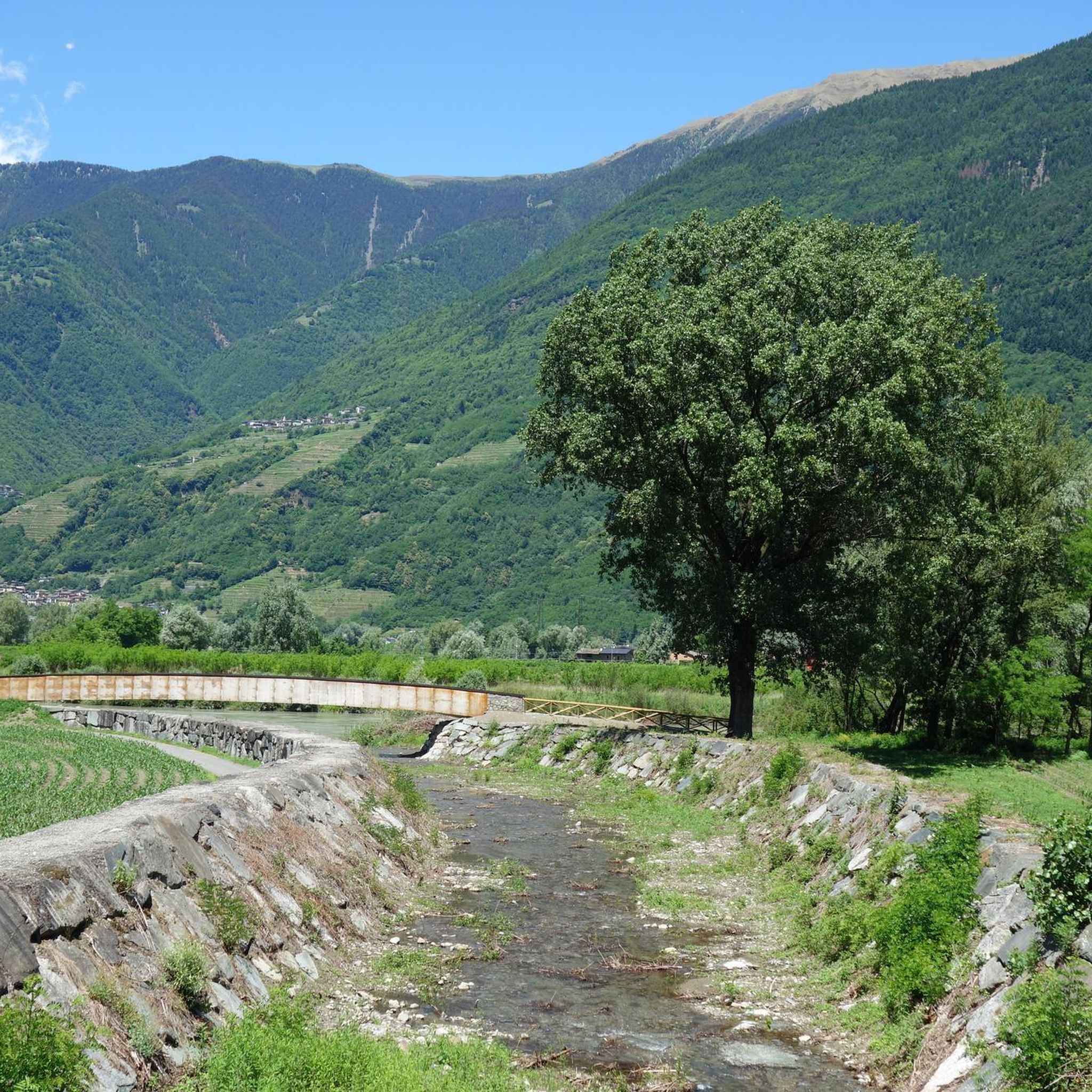
The Torrente Mello is the main watercourse that crosses the Val di Mello, one of the most suggestive valleys of Valtellina. This torrent originates from Monte Disgrazia and flows along the entire valley, fed by numerous streams and natural springs from the surrounding mountains. The Torrente Mello is characterized by crystalline waters that flow between the imposing granite rocks and the lush vegetation, creating natural scenery of rare beauty. Along its course, the torrent feeds several lakes, such as the Laghetto del Qualido, and also feeds numerous waterfalls and pools, which make the valley even more fascinating and appreciated by hikers. The path of the Torrente Mello is clearly visible along the paths that start from the village of San Martino, which is the main starting point for exploring the valley. The path that follows the course of the torrent allows you to enjoy spectacular views of the surrounding nature and access places of great naturalistic interest, making it an ideal destination for lovers of trekking and photography.
0
0
Rifugio Mello is located in the beautiful Val di Mello, one of the most well-known and appreciated valleys of Valtellina, famous for its breathtaking landscapes, imposing mountains and its crystalline lakes. The refuge is located at about 1,350 meters above sea level and is a point of reference for hikers who visit the area. Rifugio Mello is easily accessible thanks to the paths that start from the village of San Martino, in the heart of Val di Mello. The route to reach the refuge is suitable for hikers of all levels, with a walk that lasts about 1.5-2 hours, crossing larch and fir forests, offering spectacular panoramic views of the valley and the surrounding mountains. Once arrived, the refuge offers a welcoming rest area, where hikers can refresh themselves with typical Valtellina dishes, such as pizzoccheri, sciatt and local cheeses, but also enjoy an incredible view of Val di Mello and the peaks that surround it, including Monte Disgrazia. Rifugio Mello is also a starting point for numerous hikes, including those leading to Laghetto del Qualido or Cascata della Val di Mello, as well as an ideal place for a quiet stop during a longer hike. It is recommended in all seasons, but especially in spring and autumn, when the landscape is particularly fascinating thanks to the colors of nature.
2
0
Frequently Asked Questions
What is the typical difficulty level of mountaineering routes around Berbenno Di Valtellina?
Mountaineering in Berbenno Di Valtellina is primarily characterized by challenging, high alpine routes. Out of the five routes listed, four are rated as difficult, featuring significant elevation gains and remote sections. There is one moderate route available for those seeking a slightly less strenuous experience.
Are there any beginner-friendly mountaineering routes in Berbenno Di Valtellina?
While the region is known for its challenging terrain, there is one moderate route available: Val di Mello River – Mello Stream loop from Val Masino. This route offers a taste of the area's beauty without the extreme demands of the more difficult ascents. However, even moderate mountaineering requires appropriate fitness and preparation.
What kind of terrain can I expect on mountaineering routes in Berbenno Di Valtellina?
You can expect a high alpine environment with rugged rock formations, deep glacial valleys like Val di Mello, and prominent peaks such as Monte Disgrazia. The routes often involve significant elevation gains, mountain rivers, and serene alpine lakes, offering a truly wild and remote experience.
Are there any circular mountaineering trails in the area?
Yes, several routes are designed as loops, allowing you to start and finish at the same point. Examples include the challenging Cesare Ponti Hut – Monte Disgrazia (3,678 m) loop from Parcheggio Preda Rossa and the scenic Val di Mello River – Laghetto del Qualido loop from Val Masino.
What can I see along the mountaineering routes in Berbenno Di Valtellina?
The routes often pass through stunning natural landscapes. You might encounter features like the Preda Rossa Valley, the serene Val di Mello Nature Reserve, and various mountain huts such as the Cesare Ponti Hut. Some trails also offer views of impressive waterfalls like the Briglie Waterfalls of San Giuseppe.
Are there any mountain huts available for overnight stays or refreshments?
Yes, the region features several mountain huts that can serve as resting points or overnight accommodations. Notable huts include the Cesare Ponti Hut and the Luna Nascente Mountain Hut. These provide essential services in remote areas.
What do other mountaineers enjoy most about the routes in Berbenno Di Valtellina?
The mountaineering routes in Berbenno Di Valtellina are highly rated by the komoot community, with an average score of 4.9 stars from over 6 reviews. Mountaineers often praise the challenging nature of the trails, the breathtaking high alpine scenery, and the sense of remoteness found in areas like Val di Mello and around Monte Disgrazia.
Is public transport available to access the mountaineering trails?
Access to many high alpine mountaineering routes in Berbenno Di Valtellina often requires private transport to reach trailheads like Parcheggio Preda Rossa or Val Masino. While some local bus services might connect to larger towns, direct public transport to the more remote starting points for mountaineering is generally limited. Planning for car access is advisable.
Are there specific parking areas for mountaineering trailheads?
Yes, for routes like the Cesare Ponti Hut – Monte Disgrazia (3,678 m) loop, there are designated parking areas such as Parcheggio Preda Rossa. For trails starting in Val Masino, you will typically find parking facilities available in the valley. It's always recommended to check specific trailhead information for parking details before your trip.
What is the best time of year for mountaineering in Berbenno Di Valtellina?
The best time for mountaineering in this high alpine region is typically during the summer months, from late June to early September, when snow has largely melted from higher elevations and weather conditions are generally more stable. Outside of this period, routes can be significantly more challenging due to snow, ice, and rapidly changing weather.
Are there any permits required for mountaineering in Berbenno Di Valtellina?
Generally, specific permits for mountaineering itself are not required for most routes in the Berbenno Di Valtellina area. However, some protected areas or specific activities might have regulations. It's always advisable to check with local tourist information or park authorities for any specific requirements, especially if you plan to access sensitive natural reserves or engage in activities like climbing.
Can I find any less-known or 'hidden gem' mountaineering routes?
While the region's routes are well-regarded, exploring variations around areas like Val di Mello or the less frequented paths leading to specific alpine lakes, such as the Laghetto del Qualido – Cascina Piana loop from Val Masino, can offer a sense of discovery. The remote nature of many trails means you'll often find solitude even on established paths.
Most popular routes around Berbenno Di Valtellina
Most popular attractions around Berbenno Di Valtellina

Get inspired with the komoot mobile app


Explore more
Browse the best Mountain Hikes & Routes in other regions.
