The best mountain hikes around Prunières
4.6
(7)
52
hikers
7
hikes
Mountaineering routes around Prunières are located in the Hautes-Alpes region of southeastern France, offering diverse terrain for outdoor enthusiasts. The area is characterized by its mountainous landscape, including larch forests and the Durance Valley, with views of Lake Serre-Ponçon. Prunières also serves as a gateway to the Écrins National Park, providing access to high-altitude peaks and challenging ascents. This combination of features makes it a compelling destination for various mountaineering experiences.
Best mountaineering routes around Prunières
- The most popular mountaineering…
Last updated: October 9, 2026
18
hikers
9.18km
04:16
790m
790m
Hard mountaineering route. Good fitness required. Sure-footedness, sturdy shoes and alpine experience required.
4.0
(1)
11
hikers
8.99km
04:04
830m
830m
Hard mountaineering route. Good fitness required. Sure-footedness, sturdy shoes and alpine experience required.

5.0
(1)
11
hikers
11.1km
04:35
820m
820m
Hard mountaineering route. Good fitness required. Sure-footedness, sturdy shoes and alpine experience required.
5.0
(2)
8
hikers
15.6km
05:23
760m
760m
Hard mountaineering route. Very good fitness required. Mostly accessible paths. Sure-footedness required.
5.0
(1)
7
hikers
12.5km
04:01
460m
460m
Moderate mountaineering route. Good fitness required. Mostly accessible paths. Sure-footedness required.
Get access to more routes and recommendations from other explorers.
Already have an account?
Our route recommendations are based on thousands of hikes, rides, and runs completed by other people on komoot.
Start today with a free account
Your next adventure awaits.

Tips from the Community

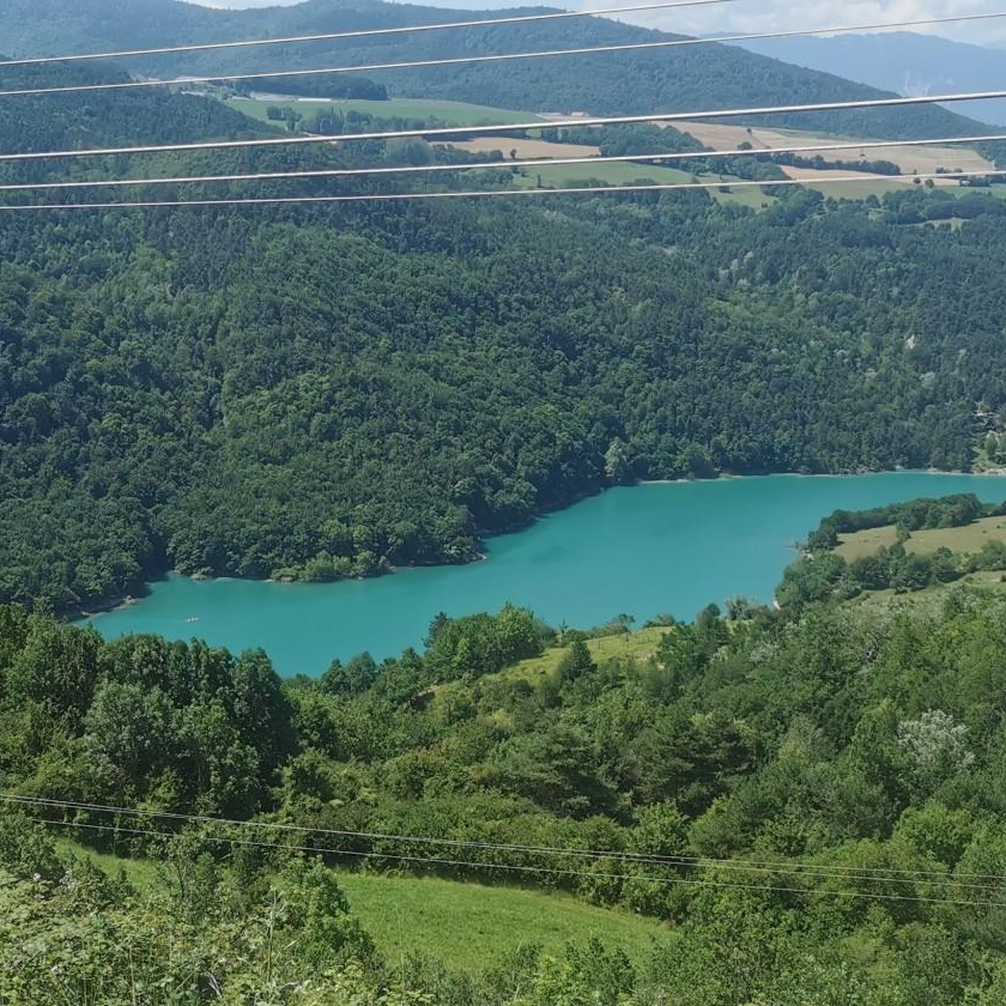
A lake with turquoise waters! The lake of Monteynard Avignonet stretches between Trièves and Matheysine. Located 25 km south of Grenoble, this artificial reservoir with its imposing dam is a paradise for gliding and sailing activities (kitesurfing, windsurfing, wing foiling, dinghies...). Its turquoise waters have made it famous, as well as the Himalayan footbridges hike, unique in Europe! You can also enjoy many other activities such as paddleboarding, fishing, and mountain biking...
0
0


Very beautiful footbridge, be careful for people who are afraid of heights.
0
0

great hike to do in good weather. very shaded
0
0

The Pont de Brion belvedere offers a breathtaking view of the charming stone bridge that spans the river below, with green hills as a backdrop. Along the trail, enjoy the tranquility of the place and the vibrant greenery that characterizes this picturesque spot.
0
0

Beautiful but unfortunately becoming a bit of a victim of its success. Done on the morning of November 2nd and there were a lot of people.
2
1
Frequently Asked Questions
How many mountaineering routes are available in Prunières?
Prunières offers a selection of 8 mountaineering routes, catering to various skill levels. These routes explore the diverse terrain of the Hautes-Alpes region, including larch forests and views of Lake Serre-Ponçon.
Are there easy mountaineering routes for beginners in Prunières?
While many routes in Prunières are moderate to difficult, there is at least one easy option available. For those looking for a less strenuous introduction to the area's beauty, you can find suitable trails that offer gentle ascents and scenic views.
What are some challenging mountaineering routes in the Prunières area?
For experienced mountaineers seeking a challenge, Prunières provides several difficult routes. One such demanding option is the Drac Footbridge – Ebron Footbridge loop from Mayres-Savel, which features significant elevation gain and covers a distance of approximately 15.6 km.
Are there any circular mountaineering routes around Prunières?
Yes, many of the mountaineering routes in Prunières are circular, allowing you to start and end at the same point. An example is the Confluent du Drac : Ébron – Passerelle de L'Ébron loop from Treffort, a moderate 16.1 km trail that explores the confluence of the Drac and Ébron rivers.
What kind of scenery can I expect on mountaineering routes in Prunières?
Mountaineering routes in Prunières offer a rich variety of scenery. You can expect to traverse mountainous terrain, walk through beautiful larch forests, and enjoy panoramic views of Lake Serre-Ponçon and the Durance Valley. The region's proximity to the Écrins National Park also means access to high-altitude alpine landscapes.
Are there any interesting landmarks or points of interest along the mountaineering routes?
Yes, several routes pass by notable landmarks. For instance, you might encounter the Ebron Footbridge or the Drac Footbridge, which are significant features in the landscape. Other natural monuments like La Pierre Percée also add to the scenic appeal.
What is the best season for mountaineering in Prunières?
The Southern French Alps, where Prunières is located, benefit from a sunny climate, making late spring, summer, and early autumn ideal for mountaineering. During these seasons, trails are generally clear of snow, and the weather is more stable for exploring the diverse terrain and high-altitude peaks.
Is it possible to spot wildlife while mountaineering in Prunières?
The diverse natural environment around Prunières, including its forests and proximity to Écrins National Park, provides opportunities for wildlife spotting. Keep an eye out for local fauna as you explore the trails, particularly in quieter, less frequented areas.
Are there any permits required for mountaineering in Prunières, especially near Écrins National Park?
While general hiking in the Prunières area typically doesn't require permits, specific regulations may apply if you venture deep into the Écrins National Park, especially for certain activities or protected zones. It's always advisable to check the official Écrins National Park website for the latest guidelines before planning your trip.
What do other mountaineers think about the routes in Prunières?
The mountaineering routes around Prunières are highly regarded by the komoot community, holding an average rating of 4.6 stars from over 10 reviews. Mountaineers often praise the varied terrain, the stunning views of Lake Serre-Ponçon, and the challenging yet rewarding ascents available.
Are there family-friendly mountaineering options in Prunières?
Prunières offers a range of trails, and while many are geared towards experienced mountaineers, there are options suitable for families looking for less strenuous walks. These routes often feature gentler gradients and shorter distances, allowing families to enjoy the beautiful alpine scenery together.
Where can I find parking for mountaineering trails in Prunières?
Parking availability varies by trailhead. Many routes, especially those starting from villages like Treffort or Villard-Saint-Christophe, will have designated parking areas. It's recommended to check the specific route details on komoot for information on parking at the starting point of your chosen trail.
Can I combine mountaineering with other outdoor activities in Prunières?
Absolutely! Prunières is an excellent base for a variety of outdoor activities. Beyond mountaineering, you can enjoy mountain biking, via ferrata, climbing, or horse riding. The nearby Lake Serre-Ponçon also offers water-based activities like paddleboarding and canoeing, providing a different perspective of the natural beauty.
Most popular routes around Prunières
Most popular attractions around Prunières

Get inspired with the komoot mobile app


Explore more
Browse the best Mountain Hikes & Routes in other regions.
