The best walks and hikes in Sibbald Meadows Pond Provincial Recreation Area
3.8
(27)
435
hikers
11
hikes
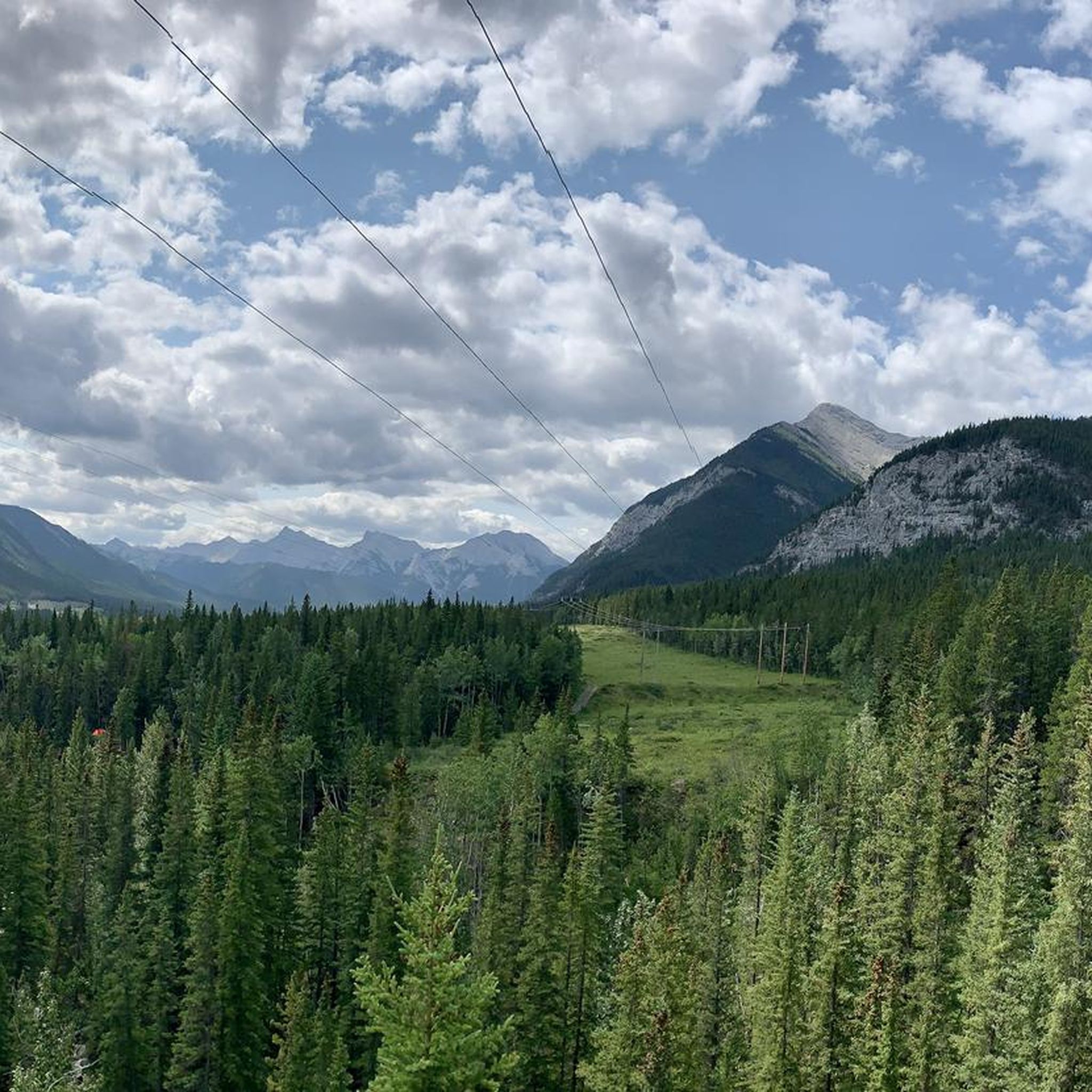
Hiking trails in Sibbald Meadows Pond Provincial Recreation Area traverse a landscape characterized by rolling foothills, dense coniferous forests, and open meadows. The region features varied terrain, including moderate ascents and descents, with several trails offering views of the surrounding Kananaskis Country. Water features such as ponds and creeks are present, contributing to the area's natural environment.
Best hiking trails in Sibbald Meadows Pond Provincial Recreation Area
- The most popular hiking route is Cox Hill NE summit – Cox Hill loop from Dawson Provincial Recreation Area, a 8.1 miles (13.0 km) trail that takes about 4 hours 27 minutes to complete, featuring significant elevation gain.
- Another top favourite among local hikers is Sibbald Flat Trailhead – Eagle Hill loop from Sibbald Lake Provincial Recreation Area, a moderate 8.9 miles (14.4 km) path. This route offers a mix of forest and open areas, with views of Eagle Hill.
- Local hikers also love the Deer Ridge Trail loop from Sibbald Lake Provincial Recreation Area, a 4.2 miles (6.8 km) trail leading through forested ridges, often completed in about 2 hours 4 minutes.
- Hiking in Sibbald Meadows Pond Provincial Recreation Area is defined by forested paths, open meadows, and moderate hills. The network offers options for various ability levels, including beginner hiking trails and more challenging moderate routes.
- The routes in Sibbald Meadows Pond Provincial Recreation Area are highly rated by the komoot community with an average score of 3.6 stars from over 20 reviews. More than 400 hikers have used komoot to explore Sibbald Meadows Pond Provincial Recreation Area's varied terrain.
Last updated: July 15, 2026
28
hikers
13.0km
04:27
700m
700m
Moderate hike. Good fitness required. Easily-accessible paths. Suitable for all skill levels.
12
hikers
7.92km
02:16
190m
190m
Moderate hike. Good fitness required. Easily-accessible paths. Suitable for all skill levels.

Sign up for free
3.65km
01:34
310m
310m
Moderate hike. Good fitness required. Easily-accessible paths. Suitable for all skill levels.
5.0
(1)
18
hikers
Moderate hike. Good fitness required. Easily-accessible paths. Suitable for all skill levels.
16
hikers
6.79km
02:04
220m
220m
Moderate hike. Good fitness required. Easily-accessible paths. Suitable for all skill levels.
Get access to more routes and recommendations from other explorers.
Sign up for free
Already have an account?
Our route recommendations are based on thousands of hikes, rides, and runs completed by other people on komoot.
Start today with a free account
Your next adventure awaits.
Login or Signup
Popular around Sibbald Meadows Pond Provincial Recreation Area
Tips from the Community

This trail is a short but relatively steep route that climbs quickly through semi-open forest and along a wide ridge to the summit of Horton Hill. The trail follows a mostly unmarked but well-used path from the Lusk Creek area, with sections of deadfall, open clearings, and occasional viewpoints toward Barrier Lake, Mount Baldy, and the surrounding front ranges as you gain elevation. Though modest in distance, the steady climb and more peaceful setting make for a lovely trek, with expansive views from the summit in a fairly short amount of time compared to the more extensive routes in the area.
0
0
Horton Hill is a rounded foothills summit in Kananaskis Country, rising above the Lusk Creek area along the eastern edge of the Rockies. Unlike the nearby sharper mountain peaks, the hill has a gentler profile, with forested slopes giving way to more open grassy areas near the summit. Its position above the surrounding valleys offers expansive views toward Barrier Lake and the front ranges of the Rocky Mountains.
0
0
Lusk Pass Trail is a gentle forested route that winds through mixed woodland, with open clearings and occasional mountain viewpoints, as it gradually climbs toward Lusk Pass. Often completed as a loop with the Baldy–Lusk connector and sections of Baldy Pass Trail, this is a peaceful trek with a fantastic wildflower meadow near the midpoint and glimpses of the surrounding peaks through harvested openings in the trees. Compared with many Kananaskis hikes, the trail feels less strenuous and more relaxed, making it a great option for a moderate day hike or bike ride.
0
0
Lusk Creek Day Use Area is a small recreation site in Kananaskis Country that serves as a trailhead for Lusk Pass, Baldy Pass, and connecting forest trails. Nestled along Lusk Creek in a lightly forested valley, there are picnic areas, toilets, plenty of parking and basic access to the surrounding trail network, with mountain scenery beginning almost immediately beyond the highway crossing. Although simple in facilities, it has a quieter, more rustic feel than busier Kananaskis trailheads, making it a convenient starting point for hiking or biking through this area.
0
0
Baldy Pass Trail is a roughly 16 kilometre picturesque route that climbs steadily through forest and cutblock openings to Baldy Pass. While much of the trail passes through dense woodland, the open sections near harvested areas offer beautiful, expansive views toward Barrier Lake and the nearby mountains before the final climb to the pass. Popular with hikers and mountain bikers, the trail has a more rugged and backcountry feel than the gentler Lusk Pass route, especially on the steeper upper sections.
0
0

Can you identify this flower?
0
0
If any are available in the kiosk to the left of the map board, grab a brochure. It will provide interesting information at each numbered post along the trail.
0
0
Frequently Asked Questions
What is the general difficulty level of hiking trails in Sibbald Meadows Pond Provincial Recreation Area?
The trails in Sibbald Meadows Pond Provincial Recreation Area primarily feature moderate difficulty. Out of the 9 available routes, 8 are rated as moderate, offering a good balance of challenge and accessibility for most hikers. There is also one easy route available for those seeking a less strenuous experience.
Are there any beginner-friendly hiking trails in Sibbald Meadows Pond Provincial Recreation Area?
Yes, for beginners or those looking for a relaxed walk, there is one easy-rated trail. An example is the Widowmaker Trail — Bow Valley Provincial Park, which is just over 4.5 km long with minimal elevation gain, making it suitable for a gentle introduction to the area's natural beauty.
What are the typical trail lengths and durations for hikes in this area?
Trail lengths vary, with routes ranging from approximately 4.5 km to 14.4 km. Duration can range from about 1 hour 10 minutes for shorter, easier paths to over 4 hours for longer, more challenging loops. For instance, the Sibbald Flat Trailhead – Eagle Hill loop is about 14.4 km and takes around 4 hours 10 minutes.
Are there any loop trails available for hiking in Sibbald Meadows Pond Provincial Recreation Area?
Yes, several trails in the area are designed as loops, offering varied scenery without retracing your steps. A popular option is the Deer Ridge Trail loop from Sibbald Lake Provincial Recreation Area, which is 6.8 km long and takes about 2 hours to complete, winding through forested ridges.
Is Sibbald Meadows Pond Provincial Recreation Area suitable for family hikes?
The area offers trails that can be enjoyed by families, particularly the easier and shorter moderate routes. The diverse terrain with forests and open meadows provides an engaging environment for children. Consider the Widowmaker Trail for a family-friendly outing.
Are dogs allowed on the hiking trails in Sibbald Meadows Pond Provincial Recreation Area?
Yes, dogs are generally welcome on trails in Sibbald Meadows Pond Provincial Recreation Area, but they must be kept on a leash at all times. This is crucial for the safety of your pet, other hikers, and local wildlife. Always remember to pack out any waste.
What is the best time of year to go hiking in Sibbald Meadows Pond Provincial Recreation Area?
The best time for hiking is typically from late spring through early fall (May to October). During these months, trails are usually clear of snow, and the weather is generally pleasant. Fall offers beautiful foliage, while spring brings wildflowers. Always check current trail conditions before heading out.
What are the winter hiking conditions like in Sibbald Meadows Pond Provincial Recreation Area?
Winter hiking is possible, but conditions can be challenging. Trails may be snow-covered and icy, requiring appropriate gear such as microspikes or snowshoes. Some routes might be less accessible. Always check local weather forecasts and trail reports before attempting a winter hike.
What should I pack for a hike in Sibbald Meadows Pond Provincial Recreation Area?
Essential items include plenty of water, snacks, appropriate layers of clothing for changing weather, sturdy hiking boots, and sun protection. Bear spray is also highly recommended as the area is home to wildlife. A map or GPS device (like komoot) is useful for navigation.
Are there any viewpoints or scenic spots along the trails?
Many trails offer scenic views of the surrounding Kananaskis Country foothills and dense forests. For example, the Sibbald Flat Trailhead – Eagle Hill loop provides views of Eagle Hill, while the Panoramic view – Barrier Lake loop offers expansive vistas of Barrier Lake and the mountains beyond.
What kind of wildlife can I expect to see while hiking?
Sibbald Meadows Pond Provincial Recreation Area is part of a rich ecosystem. Hikers might encounter various wildlife, including deer, elk, moose, and a variety of bird species. Black bears and grizzly bears are also present in the region, so it's important to be bear aware and carry bear spray.
What do other hikers enjoy most about the trails in Sibbald Meadows Pond Provincial Recreation Area?
The area is highly rated by the komoot community, with an average score of 3.6 stars from over 20 reviews. Reviewers often praise the quiet forested paths, the mix of open meadows, and the moderate challenge of the trails. Many appreciate the opportunity to explore the natural beauty of Kananaskis Country.
Most popular routes in Sibbald Meadows Pond Provincial Recreation Area

Get inspired with the komoot mobile app


Explore more
Browse the best Hikes in other regions.
