The best MTB trails around Aguilafuente
5.0
(4)
64
riders
27
rides
Mountain biking around Aguilafuente offers access to the diverse landscapes of the Segovia province, characterized by extensive plains, agricultural fields, and scattered woodlands. The region's gentle rolling hills and river valleys provide a mix of terrain suitable for various skill levels. While Aguilafuente itself is situated in a flatter area, its proximity allows for exploration of more varied natural features found in the wider province. The area is defined by its open countryside and rural charm, making it a suitable…
Last updated: October 15, 2026
5.0
(1)
27
riders
66.0km
05:27
510m
510m
Hard mountain bike ride. Very good fitness required. Suitable for all skill levels.
1
riders
47.0km
03:47
270m
270m
Moderate mountain bike ride. Good fitness required. Suitable for all skill levels.

4
riders
43.4km
02:59
150m
150m
Moderate mountain bike ride. Good fitness required. Suitable for all skill levels.
5.0
(2)
4
riders
44.4km
03:34
260m
260m
Moderate mountain bike ride. Good fitness required. Suitable for all skill levels.
2
riders
27.2km
01:59
120m
120m
Easy mountain bike ride. Great for any fitness level. Suitable for all skill levels.
Get access to more routes and recommendations from other explorers.
Already have an account?
Our route recommendations are based on thousands of hikes, rides, and runs completed by other people on komoot.
Start today with a free account
Your next adventure awaits.


Tips from the Community

views and tranquility
0
0

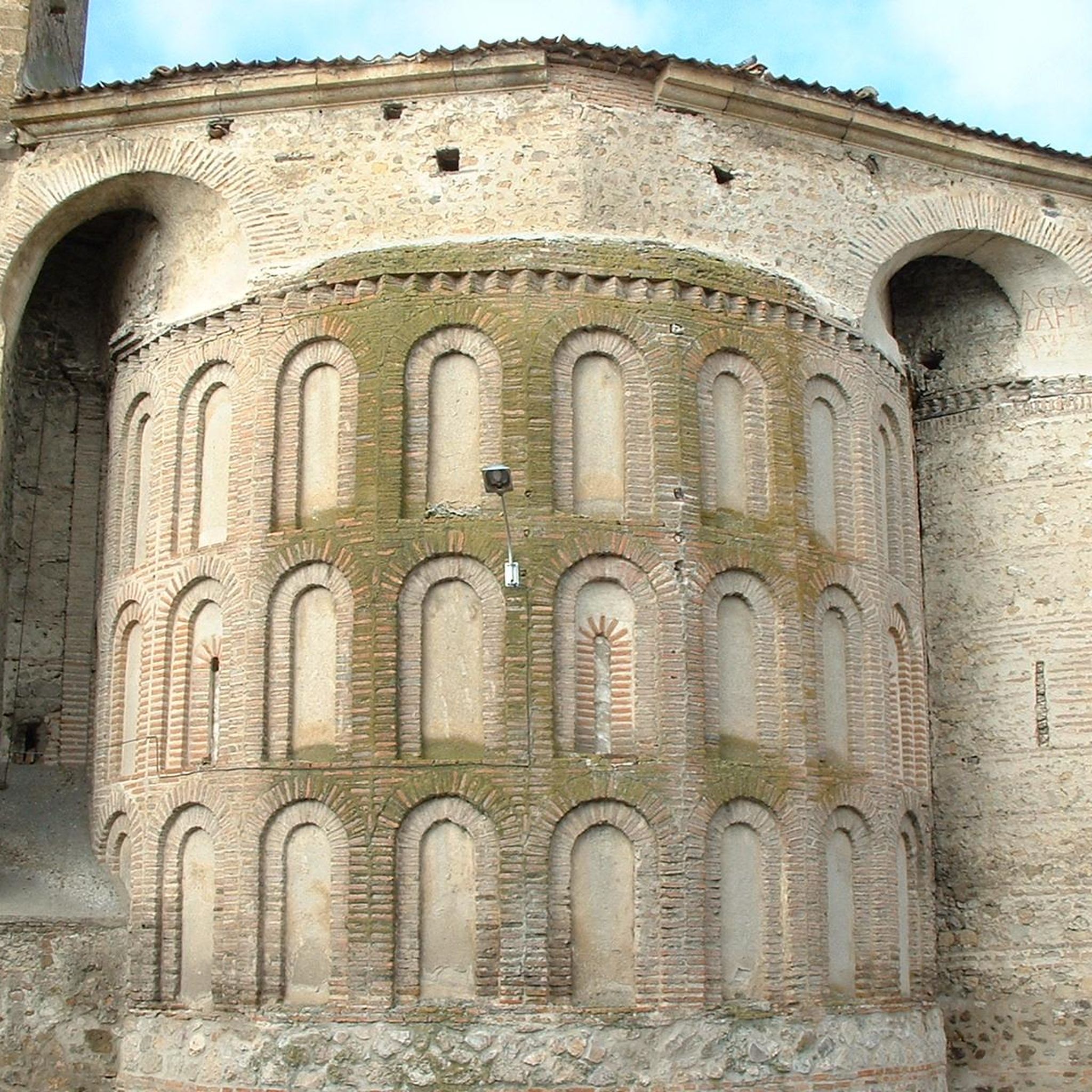
Carbonero el Mayor is a municipality and Spanish town in the province of Segovia, in the southern part of the autonomous community of Castilla y León. It appears cited in 1247 under the name Carbonero de Liedos; In 1587 it was mentioned as Carbonero la Mayor and in the 19th century it already appeared with its current name.
4
0

Carbonero el Mayor is a town located north of the city of Segovia, in the middle of the plain that goes from the Central System and the great plains of Valladolid.
1
0

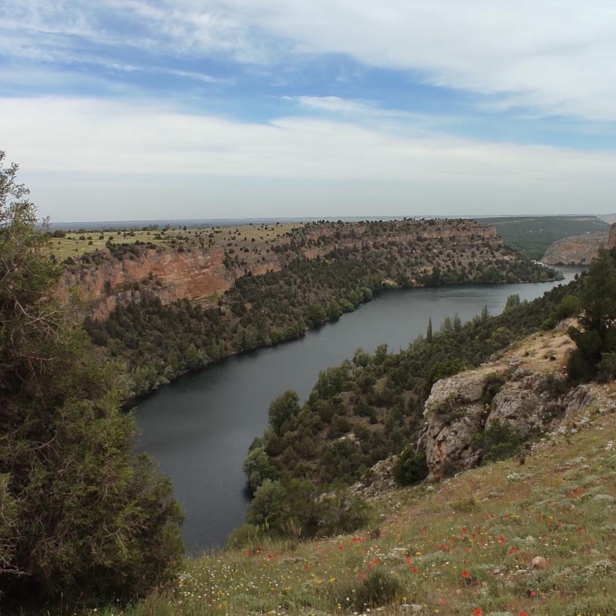
Located in the Natural Park of the Hoces del Río Duratón and the Sierra de Segovia we find the beautiful hermitage of the Eighth that stands out from the top of a hill.
1
0
Small town located in what is called Tierra de Pinares, where both towns, separated by a few meters, are part of the same town.
0
0
Fuentepelayo is one of those towns that is located in the old middle of the plain between the Sierra de Guadarrama and the Río Duero valley. It is characterized by having two churches at its core, the Iglesia de Santa María and the Iglesia de El Salvador.
0
0
Beautiful town where the Iglesia de Santa María predominates in its center and where, in addition, you can find a large expanse of pine forests in the vicinity of the town's forests.
0
0
Small hermitage that is located before the town of Peñarrubias de Pirón and is located where the Río Pirón flows. The views of the area are spectacular and on clear days, you can see the entire Sierra de Guadarrama.
0
0
Frequently Asked Questions
How many mountain bike trails are available around Aguilafuente?
There are 14 mountain bike trails available around Aguilafuente on komoot. These routes offer a mix of easy and moderate options, suitable for various skill levels.
What kind of terrain can I expect on mountain bike trails around Aguilafuente?
The immediate area around Aguilafuente features extensive plains, agricultural fields, and gentle rolling hills, offering open countryside rides. However, its location within the Segovia province means you can access more diverse terrain, including forests, valleys, and even mountainous sections with significant elevation gains and technical challenges further afield.
Are there mountain bike trails suitable for beginners near Aguilafuente?
Yes, there is one easy mountain bike trail available. The Fuentepelayo loop from Fuentepelayo is a good option, covering 16.9 miles (27.2 km) and taking approximately 2 hours to complete, making it ideal for those new to mountain biking.
Are there challenging mountain bike routes in the Aguilafuente area?
While Aguilafuente itself is in a flatter area, the wider Segovia province offers more challenging routes. Most of the trails directly around Aguilafuente are classified as moderate, such as the View of the Countryside – Carbonero el Mayor loop from Mozoncillo, which is 33.4 miles (53.7 km) long with notable elevation changes.
What are some scenic mountain bike routes around Aguilafuente?
Many routes offer scenic views of the rural landscape and open fields. The View of the Countryside – Carbonero el Mayor loop from Mozoncillo is particularly known for its expansive rural vistas. Another scenic option is the Fuentepelayo loop from Zarzuela del Pinar, which traverses open fields and small forested sections.
Are there circular mountain bike trails available?
Yes, all the mountain bike trails listed for Aguilafuente are circular routes, allowing you to start and finish at the same point. Examples include the San Martín and Mudrián loop from Zarzuela del Pinar and the Aguilafuente – Ermita de la Octava loop from Fuentepelayo.
What can I see along the mountain bike trails or nearby Aguilafuente?
While riding, you'll primarily experience open plains and agricultural landscapes. For historical and natural points of interest nearby, you can explore Turégano Castle, the town of Aguilafuente itself, the Cantalejo Lagoons, or the Ermita de la Octava (Peñarrubias de Pirón).
How long do mountain bike trails near Aguilafuente typically take to complete?
The duration varies depending on the route and your pace. Easy trails like the Fuentepelayo loop from Fuentepelayo can take around 2 hours. Moderate routes, such as the View of the Countryside – Carbonero el Mayor loop from Mozoncillo, typically range from 3 to over 4 hours.
What do other mountain bikers enjoy about the trails in Aguilafuente?
The trails around Aguilafuente are highly rated by the komoot community, with an average score of 5.0 stars. Riders often appreciate the open countryside, the quiet rural charm, and the opportunity to explore the agricultural lands and small villages of the Segovia province.
Is Aguilafuente a good base for exploring mountain biking in the wider Segovia province?
Yes, Aguilafuente's location within the province of Segovia makes it a strategic base. While the immediate area is flatter, you have access to the diverse landscapes of the wider region, including more challenging trails with significant elevation gains and technical sections found in areas like the Parque Nacional de Guadarrama.
What is the best season for mountain biking around Aguilafuente?
The Segovia province generally offers good conditions for mountain biking for much of the year. Spring and autumn are often ideal, with milder temperatures and pleasant scenery. Summers can be hot, so early morning or late afternoon rides are recommended, while winters can be cold but offer crisp, clear days.
Most popular attractions around Aguilafuente

Get inspired with the komoot mobile app


Explore more
Browse the best MTB trails in other regions.
