The best gravel rides in Golden Gate National Recreation Area
4.6
(73)
1,378
riders
62
rides
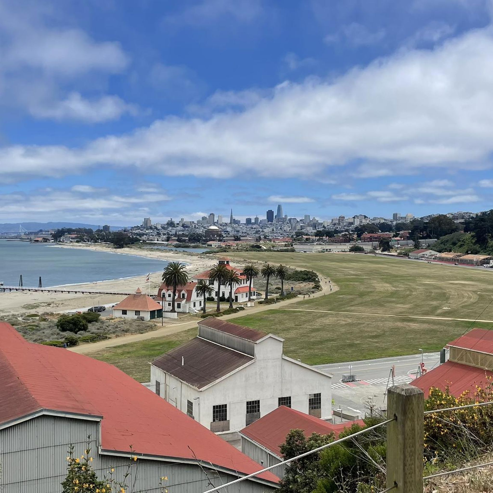
Gravel biking in Golden Gate National Recreation Area features a diverse landscape, including coastal bluffs, rolling hills, and redwood groves. The region spans over 80,000 acres, offering varied terrain from wide dirt paths to challenging ascents. Riders can expect ecosystems ranging from windswept beaches to dense forests, providing a dynamic environment for gravel routes. This area combines natural beauty with historical significance, making it suitable for different riding preferences.
Best gravel bike trails in Golden Gate National Recreation Area
- The…
Last updated: August 21, 2026
5.0
(3)
74
riders
35.0km
03:01
930m
930m
Hard gravel ride. Very good fitness required. Mostly paved surfaces. Suitable for all skill levels.
3.0
(1)
34
riders
49.9km
04:29
1,340m
1,340m
Hard gravel ride. Very good fitness required. Mostly paved surfaces. Suitable for all skill levels.

Sign up for free
32
riders
70.0km
04:57
1,290m
1,290m
Hard gravel ride. Very good fitness required. Mostly paved surfaces. Suitable for all skill levels.
38
riders
24.6km
01:56
530m
530m
Hard gravel ride. Very good fitness required. Mostly paved surfaces. Suitable for all skill levels.
4.0
(2)
18
riders
44.3km
03:25
860m
860m
Hard gravel ride. Very good fitness required. Mostly paved surfaces. Suitable for all skill levels.
Get access to more routes and recommendations from other explorers.
Sign up for free
Already have an account?
Our route recommendations are based on thousands of hikes, rides, and runs completed by other people on komoot.
Start today with a free account
Your next adventure awaits.
Login or Signup
Popular around Golden Gate National Recreation Area

Other adventures in Golden Gate National Recreation Area

Tips from the Community

Good vantage point.
0
0

This isn't the sort of road you'd take a vehicle on, nowadays - but it's great for nontechnical mountain biking, and this high point gives you nice views over the surrounding hills.
0
0

Constructed in 1917 this dam forms Alpine Lake, which sites between Kent and Bon Tempe Lakes. The road across the top of the dam make it a great place to ride on a loop around the lake.
0
0
This lake was formed by the building of Alpine Dam in 1917. It sits between Kent Lake and Bon Tempe Lake, and is popular for a variety of outdoor activities.
0
0


Devils slide itself is nice and just to the south is the beautiful Gray Whales Cove beach. There is plenty of parking at both places. Two notes for cyclist: 1. cycling along Hwy 1, coming from Pacifica, requires climbing on a relatively narrow but highly frequented road. It is not a long climb until the turnoff to Devils slide, but it might be stressful for cyclists who are not used to riding in heavy traffic. Hwy 1 south of Devils slide has enough space for everyone. 2. If you cycle on Hwy1, then check the wind forecast beforehand. Dominant wind direction is NW, which means cycling southbound maximizes tailwind and minimizes breathing in all the air pollution from stinky cars.
0
0

Gray Whale Cove State Beach is a beautiful, secluded beach located nine miles north of Highway 92 along Highway 1. This 800-foot stretch of white sand is nestled in a small valley known as "Devil's Slide" and is shielded from the highway by cliffs. The beach is named for the gray whales often spotted here during their spring migration. Facilities include free day parking, chemical toilets, but no water, so keep this in mind as you ride.
0
0
Frequently Asked Questions
How many gravel bike trails are available in Golden Gate National Recreation Area?
The Golden Gate National Recreation Area offers a wide selection of gravel biking routes, with over 80 trails available. These routes cater to various skill levels, from easier paths to more challenging ascents.
What are the typical difficulty levels for gravel biking in the GGNRA?
Gravel biking in the GGNRA ranges from moderate to difficult. While there are a few easier routes, the majority of trails are rated as moderate (around 19 routes) or difficult (over 60 routes), often featuring significant elevation gains and varied terrain.
What kind of terrain can I expect on gravel bike trails in the Golden Gate National Recreation Area?
You'll encounter a diverse range of terrain, including coastal bluffs, rolling hills, and even redwood groves. Many trails, especially in the Marin Headlands, are wide, smooth dirt paths, but you can also find more challenging ascents and varied surfaces through grasslands and forests. The area's unique geology contributes to its varied habitats.
Are there any family-friendly gravel biking options in the GGNRA?
Yes, for a more relaxed ride suitable for families, the Tennessee Valley Trail is a gentle, wide dirt path leading to Tennessee Cove Beach. While popular and potentially crowded on holidays, it offers a scenic and accessible experience. You can also find a few other easier routes among the 80+ available.
What are some notable landmarks or viewpoints I can see while gravel biking in the GGNRA?
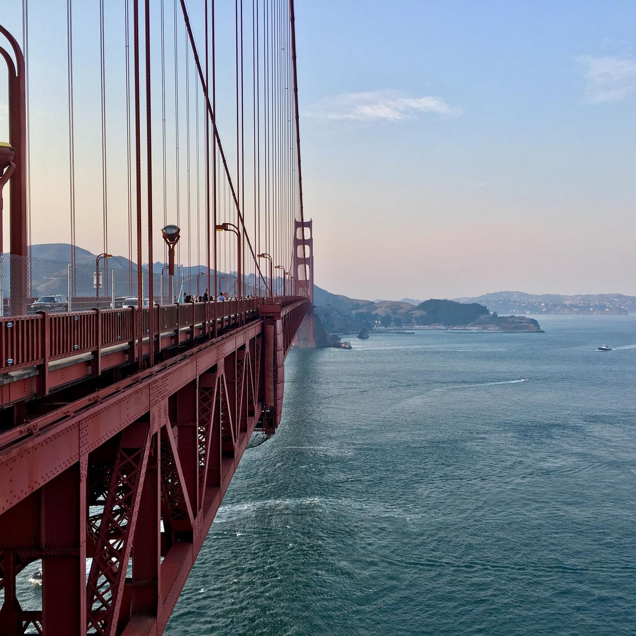
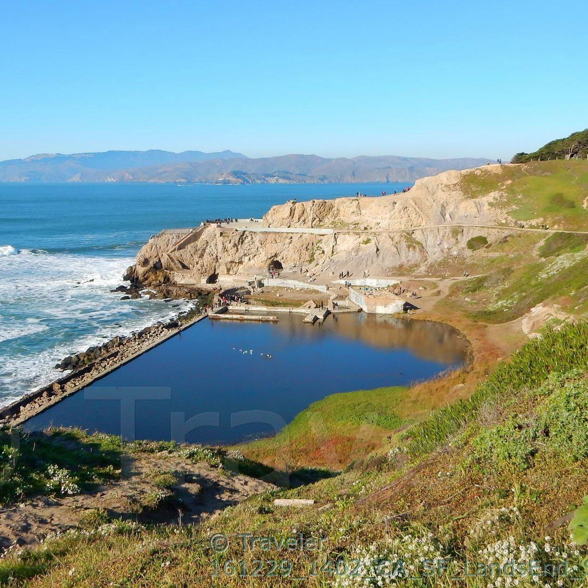
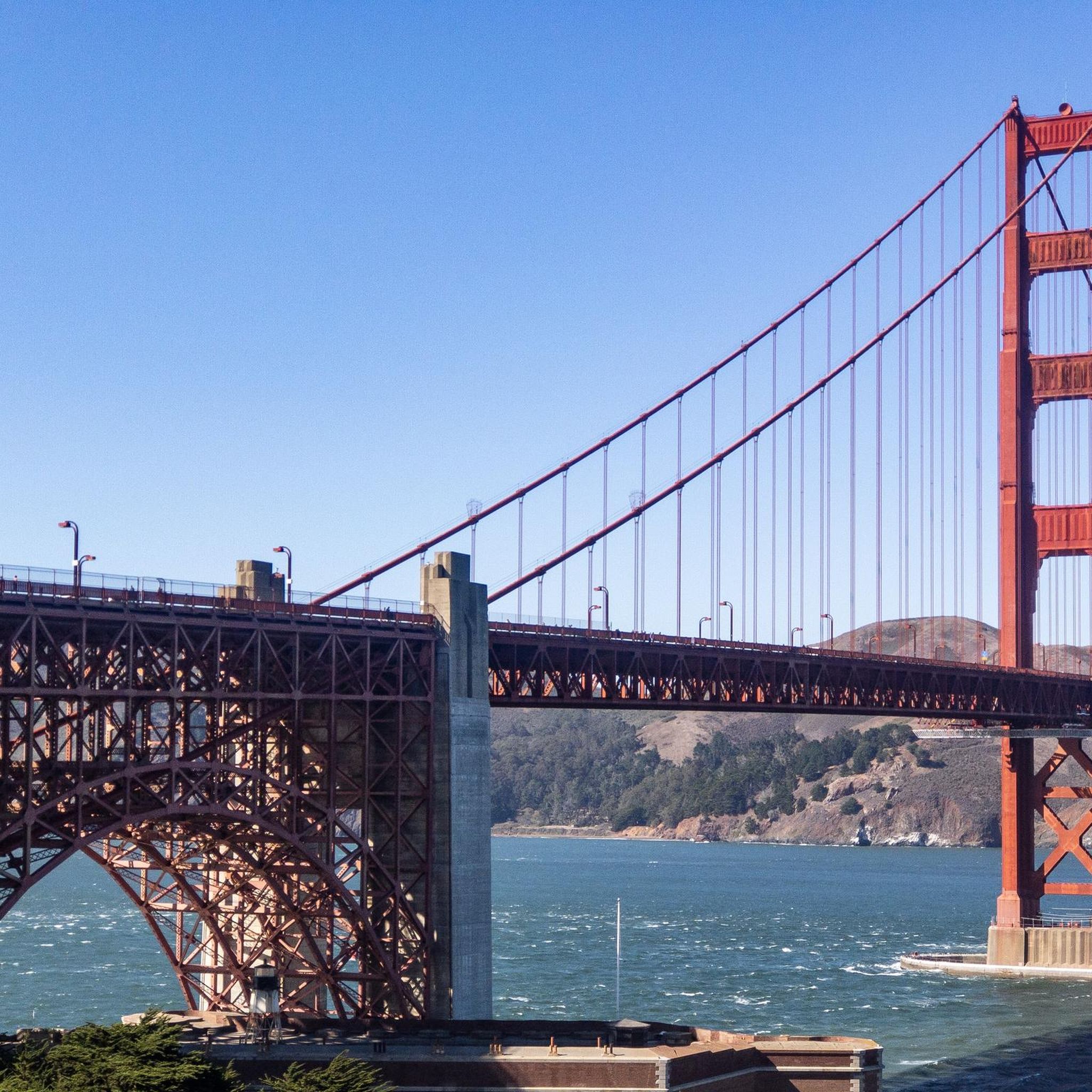
Many routes offer breathtaking views and pass by significant landmarks. You can ride past the iconic Golden Gate Bridge, explore historic sites like Fort Point, or enjoy sweeping vistas from Golden Gate Bridge Overlook Battery Spencer. Coastal trails like Coastal Trail - Land's End also provide stunning ocean views.
What is the best time of year for gravel biking in the Golden Gate National Recreation Area?
The GGNRA is generally enjoyable year-round. Spring brings vibrant wildflowers to the grasslands, while summer offers golden hues. The coastal climate means temperatures are often mild. Be prepared for potential fog, especially in summer, and check weather forecasts for wind, which can be a factor on coastal bluffs.
Are there any loop gravel bike trails in the GGNRA?
Yes, many of the gravel routes in the GGNRA are designed as loops, allowing you to start and end at the same point. An example is the Sausalito — Mill Valley Path – Marincello Trail loop from Marin City, which offers a substantial ride through varied landscapes.
Can I bring my dog on gravel bike trails in the Golden Gate National Recreation Area?
The GGNRA has specific regulations regarding dogs on trails. While some areas allow dogs on leash, others do not. It's best to check the official Golden Gate National Recreation Area website or signage at trailheads for the most current and specific rules regarding dog access on individual trails to ensure compliance.
What are the parking options for accessing gravel bike trails in the GGNRA?
Parking is available at various access points throughout the Golden Gate National Recreation Area, particularly in popular areas like the Marin Headlands and near trailheads. Specific parking availability can vary by location, so it's advisable to check maps or park information for your chosen starting point.
Is public transport available to reach gravel biking areas in the GGNRA?
Public transport options exist to access parts of the Golden Gate National Recreation Area, especially those closer to San Francisco and Marin County. Depending on your starting point, you might be able to use local bus services. Planning your route in advance and checking public transport schedules is recommended.
What do other gravel bikers enjoy most about the GGNRA?
The Golden Gate National Recreation Area is highly rated by the komoot community, with an average score of 4.5 stars from nearly 40 reviews. Riders often praise the raw scenery, the sense of being far from the city despite its proximity, and the unparalleled views of the Golden Gate Bridge and Pacific Ocean.
Are there any cafes or amenities near the gravel bike trails in the GGNRA?
While many trails offer a sense of wilderness, you can find amenities in nearby towns like Sausalito, Mill Valley, and areas bordering San Francisco. These towns offer cafes, restaurants, and shops where you can refuel before or after your ride. Within the park, options are more limited, so plan accordingly.
What kind of wildlife might I spot while gravel biking in the GGNRA?
The GGNRA is rich in biodiversity. You might spot various bird species, including raptors, along the coastal bluffs and in the wetlands. Deer, coyotes, and other small mammals are also common. Keep an eye out for marine life if you're riding near the coast, such as seals or sea lions.
Most popular routes in Golden Gate National Recreation Area
Most popular attractions in Golden Gate National Recreation Area

Get inspired with the komoot mobile app


