The best gravel rides around Brinkhaven
49
riders
1
ride
Gravel biking around Brinkhaven features routes that traverse varied terrain, including sections of the Holmes County Trail and paths near Mohican Wilderness. The area is characterized by rolling hills and forested landscapes, with routes often incorporating significant elevation changes. These trails provide options for gravel bikers seeking challenging climbs and diverse natural settings.
Best gravel bike trails around Brinkhaven
- The most popular gravel bike trail is Climb loop from Mohican Wilderness Campground, a 30.5 miles (49.1 km) trail that takes 3 hours 47 minutes to complete. This difficult route features substantial elevation gain through forested areas.
- Another top favourite among local gravel bikers is Baddow Pass History Signage loop from Glenmont, a difficult 64.3 miles (103.4 km) path. This route offers extensive mileage and significant climbs, passing historical signage.
- Local gravel bikers also love the Bridge of Dreams – Baddow Pass History Signage loop from Brinkhaven, a 32.8 miles (52.8 km) trail leading through varied landscapes, often completed in about 3 hours 33 minutes.
- Gravel biking around Brinkhaven is defined by rolling hills, forested trails, and routes that incorporate historical points of interest. The network offers options for different ability levels, though many routes feature challenging climbs.
- The guide includes highly-rated routes that showcase the best of the region's landscape. More than 40 gravel bikers have used komoot to explore Brinkhaven's varied terrain.
Last updated: July 2, 2026
13
riders
44.3km
03:20
820m
820m
The Climb loop from Mohican Wilderness Campground offers a deep dive into the scenic Mohican Wilderness, where you'll navigate rolling gravel roads and hard-packed decomposed granite surfaces. This route is defined by its sustained climbs, taking you through extensive forests and river valleys, with glimpses of picturesque features like covered bridges. It's a demanding ride that rewards you with a true sense of accomplishment and immersion in nature.
Planning your ride means preparing for a difficult 27.5-mile (44.3 km) journey with 2696 feet (822 metres) of elevation gain, typically taking around 3 hours and 19 minutes. The trailhead is conveniently located at Mohican Wilderness Campground, a popular spot. Arriving early is advisable, especially on busy days, to ensure a smooth start to your adventure.
This loop is a standout for advanced gravel bikers in Ashland County, known for its emphasis on challenging ascents. The Mohican region itself is a hub for outdoor enthusiasts, boasting diverse terrain and stunning vistas, including the Clear Fork Gorge and Lyon's Falls nearby. It's a prime destination for those seeking a rigorous workout within a beautiful natural setting.
9
riders
103km
06:25
1,620m
1,610m
Hard gravel ride. Very good fitness required. Mostly paved surfaces. Suitable for all skill levels.

Sign up for free
6
riders
99.2km
06:09
1,410m
1,410m
Hard gravel ride. Very good fitness required. Mostly paved surfaces. Suitable for all skill levels.
8
riders
38.5km
02:42
560m
560m
The Baddow Pass History Signage loop from Mohican Wilderness Campground offers a demanding gravel biking experience through Ohio's scenic Ashland County. You'll navigate diverse landscapes, from dense forests to wide river valleys, with sections of the Mohican Valley Trail showcasing quiet hills and historical markers. Expect a mix of paved and unpaved surfaces, including challenging stretches of chunky gravel and steep climbs that might require you to push your bike. Keep an eye out for the impressive Bridge of Dreams, a notable landmark along the route.
This difficult 23.9-mile (38.5 km) loop features 1847 feet (563 metres) of elevation gain and typically takes around 2 hours and 42 minutes to complete. Starting from the Mohican Wilderness Campground provides convenient access to the trailhead. Given the significant elevation changes and varied terrain, ensure you have very good fitness and carry ample water, especially during warmer months. Dry conditions are ideal for tackling this advanced gravel biking route.
Beyond the physical challenge, this route is rich in history, with signage along the trail detailing its past as a Pennsylvania Railroad line. It's part of the larger Ohio to Erie Trail, blending a connection to the region's heritage with a robust workout. The Mohican Wilderness area is known for its outdoor activities, making this loop a prime example of the challenging gravel biking trails available.
4
riders
52.8km
03:36
690m
690m
Hard gravel ride. Very good fitness required. Mostly paved surfaces. Suitable for all skill levels.
Our route recommendations are based on thousands of hikes, rides, and runs completed by other people on komoot.
Start today with a free account
Your next adventure awaits.
Login or Signup
Popular around Brinkhaven

Tips from the Community

This small display has a short write up and a few pictures going over the history and importance of Baddow Pass.
0
0
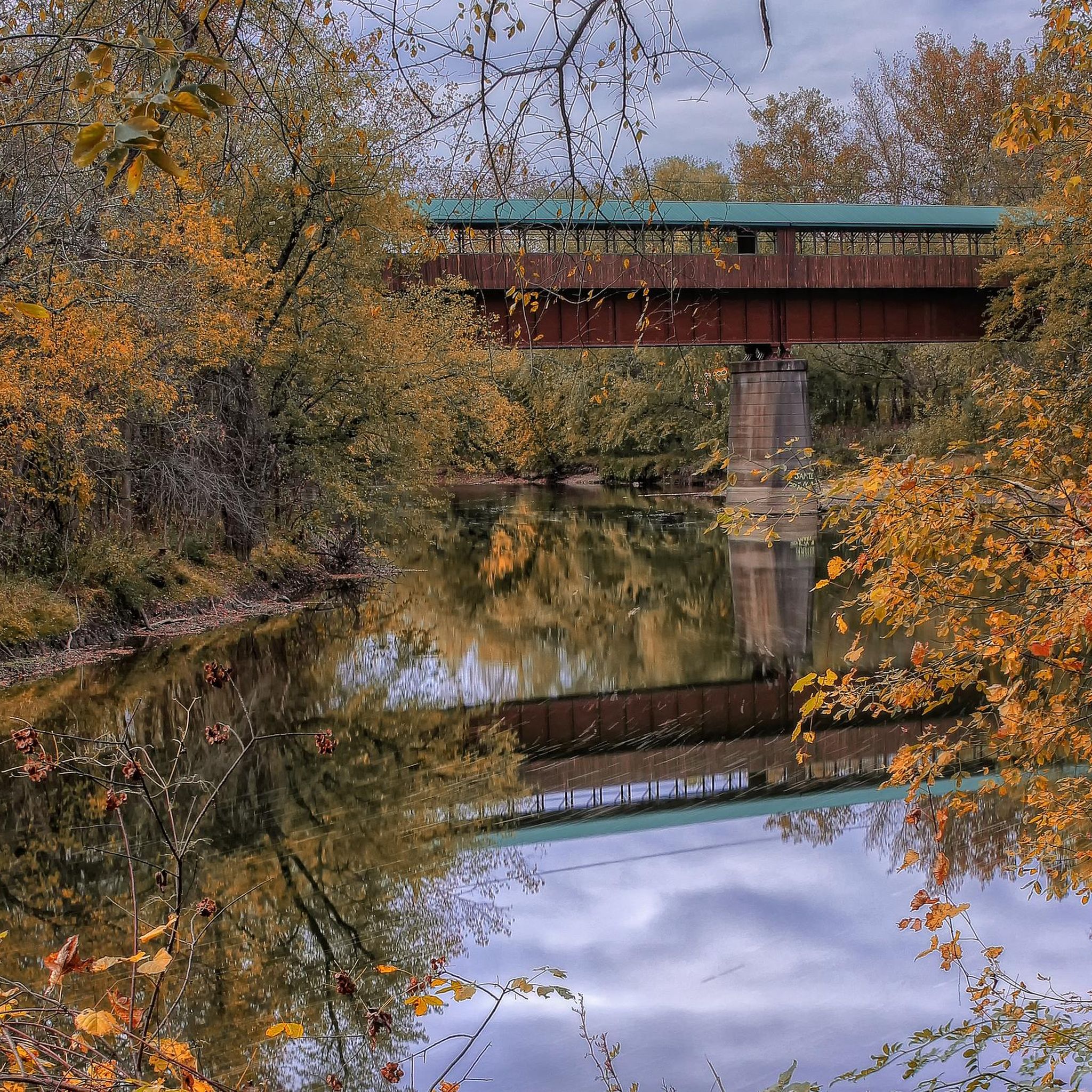
This 370-foot covered bridge began as a railroad bridge in the 1920s. It wasn't covered until 1998, at which point it became the second longest covered bridge in Ohio, and the third longest in the USA.
1
0


The Holmes County Trail is a 23-mile paved trail that travels through Ohio's Amish country. This path was the first path in the country designed to accommodate Amish buggies.
0
0
Frequently Asked Questions
What is the general difficulty level of gravel bike trails around Brinkhaven?
Gravel biking around Brinkhaven is characterized by routes with significant elevation changes and rolling hills. Most routes, such as the Climb loop from Mohican Wilderness Campground, are rated as difficult, featuring challenging climbs through forested areas.
Are there any beginner-friendly or easy gravel bike routes in Brinkhaven?
The gravel routes listed for Brinkhaven generally feature challenging climbs and significant elevation gains, making them more suitable for experienced gravel bikers. For those seeking an easier experience, consider shorter sections of the Holmes County Trail, which offers flatter, paved sections suitable for a more relaxed ride, though dedicated gravel routes tend to be more demanding.
What are some typical lengths for gravel bike trails in the Brinkhaven area?
Trail lengths vary, offering options for different endurance levels. For example, the Climb loop from Mohican Wilderness Campground is about 49 km (30.5 miles), while the Baddow Pass History Signage loop from Glenmont extends to over 103 km (64 miles).
Are there any loop trails for gravel biking near Brinkhaven?
Yes, many of the gravel routes in the area are designed as loops. Examples include the Bridge of Dreams – Baddow Pass History Signage loop from Brinkhaven, which is a 52.8 km (32.8 miles) circuit, and the Baddow Pass History Signage loop from Mohican Wilderness Campground, covering 38.5 km.
What kind of terrain can I expect on Brinkhaven's gravel bike trails?
Expect varied terrain including rolling hills, forested paths, and sections that may incorporate parts of the Holmes County Trail. The region is known for its natural beauty and challenging ascents, providing a diverse riding experience.
Are there any historical points of interest along the gravel routes?
Yes, some routes incorporate historical points. For instance, the Baddow Pass History Signage loop from Glenmont passes historical signage, offering a glimpse into the region's past while you ride.
What is the best time of year to go gravel biking in Brinkhaven?
Spring and fall generally offer the most pleasant conditions for gravel biking in Brinkhaven, with cooler temperatures and vibrant foliage. Summer can be warm and humid, while winter may bring snow and ice, making some trails impassable or more challenging.
What should I wear for gravel biking in Brinkhaven, considering the conditions?
Given the varied terrain and potential for significant elevation changes, layered clothing is recommended. Be prepared for changing weather, especially in spring and fall. Essential gear includes a helmet, gloves, appropriate cycling shoes, and plenty of water, particularly for longer routes with challenging climbs.
Are there any viewpoints or scenic spots along the gravel trails?
The routes often traverse forested areas and rolling hills, providing numerous scenic vistas, especially during ascents and descents. The natural landscape of Mohican Wilderness and the Holmes County Trail offers picturesque views throughout your ride.
Where can I find parking for gravel bike trails in Brinkhaven?
Parking is typically available near trailheads or designated access points. For routes starting near Mohican Wilderness, you can often find parking at or around campgrounds. For routes utilizing the Holmes County Trail, look for parking areas in towns like Brinkhaven or Glenmont that provide access to the trail.
Are there any cafes or places to refuel near the gravel bike trails?
While the trails themselves are often in natural, rural settings, you can find cafes and small eateries in nearby towns such as Brinkhaven, Glenmont, or Loudonville. It's advisable to plan your route and carry sufficient snacks and water, especially for longer rides, as amenities might be sparse directly along the trails.
What do other gravel bikers enjoy most about gravel biking in Brinkhaven?
Gravel bikers often praise the challenging nature of the routes, the beautiful forested landscapes, and the sense of adventure found on the varied terrain. The significant elevation gains provide a rewarding workout, and the incorporation of historical elements on some routes adds an interesting dimension to the ride.
Most popular routes around Brinkhaven

Get inspired with the komoot mobile app


