The best gravel rides around Sharpsburg
4.8
(19)
147
riders
8
rides
Gravel biking around Sharpsburg offers diverse terrain across both Maryland and Georgia. In Maryland, the region features routes near the C&O Canal and Antietam Aqueduct, often incorporating paved sections and requiring good fitness. Sharpsburg, Georgia, provides well-maintained gravel roads, including trails through pine forests and along the Ocmulgee River. The landscape includes a mix of historical areas, natural waterways, and managed forest lands suitable for varied gravel cycling experiences.
Best gravel bike trails around Sharpsburg
- The most popular gravel bike trail is Big Slackwater – Big Slackwater View loop from Sharpsburg, a 71.6 miles (115.2 km) trail that takes 10 hours 13 minutes to complete. This difficult route explores the area around Big Slackwater.
- Another top favourite among local gravel bikers is Shepherdstown – Antietam Aqueduct loop from Dargan, a difficult 50.1 miles (80.6 km) path. This route connects Shepherdstown with the historic Antietam Aqueduct.
- Local gravel bikers also love the Big Slackwater – Big Slackwater View loop from Dargan, a 43.9 miles (70.8 km) trail leading through the Big Slackwater area, often completed in about 6 hours 19 minutes.
- Gravel biking around Sharpsburg is defined by canal paths, riverfront trails, and managed forest roads. The network offers options for different ability levels, from moderate to difficult.
- The routes in Sharpsburg are highly rated by the komoot community with an average score of 4.9 stars from over 10 reviews. More than 130 gravel bikers have used komoot to explore Sharpsburg's varied terrain.
Last updated: July 8, 2026
5.0
(2)
56
riders
This challenging gravel biking route, the Big Slackwater View – Big Slackwater loop from Antietam National Battlefield, offers a unique blend of history and natural beauty. You'll navigate varied terrain, from the historic grounds of Antietam National Battlefield to the stunning Big Slackwater section of the C&O Canal Towpath. The highlight is undoubtedly riding on the unique concrete pathway that hugs the Potomac River, giving you the sensation of cycling directly on the water. Expect mountainous landscapes and extensive river views throughout this demanding 69.9-mile (112.5 km) journey.
To tackle this difficult route, plan for approximately 8 hours and 50 minutes in the saddle, covering 1425 feet (434 metres) of elevation gain. Starting from Antietam National Battlefield is a good option, so check for parking availability there. Given the length and difficulty, an early start is crucial, and carrying ample water and supplies is a must. Be prepared for some significant hills and potentially unpaved, difficult sections that may require pushing your bike.
The Big Slackwater section of the C&O Canal Towpath is a true engineering marvel, rebuilt after being an impassable "missing link" for years. This unique pathway, with elevated sections bolted to bedrock, allows for a continuous ride along the canal, offering an unparalleled riverine experience. The trail's blend of Civil War history and the distinctive C&O Canal environment makes it a standout gravel biking adventure in the region.
5.0
(3)
39
riders
56.6km
04:25
130m
130m
Moderate gravel ride. Good fitness required. Mostly paved surfaces. Suitable for all skill levels.

Sign up for free
4.5
(4)
13
riders
41.4km
03:30
190m
190m
Moderate gravel ride. Good fitness required. Mostly paved surfaces. Suitable for all skill levels.
5.0
(2)
12
riders
23.4km
02:02
140m
140m
Moderate gravel ride. Good fitness required. Mostly paved surfaces. Suitable for all skill levels.
5.0
(5)
13
riders
25.5km
02:09
140m
140m
The Horseshoe Bend campsite – Shepherdstown loop offers a delightful gravel biking experience along the C&O Canal Towpath, immersing you in dense woodlands and providing continuous views of the Potomac River. You'll ride on a largely flat, crushed gravel surface, making it a smooth journey. The route's highlight is the Horseshoe Bend Campsite, named for a dramatic U-shaped turn in the river, offering a picturesque turnaround point.
Starting from Shepherdstown, you'll find plenty of amenities like cafes and bike shops before you hit the trail. This route is particularly well-suited for families and those new to gravel biking, thanks to its easy profile and traffic-free environment. Consider visiting in the fall when the riverside trees burst with vibrant colors, enhancing the natural beauty of the ride.
This 15.9-mile (25.5 km) moderate gravel biking route, with a gentle 468 feet (143 metres) of elevation gain, typically takes around 2 hours and 8 minutes to complete. It's a fantastic option for a relaxed outing, offering a blend of natural beauty and historical significance as you follow the path of the C&O Canal National Historical Park.
Get access to more routes and recommendations from other explorers.
Sign up for free
Already have an account?
Our route recommendations are based on thousands of hikes, rides, and runs completed by other people on komoot.
Start today with a free account
Your next adventure awaits.
Login or Signup
Popular around Sharpsburg

Tips from the Community

One of my favorite rides! The trail is well maintained and smooth. So many spots to rest and take breathtaking pics
1
0

28 Sept 2025: staircase closed as they rebuild it
0
0

A paved elevated boardwalk stretches out along the water, giving you a fantastic view of the Potomac River. This spot can get pretty popular on summer weekends.
0
0

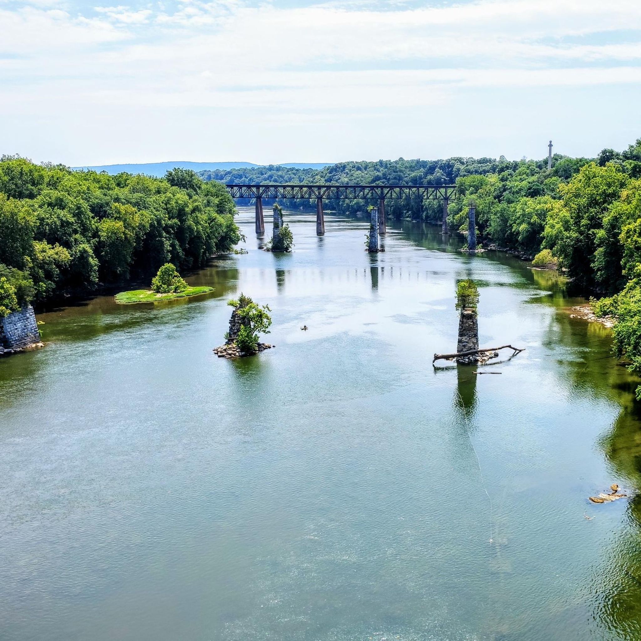
Dam No. 4 is located around mile 84 of the C&O Canal Towpath. Built in 1856, this dam was crucial for maintaining water levels for canal operations and remains an impressive structure along the river. The area around the dam is known for its scenic views and wildlife.
0
0
The Antietam Aqueduct was built in 1834 to carry canal boats over Antietam Creek. It is over 140 feet long and is one of many such aqueducts along the C&O Canal.
0
0
The Antietam Aqueduct, located at mile 69.4 of the C&O Canal Towpath, is a three-arch stone aqueduct that once carried the canal over Antietam Creek. Built in 1834, it is constructed from limestone quarried nearby and remains one of the best-preserved aqueducts along the canal. During the Civil War, it was near the site of Confederate troop movements before and after the Battle of Antietam in 1862. Though it suffered some damage over the years, it has been fully restored and now serves as a scenic and historic stop along the towpath, offering great river views and picnic spots.
0
0
Shepherdstown, West Virginia, is the oldest town in the state (founded in 1762) and has a fun, vibrant college-town atmosphere. Located along the Potomac River at mile 72 of the C&O Canal Towpath, it is home to Shepherd University, giving it a lively college-town vibe with great cafés, restaurants, and shops. Rich in Civil War history, it played a role in the aftermath of the Battle of Antietam, as wounded soldiers were treated here. With its historic district, riverside views, and plenty of accommodations, Shepherdstown is a perfect overnight stop for cyclists C&O Canal Towpath or to just visit when exploring the area.
0
0
Dam No. 4 is located around mile 84 of the C&O Canal Towpath. Built in 1856, this dam was crucial for maintaining water levels for canal operations and remains an impressive structure along the river. The area around the dam is known for its scenic views and wildlife, making it a nice spot to pause before continuing on your ride.
0
0
Frequently Asked Questions
How many gravel bike trails are available around Sharpsburg?
There are 7 gravel bike trails documented around Sharpsburg on komoot, offering a range of experiences from moderate to difficult.
Are there any easy or beginner-friendly gravel routes in Sharpsburg?
While many routes in Sharpsburg are rated moderate to difficult, the region in Georgia offers several well-maintained gravel trails suitable for various skill levels. For example, the Ocmulgee Camp Loop consists of well-maintained gravel roads, and county-maintained roads like Dean Road and Panther Creek Road in Georgia provide easy and scenic options.
What are some challenging gravel biking options in the Sharpsburg area?
For a more challenging ride, consider routes in Sharpsburg, Maryland, such as the Big Slackwater – Big Slackwater View loop from Sharpsburg, which is 71.6 miles long and rated difficult. Another demanding option is the Shepherdstown – Antietam Aqueduct loop from Dargan, covering 50.1 miles. Some sections in Maryland may even require pushing your bike due to their difficulty.
Are there any long-distance gravel routes available?
Yes, Sharpsburg offers several long-distance options. The Big Slackwater – Big Slackwater View loop from Sharpsburg is a significant 71.6-mile route. Additionally, the C&O Canal, accessible near Sharpsburg, Maryland, provides an extensive 184.5-mile path for longer adventures.
Can I find circular gravel routes in Sharpsburg?
Many of the gravel routes around Sharpsburg are designed as loops. Examples include the Big Slackwater – Big Slackwater View loop from Sharpsburg and the Dam 4 C&O – Shepherdstown loop from Scrabble.
What kind of natural features or attractions can I see along the gravel trails?
Around Sharpsburg, Maryland, you can explore historical sites like the Antietam National Battlefield and natural areas such as Big Slackwater and Dam No. 4 along the C&O Canal. In Sharpsburg, Georgia, trails wind through pine experimental areas, cross Falling Creek, and follow the Ocmulgee River. The Flat Creek Nature Area features a boardwalk across wetlands, offering opportunities for wildlife viewing.
Are there any family-friendly options for gravel biking?
In Sharpsburg, Georgia, the well-maintained gravel trails like the Ocmulgee Camp Loop or the county-maintained roads (Dean Road, Panther Creek Road) offer easier, scenic routes that can be suitable for families. The Flat Creek Nature Area also provides a boardwalk for nature walks, which can be a pleasant addition to a family outing.
Where can I find parking or trailheads for gravel biking in Sharpsburg?
Specific parking information varies by trailhead. For routes in Maryland, areas near the C&O Canal and towns like Dargan or Sharpsburg itself often provide access points. In Georgia, the Ocmulgee Camp Loop has a multi-use trailhead with a dispersed camping area. It's always recommended to check the individual route details on komoot for precise trailhead and parking information.
What do other gravel bikers say about the trails in Sharpsburg?
The gravel biking routes around Sharpsburg are highly rated by the komoot community, with an average score of 4.9 stars from over 10 reviews. More than 130 gravel bikers have explored the varied terrain, often praising the mix of canal paths, riverfront trails, and managed forest roads.
Are there any parks or recreational areas to visit in Sharpsburg, Georgia?
Yes, Sharpsburg, Georgia, offers several parks and recreational areas. These include Staley Park & Pavilion, the upcoming Sharpsburg Library & Library Park, the Flat Creek Nature Area with its boardwalk, and the Line Creek Nature Area with a small pond. You can find more information on the Sharpsburg, GA Parks and Recreation website.
What kind of terrain can I expect on gravel rides in Sharpsburg?
The terrain varies significantly between the Maryland and Georgia regions. In Maryland, you'll find a mix of canal paths, historical routes, and some mostly paved sections, despite being categorized as gravel, which can be quite challenging. In Georgia, expect well-maintained gravel roads, some dirt and muddy sections, and routes through pine forests and along rivers. Some county roads in Georgia, like Lion Lane, can be very rough and washed out.
Most popular routes around Sharpsburg
Most popular attractions around Sharpsburg

Get inspired with the komoot mobile app


Explore more
Browse the best Gravel rides in other regions.
