The best gravel rides around Lakeside
4.5
(2)
47
riders
8
rides
Gravel biking around Lakeside features a network of trails primarily following river corridors and multi-use paths, offering varied terrain for cyclists. The region is characterized by relatively flat sections along waterways, interspersed with areas of gentle elevation gain. These routes often traverse urban fringes and natural open spaces, providing a mix of paved and unpaved surfaces suitable for gravel bikes. The landscape includes riverine environments, open parklands, and some sections with views of the surrounding plains and distant hills.
Best…
Last updated: July 13, 2026
4.0
(1)
9
riders
23.6km
01:41
140m
140m
Easy gravel ride. Great for any fitness level. Mostly paved surfaces. Suitable for all skill levels.
6
riders
This moderate gravel biking route, spanning 19.7 miles (31.7 km) with 757 feet (231 metres) of elevation gain, offers a fantastic blend of parkland and wildlife refuge, typically completed in…

Sign up for free
7
riders
116km
07:15
670m
670m
Hard gravel ride. Very good fitness required. Mostly paved surfaces. Suitable for all skill levels.
2
riders
Moderate gravel ride. Good fitness required. Mostly paved surfaces. Suitable for all skill levels.
7
riders
38.4km
02:29
420m
420m
Moderate gravel ride. Good fitness required. Mostly paved surfaces. Suitable for all skill levels.
Get access to more routes and recommendations from other explorers.
Sign up for free
Already have an account?
Our route recommendations are based on thousands of hikes, rides, and runs completed by other people on komoot.
Start today with a free account
Your next adventure awaits.
Login or Signup


Tips from the Community

The bridge was not open on 9/25/25, it looks completed and ready for action, but needs to be approved by JeffCo Engineering. Should be fully open soon.
1
0

You can see William Frederick Hayden Park on the right, and Denver on the left from Carl's Point. A perfect spot to take a mid ride photo or simply take a break and enjoy the view.
0
0


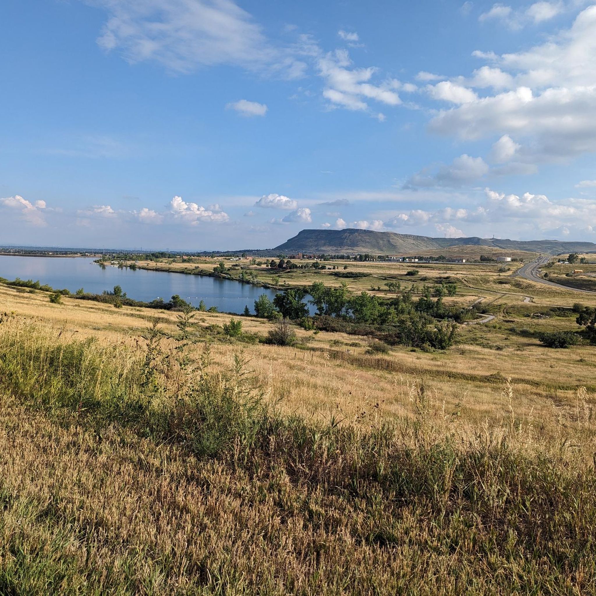
Great view of Standley Lake from the northern side. It is definitely worth stopping for a minute to admire the vista before continuing your ride.
0
0
Soon to be new bridge over Indiana St that will connect Rocky Flats to Westminster Hills Open Space. Great new addition to the Rocky Flats trail system, will open up lots of options for gravel riding between Golden and Boulder.
0
0
New bridge on the connector trail between Rocky Flats and Westminster Hills. As of April 2025, the connector trail is almost completed.
0
0
Fun mellow gravel riding around Stanley Lake, nice area to include in a gravel ride, great birding and lakeside trails.
1
0
Frequently Asked Questions
How many gravel bike trails are available around Lakeside?
There are 9 gravel bike trails documented around Lakeside on komoot, offering a variety of experiences for cyclists. These routes range from moderate to difficult, primarily following river corridors and multi-use paths.
What kind of terrain can I expect on gravel bike trails in Lakeside?
Gravel biking around Lakeside features diverse terrain. You'll find relatively flat sections along waterways, interspersed with areas of gentle elevation gain. Routes often traverse urban fringes and natural open spaces, providing a mix of paved and unpaved surfaces. The landscape includes riverine environments, open parklands, and some sections with views of surrounding plains and distant hills.
Are there any long-distance gravel routes for experienced riders?
Yes, for experienced riders looking for a challenge, the Cherry Creek Trail – East/West Regional Trail loop from 10th & Osage is a difficult 72.0-mile (116.0 km) trail with significant elevation gain, typically taking over 8 hours to complete.
Are there any moderate gravel routes suitable for a day trip?
Absolutely. A popular moderate option is the Platte River Trail bridge – Bridge over South Platte River loop from 10th & Osage. This 37.9-mile (61.1 km) path follows river trails with moderate elevation changes, making it a great choice for a day out.
What are some scenic viewpoints or landmarks I can see along the gravel trails?
Many routes offer scenic views. For instance, the Confluence Park – Cherry Creek Trail loop from 30th & Downing passes through Confluence Park. While not directly on a gravel route, the View of Denver skyline from Sloan's Lake west shore is a notable viewpoint in the broader Lakeside area, and some trails might offer glimpses of the city or natural landscapes.
What do other gravel bikers enjoy most about riding in Lakeside?
The komoot community highly rates the gravel biking experience in Lakeside, with an average score of 5.0 stars. Riders often praise the varied terrain, the network of river trails and multi-use paths, and the accessibility of routes that combine urban fringes with natural open spaces.
Are there any trails that pass by lakes or natural water features?
Yes, the region is characterized by river corridors and multi-use paths that often follow waterways. You can find highlights like Lowell Ponds Wildlife Area and Sloan's Lake Park in the vicinity, offering pleasant lakeside views and natural environments.
Are there any gravel routes that are good for exploring urban areas or city attractions?
Some routes, like the Confluence Park – Cherry Creek Trail loop from 30th & Downing, lead through urban parks and areas close to city attractions. Nearby points of interest include Union Station Denver and the 16th Street Mall, which could be explored before or after your ride.
What is the typical elevation gain on Lakeside's gravel trails?
The elevation gain varies significantly depending on the route. Moderate trails like the Platte River Trail bridge – Bridge over South Platte River loop from 10th & Osage have around 191 meters of elevation gain, while more difficult routes such as the Cherry Creek Trail – East/West Regional Trail loop from 10th & Osage can feature over 650 meters of climbing.
Are there any shorter, less demanding gravel routes for a quicker ride?
Yes, for a shorter and less demanding ride, consider the Majestic View Park – Majestic View Park loop from Two Ponds National Wildlife Refuge. This moderate route covers about 32.8 miles (52.8 km) and offers a pleasant experience without extensive duration or extreme difficulty.
Can I find routes that offer a mix of natural scenery and urban elements?
Many of Lakeside's gravel routes offer this blend. They often traverse river valleys and open parklands while remaining accessible from urban centers, providing a dynamic cycling experience that combines natural beauty with glimpses of city life.
Most popular attractions around Lakeside

Get inspired with the komoot mobile app


Explore more
Browse the best Gravel rides in other regions.
