The best gravel rides around Romeyer
4.8
(52)
302
riders
34
rides
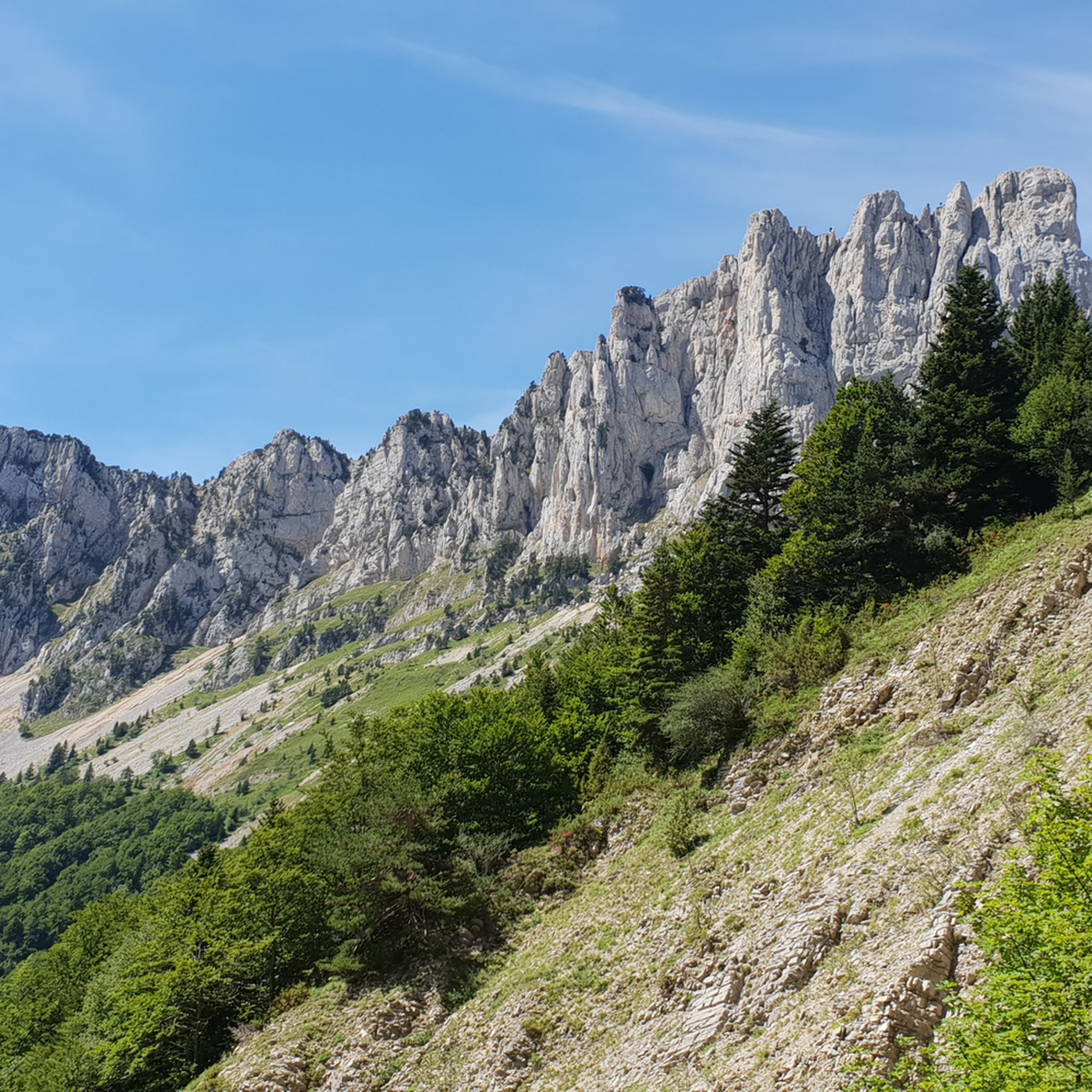
Gravel biking around Romeyer offers exploration within the Drôme department, nestled in the Auvergne-Rhône-Alpes region of France. The area is characterized by dramatic mountainous terrain, including the Montagne du Glandasse and Dent de Die, and is situated within the Vercors Regional Natural Park. Extensive forests cover much of the commune, providing numerous unpaved roads and tracks suitable for gravel cycling. The landscape features valleys like Meyrosse and a "mountain fringe climate."
Best gravel bike trails around Romeyer
- The most popular…
Last updated: August 26, 2026
5.0
(1)
37
riders
57.2km
04:07
1,070m
1,070m
Hard gravel ride. Very good fitness required. Mostly paved surfaces. Suitable for all skill levels.
4.7
(15)
31
riders
36.8km
02:32
670m
670m
Hard gravel ride. Very good fitness required. Mostly paved surfaces. Suitable for all skill levels.

Sign up for free
5.0
(2)
15
riders
29.3km
02:17
590m
590m
Hard gravel ride. Very good fitness required. Mostly paved surfaces. Suitable for all skill levels.
10
riders
19.9km
01:57
630m
630m
Hard gravel ride. Very good fitness required. Mostly paved surfaces. Suitable for all skill levels.
4.0
(2)
13
riders
30.5km
02:10
570m
570m
Hard gravel ride. Very good fitness required. Mostly paved surfaces. Suitable for all skill levels.
Get access to more routes and recommendations from other explorers.
Sign up for free
Already have an account?
Our route recommendations are based on thousands of hikes, rides, and runs completed by other people on komoot.
Start today with a free account
Your next adventure awaits.
Login or Signup
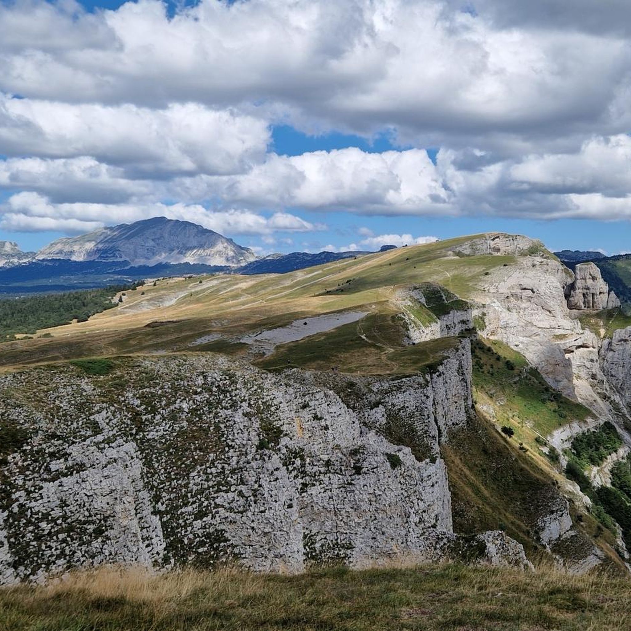
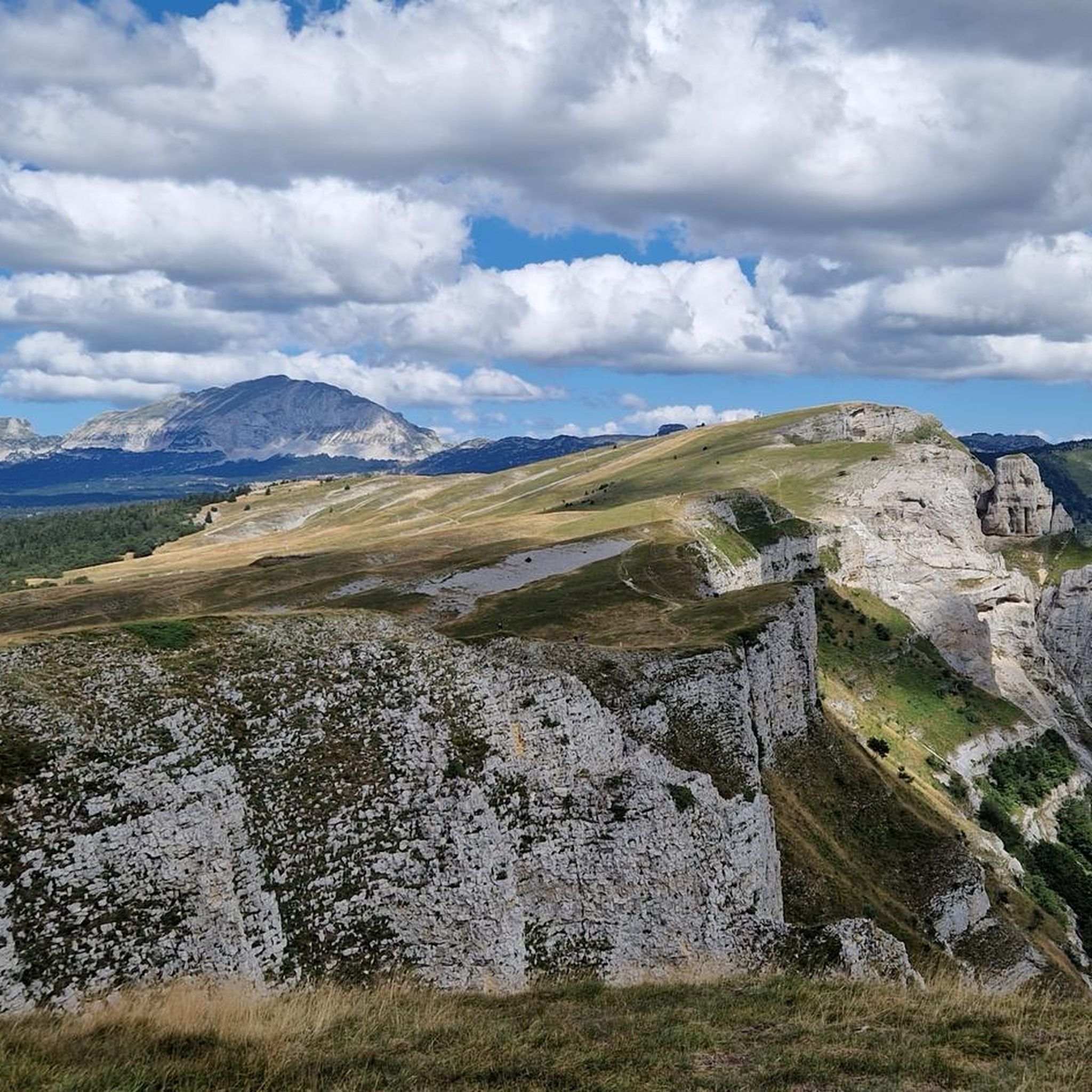
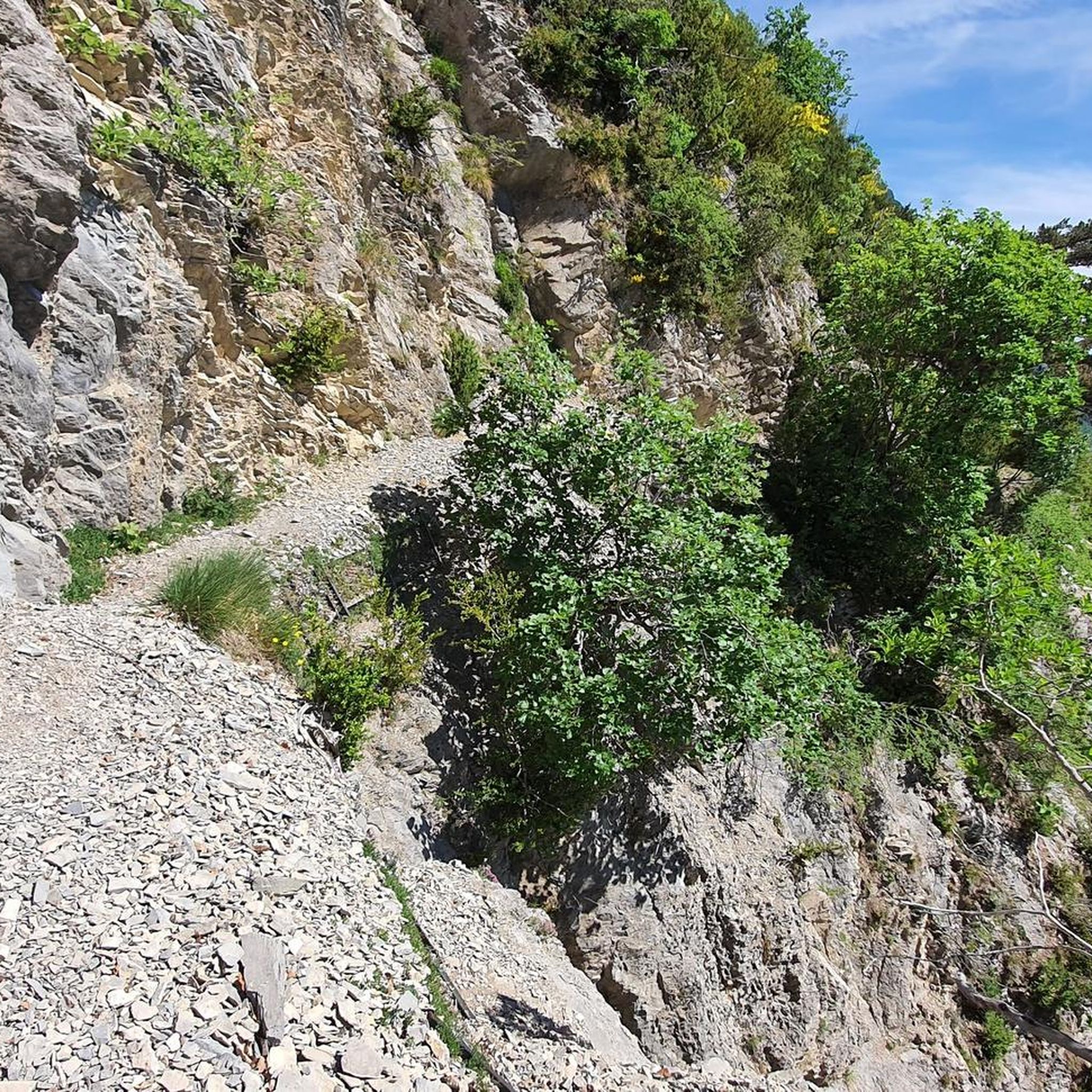
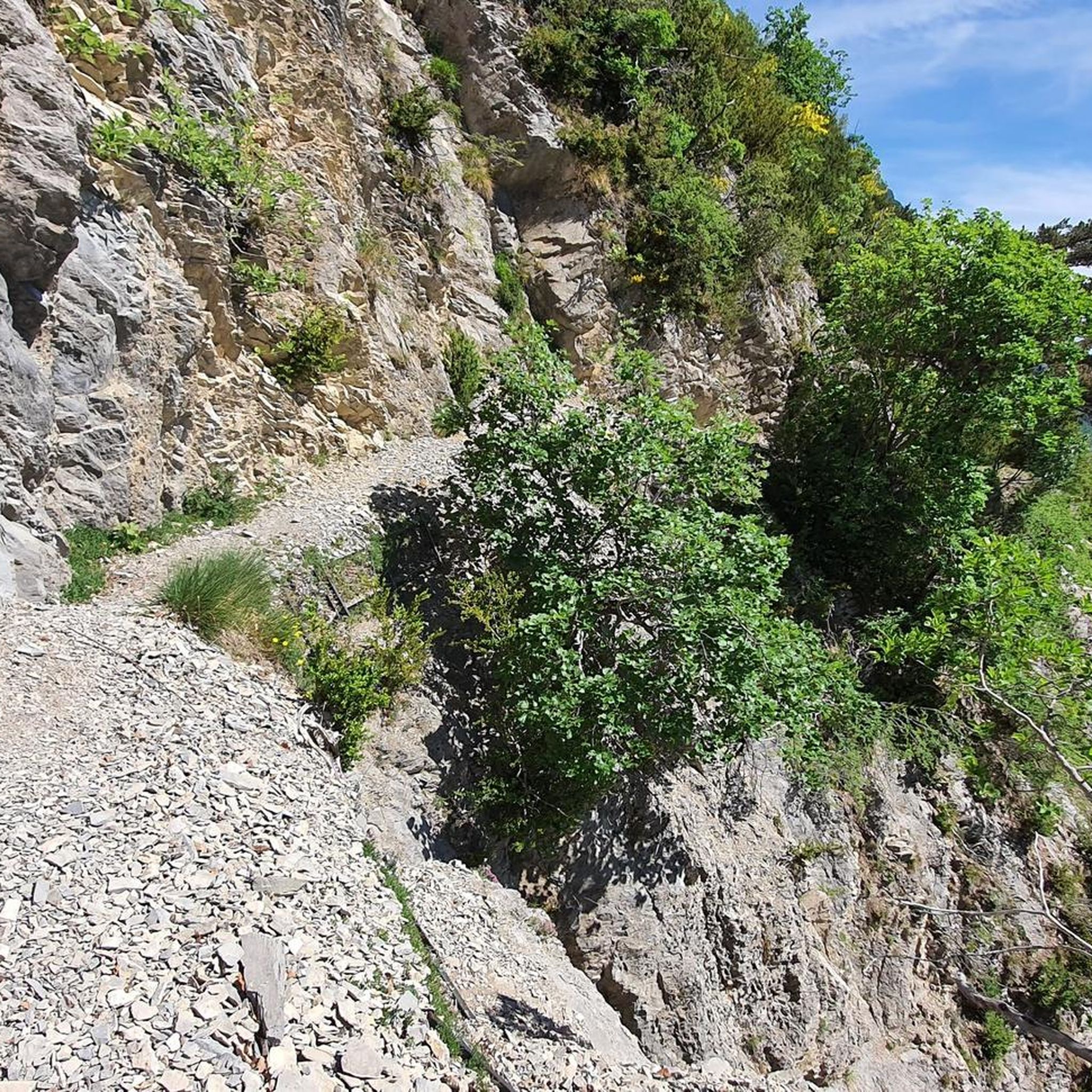
Tips from the Community

Conversation in AI Mode: valle di la sureThe Sûre Valley (or Vallée de la Sûre) is a splendid natural region that extends along the course of the Sûre river (called Sauer in German), mainly located between Belgium and Luxembourg, with some extensions into Germany.If, on the other hand, you were looking for a location related to the French mountains (in the Chartreuse massif), you might be referring to the area around the summit of Grande Sure.Here are the main attractions and activities related to the Sûre Valley (Ardennes/Luxembourg):🏞️ Nature and National ParksHaute-Sûre Natural Park: Located in the province of Luxembourg (Belgium), it includes dense forests, marshy areas, and vast agricultural plateaus.Haute-Sûre Lake: Located in Luxembourg, it is the country's largest reservoir and a paradise for water sports, hiking, and relaxation.🚴 Hiking and CyclingCycling Routes: The valley offers spectacular and flat cycling routes along the river, such as the famous S3 Tour de la Vallée de la Sûre in Luxembourg, ideal for discovering typical villages and castles.Trekking Trails: There are numerous circular routes of varying difficulty, perfect for walks in the woods and along waterways.👨👩👧👦 Featured AttractionsZooParc Vallée de la Sûre: Located in Vaux-sur-Sûre (Belgium), it is a wildlife park in the Ardennes where you can observe rare species and participate in educational activities such as the "zookeeper for a morning".Would you like more information about a specific area of the Sûre Valley? Let me know if you are interested in:Detailed trekking or cycling routesInformation about castles and historic villages in the areaDetails about the Grande Sure summit in France, in case you were looking for the mountainAI responses may contain errors. Learn moreZooParc Vallée de la SûreZooParc Vallée de la Sûre • Parc animalier de l'ArdenneÀ Vaux-sur-Sûre, à deux battements d'ailes de Bastogne, Libramont et Neufchâteau, laissez-vous emporter par une aventure unique où...Decathlon OutdoorThe great Sure di Currière - Decathlon OutdoorJune 17, 2026 — From its 1,920-meter summit, the Grande Sure majestically overlooks the valley. From its peak, it offers a magnificent view of the valley...visit WalloniaHaute-Sure and Anlier Forest Natural ParkIt consists of vast agricultural plateaus, the Sûre basin, with its resinous valleys, the Anlier massif, the important relief...Show allvalle di la sure in the VercorsIn the Vercors Massif (France), the name "La Sure" does not refer to a long watercourse, but to a splendid alpine basin and a panoramic peak that dominates the northern part of the massif. In particular, it refers to the area and hiking route of Le Val de la Sure, located near the municipality of Autrans-Méaudre en Vercors.
3
0

Very well signposted, dozens of kilometers possible on foot, gravel, mountain biking, trail running, an exceptional mountain range to discover.
1
0
magnificent panorama, very pleasant walk
0
0
hours of walking in the vineyards
0
0
nice little walk to do with the family
0
0
A beautiful page of history
1
0
Frequently Asked Questions
What kind of gravel biking experience can I expect around Romeyer?
Gravel biking around Romeyer offers a diverse experience within the Drôme department, characterized by dramatic mountainous terrain, dense forests, and quiet rural roads. Located within the Vercors Regional Natural Park, you'll find a mix of challenging climbs and scenic descents, with routes often featuring significant elevation gain. The area is ideal for those seeking a tranquil and scenically rich experience away from major traffic.
How many gravel bike trails are available in Romeyer?
There are over 30 gravel bike routes available around Romeyer, offering a wide range of options for exploration. The komoot community has extensively mapped and reviewed these trails, ensuring a variety of choices for different skill levels.
Are there gravel bike trails suitable for beginners in Romeyer?
While many routes around Romeyer are quite challenging, there is at least one easier gravel bike trail available. The region's diverse network also includes paths that are more accessible, though most routes feature notable elevation changes. It's always recommended to check the route details on komoot for specific difficulty ratings before heading out.
How challenging are the gravel bike routes in Romeyer?
The majority of gravel bike routes around Romeyer are classified as difficult, with 28 out of 32 routes falling into this category. These trails often involve significant climbing, such as the Die – The town center loop from Die which features over 3,500 feet of climbing. Riders should be prepared for varied terrain, including forest paths, winding country roads, and technical sections.
What is the best time of year for gravel biking in Romeyer?
Romeyer experiences a 'mountain fringe climate,' which means varied conditions throughout the year. Spring and autumn generally offer pleasant temperatures and vibrant scenery, making them ideal for gravel biking. Summer can be warm, especially at lower elevations, while winter may bring snow to higher mountain passes, potentially limiting access to some routes. Always check local weather forecasts before your ride.
Are there any loop trails for gravel biking near Romeyer?
Yes, many gravel bike routes around Romeyer are designed as loops, allowing you to start and finish in the same location. For example, the popular Die – Justin's Cross loop from Place de l'Horloge is a great option, covering nearly 19 miles (30 km) with significant elevation gain. Another option is the Col de Marignac – Route des Bouanes loop from Romeyer, a longer route offering diverse landscapes.
What do other gravel bikers enjoy the most about gravel biking in Romeyer?
The gravel biking experience in Romeyer is highly rated by the komoot community, with an average score of 4.7 stars from over 30 reviews. Riders often praise the stunning mountainous landscapes, the tranquility of the Vercors Regional Natural Park, and the challenging yet rewarding nature of the trails. The extensive network of unpaved roads and tracks, away from traffic, is also a frequently highlighted positive aspect.
What natural features or landmarks can I see along the gravel bike trails around Romeyer?
The routes around Romeyer offer breathtaking views of the Montagne du Glandasse and Dent de Die. You can also explore the serene Valley of Meyrosse and pass by the source of the Rays river. For specific points of interest, consider routes that take you near mountain passes like Col de Marignac or Col de l'Allimas, which offer panoramic vistas. The region's extensive forests and rural character provide a constant backdrop of natural beauty.
Are there any family-friendly gravel biking options near Romeyer?
While many routes in the immediate Romeyer area are quite demanding, the broader Vercors Regional Natural Park offers a range of options, including the 55 km Via Vercors, which is designed as a 'gentle travel' path. This route connects various villages and provides a secure and accessible way to experience the region's nature and heritage, potentially offering more family-friendly sections. Always check individual route details for suitability.
Is there parking available for gravel bikers in Romeyer?
As a rural commune, Romeyer and nearby towns like Die typically offer various parking options, especially in village centers or near trailheads. Given the dispersed nature of housing and the focus on outdoor activities, you should be able to find suitable parking. It's advisable to check local signage or use navigation apps for specific parking locations when planning your ride.
Can I access Romeyer's gravel trails using public transport?
Public transport access to Romeyer itself might be limited due to its rural location. However, nearby larger towns like Die, which serve as starting points for several gravel routes, are generally better connected by regional transport services. From Die, you can often cycle to the trailheads. For detailed public transport information, it's best to consult regional bus or train schedules for the Drôme department.
Can I bring my dog on the gravel bike trails around Romeyer?
The Vercors Regional Natural Park, where Romeyer is located, generally welcomes dogs on trails, provided they are kept on a leash to protect wildlife and ensure the safety of other users. Always be mindful of local regulations, especially in protected areas or near livestock. Ensure your dog is fit enough for the terrain and distance, and always carry enough water for both of you.
Are there cafes or accommodation options near the gravel bike trails in Romeyer?
Romeyer is a small, rural commune, so amenities like cafes and dedicated accommodation might be limited directly within the village. However, the nearby town of Die, which is a common starting point for many gravel routes, offers a wider range of cafes, restaurants, and accommodation options. You can plan your rides to pass through or end in Die for refreshment and lodging.
Most popular routes around Romeyer
Most popular attractions around Romeyer

Get inspired with the komoot mobile app


Explore more
Browse the best Gravel rides in other regions.
