The best waterfall hikes and walks in the Harmonie Mountains
4.8
(203)
2,687
hikers
4
hikes
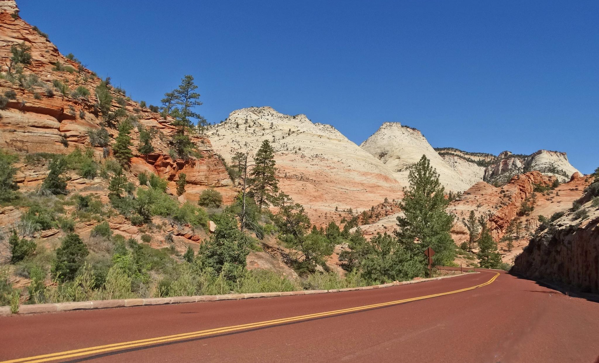
Waterfall hiking trails in the Harmonie Mountains offer diverse landscapes, from lowland river areas to mountainous terrain. The region encompasses both the riverine ecosystems of Harmonie State Park in Indiana and the higher elevations of the Harmony Mountains in Utah. Hikers can explore areas characterized by dry-mesic upland forests, mesic ravine forests, and wet floodplain forests, or ascend to peaks reaching over 2,500 meters. The trails often feature pleasant streams, towering trees, and a variety of wildflowers, with some routes leading through canyons and past notable waterfalls.
Best waterfall hiking trails in the Harmonie Mountains
- The most popular waterfall hiking route is Kanarra Falls Trail, a 1.8 mile (3.0 km) trail that takes 1 hour 3 minutes to complete. This moderate route leads through a scenic slot canyon with multiple waterfalls.
- Another top favourite among local hikers is Toquerville Falls, a moderate 6.8 mile (11.0 km) path. This trail follows a river to a series of cascading waterfalls, offering views of the surrounding desert landscape.
- Local hikers also love the Rattlesnake Gulch Trail, a 2.9 mile (4.7 km) trail leading through a gulch with seasonal waterfalls, often completed in about 1 hour 17 minutes.
- Hiking in the Harmonie Mountains is defined by lowland river valleys, diverse forest types, and high-elevation mountain peaks. The network offers options for different ability levels, from moderate walks to difficult, multi-day traverses.
- The routes in Harmonie Mountains are highly rated by the komoot community with an average score of 4.7 stars from over 125 reviews. More than 1500 hikers have used komoot to explore Harmonie Mountains's varied terrain.
Last updated: July 7, 2026
5.0
(1)
7
hikers
2.96km
01:03
190m
10m
The Kanarra Falls Trail offers an accessible taste of Utah's iconic slot canyons, guiding you through a landscape that evolves from a dirt path alongside Kanarra Creek to dramatic red rock walls. You'll find yourself wading through the creek, navigating rocky riverbeds, and eventually reaching the highlight: a stunning first waterfall with a metal ladder, followed by a second waterfall and even a natural waterslide. The experience is immersive, with towering sandstone walls enclosing the creek, creating a memorable journey for those who don't mind getting wet.
To visit, you'll need to plan ahead, as a permit system limits daily access to 150-180 hikers, with permits costing around $15 and requiring advance purchase. It's crucial to check the weather forecast before you go, especially during the monsoon season from July to September, as flash floods are a serious risk in the narrow canyon. This moderate 1.8-mile (3.0 km) hike, with 636 feet (194 metres) of elevation gain, typically takes about 1 hour and 3 minutes, but allow more time for enjoying the scenery and navigating the creek.
Often compared to a smaller, less crowded version of Zion National Park's Narrows, Kanarra Falls stands out for its unique combination of slot canyon exploration and waterfall ascents. The presence of the distinctive ladder at the first waterfall adds a fun, photogenic challenge, while the natural waterslides and pools further up provide a refreshing reward. This trail is an excellent choice for hikers seeking a unique geological adventure without the technical gear or intense crowds often associated with more famous canyons.
11.0km
03:13
340m
270m
Embark on a moderate hike to Toquerville Falls, a 6.8-mile (11.0 km) journey that winds through a classic Utah desert scene. You will gain 1103 feet (336 metres) in elevation over an estimated 3 hours and 13 minutes, encountering striking red rock cliffs and sandy washes. The highlight is a two-tiered waterfall where La Verkin Creek cascades over smooth rock ledges, creating a refreshing oasis amidst the arid landscape.
To reach the falls, be aware that the primary route is a rough, rocky dirt road, frequently used by off-road vehicles. If you plan to hike the entire road, prepare for full sun exposure and potentially muddy, deeply rutted sections after rain. A 4x4 vehicle is often recommended or necessary to navigate the road to the trailhead, so plan your approach accordingly.
This trail offers a unique contrast where clear water and lush greenery thrive against the dusty desert backdrop. As you hike, you can enjoy expansive views of the Hurricane Cliffs, Kolob Canyon, and the distant Pine Valley Mountains, making the journey to this hidden gem a memorable exploration of Utah's diverse terrain.

Sign up for free
134km
43:54
3,840m
3,960m
The Zion Traverse: Lee Pass to East Rim Trailhead offers a truly immersive backpacking experience through Zion National Park's diverse landscapes. You'll journey from the remote Kolob Canyons, with their towering mesas and natural arches like Kolob Arch, through high-desert ponderosa forests, and eventually into the dramatic scenery of Zion Canyon. The terrain is incredibly varied, transitioning from hard-packed creek bottoms to sandy paths and dramatic cliffside descents, providing a "mind-blowingly beautiful" and ever-changing backdrop. This is a multi-day adventure that showcases the park's geological grandeur and diverse ecosystems.
This difficult route, covering 83.4 miles (134.3 km) with 12599 feet (3840 metres) of elevation gain and an estimated duration of 43 hours and 53 minutes, requires significant planning. While the full traverse to the East Rim Trailhead is currently inaccessible, a modified version typically ends at The Grotto (Shuttle Stop #6). Wilderness permits are essential for overnight stays and are highly sought after. Be prepared for limited water sources and arrange shuttle services for transportation between trailheads. The best time to visit is during Spring or Fall for optimal weather conditions.
What makes the Zion Traverse stand out is its deep backcountry immersion, allowing you to explore areas fewer day hikers reach. You'll witness the park's varied ecosystems, from high-desert to lush canyon floors, and might even spot wildlife like golden eagles or canyon tree frogs. It's a top-rated multi-day hike in Zion National Park, offering a unique perspective on its soaring Navajo sandstone monoliths and steep echoing canyons, a true testament to the park's wild beauty.
4.75km
01:18
70m
70m
Embark on the Rattlesnake Gulch Trail for a moderate hike through the unique desert environment of Washington County, Utah. This route spans 2.9 miles (4.7 km) and involves a gentle elevation gain of 229 feet (70 metres), making it a pleasant journey. You can expect to complete the hike in about 1 hour and 17 minutes, enjoying the characteristic flora and geological formations along the way. The trail's highlight is reaching the beautiful Toquerville Falls, a refreshing cascade that offers a perfect spot to pause and take in the scenery.
Planning your visit to Rattlesnake Gulch Trail is straightforward, as the route is generally accessible for hikers. You will typically find parking available conveniently close to the trailhead, which simplifies your arrival. Before heading out, always make sure to check the current local conditions, particularly the weather forecast. This will help ensure you have a pleasant and safe hiking experience in the desert landscape.
The Rattlesnake Gulch Trail is notable for leading you directly to the refreshing Toquerville Falls, a significant natural feature in this part of Utah. The journey itself provides a clear example of the desert's distinct ecosystem, showcasing its resilient plant life and interesting geological formations. This trail offers a great opportunity to experience the scenic landscapes of Washington County without requiring an extensive time commitment.
Our route recommendations are based on thousands of hikes, rides, and runs completed by other people on komoot.
Start today with a free account
Your next adventure awaits.
Login or Signup
Popular around Harmonie Mountains
Other adventures in the Harmonie Mountains

Tips from the Community

Works great with the shuttle bus
0
0


Great view from Emerald Pools Trail of the valley and the Virgin River. This is a great place along the trail to take a quick break to enjoy the peaceful setting.
0
0

From the Scout lookout you can watch the turkey vultures' flight show...
0
0

The Grotto is a popular picnic area and trailhead for many of the park's most popular trails and is shuttle stop #6 when the service is running. In the early 1920s this spot was the end of the road into Zion Canyon. There are great views of the Virgin River and Angels Landing from the picnic area, which is shaded by large cottonwood trees. You can access several popular trails from here, including: The Grotto Trail, Kayenta Trail, Angels Landing (via West Rim Trail), and Scout Lookout (via West Rim Trail). Keep in mind that you need a permit to hike Angels Landing.
3
0

From this outlook you can either continue along the trail or turn off to Angels Landing
2
0

Nice view over the valley.
1
0
Rest area overlooking the Virgin River. One of the few trees on the way. Unfortunately, right at the beginning of the trail
1
0
Frequently Asked Questions
How many waterfall hiking trails are available in the Harmonie Mountains?
There are 5 distinct waterfall hiking trails featured in this guide for the Harmonie Mountains, offering a variety of experiences for hikers.
Are there any easy waterfall hikes suitable for beginners or families?
While most of the waterfall trails in this guide are rated as moderate, routes like the Rattlesnake Gulch Trail offer a manageable distance and elevation gain, making them suitable for those seeking a less strenuous experience. Always check the individual route details for the latest information on difficulty.
What is the best time of year to visit the waterfalls in the Harmonie Mountains?
The best time to experience the waterfalls at their fullest flow is typically during spring, following snowmelt, or after periods of significant rainfall. However, the unique geology of the Harmonie Mountains means that some waterfalls, like those found on the Kanarra Falls Trail, offer year-round beauty, often requiring wading through water regardless of the season.
Are dogs allowed on waterfall hiking trails in the Harmonie Mountains?
Policies regarding dogs can vary by specific trail and land management. For example, trails like Toquerville Falls are generally dog-friendly, but it's always recommended to check the specific regulations for each route or park before you go. Ensure your dog is on a leash and you pack out all waste.
Are there any circular waterfall routes in the Harmonie Mountains?
Yes, for those who prefer not to retrace their steps, the Lower Kanarra Falls loop from Kanarraville offers a scenic circular option, allowing you to experience the beauty of the falls from different perspectives.
What kind of terrain can I expect on waterfall hikes in this region?
The terrain around waterfalls in the Harmonie Mountains can be quite varied. You might encounter sandy paths, rocky streambeds, and even sections requiring wading through water, as is common on the Kanarra Falls Trail. Some trails may also feature narrow gorges and require scrambling over obstacles. Always wear appropriate footwear with good grip.
What other attractions can I explore near the waterfall trails?
Beyond the waterfalls, the Harmonie Mountains region offers diverse natural attractions. You can explore unique geological formations like the Petrified Dunes in Snow Canyon State Park, or visit serene bodies of water such as Gunlock Reservoir State Park and Pine Valley Reservoir. These are great options for extending your outdoor adventure.
What do other hikers enjoy most about the waterfall trails in the Harmonie Mountains?
The komoot community highly rates the waterfall trails in the Harmonie Mountains, with an average score of 4.7 stars. Hikers frequently praise the stunning natural beauty, the unique experience of hiking through water in slot canyons, and the rewarding views of the cascades.
Are there opportunities for wild swimming or wading near the waterfalls?
Many waterfall trails in the Harmonie Mountains, particularly those involving slot canyons like the Kanarra Falls Trail, inherently involve wading through water. While designated swimming areas might be limited directly at the falls, the experience of being in the cool water is a significant part of these adventures. Always be aware of water levels and currents.
What should I wear for a waterfall hike in the Harmonie Mountains?
Given the varied terrain and potential for wading, it's recommended to wear waterproof or quick-drying clothing and sturdy, water-resistant hiking shoes or sandals with good traction. Layers are always a good idea, and consider bringing a dry bag for electronics and valuables, especially on trails where you'll be in the water.
Is parking available at the trailheads for waterfall hikes?
Parking availability varies by trailhead. Popular spots like those for Kanarra Falls often have designated parking areas, though they can fill up quickly during peak seasons. It's advisable to arrive early, especially on weekends, and always check for any required permits or fees beforehand.
Most popular routes in the Harmonie Mountains
Most popular attractions in the Harmonie Mountains

Get inspired with the komoot mobile app


Explore more
Browse the best Hikes in other regions.
