The best road cycling routes in Mount Madonna County Park
4.5
(3)
222
riders
14
rides
Road cycling in Mount Madonna County Park features varied landscapes, transitioning from redwood forests at higher elevations to oak woodlands, chaparral, and grassy meadows. The park offers challenging ascents and descents through the Santa Cruz Mountains, with routes providing views of the Santa Clara Valley and Monterey Bay. Cyclists encounter roads bordered by towering redwoods, particularly in the upper reaches of the park. This diverse terrain provides a range of road cycling experiences.
Best road cycling routes in Mount Madonna…
Last updated: July 8, 2026
4.0
(2)
102
riders
Easy road ride. Great for any fitness level. Mostly well-paved surfaces and easy to ride.
5.0
(1)
26
riders
117km
06:29
1,830m
1,830m
Hard road ride. Very good fitness required. Some segments of this route may be unpaved and difficult to ride.

Sign up for free
8
riders
39.7km
01:52
530m
530m
Moderate road ride. Good fitness required. Mostly well-paved surfaces and easy to ride.
3
riders
22.7km
01:04
300m
300m
The Roadbike loop from Corralitos offers a classic Santa Cruz Mountains road cycling experience, winding through rolling hills and past vineyards. You'll pedal through sections of dense redwood forests, eventually…
51
riders
85.2km
04:34
1,210m
1,210m
Hard road ride. Very good fitness required. Mostly well-paved surfaces and easy to ride.
Get access to more routes and recommendations from other explorers.
Sign up for free
Already have an account?
Our route recommendations are based on thousands of hikes, rides, and runs completed by other people on komoot.
Start today with a free account
Your next adventure awaits.
Login or Signup
Popular around Mount Madonna County Park


Tips from the Community


Bamboo Giant Nursery is a peaceful nursery garden with 60 different varieties of non-native bamboo and other species of plants, with some bamboos 50 feet tall. The nursery offers picnic areas, benches and gazebos surrounded by a beautiful garden and small ponds.
0
0

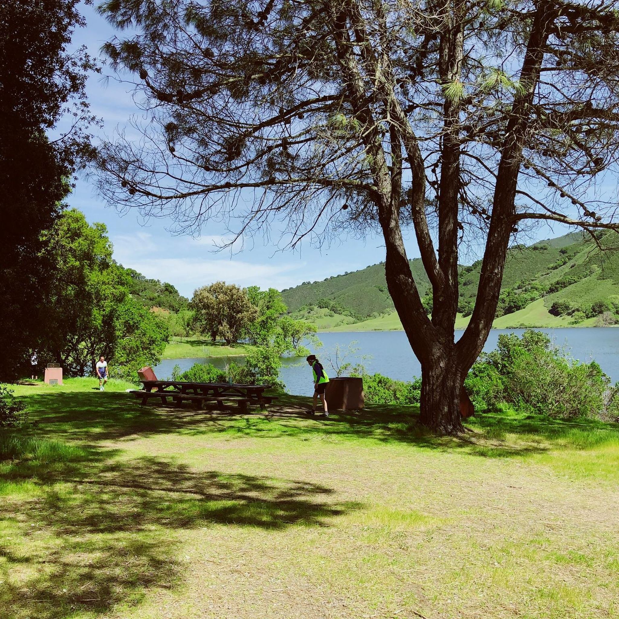
Chesbro Reservoir County Park is a 232-acre park that surrounds Chesbro Reservoir and is known for catch-and-release fishing. There is no swimming or boating allowed in the lake.
0
0

For cyclists exploring Santa Cruz, Pleasure Point Beach on 38th Avenue beckons with its beauty and recreational opportunities. Ideal for swimming, sunbathing, and surfing, the beach offers a picturesque setting. It is accessible via a brief walk from the road.
0
0

Twin Lakes State Beach features a mile of sandy shoreline for swimming and picnicking, situated near the Santa Cruz Harbor. Adjacent Schwan Lake Park offers picturesque walking trails through oak preserves and coastal grasslands, ideal for dog-walking and bird watching. The day-use area operates from sunrise to sunset.
0
0

Branciforte Drive is a beautiful and mellow road to ride. The climbs are gentle compared to other roads in the area.
0
0
Pleasure Point Beach is a popular surf spot and is part of Pleasure Point Park. The park also features restrooms, picnic tables, and offers great views.
0
0
Schwan Lake is part of Twin Lakes State Park and was originally known as Schwan Lagoon when it connected to the ocean. Harbor construction restricted the flow of water from the ocean, transforming it into a freshwater lake.
0
0
Frequently Asked Questions
How many road cycling routes are available in Mount Madonna County Park?
Mount Madonna County Park offers a diverse network of over 15 road cycling routes. These routes cater to various skill levels, including 7 easy, 6 moderate, and 4 difficult options, ensuring a suitable ride for almost every cyclist.
What are the typical landscapes I'll encounter while road cycling in Mount Madonna County Park?
Road cycling in Mount Madonna County Park takes you through varied landscapes. You'll experience towering redwood forests at higher elevations, transitioning to oak woodlands, dense chaparral, and grassy meadows as you descend. Roads are often bordered by redwoods, especially in the upper reaches of the park.
What is the best time of year for road cycling in Mount Madonna County Park?
The park offers enjoyable cycling throughout much of the year. Spring and fall generally provide the most pleasant temperatures. While specific seasonal considerations for cycling aren't detailed, the diverse terrain and tree cover can offer shade during warmer months and protection during cooler periods.
Are there challenging climbs for experienced road cyclists in the park?
Yes, Mount Madonna County Park is renowned for its challenging climbs. The Rio Del Mar Beach – Seacliff State Beach loop from Summit Conservation Easement, for example, is a difficult route with significant elevation gain. The Mount Madonna Road Climb itself is a 'must-do' for many, featuring a 4-mile ascent with an average gradient of 7.5% and sections reaching 13%.
Are there any easier or family-friendly road cycling options?
Absolutely. For a less strenuous ride, consider the View of Chesbro Reservoir – Uvas Reservoir loop from Chitactac-Adams Heritage County Park. This easy 20.6-mile path offers scenic views of two reservoirs and is suitable for those seeking a more relaxed experience. There are 7 easy routes available in total.
What kind of views can I expect on road cycling routes?
From higher elevations within Mount Madonna County Park, road cyclists are treated to expansive views overlooking the Santa Clara Valley to the east and Monterey Bay to the west. Routes also offer scenic journeys through the Santa Cruz Mountains, with lush redwood groves and views of Watsonville.
Are there loop trails for road cycling in Mount Madonna County Park?
Yes, many road cycling routes in the park are designed as loops. For instance, the Rio Del Mar Beach – Seacliff State Beach loop from Summit Conservation Easement and the View of Chesbro Reservoir – Uvas Reservoir loop from Chitactac-Adams Heritage County Park are popular loop options, allowing you to start and finish at the same point.
Is there parking available for road cyclists at Mount Madonna County Park?
Yes, Mount Madonna County Park provides various parking options for visitors. Specific parking areas are available throughout the park, including near trailheads and recreational facilities, making it convenient for cyclists to access the routes.
What natural features or landmarks can I see along the road cycling routes?
While cycling, you'll encounter diverse natural features like towering redwood forests, oak woodlands, and boulder-strewn grasslands. You can also explore historical elements such as the ruins of cattle baron Henry Miller's summer home, and observe wildlife at the unique White Deer Pen exhibit. The park's Visitor Center also offers exhibits on its natural and cultural heritage.
What wildlife might I encounter while cycling?
Mount Madonna County Park is home to diverse wildlife. It's common to spot deer and turkeys. The park also features a unique White Deer Pen exhibit, offering a chance to see these animals up close.
What do other road cyclists say about their experience in Mount Madonna County Park?
The road cycling routes in Mount Madonna County Park are highly rated by the komoot community, with an average score of 3.3 stars from over 6 reviews. Cyclists often praise the challenging climbs, the remote and scenic nature of the roads, and the diverse terrain that includes redwood forests and expansive views.
Are there paved road cycling routes within Mount Madonna County Park?
Many of the road cycling routes in Mount Madonna County Park are mostly paved, offering a smooth surface for road bikes. However, cyclists should be aware that some segments, particularly on more diverse terrain, may be unpaved and require caution, especially on descents.
Are there places to eat or get coffee near Mount Madonna County Park?
While specific cafes or restaurants directly within the park are limited, the surrounding areas near Mount Madonna County Park offer various dining options. For more information on local amenities, you might find resources on sites like Visit Gilroy helpful for planning your post-ride refreshments.
Most popular routes in Mount Madonna County Park

Get inspired with the komoot mobile app


Explore more
Browse the best Road cycling routes in other regions.
