The best walks and hikes in Deem Hills Recreation Area
4.4
(116)
495
hikers
45
hikes
Hiking in Deem Hills Recreation Area offers a network of trails through a landscape characterized by rolling hills and desert terrain. The area features varied elevation changes, with routes ascending to viewpoints over the surrounding region. These hiking trails in Deem Hills Recreation Area provide opportunities to explore the natural environment of Maricopa County.
Best hiking trails in Deem Hills Recreation Area
- The most popular hiking route is Ridgeline Trail — Deem Hills Recreation Area, a 3.9 miles (6.2 km) trail that takes 1 hour 49 minutes to complete. This easy route features an elevation gain of 175 meters.
- Another top favourite among local hikers is Deem Hills Circumference Trail — Deem Hills Recreation Area, a moderate 5.9 miles (9.5 km) path. This trail offers a longer experience with 218 meters of elevation gain across varied terrain.
- Local hikers also love the Deem Hills inner loop — Deem Hills Recreation Area, a 5.2 miles (8.3 km) trail leading through the central part of the recreation area, often completed in about 2 hours 27 minutes.
- Hiking in Deem Hills Recreation Area is defined by desert hills, ridgeline paths, and open landscapes. The network offers options for different ability levels, from easy walks to moderate ascents.
- The routes in Deem Hills Recreation Area are highly rated by the komoot community with an average score of 4.4 stars from more than 80 reviews. More than 400 hikers have used komoot to explore Deem Hills Recreation Area's varied terrain.
Last updated: August 18, 2026
6
hikers
4.19km
01:12
100m
100m
The Circumference Trail and Basalt Trail loop offers a quintessential Sonoran Desert experience, winding through a landscape dotted with iconic saguaro cacti and unique basalt volcanic rock formations. You'll enjoy expansive views of Phoenix and the surrounding low mountains, especially beautiful during the golden hours, as you navigate a mix of flat and gently rocky terrain.
Located within the popular Deem Hills Recreation Area, this loop is easily accessible, though arriving earlier in the day is advisable, especially on weekends. Dogs are permitted on the trail, provided they are on a leash. Spring brings the added bonus of wildflowers, making it an ideal time to visit, though cooler mornings and evenings are pleasant year-round.
This easy 2.6-mile (4.2 km) hike, with a modest 341 feet (104 metres) of elevation gain, takes approximately 1 hour and 12 minutes to complete, making it a perfect family-friendly option for a quick desert immersion. The trail's defining feature is its ancient basalt rock, formed over 2.5 million years ago, providing a fascinating geological backdrop to your desert adventure.
17.1km
04:21
60m
40m
Hike the moderate 10.6-mile Pyramid Peak Loop in Phoenix, Arizona, offering desert scenery and solitude with minimal elevation gain.

Sign up for free
27
hikers
6.22km
01:49
180m
170m
The Deem Hills Loop via Circumference Trail and Ridgeline Trail offers a fantastic urban escape, winding through diverse Sonoran Desert terrain. You'll start on wide dirt paths with volcanic rocks, gradually transitioning to steeper sections. The real payoff comes on the Ridgeline Trail, where you'll navigate switchbacks to reach stunning 360-degree viewpoints overlooking Phoenix, Glendale, and distant mountain ranges, all set against a backdrop of unique basalt formations.
This easy 3.9-mile (6.2 km) loop, with 576 feet (175 metres) of elevation gain, typically takes about 1 hour and 48 minutes. The trails are well-maintained and clearly marked, making it easy to follow. Located in North Phoenix, the Deem Hills Recreation Area is easily accessible; plan to arrive early for parking, especially on busy days. Remember to bring plenty of water, as the desert environment demands it, and consider hiking during the cooler months for the most comfortable experience.
What makes this trail notable is its accessibility as an urban oasis combined with surprisingly expansive views. Despite its modest elevation, the panoramic vistas from the Ridgeline Trail are truly impressive. The area's unique geology, featuring basalt volcanic rock formations dating back millions of years, adds a distinctive character to the hike, making it a standout among Phoenix's loop hiking trails.
9
hikers
9.50km
02:42
220m
220m
The Deem Hills Circumference Trail is a fantastic way to immerse yourself in the Sonoran Desert without leaving Phoenix. This moderate 5.9-mile (9.5 km) loop takes you through varied terrain, from sandy stretches to rocky ascents, all while showcasing the area's distinctive basaltic rock formations. You'll enjoy impressive vistas of the city, distant mountain ranges like the McDowell Mountains, and the unique desert flora, making for a rewarding hike that typically takes around 2 hours and 41 minutes.
Planning your visit is easy, with ample parking available at trailheads such as the Basaltic Trailhead. The Deem Hills Recreation Area is open year-round, but for the best experience and to avoid the intense Arizona heat, consider hiking during the cooler months or early in the morning. Always bring plenty of water, as there are no services on the trail itself. The trail is well-maintained and marked, making navigation simple.
What makes this trail stand out is its ability to offer a significant desert hiking experience within an urban setting. It circles nearly 1,000 acres of Sonoran Desert, providing access to other routes like the challenging Ridgeline Trail, which leads to the highest point in the park. Despite its popularity, the trail often feels peaceful, offering a true escape into nature with 715 feet (218 metres) of elevation gain.
2
hikers
8.33km
02:27
250m
250m
Hike the 5.2-mile Deem Hills Ridgeline and Circumference Loop for moderate desert terrain, unique basalt formations, and 360-degree Phoenix
Get access to more routes and recommendations from other explorers.
Sign up for free
Already have an account?
Our route recommendations are based on thousands of hikes, rides, and runs completed by other people on komoot.
Start today with a free account
Your next adventure awaits.
Login or Signup


Tips from the Community

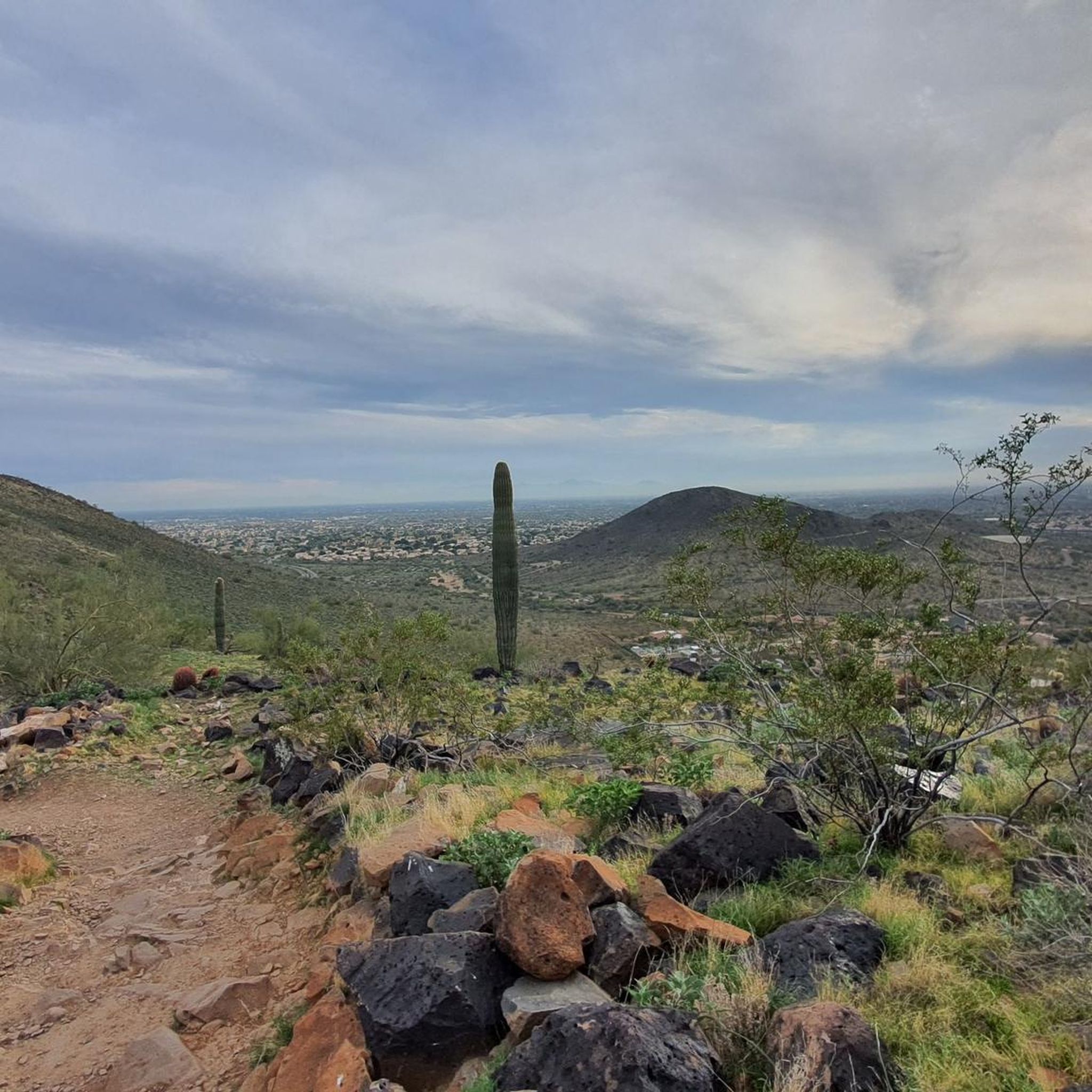
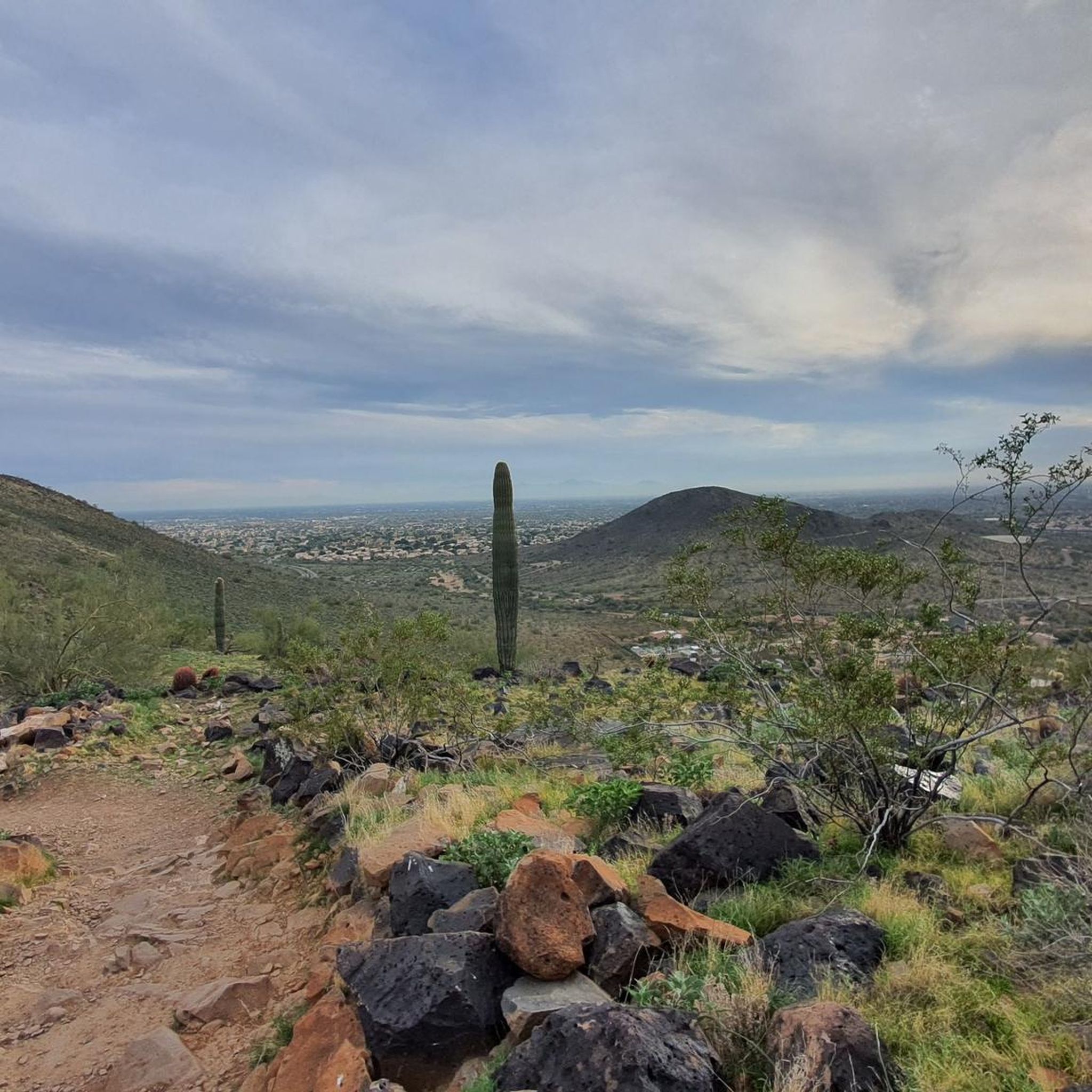
Deem Hills Recreation Area near Phoenix, Arizona, offers easy trails through nearly 1,000 acres of Sonoran Desert, featuring unique basalt volcanic rock formations. The Circumference trail offers panoramic views of Phoenix, while the Ridgeline trail, at 1.5 miles, stands as the highest in elevation. With various shorter trails, it caters to different distances and difficulty levels.
1
0

Basalt is the type of rock that gives the name to this trail; it's possible to see some huge boulders of basalt along the trail that were formed at least 2,5 million years ago by volcanic activity in the area.
0
0
Ridgeline Trail is the highest trail at Deem Hills Recreation Park. For a trail in an urban park it has less traffic than most. It’s a great option for those looking for a quiet moment, with views of the Sonoran Desert and not many nearby houses.
0
0
This trail is a mostly flat round trip trail that traverses the entire area of the Deem Hills Recreation Area. Dogs are allowed, but must be on a leash.
0
0
Deem Hills is composed with Sonoran Desert landscape, with 1846 ft, this hill has not so high elevation, but still has some nice views of the Phoenix and Glendale area.
0
0
Frequently Asked Questions
How many hiking trails are there in Deem Hills Recreation Area?
Deem Hills Recreation Area offers a network of over 30 hiking trails. These routes cater to various skill levels, from easy walks to more challenging ascents.
What kind of terrain can I expect on the trails in Deem Hills Recreation Area?
The trails in Deem Hills Recreation Area traverse a landscape characterized by rolling hills and desert terrain. You'll encounter varied elevation changes, with paths ascending to viewpoints over the surrounding region. The environment is typical of Maricopa County's natural desert.
Are there any easy hiking trails suitable for beginners or families?
Yes, approximately half of the trails in Deem Hills Recreation Area are rated as easy. For instance, the Ridgeline Trail — Deem Hills Recreation Area is an easy 3.9-mile route with a moderate elevation gain, often completed in under two hours. Another easy option is the Basaltic Trail & Deem Hills trail loop, which is 3.3 miles long.
Are there any circular hiking routes in Deem Hills Recreation Area?
Yes, many trails in Deem Hills Recreation Area are designed as loops. A popular moderate circular route is the Deem Hills Circumference Trail — Deem Hills Recreation Area, which is 5.9 miles long. Another option is the Deem Hills inner loop — Deem Hills Recreation Area, a 5.2-mile trail through the central part of the area.
What is the typical duration for hikes in Deem Hills Recreation Area?
Hike durations vary depending on the trail's length and your pace. Shorter, easy routes like the Ridgeline Trail can take around 1 hour 49 minutes. Longer, moderate trails such as the Deem Hills to Ridgeline Trail & Basaltic Trail might take over 2 hours 30 minutes.
What do other hikers enjoy most about Deem Hills Recreation Area?
The area is highly rated by the komoot community, with an average score of 4.4 stars from over 80 reviews. Hikers often praise the varied terrain, the ridgeline paths, and the open desert landscapes that offer opportunities for different ability levels.
Are there any trails with significant elevation gain for a more challenging hike?
While most trails are easy to moderate, some offer notable elevation gains. For example, the Deem Hills inner loop — Deem Hills Recreation Area has an elevation gain of 248 meters over 5.2 miles, providing a good workout.
Is there parking available at Deem Hills Recreation Area?
Yes, parking facilities are available at Deem Hills Recreation Area for hikers accessing the trails. Specific details regarding parking capacity or fees are not provided in the guide, but general access is supported.
What should I bring when hiking in Deem Hills Recreation Area?
Given the desert environment, it's essential to bring plenty of water, especially during warmer months. Sun protection like hats, sunglasses, and sunscreen is also highly recommended. Sturdy hiking shoes are advisable for navigating the varied terrain.
Are dogs allowed on the hiking trails in Deem Hills Recreation Area?
The guide does not explicitly state rules regarding dogs. However, in many recreation areas with similar desert environments, dogs are often permitted on leash. It's always best to check local signage upon arrival for specific regulations.
Are there any viewpoints or scenic spots along the trails?
Yes, the trails in Deem Hills Recreation Area are known for ascending to viewpoints that offer expansive views over the surrounding region and the desert landscape. Many routes, particularly those along ridgelines, provide scenic opportunities.
Most popular routes in Deem Hills Recreation Area

Get inspired with the komoot mobile app


Explore more
Browse the best Hikes in other regions.
