The best walks and hikes in King Mountain Open Space Preserve
4.8
(452)
8,060
hikers
321
hikes
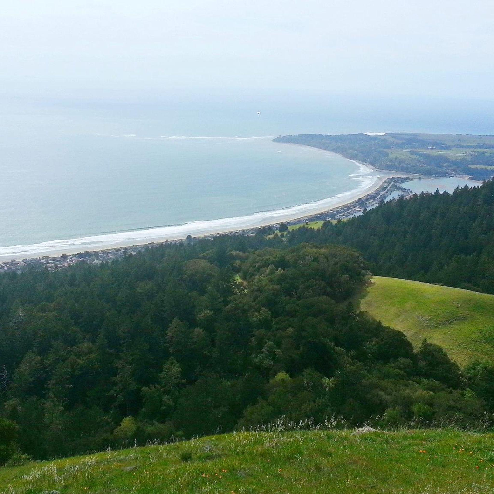
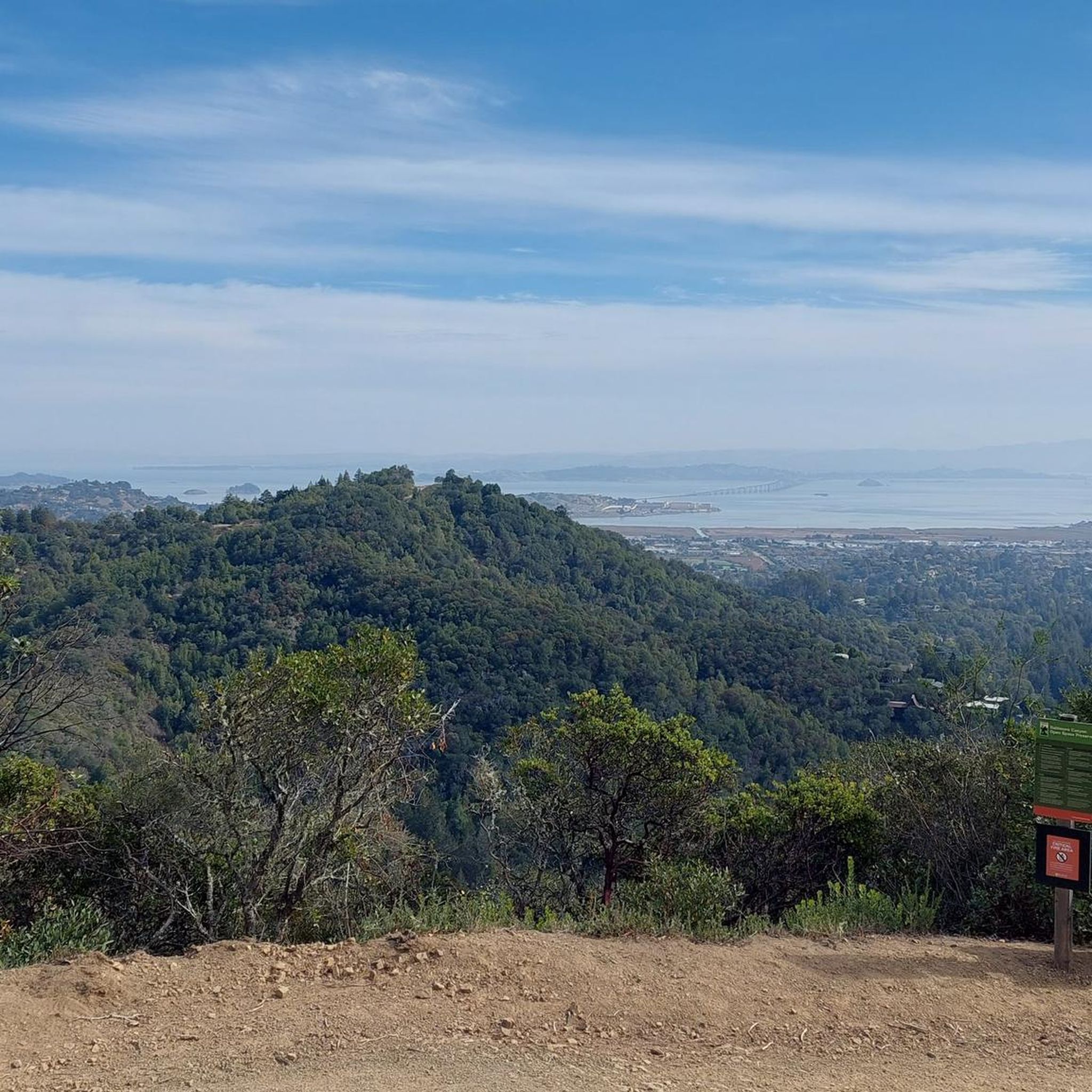
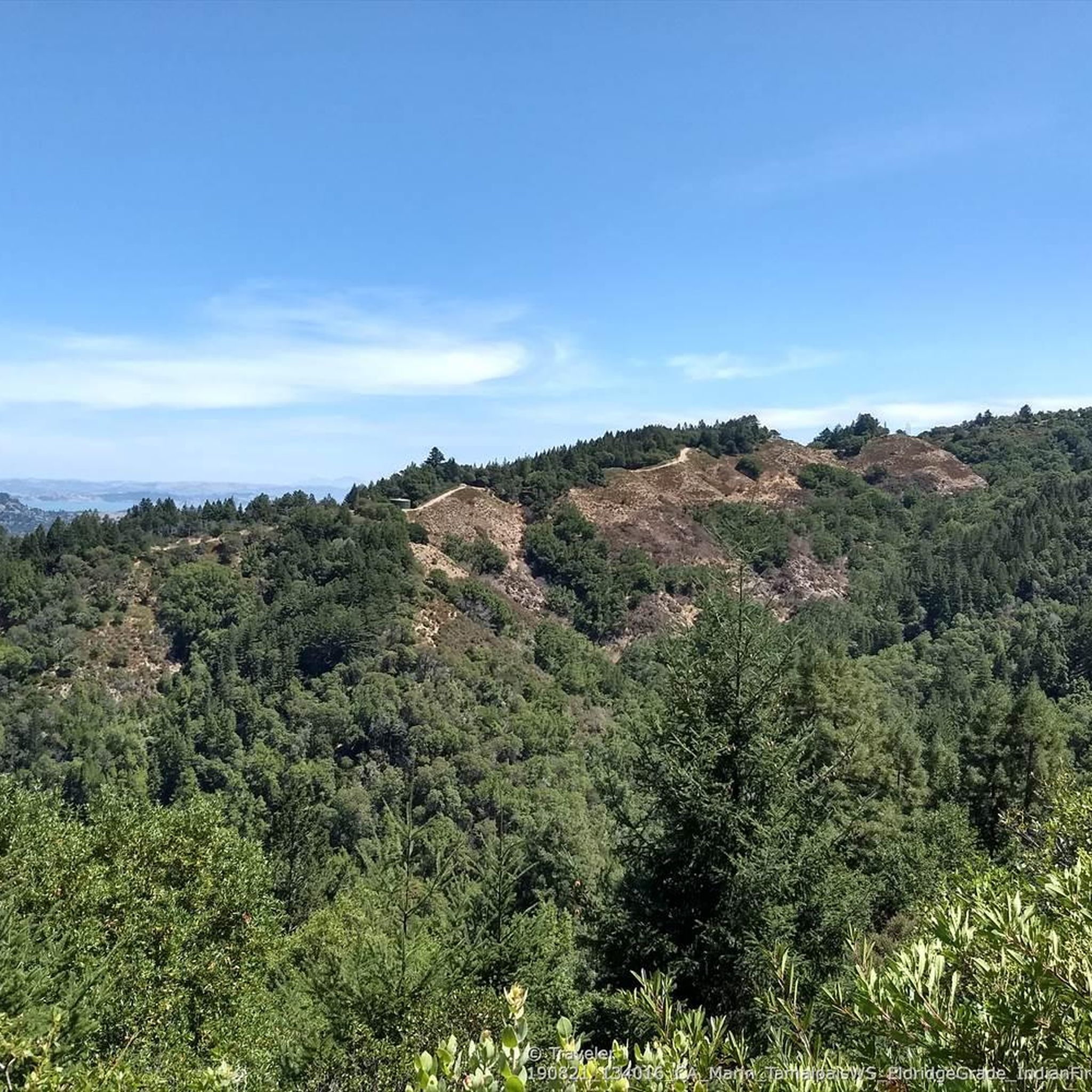
Hiking in King Mountain Open Space Preserve offers diverse terrain, including shaded mixed woodlands, sunny grasslands, and redwood canyons. This 193-acre preserve in Larkspur features varied plant life and seasonal waterfalls after rainstorms. Hikers can experience panoramic views of the San Francisco Bay, Mount Tamalpais, and the Richmond-San Rafael Bridge from various points along the trails. The preserve provides accessible trails for different fitness levels, connecting to other natural areas for extended adventures.
Best hiking trails in King Mountain Open Space Preserve
- The most popular hiking route is King Mountain Loop Trail via Ladybug Trail — King Mountain Open Space Preserve, a 4.4 miles (7.0 km) trail that takes 2 hours 2 minutes to complete. This moderate route features varied landscapes and offers views of the surrounding Bay Area.
- Another top favourite among local hikers is Dawn Falls Trail – Dawn Falls loop from Larkspur, an easy 3.3 miles (5.3 km) path. This trail leads through scenic areas, including a notable seasonal waterfall.
- Local hikers also love the View from King Mountain loop from Larkspur, a 2.1 miles (3.4 km) trail leading through diverse vegetation, often completed in about 59 minutes.
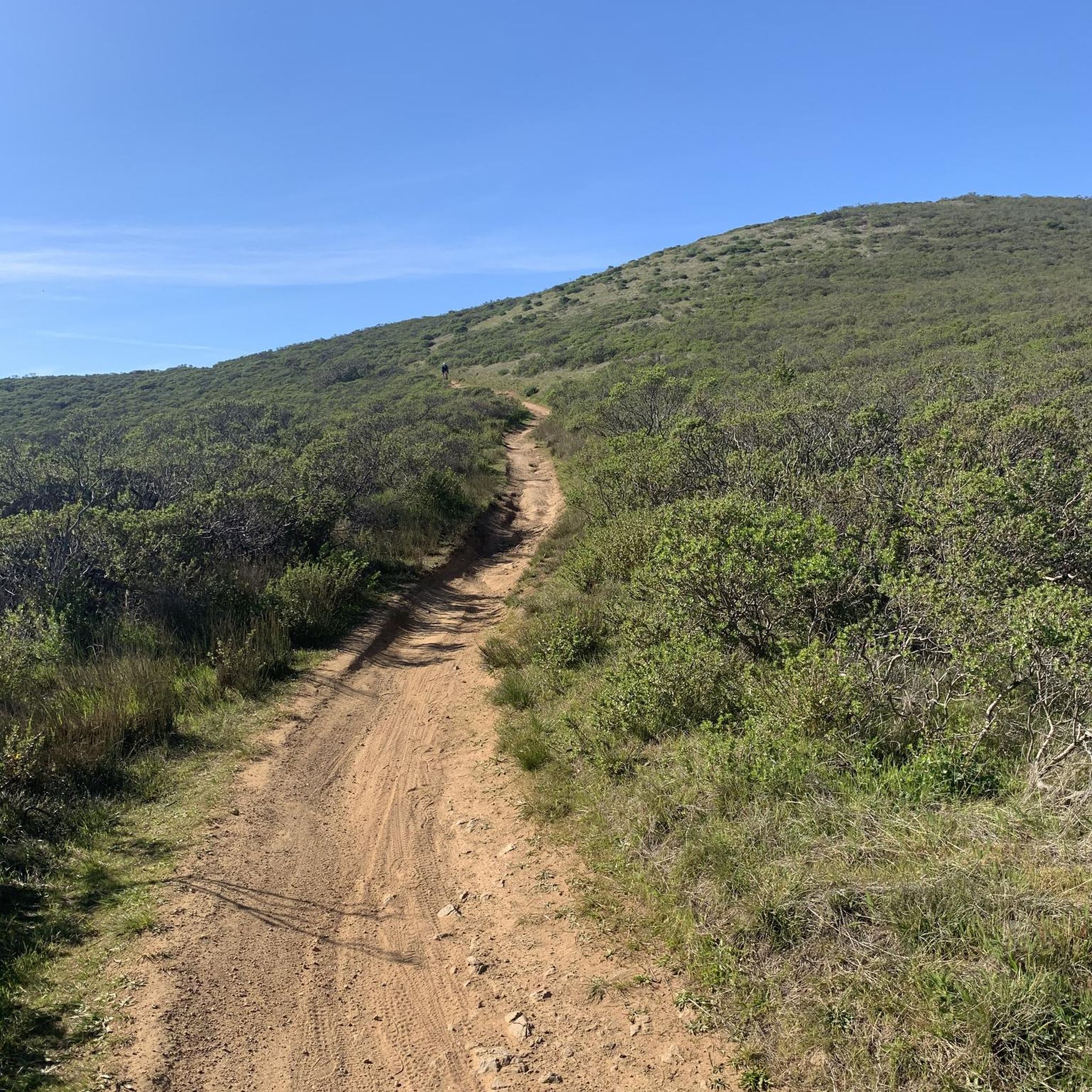
- Hiking in King Mountain Open Space Preserve is defined by shaded mixed woodlands, sunny grasslands, and redwood canyons. The network offers options for different ability levels, from easy walks to moderate climbs.
- The routes in King Mountain Open Space Preserve are highly rated by the komoot community with an average score of 4.8 stars from more than 440 reviews. More than 8,300 hikers have used komoot to explore King Mountain Open Space Preserve's varied terrain.
Last updated: July 1, 2026
5.0
(3)
15
hikers
3.24km
00:55
70m
80m
The King Mountain Loop Trail offers a delightful escape into Marin County's diverse landscapes, perfect for a quick nature fix. You'll wander through shaded redwood and bay tree canyons, open grasslands, and chaparral, all while enjoying impressive panoramic views of the San Francisco Bay, including San Rafael and the Richmond-San Rafael Bridge. This easy 2.0-mile (3.2 km) hike involves about 244 feet (74 metres) of elevation gain and typically takes around 55 minutes, making it a great option for a refreshing outing.
Planning your visit to the King Mountain Loop Trail is straightforward, as it's easily accessible from Larkspur. While generally easy, some sections do feature steeper inclines and switchbacks, so be prepared for a bit of a workout. The trail is dog-friendly, but remember to keep your furry friend on a leash in designated areas. Spring is a particularly rewarding time to go, as you can catch the wildflowers in bloom and seasonal waterfalls after a good rain.
What makes this trail stand out is its blend of secluded natural beauty with easy accessibility. Despite its proximity to urban areas, it often feels quieter than other popular Marin County trails, offering a peaceful experience. You'll encounter a rich variety of flora, from oaks and bay laurels to madrones and redwoods, providing a vibrant botanical journey. There's even a rustic wooden bench along the way, perfect for a short rest and soaking in the views.
5.0
(2)
11
hikers
4.20km
01:04
10m
10m
The Corte Madera Creek Loop offers a delightful, flat journey along the water's edge, perfect for a leisurely outing. This multi-use pathway provides continuous scenic views of Corte Madera Creek, with opportunities to spot windsurfers and even docking ferries near the Larkspur Ferry Terminal. You'll traverse wide, even surfaces, including charming boardwalk sections, and might catch glimpses of Mount Tamalpais in the distance, making for a serene and accessible experience.
Planning your visit to this easy 2.6-mile (4.2 km) route, which takes about 1 hour and 3 minutes with only 20 feet (6 metres) of elevation gain, is straightforward. The path is easily accessible from various points in Larkspur and Ross, with parking typically available nearby. It's an excellent choice for a casual walk at any time of day or year, and its connection to the Larkspur Ferry Terminal even allows for unique combined travel options.
This segment of the Corte Madera Creek Path is a key part of the broader San Francisco Bay Trail, highlighting its importance as an urban greenway. Near Remillard Park, a central pond often hosts turtles and ducks, adding a touch of wildlife to your walk. Its flat, wide terrain makes it an ideal choice for families, those with strollers, or anyone seeking a gentle, low-impact way to enjoy the Marin County waterfront.

Sign up for free
1.09km
00:27
90m
90m
Hike the easy Barbara Springs Trail in Larkspur, CA, a 0.7-mile route with 302 feet of gain through lush redwood forests.
2.27km
00:47
170m
0m
The Dawn Falls Trail offers a delightful journey through a lush redwood wonderland, where towering trees and vibrant ferns create a truly magical atmosphere. You'll meander alongside Larkspur Creek, enjoying the constant sound of water cascading over rocks, before reaching the impressive 30-foot Dawn Falls. While much of the path is gentle, the final quarter-mile to the waterfall involves a short, steep climb, making it an engaging experience for hikers of varying abilities.
This easy 1.4-mile (2.3 km) hike, with 566 feet (173 metres) of elevation gain, can be completed in about 46 minutes, making it a perfect quick escape. To witness the waterfall at its best, plan your visit in late winter or early spring after significant rainfall; it can slow to a trickle in summer. The trail is easily accessible in Larkspur and is also dog-friendly, offering a peaceful alternative to more crowded Bay Area trails.
What truly sets this trail apart is its combination of a picturesque waterfall and immersive redwood groves, creating a serene environment often described as a local secret. It's an excellent option for families or anyone seeking a high-reward nature experience without a lengthy commitment. The trail's accessibility and tranquil setting make it a notable gem in Marin County.
9
hikers
7.03km
02:02
170m
170m
Hike the King Mountain Loop Trail, a moderate 4.4-mile route in Larkspur, offering diverse scenery and views of Mount Tam and San Pablo Bay.
Get access to more routes and recommendations from other explorers.
Sign up for free
Already have an account?
Our route recommendations are based on thousands of hikes, rides, and runs completed by other people on komoot.
Start today with a free account
Your next adventure awaits.
Login or Signup
Tips from the Community

The views from the trail are nice as you can see wildflowers and a few overlooks along the way. Most of the trail is shaded which makes the trail more accessible throughout the summer. This is a popular spot, so getting here early is in your best interest.
0
0

Beautiful and easy path that gets you away from cars! Runs for a good distance from the ferry terminal all the way to Ross/San Anselmo.
0
0

From this point upstream the bed of Corte Madera Creek is canalized in a narrow concrete channel. Downstream it opens into a partially tidal estuary that lost much of its wetlands, but still has a lot of natural features.
0
0
Ladybug Trail climbs from Dawn Falls Trail to about midway up King Mountain and then follows the contours to the east
0
0
Very small waterfall near the beginning of little Lakspur Creek
0
0
At the dead end of Madrone Avenue begins this very pleasant redwood forest trail, along Larkspur Creek.
0
0
Frequently Asked Questions
How many hiking trails are available in King Mountain Open Space Preserve?
King Mountain Open Space Preserve offers a wide variety of hiking experiences, with over 270 routes to explore. These trails traverse diverse landscapes, from shaded woodlands to sunny grasslands, ensuring there's something for every hiker.
Are there easy trails suitable for beginners or families in King Mountain Open Space Preserve?
Yes, the preserve is very welcoming for beginners and families. There are over 100 easy routes, many of which are relatively short and feature gentle elevation changes. A great option is the View from King Mountain loop from Larkspur, which is 2.1 miles long and offers scenic views without being too strenuous.
Can I bring my dog on the trails in King Mountain Open Space Preserve?
Yes, King Mountain Open Space Preserve is a dog-friendly destination. Dogs are generally welcome, though specific rules apply regarding leashing on trails and voice command on fire roads. Always ensure your dog is under control to protect wildlife and other hikers.
Are there any trails with waterfalls in King Mountain Open Space Preserve?
Yes, the preserve is known for its seasonal waterfalls, especially after rainstorms. The Dawn Falls Trail – Dawn Falls loop from Larkspur is a popular choice that leads to a notable seasonal waterfall. This trail is also connected to the larger Baltimore Canyon Open Space Preserve.
What kind of views can I expect while hiking in King Mountain Open Space Preserve?
Hikers can enjoy spectacular panoramic views from various points along the trails. You'll find sweeping vistas of the San Francisco Bay, Larkspur below, Mount Tamalpais, and even the Richmond-San Rafael Bridge on clear days. The View from King Mountain highlight is a particularly rewarding spot.
Are there any circular hiking routes in King Mountain Open Space Preserve?
Absolutely. Many trails in the preserve are designed as loops, offering varied scenery without retracing your steps. The King Mountain Loop Trail via Ladybug Trail is a prominent example, encircling the mountain through diverse landscapes.
What is the best time of year to hike in King Mountain Open Space Preserve?
While enjoyable year-round, visiting during spring after a rainstorm is highly recommended. This is when the woods and grasslands are dotted with wildflowers, and tiny seasonal waterfalls emerge, making the scenery particularly vibrant and picturesque.
What are some notable natural features or attractions to look out for?
Beyond the stunning views, you'll encounter diverse vegetation including redwood, tanoak, and California bay canyons. Keep an eye out for wildflowers in spring, and the seasonal Dawn Falls Trail is a must-see after rainfall. The preserve also connects to other areas like Baltimore Canyon Open Space Preserve for extended exploration.
How long do hikes in King Mountain Open Space Preserve typically take?
Hike durations vary significantly depending on the route and your pace. For example, the King Mountain Loop Trail via Ladybug Trail, at 4.4 miles, typically takes around 2 hours. Shorter, easier loops like the View from King Mountain loop from Larkspur can be completed in under an hour.
What do other hikers enjoy most about King Mountain Open Space Preserve?
The area is highly rated by the komoot community, with an average score of 4.8 stars from over 440 reviews. Reviewers often praise the diverse terrain, the rewarding panoramic views of the Bay Area, and the accessibility of trails for various fitness levels. Many appreciate the combination of shaded woodlands and open vistas.
Are there opportunities for longer or more challenging hikes?
While King Mountain Open Space Preserve itself offers moderate trails, it provides excellent connectivity to other natural areas. The Ladybug Trail, for instance, connects to Baltimore Canyon Open Space Preserve, allowing for longer excursions. More strenuous hikes into the heart of Mount Tamalpais are also possible by linking up with adjacent trail networks.
Where are the main trailheads and parking areas for King Mountain Open Space Preserve?
The preserve is easily accessible, with trailheads originating directly from residential Larkspur. Specific parking information can often be found on individual route pages or local park websites, but generally, access points are integrated into the community, making it convenient for local and visiting hikers.
Most popular routes in King Mountain Open Space Preserve
Most popular attractions in King Mountain Open Space Preserve

Get inspired with the komoot mobile app


Explore more
Browse the best Hikes in other regions.
