Routes

Planner

Features

Updates

App

Login or Signup

Get the App

Login or Signup

Routes
Hikes
United States
New York
Westchester County

Franklin Delano Roosevelt State Park

Routes
Hikes
United States
New York
Westchester County

Franklin Delano Roosevelt State Park

The best walks and hikes in Franklin Delano Roosevelt State Park

5.0

(7)

166

hikers

26

hikes

Hiking in Franklin Delano Roosevelt State Park offers access to Georgia's largest state park, encompassing over 9,000 acres of diverse terrain. The region is characterized by the Pine Mountain Ridge, featuring thick forests of pine and hardwoods, numerous creeks, and small waterfalls. Hikers can explore varied landscapes including rock formations, golden grasslands, and valleys, with elevations reaching up to 1,395 feet at Dowdell's Knob.

Best hiking trails in Franklin Delano Roosevelt State Park

  • The most popular hiking route is FDR State Park Road Loop, a 2.8 miles (4.6 km) trail that takes 1 hour 13 minutes to complete. This easy route offers a gentle exploration of the park's accessible areas.
  • Another top favourite among local hikers is North County Trailway, a moderate 7.1 miles (11.5 km) path. This trail provides a longer journey through varied park scenery, often completed in about 3 hours.
  • Local hikers also love the Quarry Lookout via White, Red, Green, Blue, and Pink Trail Loop, a 3.0 miles (4.8 km) trail leading through mixed forest and offering a lookout point, often completed in about 1 hour 20 minutes.
  • Hiking in Franklin Delano Roosevelt State Park is defined by its extensive forest trails, scenic creeks, and notable viewpoints like Dowdell's Knob. The park's network offers options for easy, moderate, and challenging routes, catering to various ability levels.
  • The routes in Franklin Delano Roosevelt State Park are highly rated by the komoot community with an average score of 5.0 stars from several reviews. Nearly 200 hikers have used komoot to explore Franklin Delano Roosevelt State Park's varied terrain.

Last updated: August 17, 2026

6

hikers

#1.

FDR State Park Road Loop

4.56km

01:13

50m

50m

The FDR State Park Road Loop offers a serene and accessible hiking experience within the expansive Franklin D. Roosevelt State Park. This easy 2.8-mile (4.6 km) route guides you through peaceful mixed oak-pine forests, providing a glimpse into the diverse plant habitats found on Pine Mountain. You will find yourself immersed in nature, away from the hustle, enjoying a path that is mostly flat and well-maintained, perfect for a relaxing walk. It is a great option if you are looking for a gentle outing that takes around 1 hour and 13 minutes, without significant elevation changes.

Planning your visit to this loop is straightforward, as it is part of Georgia's largest state park, which typically offers good parking facilities. While specific warnings for this particular trail are not noted, it is always a good idea to check the park's general operating hours and any potential fees before you go. Spring and fall are particularly beautiful times to hike here, with wildflowers blooming or vibrant autumn leaves creating a colorful backdrop. Remember to bring water, especially if you are hiking during warmer parts of the day.

This trail provides an excellent starting point for exploring a park rich in both natural beauty and history. FDR State Park is famous for its connection to President Franklin D. Roosevelt, who frequently visited the area, including Dowdell's Knob, for reflection. Many of the park's facilities were built by his Civilian Conservation Corps, adding a layer of historical significance to your outdoor adventure. It is a family-friendly option that showcases the park's charm without the demands of more strenuous routes like the longer Pine Mountain Trail sections.

Navigate with device

Send to Phone

Save

Easy

3

hikers

11.5km

03:00

80m

80m

The North County Trailway offers a delightful escape on a paved multi-use path, winding through a pleasant mix of forests, wetlands, and suburban landscapes. You'll find yourself on a smooth asphalt surface, perfect for a relaxed walk, with the route generally following a gentle grade. Keep an eye out for the impressive bridge crossing the New Croton Reservoir, which provides a scenic highlight and a great viewpoint along the way.

This moderate 7.1-mile (11.5 km) hike, with a modest 259 feet (79 metres) of elevation gain, typically takes around 2 hours and 59 minutes to complete. The trail is well-maintained and wide, making it suitable for a variety of users, including families and those with strollers or wheelchairs. There are multiple entry points with parking areas, and amenities like restrooms and picnic spots are available along the broader trail system.

Part of the larger Empire State Trail, the North County Trailway follows the historic route of the former Putnam Division of the New York Central Railroad. You can spot historic marker plaques at old station locations, adding a touch of history to your outing. It's a dog-friendly trail, provided your furry friends are leashed, and its connectivity allows for extended adventures if you wish to link up with the South County or Putnam Trailways.

Moderate
guide_signup
Let us show you the way with the komoot mobile app
With a free komoot account, you can easily find, customize, and navigate endless outdoor adventures.

Sign up for free

The Quarry Lookout via White, Red, Green, Blue, and Pink Trail Loop offers a delightful journey through a network of distinctly blazed singletrack paths. You'll experience varied terrain, including some uphill sections and steps as the trail descends into the Quarry basin, all leading to the rewarding Quarry Lookout with its unique perspective on the landscape. This moderate 3.0-mile (4.8 km) hike, with 343 feet (105 metres) of elevation gain, can be completed in about 1 hour and 20 minutes, making it an ideal choice for a quick, engaging outing.

Planning your visit is simple, as parking is typically available directly at the trailhead, ensuring easy access to the Sylvan Glen Park Preserve. Since the trail is generally comfortable for most hikers, it's a great option for a morning or afternoon adventure. There are no specific permits or fees mentioned, so you can focus on enjoying the natural surroundings.

What makes this loop stand out is its unique combination of named paths, providing a diverse hiking experience as you traverse different sections of the preserve. It's a fantastic way to explore the local landscape and enjoy a moderate workout without committing to a full-day trek. The Quarry Lookout itself is a notable feature, offering a distinct viewpoint that sets this trail apart from others in the area.

Moderate

5.0

(4)

28

hikers

If you're looking for a quick, immersive nature fix near Tulsa, the Turkey Mountain Trail loop offers a fantastic experience. This easy 2.0-mile (3.2 km) hiking route takes about 1 hour to complete, guiding you through a diverse landscape of timbered paths, rocky sections, and canopied trails. You'll enjoy picturesque views of the Tulsa cityscape and the Arkansas River from various bluffs, feeling a world away from urban bustle despite being so close.

Planning your visit is straightforward, with a renovated asphalt parking lot at the main entrance providing restrooms and water access for you and your dog. The trail is accessible year-round, but starting early in the morning can enhance your experience with cooler temperatures and fewer crowds. This makes it an ideal option for a spontaneous outdoor adventure or a regular fitness walk.

Turkey Mountain is a true urban wilderness, spanning over 750 rugged acres and designated as part of the National Recreation Trail system. It's a multi-use park, welcoming hikers, runners, mountain bikers, and equestrians across its extensive network of trails. The area's unique cross-timber to Ozark transition vegetation, with blackjack and post oaks, hickories, and redbuds, supports an active woodland animal population, including deer and various bird species.

Easy

Easy hike. Great for any fitness level. Easily-accessible paths. Suitable for all skill levels.

Easy
Sign up for free to see 22 more hikes in Franklin Delano Roosevelt State Park.

Get access to more routes and recommendations from other explorers.

Sign up for free

Already have an account?

Our route recommendations are based on thousands of hikes, rides, and runs completed by other people on komoot.

Start today with a free account

Your next adventure awaits.
Login or Signup

Popular around Franklin Delano Roosevelt State Park

Road Cycling Routes in Franklin Delano Roosevelt State Park

MTB Trails in Franklin Delano Roosevelt State Park

Cycling in Franklin Delano Roosevelt State Park

Running Trails in Franklin Delano Roosevelt State Park

Tips from the Community

Mr.B
August 17, 2024, View from Turkey Mountain

It's definitely a good climb for anyone who wants to start hiking. Terrain could get a little rocky in some areas but definitely manageable.

1

0

The North County Trailway is a 20-mile rail trail from Baldwin Place to Sleepy Hollow. The section around Yorktown Heights is particularly scenic. It passes several Revolutionary War monuments and an old railway depot. The section ends at a beautiful old railway trestle bridge.

0

0

This bronze statue is a memorial to the Battle of Pines Bridge, a battle in the Revolutionary War. The monument is made to reflect the diversity of the soldiers in the war. The monument is located in Railroad Park, which has benches and a cafe.

0

0

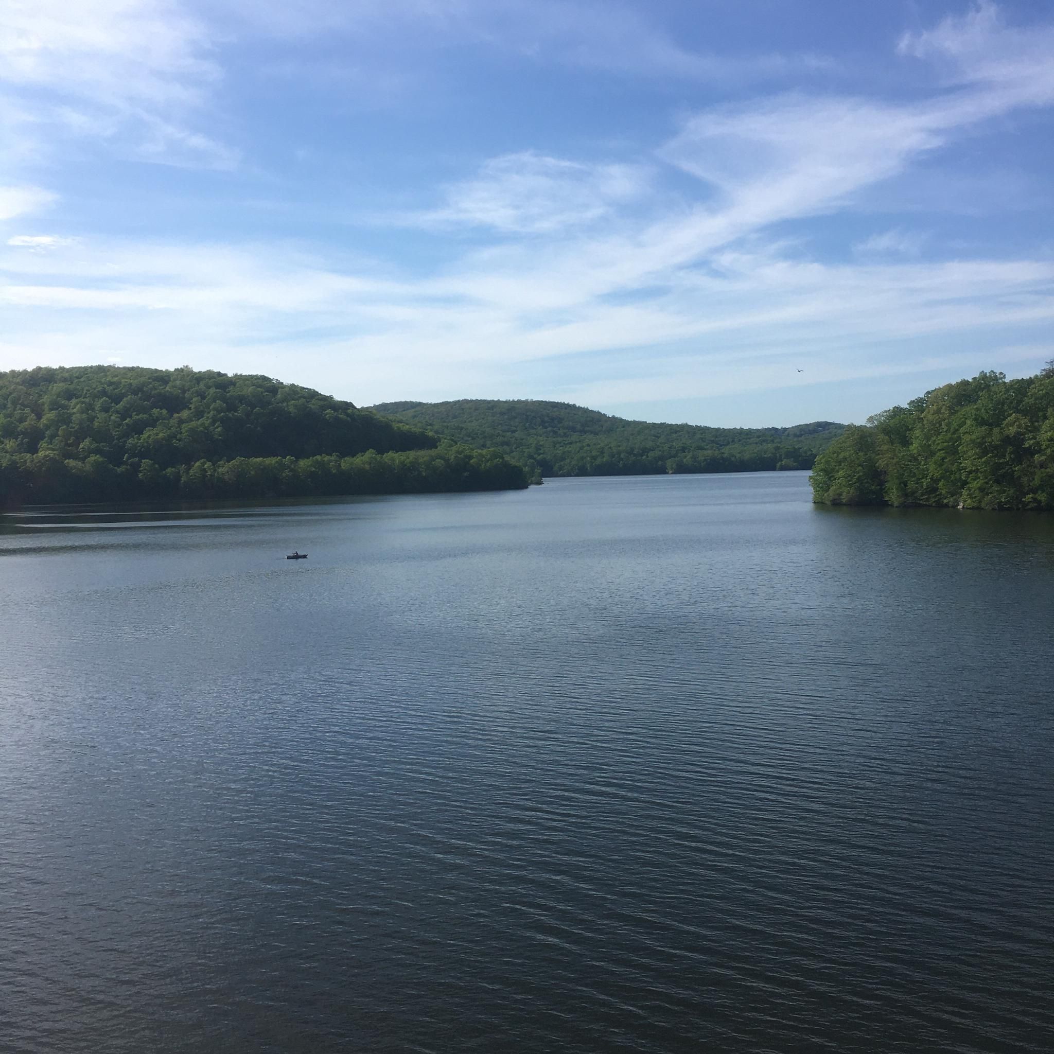
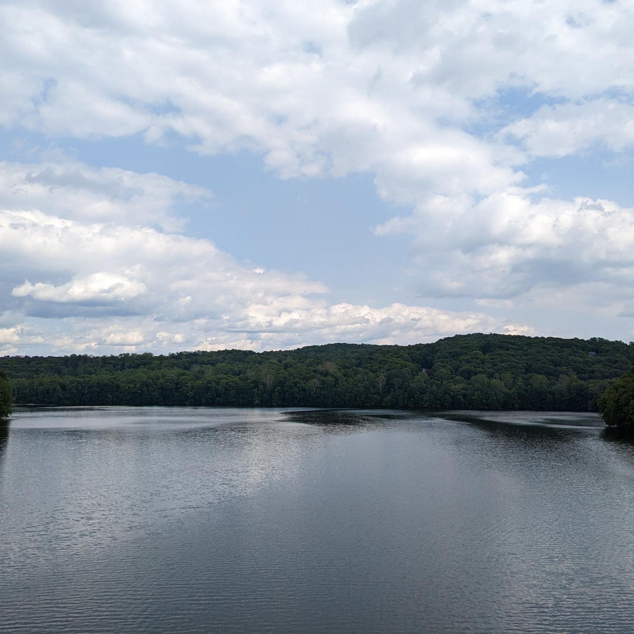
As you cross over an old rail trestle bridge, you are treated to great views of the New Croton Reservoir. The bridge is not open for car traffic, so you can stop on the path for a quick break to take in the views.

2

0

Interesting tunnel under Kitchawan Road. The tunnel was constructed when this trail was still a railroad, but it has been adapted for hikers and cyclists. It is a fairly short tunnel, so you are able to walk through it without a light.

1

0

The trail up has a moderate incline but the views are definitely worth it. Once you reach the summit, there's plenty of space to take a breather and enjoy a snack. If you're lucky, you may spot wild turkeys.

0

0

Great views of Croton reservoir and the red bridge itself is worth a stop. That said watch out for stopped cyclist and pedestrians if you're biking through.

2

0

Nice little park with benches by an old little railroad station. The cafe on the south side of the park is a good place to stop as well.

0

0

Frequently Asked Questions

How many hiking trails are available in Franklin Delano Roosevelt State Park?

Franklin Delano Roosevelt State Park offers a wide variety of hiking experiences, with over 25 distinct trails. These range from easy strolls to more challenging routes, catering to different fitness levels and preferences.

What are the best times of year to hike in Franklin Delano Roosevelt State Park?

The park is beautiful year-round, but many hikers find spring and fall to be ideal. Spring brings lush greenery and blooming wildflowers, while fall offers spectacular golden grasslands and vibrant foliage. Winter can also be pleasant for hiking, with clearer views and fewer crowds, though conditions may vary.

Are there any family-friendly hiking trails in the park?

Yes, the park has several trails suitable for families. An easy option is the FDR State Park Road Loop, which is 2.8 miles long and generally takes just over an hour to complete. It offers a gentle introduction to the park's accessible areas.

Can I bring my dog on the hiking trails in Franklin Delano Roosevelt State Park?

Yes, dogs are generally welcome on the hiking trails in Franklin Delano Roosevelt State Park, but they must be kept on a leash at all times. Please remember to clean up after your pet to help keep the park enjoyable for everyone.

Are there any trails with waterfalls in the park?

Absolutely! The Pine Mountain Trail, which meanders across the Pine Mountain Ridge, features several beautiful waterfalls, particularly along its eastern end. Hikers can discover cascades like Csonka Falls, Big Rock Falls, Slippery Rock Falls, and Cascade Falls within the park.

What are some notable viewpoints or attractions along the trails?

One of the most iconic viewpoints is Dowdell's Knob, offering breathtaking panoramic views of the valley from an elevation of 1,395 feet. This was a favorite spot of President Franklin D. Roosevelt. The Wolfden Loop also features spilling waterfalls, beaver ponds, and golden grasslands, making it a very scenic option.

Are there any circular hiking routes available?

Yes, the park offers several loop trails for hikers. For example, the Turkey Mountain Trail loop is an easy 2-mile route that provides a pleasant circular walk through the park's natural beauty.

What do other hikers enjoy most about Franklin Delano Roosevelt State Park?

The komoot community highly rates the hiking experience in Franklin Delano Roosevelt State Park, with an average score of 5.0 stars. Reviewers often praise the extensive network of well-maintained trails, the diverse landscapes including forests and waterfalls, and the peaceful atmosphere that allows for a true escape into nature.

Are there any easy trails for beginners or those looking for a relaxed walk?

Yes, the park has numerous easy trails. Over 20 of the park's routes are classified as easy. A good option for a relaxed walk is the View from bridge – Tunnel under Kitchawan Road loop from Kitchawan Nature Preserve, which is about 2.7 miles long and offers a gentle experience.

What kind of terrain can I expect on the trails?

The park's terrain is quite diverse, ranging from thick forests of pine and hardwoods to open golden grasslands. You'll encounter varied landscapes including creeks, small waterfalls, and interesting rock formations. The Pine Mountain Ridge provides some elevation changes, with the highest point at Dowdell's Knob reaching 1,395 feet.

Are there any trails that explore the park's historical connections?

While specific historical trails aren't explicitly named, the park itself is rich in history, particularly its connection to President Franklin D. Roosevelt. Hiking to Dowdell's Knob, his favorite picnic spot, offers a direct link to his time in the area. The park also features amenities built by the Civilian Conservation Corps (CCC) during the Great Depression, which you might encounter along various routes.

How can I find parking at the trailheads?

Franklin Delano Roosevelt State Park provides various parking locations and trailheads throughout its extensive area. Specific parking details are usually available on park maps or can be found when planning your route on komoot, which often includes trailhead starting points.

Are there any longer, more challenging routes for experienced hikers?

For those seeking a longer journey, the North County Trailway is a moderate 7.1-mile path that takes approximately 3 hours to complete. It offers a more extended exploration of the park's varied scenery, traversing through different forest types and landscapes.

Most popular routes in Franklin Delano Roosevelt State Park

Easy hikes in Franklin Delano Roosevelt State Park

Store rating

Get inspired with the komoot mobile app

With a free komoot account, you can easily find, customize, and navigate endless outdoor adventures.

or

Join komoot Now

Store rating

Explore more

Browse the best Hikes in other regions.

HartsdaleMontrose Point State ForestJefferson Valley-YorktownCrompondPleasantvilleMount VernonArdsleyPeekskillDonald J. Trump State Park (French Hill Unit) (Closed)Shrub OakSalt Hill State ForestMount KiscoVillage of Dobbs FerryElmsfordYorktown HeightsMillwoodChappaquaValhallaBedford HillsGolden'S BridgeKatonahCrugersArmonkFairviewTuckahoeCroton-On-HudsonLake MoheganBronxvilleGreenvilleYonkersRockefeller State Park PreserveVerplanckMontroseVillage of Hastings-on-HudsonBedfordTown/Village of HarrisonVillage of IrvingtonRye BrookEastchesterPort ChesterRyeNew RochellePelhamScotts CornersWhite PlainsLarchmontScarsdalePelham ManorBriarcliff ManorOssiningSleepy HollowMamaroneckHeritage HillsShenorockVillage of BuchananHawthorneVillage of TarrytownLincolndaleThornwood

Nearby adventure guides

Things to Do in Donald J. Trump State Park (French Hill Unit) (Closed)

background

Get ready to conquer new peaks

Sign up for Free

Explore
RoutesRoute plannerFeaturesRedeem a voucherHikesMTB TrailsRoad cycling routesBikepackingSitemap
Download the app
Follow Us on Socials

© komoot GmbH

Privacy Policy