The best road cycling routes in Ringing Rocks County Park
4.5
(2)
222
riders
21
rides
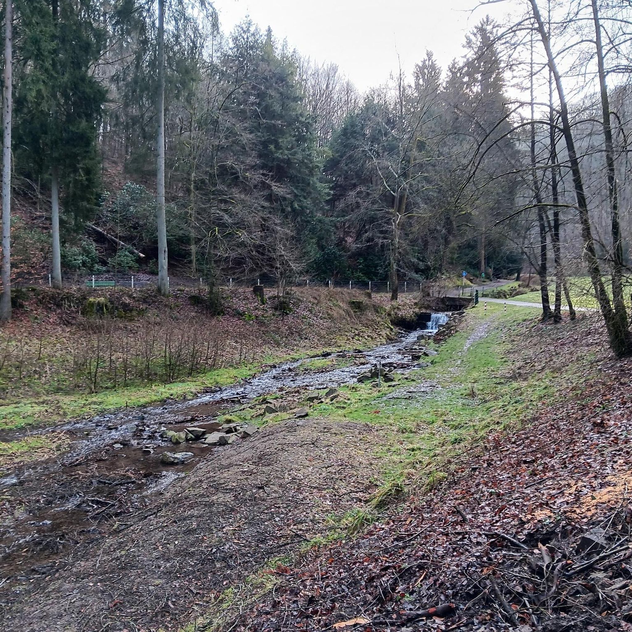
Road cycling routes in Ringing Rocks County Park offer access to the scenic landscapes of Bucks County, Pennsylvania. The area is characterized by rolling terrain, tree-covered roads, and open meadows, providing varied cycling experiences. While the park itself features unique geological formations like the Ringing Rocks Boulder Field and Bucks County's largest waterfall, the surrounding roads and proximity to the Delaware Canal State Park are key for road cyclists. This region provides a network of routes that connect natural attractions with picturesque rural settings.
Best road cycling routes in Ringing Rocks County Park
- The most popular road cycling route is New Hope-Lambertville Bridge – New Hope loop from Frenchtown, a 32.7 miles (52.6 km) trail that takes 2 hours 7 minutes to complete. This route offers views of the Delaware River and connects historic towns.
- Another top favourite among local road cyclists is Cabin Creek Covered Bridge loop from Frenchtown, a moderate 35.0 miles (56.4 km) path. This route navigates through rural landscapes and past historic covered bridges.
- Local road cyclists also love the Roadbike loop from Frenchtown, a 23.6 miles (38.1 km) trail leading through tree-lined roads and open countryside, often completed in about 1 hour 43 minutes.
- Road cycling in Ringing Rocks County Park is defined by rolling terrain, tree-covered roads, and access to the Delaware Canal towpath. The network offers options for different ability levels, from easy loops to more challenging rides with significant elevation gain.
- The routes in Ringing Rocks County Park are highly rated by the komoot community with an average score of 4.5 stars from a few reviews. More than 200 road cyclists have used komoot to explore Ringing Rocks County Park's varied terrain.
Last updated: July 13, 2026
2
riders
57.3km
03:08
700m
700m
Moderate road ride. Good fitness required. Mostly well-paved surfaces and easy to ride.
2
riders
57.4km
02:31
430m
430m
The Roadbike loop from Little York offers a delightful escape into the countryside, winding through beautiful scenery with a mix of trees and open fields. This entirely paved route is perfect for road bikes, providing a peaceful experience with notably light traffic. You'll cover 35.7 miles (57.4 km) with a moderate 1421 feet (433 metres) of elevation gain, making it a great option for a solid ride.
Planning your ride is straightforward; the route is well-suited for road bikes due to its fully paved surfaces. While specific parking details aren't highlighted, the general area is known for its light traffic, suggesting a relaxed cycling environment. Aim for a clear day to fully appreciate the scenic rural views.
What sets this route apart is its balance of distance and manageable elevation, coupled with the quiet, rural atmosphere. It's a fantastic choice if you're seeking a pleasant, uninterrupted ride away from busy roads, allowing you to immerse yourself in the natural beauty of the Hunterdon County landscape.

Sign up for free
4.0
(1)
92
riders
53.3km
02:12
220m
220m
Moderate road ride. Good fitness required. Mostly well-paved surfaces and easy to ride.
5.0
(1)
30
riders
56.6km
02:50
640m
640m
Moderate road ride. Good fitness required. Mostly well-paved surfaces and easy to ride.
8
riders
38.1km
01:44
260m
260m
The Roadbike loop from Frenchtown offers a delightful spin through the New Jersey countryside, perfect for a relaxed afternoon on two wheels. This easy 23.7-mile (38.1 km) route takes you along paved roads, providing gentle rolling hills and flat stretches, with an elevation gain of 852 feet (260 metres). You'll enjoy charming small towns and picturesque river views along the Delaware River, making for a scenic ride that typically takes about 1 hour and 43 minutes.
Planning your visit is straightforward, as Frenchtown is a popular cycling destination with amenities like coffee shops and restaurants. The route is entirely on paved surfaces, so you won't need to worry about the crushed stone sections of the D&R Canal Towpath, which are better suited for other bike types. This makes it an accessible option for road cyclists of all skill levels looking for a smooth and enjoyable ride.
This road cycling loop is a fantastic way to experience the natural beauty and historic charm of the Frenchtown area. You'll pass through vibrant wetlands and woodlands, with plenty of opportunities for nature observation. It's a great choice if you're seeking road cycling routes near Frenchtown NJ that combine ease with beautiful scenery, offering a peaceful escape from busier areas.
Get access to more routes and recommendations from other explorers.
Sign up for free
Already have an account?
Our route recommendations are based on thousands of hikes, rides, and runs completed by other people on komoot.
Start today with a free account
Your next adventure awaits.
Login or Signup
Popular around Ringing Rocks County Park


Tips from the Community

From this vantage point, you can enjoy a beautiful view of the Delaware River, which stretches 330 miles long. The river's headwaters originate at the meeting of the East and West Branch Delaware River in Hancock, New York.
0
0

From this spot on the Delaware and Raritan Canal Townpath near Frenchtown, where you get fantastic views of the Deleware River close to town. The Deleware River is the longest free-flowing river east of the Mississippi River in the United States. The Townpath runs for nearly 70 miles along the river, offering a fantastic, car-free way to enjoy the scenery.
1
0

This is a great place to see one of the locks of the Delaware Canal. Lock 20 was built next to a big grist mill, and can accommodate two canal boats. This part of the Delaware is known as the Narrows, where cliffs are particularly high. From here you can see out to the river and the tall red cliffs.
1
0

Upon entering the main road through the Shick Reserve, you'll be treated to a rather short but relatively steep gravel descent before the road opens up to some pavement and a small farm. What follows are some undulating hills, a common characteristic of the backroads in this part of NJ. Watch out for deer.
0
0

The bridge connects Lambertville, NJ with New Hope, PA. It has a nice walkway for bikes and pedestrians.
0
0
The bridge connects Lambertville, NJ with New Hope, PA. It has a nice walkway for bikes and pedestrians.
1
0
New Hope is a beautiful small town, with a lot of riverside restaurants and cafés. The perfect spot for a break on a long bike ride.
0
0
Frequently Asked Questions
How many road cycling routes are available in the Ringing Rocks County Park area?
There are over 20 road cycling routes in the vicinity of Ringing Rocks County Park, offering a variety of experiences for cyclists. These routes are highly rated by the komoot community, with an average score of 4.5 stars.
What kind of terrain can I expect when road cycling around Ringing Rocks County Park?
The region around Ringing Rocks County Park is characterized by rolling terrain, tree-covered roads, and open meadows. You'll find scenic roads like Clay Ridge, Beaver Run, and Center Hill Road, which are immensely enjoyable for riding. While the park itself has some rugged areas, the surrounding roads are well-suited for road cycling.
Are there any easy or family-friendly road cycling routes in the area?
Yes, the area offers routes suitable for various ability levels. For example, the Roadbike loop from Frenchtown is an easy 23.6-mile (38.1 km) trail that leads through tree-lined roads and open countryside, making it a good option for families or those seeking a less strenuous ride.
Can I access the Delaware Canal State Park towpath from Ringing Rocks County Park for longer rides?
Absolutely. Ringing Rocks County Park is a short distance from the 60-mile Delaware Canal State Park, which features a continuously intact historic canal and towpath. Cyclists can find routes that loop between Ringing Rocks County Park and the Delaware Canal State Park, offering extensive paved surfaces for longer rides.
What are some notable natural attractions or landmarks I might encounter on a road cycling route?
While road cycling, you'll be in proximity to unique natural features. Ringing Rocks County Park itself is home to the famous Ringing Rocks Boulder Field, where diabase boulders produce a metallic sound when struck, and Bucks County's largest waterfall. Many routes incorporate these natural areas or offer scenic views of the surrounding landscape.
Are there any routes that feature historic elements or covered bridges?
Yes, the region is rich in history. A popular route like the Cabin Creek Covered Bridge loop from Frenchtown, a moderate 35.0-mile (56.4 km) path, specifically navigates through rural landscapes and past historic covered bridges, offering a glimpse into the area's past.
Where can I park when planning a road cycling trip to Ringing Rocks County Park?
Ringing Rocks County Park offers parking facilities for visitors. The Highlands Trail, which connects to the D&L Trail, ends at the park's parking lot, making it a convenient starting point for exploring the area by bike.
What are the typical distances and elevation gains for road cycling routes in this area?
Routes vary in length and challenge. You can find rides ranging from approximately 23 miles (38 km) with around 260 meters of elevation gain, such as the Roadbike loop from Frenchtown, to longer, more challenging options like the Lake Nockamixon loop from Frenchtown, which covers nearly 37 miles (59.5 km) with over 600 meters of ascent.
Are permits required for road cycling in or around Ringing Rocks County Park?
Generally, permits are not required for road cycling on public roads in the Ringing Rocks County Park area. However, it's always advisable to check the official Bucks County Parks and Recreation website for any specific regulations regarding park usage: buckscounty.gov.
What do other road cyclists enjoy most about the routes near Ringing Rocks County Park?
The komoot community highly rates the road cycling experience here, with an average score of 4.5 stars. Cyclists often praise the picturesque Bucks County landscape, the variety of rolling terrain, and the access to scenic roads and the Delaware Canal towpath, which combine to offer diverse and enjoyable rides.
Can I find routes that offer views of the Delaware River?
Yes, several routes in the area provide beautiful views of the Delaware River. For instance, the New Hope-Lambertville Bridge – New Hope loop from Frenchtown is a popular 32.7-mile (52.6 km) route that offers direct views of the river and connects historic towns along its banks.
Are there any routes that explore the area around Lake Nockamixon?
Yes, for those looking to explore further afield, the Lake Nockamixon loop from Frenchtown is a moderate 37-mile (59.5 km) route that takes you through the scenic landscapes surrounding Lake Nockamixon, offering a different perspective of the region.
Most popular routes in Ringing Rocks County Park

Get inspired with the komoot mobile app


Explore more
Browse the best Road cycling routes in other regions.
