The best walks and hikes in Parque Nacional Huerquehue
4.7
(190)
1,355
hikers
4
hikes
Hiking in Parque Nacional Huerquehue features mountainous terrain, ancient Araucaria forests, and numerous lakes and waterfalls. The park is situated within the Valdivian temperate rainforest ecoregion, characterized by its unique biodiversity and Andean Patagonian forests. Elevations range from 2,300 to 6,500 feet (720 to 2,000 meters), offering varied landscapes for exploration. The region provides panoramic views of volcanoes such as Villarrica, Quetrupillan, and Lanin from higher vantage points.
Best hiking trails in Parque Nacional Huerquehue
- The most popular hiking route is Sendero los lagos de Huerquehue — Parque Nacional Huerquehue, a 7.8 miles (12.6 km) trail that takes 4 hours 24 minutes to complete. This moderate route ascends through forests to a circuit of lakes.
- Another top favourite among local hikers is Los Lagos Trail, a moderate 6.7 miles (10.8 km) path. This trail leads through lush forests and past several pristine lakes.
- Local hikers also love the Sendero San Sebastián — Parque Nacional Huerquehue, an 8.8 miles (14.2 km) trail leading through mountainous terrain to a summit viewpoint, often completed in about 5 hours 54 minutes.
- Hiking in Parque Nacional Huerquehue is defined by ancient Araucaria forests, crystal-clear lakes, and panoramic volcanic views. The network offers options for different ability levels, from moderate lake circuits to challenging summit ascents.
- The routes in Parque Nacional Huerquehue are highly rated by the komoot community with an average score of 4.7 stars from over 150 reviews. More than 1000 hikers have used komoot to explore Parque Nacional Huerquehue's varied terrain.
Last updated: July 7, 2026
4.7
(78)
542
hikers
12.6km
04:25
640m
640m
Moderate hike. Good fitness required. Easily-accessible paths. Suitable for all skill levels.
4.6
(60)
315
hikers
10.8km
03:50
560m
560m
Moderate hike. Good fitness required. Easily-accessible paths. Suitable for all skill levels.

Sign up for free
4.9
(21)
156
hikers
14.2km
05:55
1,170m
1,170m
Hard hike. Very good fitness required. Easily-accessible paths. Suitable for all skill levels.
4.8
(37)
360
hikers
16.3km
06:24
1,150m
1,150m
Hard hike. Very good fitness required. Easily-accessible paths. Suitable for all skill levels.
Our route recommendations are based on thousands of hikes, rides, and runs completed by other people on komoot.
Start today with a free account
Your next adventure awaits.
Login or Signup
Popular around Parque Nacional Huerquehue
Tips from the Community

You've reached the summit of San Sebastián Hill, from where you can clearly see the Villarrica volcano in the distance. The spot definitely deserves a good photo.
0
0
For quite some time, the ascent to San Sebastián hill is through extremely tall trees. Every now and then, there's a clearing that allows you to admire the landscape.
0
0

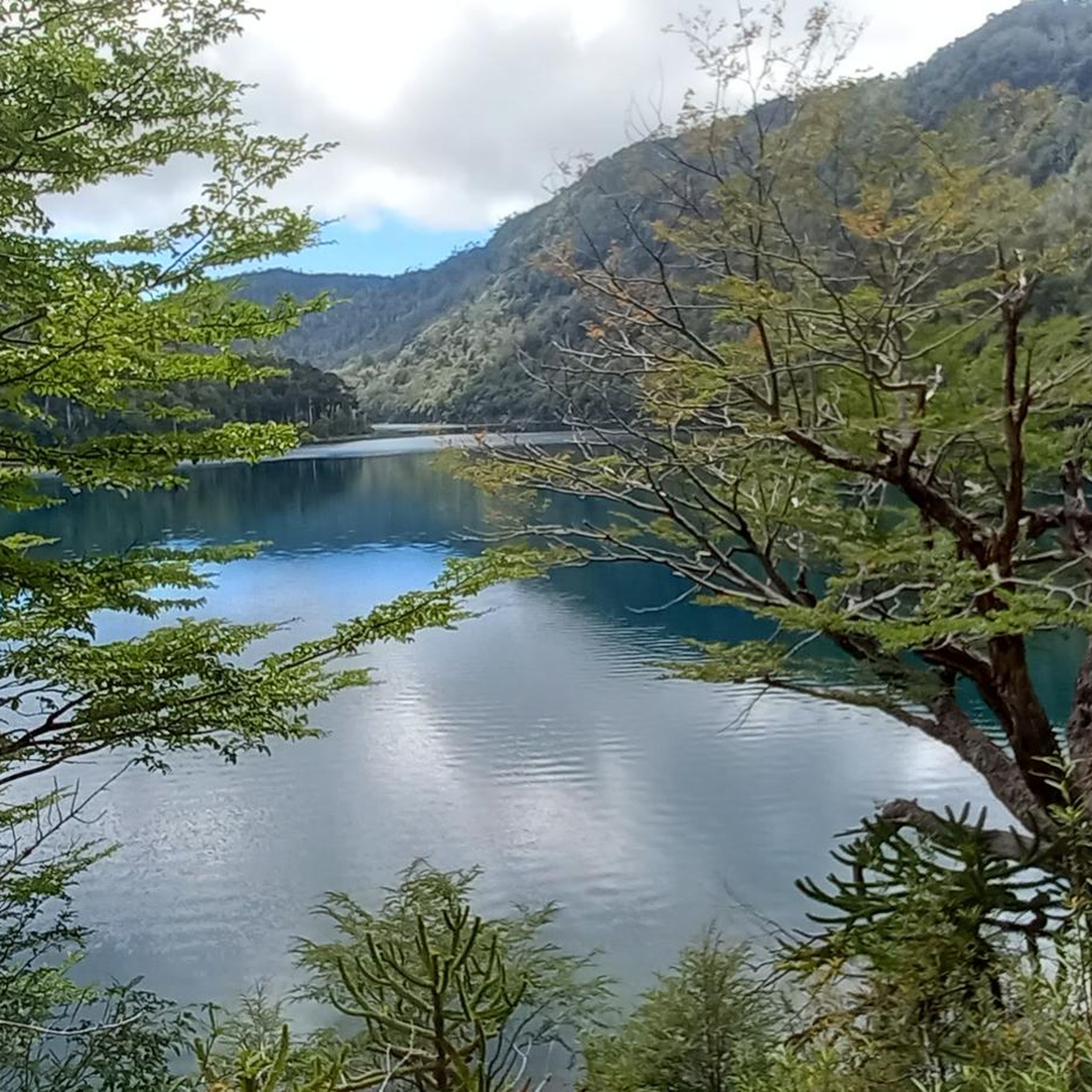
The lake is nestled amidst the vastness of the Andes Mountains. It's worth pausing for a moment to observe the reflection of the hills and feel the tranquility of the place.
0
0
Along the path, this crystal-clear lagoon appears among the vegetation, surrounded by shade where you can enjoy a rest along the way.
0
0
The park is famous for its forest and lagoon landscapes. It's ideal for hiking, enjoying nature, and seeing wildlife such as huemul deer and condors.
0
0

There is a fee to enter the park (2025: 10,000 CLP). There is a large car park 200m behind the entrance.
0
0

Lago Chico, nestled in the breathtaking Andean landscape, offers a tranquil retreat for hikers seeking peace and nature. The trail leads you through a wide, open landscape framed by snow-capped mountain peaks. The rolling hills and expansive meadows, often dotted with small bushes and scattered trees, are particularly striking. It's an ideal place to let your thoughts wander, feel the cool breeze from the lake, and absorb the profound silence. The lake's shore invites you to pause and enjoy the view of the serene waters, where the mountain scenery is reflected in the surface. The area around Lago Chico also offers several interesting trails for shorter hikes that take you deeper into the surroundings. It's a wonderful place to end the day and savor the peace of nature. ``` ``` ``` ] . ... . . . . . A tip: Pack a small snack, sit by the shore and observe nature – sometimes an eagle flies over the mountains or you see small animals near the lake. Especially in the early morning or late afternoon, there is a wonderful, almost mystical atmosphere here.
0
0

Bring warm clothes, it's windy here. Return to the refugio takes only 60-75 minutes. If you camp there maybe you bring headlamp and stay at the Mirador until sunset. Also: there is mobile service up here.
1
0
Frequently Asked Questions
What kind of landscapes can I expect to see while hiking in Parque Nacional Huerquehue?
Parque Nacional Huerquehue offers a stunning variety of landscapes, including ancient Araucaria forests, crystal-clear lakes and lagoons like Chico Lake and Toro Lagoon, and numerous waterfalls. From higher elevations, you can also enjoy panoramic views of volcanoes such as Villarrica, Quetrupillan, and Lanin.
Are there any trails that feature waterfalls in Parque Nacional Huerquehue?
Yes, the park is known for its numerous rushing streams and waterfalls. Trails often lead past captivating cascades like Nido de Aguila (Eagle's Nest) and Truful Waterfalls, providing scenic resting points and photo opportunities amidst the lush Valdivian temperate rainforest.
What is the typical difficulty level of hikes in Parque Nacional Huerquehue?
The park offers a range of trails to suit different fitness levels. You'll find moderate routes like Sendero los lagos de Huerquehue, which ascends through forests to a circuit of lakes, as well as more challenging and strenuous options such as Sendero San Sebastián, which leads to a summit viewpoint with significant elevation gain.
Are there any family-friendly hiking options in Parque Nacional Huerquehue?
While specific 'easy' trails are not detailed in the provided data, the park generally offers a variety of trails. Shorter, gentler walks like the Ñirrico, Quinchol, and Aquila and Truful Waterfall trails are known to showcase diverse ecosystems and scenic viewpoints, which could be suitable for families looking for less strenuous options.
What kind of wildlife might I encounter on the trails?
Parque Nacional Huerquehue is part of the rich Valdivian temperate rainforest, protecting a unique ecosystem. Hikers might spot diverse fauna, including protected species like the elusive kodkod (Leopardus guigna), the pudú (the world's smallest deer), the culpeo (Andean fox), and various bird species such as the Magellanic woodpecker and Andean condor.
What is the best time of year to visit Parque Nacional Huerquehue for hiking?
The best time to visit for hiking generally depends on weather conditions. The park is characterized by its mountainous terrain and temperate rainforest climate. It's advisable to check local weather forecasts and park conditions, especially during the colder months, as higher elevations can experience snow and more challenging conditions.
Are there any circular routes available for hiking in the park?
Yes, some of the popular trails in Parque Nacional Huerquehue are designed as circuits. For example, Sendero los lagos de Huerquehue is described as a route that ascends through forests to a circuit of lakes, offering a complete loop experience.
What are the parking and access arrangements for the trails in Parque Nacional Huerquehue?
Access to Parque Nacional Huerquehue typically involves reaching the park entrance, where parking facilities are usually available. It's recommended to arrive early, especially during peak season, as parking can be limited. For detailed information on specific trailheads and current access rules, it's best to consult the park's official website or local visitor centers.
Do I need a permit to hike in Parque Nacional Huerquehue?
Yes, as a national park, entry usually requires a permit or entrance fee. These fees contribute to the maintenance and conservation of the park's natural environment and facilities. It's advisable to check the official CONAF (Corporación Nacional Forestal) website or contact the park administration directly for the most up-to-date information on permit requirements and fees before your visit.
What do other hikers enjoy most about the trails in Parque Nacional Huerquehue?
The trails in Parque Nacional Huerquehue are highly rated by the komoot community, with an average score of 4.7 stars. Reviewers often praise the stunning natural beauty, particularly the ancient Araucaria forests, the pristine lakes, and the rewarding panoramic volcanic views from higher points like San Sebastian Hill.
How long do hikes typically take in Parque Nacional Huerquehue?
Hike durations vary significantly based on the trail's length and difficulty. For instance, the moderate Sendero los lagos de Huerquehue, which is 7.8 miles (12.6 km), typically takes around 4 hours 24 minutes. More challenging routes like Sendero San Sebastián, at 8.8 miles (14.2 km) with significant elevation, can take closer to 5 hours 54 minutes or more.
Are there any specific viewpoints or landmarks I should look out for?
Absolutely. Key natural landmarks include the ancient Araucaria forests themselves, which are a highlight. Hikers can also enjoy stunning views from various points along trails, especially from the summit of San Sebastian Hill, which offers 360-degree vistas of multiple volcanoes, lakes, and forests. The numerous lakes and lagoons, such as Chico Lake and Toro Lagoon, are also prominent features.
Most popular routes in Parque Nacional Huerquehue
Most popular attractions in Parque Nacional Huerquehue

Get inspired with the komoot mobile app


Explore more
Browse the best Hikes in other regions.
