The best MTB trails in Volcán De Agua
4.7
(9)
138
riders
22
rides
Mountain biking in Volcán de Agua provides diverse terrain on the slopes of a majestic stratovolcano, rising to 3,760 meters (12,340 feet) above sea level. The region features a network of singletrack, jeep tracks, and dirt roads winding through lush forests, coffee plantations, and volcanic landscapes. Riders can experience significant descents and panoramic views of surrounding volcanoes like Acatenango and the active Fuego.
Best mountain bike trails in Volcán de Agua
- The most popular mountain bike trail is Santa María…
Last updated: July 1, 2026
8
riders
19.1km
02:21
920m
930m
Hard mountain bike ride. Very good fitness required. Suitable for all skill levels.
9
riders
35.5km
02:45
710m
710m
Moderate mountain bike ride. Good fitness required. Suitable for all skill levels.

Sign up for free
12
riders
34.0km
03:26
1,140m
1,140m
Hard mountain bike ride. Very good fitness required. Suitable for all skill levels.
4.5
(2)
23
riders
57.9km
04:57
1,540m
1,540m
Hard mountain bike ride. Very good fitness required. Suitable for all skill levels.
11
riders
25.9km
02:16
590m
590m
Moderate mountain bike ride. Good fitness required. Suitable for all skill levels.
Get access to more routes and recommendations from other explorers.
Sign up for free
Already have an account?
Our route recommendations are based on thousands of hikes, rides, and runs completed by other people on komoot.
Start today with a free account
Your next adventure awaits.
Login or Signup
Popular around Volcán De Agua
Tips from the Community

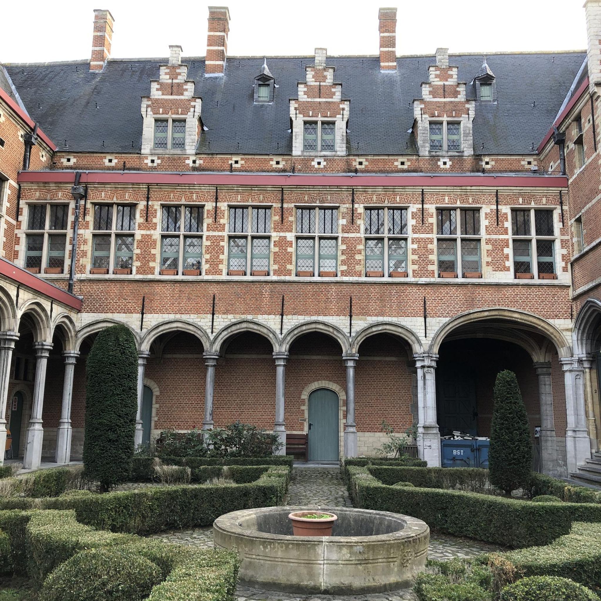
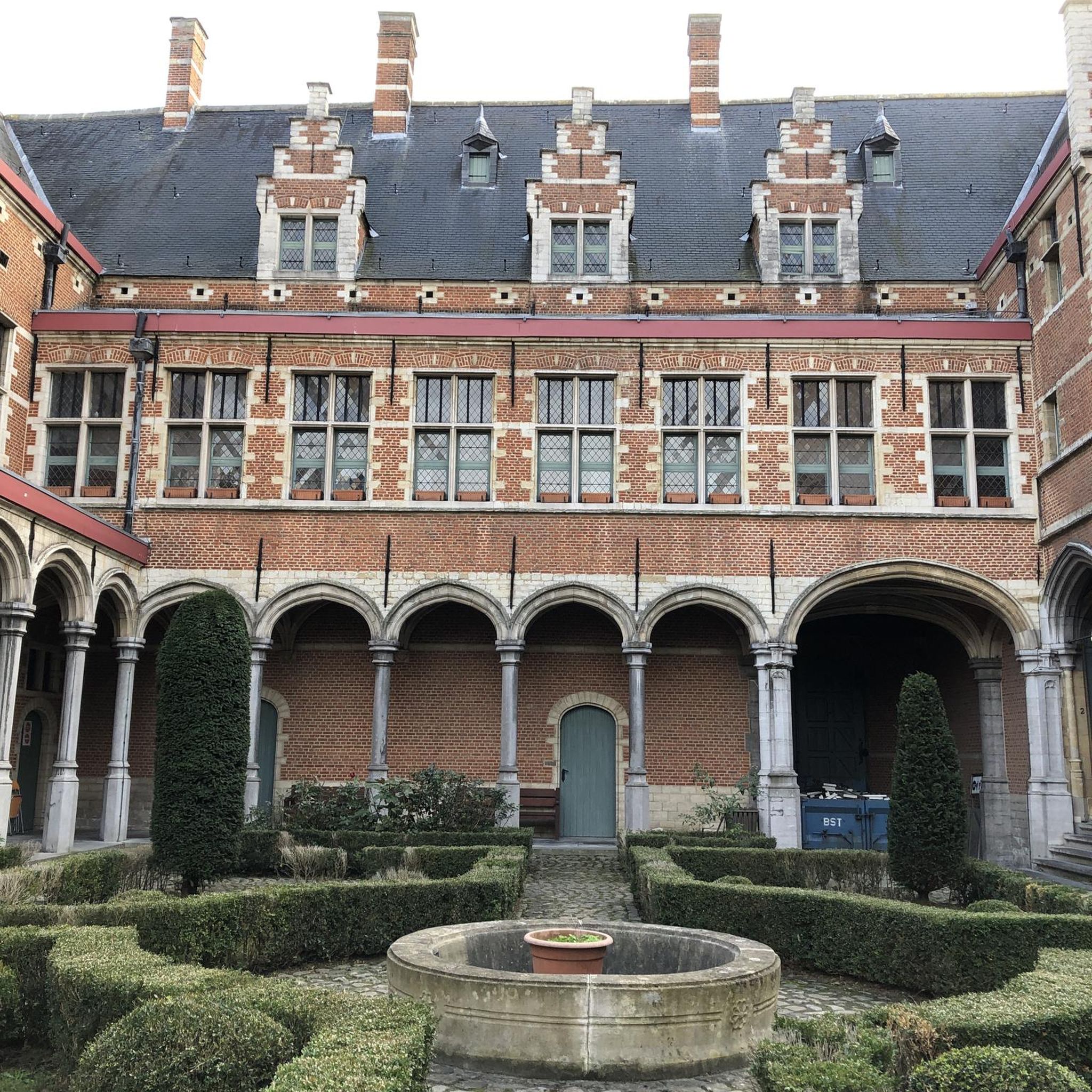
Right next to Plaza Central, a beautiful square with a park in the middle of the city
1
0
Is the best preserved baroque building in the old capital of the country. The Mercedarian Order was founded in 1218 by Peter Nolascus in the Kingdom of Aragon. De.m.wikipedia.org
0
0
Located on the central square of Antigua in Guatemala. It serves as the headquarters of the Guatemalan Institute of Tourism, the Antigua Tourism Association, the National Police, and the Government of the Department of Sacatepquez. Wikipedia
2
0
With the permission of the first bishop of Guatemala, Francisco Marroquin, the Mercedians, who were mainly active in Peru, attempted to build a church and monastery in Antigua with great difficulty. It is thanks to the construction instructions of the architect Juan de Dios Estrada from 1749 that La Merced survived the 1773 earthquake relatively well. (Travel guide Reise Know how Guatemala)
1
0

The Palacio de los Capitanes Generales was the administrative headquarters of the Spanish colonial government. The building on the Parque Central was built in 1558, was damaged several times by earthquakes and is now a cultural center.
4
0

A wonderfully green park in the heart of the city. Sitting on one of the benches you can watch the hustle and bustle around you.
1
0


a good place to visit. a good facade.
1
0
Frequently Asked Questions
How many mountain bike trails are available in Volcán de Agua?
There are over 20 mountain bike trails recorded in Volcán de Agua on komoot, offering a diverse range of experiences for riders. These routes traverse the slopes of the majestic stratovolcano, providing varied terrain and stunning views.
Are there mountain bike trails suitable for beginners in Volcán de Agua?
Yes, Volcán de Agua offers several routes suitable for beginners. There are 3 easy mountain bike trails available, providing a gentler introduction to the region's beautiful landscapes. These trails are a great way to enjoy the scenery without overly technical challenges.
What kind of terrain can I expect on mountain bike trails around Volcán de Agua?
The terrain around Volcán de Agua is incredibly diverse, ranging from purpose-built singletrack trails with downhill switchbacks to jeep tracks and dirt roads. You'll ride through lush forests, coffee plantations, and volcanic landscapes, often encountering sections cut through meadows with thick layers of vines, even forming tunnels. The volcanic nature of the area means you can expect significant descents and varied ecosystems.
Are there challenging mountain bike routes for experienced riders in Volcán de Agua?
Absolutely. For experienced riders seeking a challenge, Volcán de Agua features 7 difficult mountain bike trails. Routes like Santa María de Jesús loop from Fuentes del Valle San Miguel and Mountainbike loop from Antigua Guatemala offer demanding climbs and technical descents, often with significant elevation changes.
What scenic views can I expect on the mountain bike trails?
Mountain bike trails in Volcán de Agua offer breathtaking panoramic views. You'll frequently encounter vistas of surrounding volcanoes, including the active Fuego and Acatenango, as well as expansive hillside farms and mountain ridges. The descent from the volcano's slopes provides ever-changing perspectives of the diverse ecosystems.
What is the best time of year for mountain biking in Volcán de Agua?
While specific weather data isn't provided, the region's climate generally suggests that the dry season (typically November to April) would be ideal for mountain biking. This period usually offers more stable weather conditions and less muddy trails, making for a more enjoyable and safer riding experience.
Can I find loop trails for mountain biking in Volcán de Agua?
Yes, many of the mountain bike routes in Volcán de Agua are designed as loops, allowing you to start and finish at the same point. Examples include the Parroquia San Sebastián loop from Fuentes del Valle San Miguel and the Santa María de Jesús loop from Santa Catarina Barahona, which are popular choices among local riders.
Are there any cultural or natural attractions along the mountain bike routes?
Yes, the routes often traverse significant cultural and natural landscapes. You'll frequently ride through coffee plantations, offering a glimpse into the region's agricultural heritage. The trails also pass through lush forests, providing a verdant environment. The historic city of Antigua, a UNESCO World Heritage site, serves as an excellent base and offers charming colonial architecture nearby.
What do other mountain bikers enjoy most about mountain biking in Volcán de Agua?
The mountain biking experience in Volcán de Agua is highly rated by the komoot community, with an average score of 4.7 stars. Riders frequently praise the diverse terrain, the stunning panoramic views of the surrounding volcanoes, and the unique experience of riding through lush forests and coffee plantations. The challenging descents and varied ecosystems are also often highlighted.
Are there options for family-friendly mountain biking in the area?
While many trails offer intermediate to advanced experiences, the network around Volcán de Agua does include easier routes that could be suitable for families with some mountain biking experience. The 3 easy trails available provide less technical terrain, allowing for a more relaxed ride through the scenic landscapes. Always check the specific route details for elevation and surface conditions to ensure it matches your family's ability.
What is the typical duration and distance of mountain bike trails in Volcán de Agua?
The trails vary significantly in length and duration. For example, a moderate route like Parroquia San Sebastián loop from Fuentes del Valle San Miguel is about 22.9 miles (36.9 km) and takes around 2 hours 47 minutes. More challenging routes, such as the Santa María de Jesús loop from Santa Catarina Barahona, can be 20.9 miles (33.6 km) and take approximately 3 hours 24 minutes, due to greater elevation changes.

Get inspired with the komoot mobile app


