The best road cycling routes in Parque Estatal Monte Alto
5.0
(3)
289
riders
15
rides
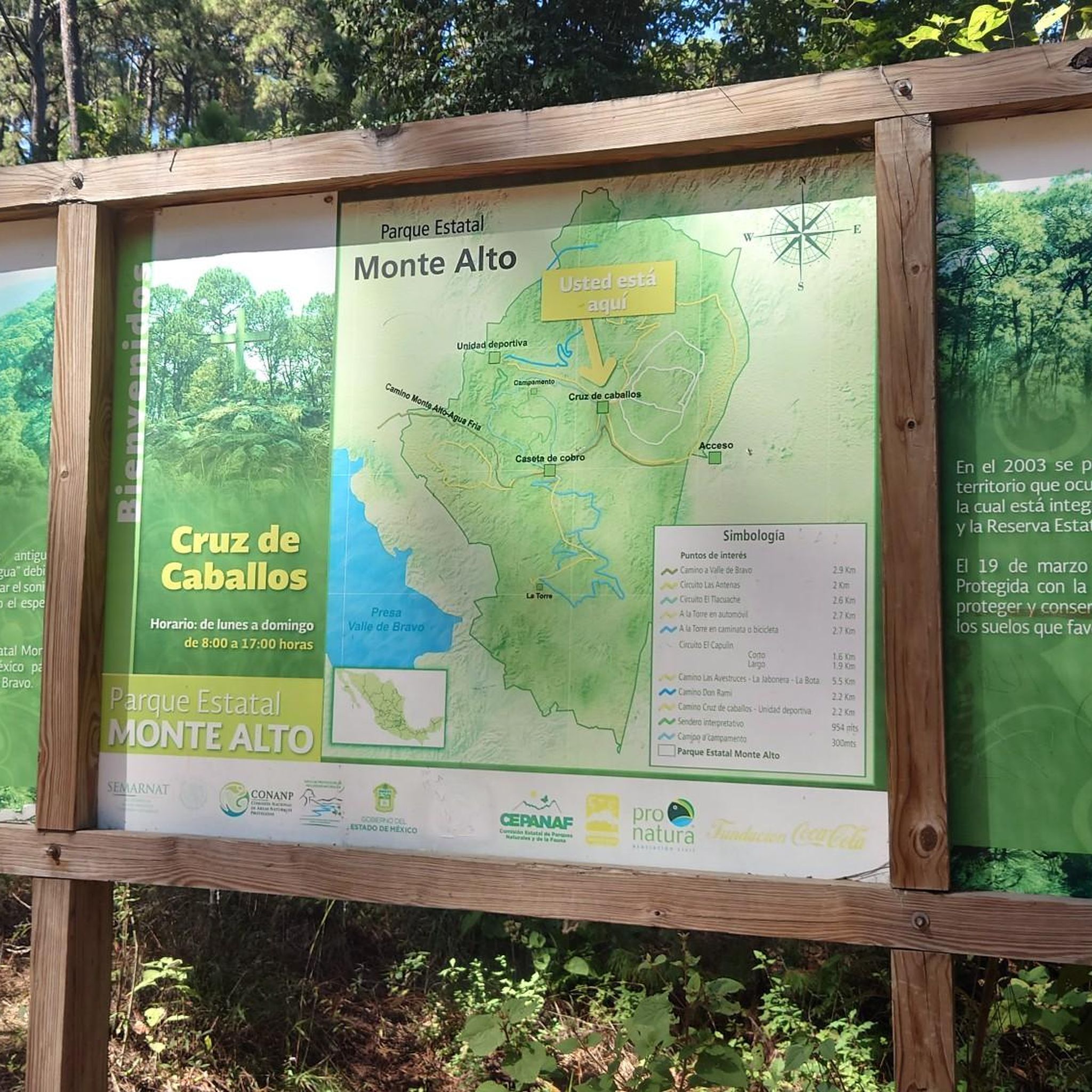
Road cycling in Parque Estatal Monte Alto, located east of Valle de Bravo, Mexico, offers diverse routes across a landscape shaped by inactive volcanoes. The topography features steep slopes and panoramic views, with gentler gradients extending towards the Acatitlán valley. Dominant pine-oak forests provide a consistent green backdrop, while some routes include segments with varying elevation changes. The park's terrain includes both well-paved surfaces and some unpaved sections on longer, more challenging rides.
Best road cycling routes in Parque Estatal…
Last updated: July 10, 2026
5.0
(1)
8
riders
43.7km
02:30
860m
860m
Moderate road ride. Good fitness required. Mostly well-paved surfaces and easy to ride.
55
riders
134km
07:31
3,040m
3,040m
Hard road ride. Very good fitness required. Mostly well-paved surfaces and easy to ride.

Sign up for free
25
riders
109km
06:31
2,650m
2,650m
Hard road ride. Very good fitness required. Some segments of this route may be unpaved and difficult to ride.
20
riders
118km
06:37
2,500m
2,500m
Hard road ride. Very good fitness required. Some segments of this route may be unpaved and difficult to ride.
15
riders
63.7km
03:51
1,320m
1,320m
Hard road ride. Very good fitness required. Some segments of this route may be unpaved and difficult to ride.
Get access to more routes and recommendations from other explorers.
Sign up for free
Already have an account?
Our route recommendations are based on thousands of hikes, rides, and runs completed by other people on komoot.
Start today with a free account
Your next adventure awaits.
Login or Signup
Popular around Parque Estatal Monte Alto


Frequently Asked Questions
What kind of terrain can I expect on road cycling routes in Parque Estatal Monte Alto?
Parque Estatal Monte Alto offers diverse terrain for road cycling. You'll find routes with well-paved surfaces, especially on moderate loops. However, some longer, more challenging rides may include unpaved sections. The landscape is shaped by inactive volcanoes, featuring steep slopes, impressive panoramic views, and gentler gradients towards the Acatitlán valley.
Are there road cycling routes suitable for beginners in Parque Estatal Monte Alto?
While Parque Estatal Monte Alto is known for its challenging routes, there are options for various fitness levels. The guide lists 4 moderate routes, which could be a good starting point for less experienced riders. For example, the Hacienda Pipiol loop from Los Hoyos is a moderate 43.7 km ride with significant elevation gain, offering a taste of the park's terrain without being overly demanding.
What natural features will I encounter while road cycling in Parque Estatal Monte Alto?
As you cycle through Parque Estatal Monte Alto, you'll be surrounded by a dominant pine-oak forest, with pines often reaching around twenty meters in height. The park's topography, influenced by three inactive volcanoes, provides varied landscapes, from steep slopes to gentler areas. In more humid spots, you might even spot elegant wild orchids.
Are there any scenic viewpoints along the road cycling routes?
Yes, the volcanic topography of Parque Estatal Monte Alto creates numerous opportunities for impressive panoramic views. Many routes traverse areas with steep slopes, offering breathtaking vistas of the surrounding landscape and the Acatitlán valley. Keep an eye out for elevated sections that provide expansive outlooks.
Is there parking available for road cyclists in Parque Estatal Monte Alto?
While specific parking areas for road cyclists are not detailed, Parque Estatal Monte Alto is a popular outdoor destination with various activities like hiking and paragliding. It is common for such parks to have designated parking facilities, especially near trailheads or popular access points. We recommend checking local park information or maps for precise parking locations before your visit.
What is the best season for road cycling in Parque Estatal Monte Alto?
The region's climate generally allows for road cycling throughout much of the year. However, for the most comfortable experience, consider visiting during seasons with moderate temperatures and less rainfall. Always check the local weather forecast before heading out, as conditions can vary, especially with the park's elevation changes.
What kind of wildlife might I see while road cycling in Parque Estatal Monte Alto?
Parque Estatal Monte Alto is home to diverse wildlife. While cycling through the pine-oak forests, you might spot various animals such as squirrels, hummingbirds, hawks, owls, and rabbits. Maintaining a respectful distance and observing quietly will increase your chances of a sighting.
Are there loop road cycling routes available in Parque Estatal Monte Alto?
Yes, Parque Estatal Monte Alto features several loop road cycling routes. Popular options include the Hacienda Pipiol loop from Los Hoyos, the challenging El Mapa loop from Mesa de Jaimes, and the Presa Ixtapantongo loop from Valle de Bravo, all designed to bring you back to your starting point.
Are the road cycling routes in Parque Estatal Monte Alto suitable for families?
The road cycling routes in Parque Estatal Monte Alto range from moderate to difficult. While there are 4 moderate routes, many involve significant elevation gain and distances, making them more suitable for experienced cyclists. Families with younger children or those seeking very gentle rides might find the terrain challenging. It's best to assess the specific route's distance and elevation profile to determine its suitability for your family's fitness level.
Are dogs allowed on the road cycling trails in Parque Estatal Monte Alto?
The provided information does not specify rules regarding dogs on road cycling trails within Parque Estatal Monte Alto. As a general practice in natural parks, it's advisable to check the official park regulations or contact park authorities directly regarding pet policies, especially concerning leashing requirements and waste disposal, to ensure a pleasant experience for everyone and protect local wildlife.
How many road cycling routes are available in Parque Estatal Monte Alto?
There are over 15 road cycling routes available in Parque Estatal Monte Alto, offering a variety of options for different skill levels and preferences. These include 4 moderate routes and 12 difficult routes, ensuring there's a challenge for every road cyclist.
What do other road cyclists enjoy the most about road cycling in Parque Estatal Monte Alto?
The road cycling experience in Parque Estatal Monte Alto is highly rated by the komoot community, with an average score of 5.0 stars. Reviewers often praise the diverse terrain, the challenging climbs, and the scenic beauty of the pine-oak forests and panoramic views. The variety of routes, from moderate loops to difficult long-distance rides, is also a significant draw.
What are some of the more challenging road cycling routes in the park?
For experienced road cyclists seeking a challenge, Parque Estatal Monte Alto offers several demanding routes. The El Mapa loop from Mesa de Jaimes is a difficult 134 km route with over 3,000 meters of elevation gain, navigating varied terrain. Another challenging option is the Presa Ixtapantongo loop from Valle de Bravo, covering 118 km with significant climbing.
Most popular routes in Parque Estatal Monte Alto

Get inspired with the komoot mobile app


