The best walks and hikes in E.C. Manning Provincial Park
4.7
(98)
971
hikers
21
hikes
Hiking trails in E.C. Manning Provincial Park traverse a diverse landscape within the Cascade Mountains, featuring wet coastal rainforests, jagged peaks, and extensive alpine meadows. The park is characterized by its varied terrain, including a chain of small lakes like Lightning Lake, and broad riverbeds. Elevations range from valley floors to challenging mountain summits, offering a wide spectrum of natural features for hikers.
Best hiking trails in E.C. Manning Provincial Park
- The most popular hiking route is Mount Outram Trail, a 12.1 miles (19.5 km) trail that takes 10 hours 32 minutes to complete. This difficult route offers significant elevation gain and panoramic mountain views.
- Another top favourite among local hikers is Lightning Lake Day Use Area – Start of Lightning Lake Trail loop from Lightning Lake Beach, a moderate 5.3 miles (8.5 km) path. This loop circles Lightning Lake, a prominent feature of the park, and is suitable for non-motorized water sports.
- Local hikers also love the Lightning Lake Day Use Area – Start of Lightning Lake Trail loop from Skyview Campground, a 3.9 miles (6.3 km) trail leading through forested areas around Lightning Lake, often completed in about 1 hour 42 minutes.
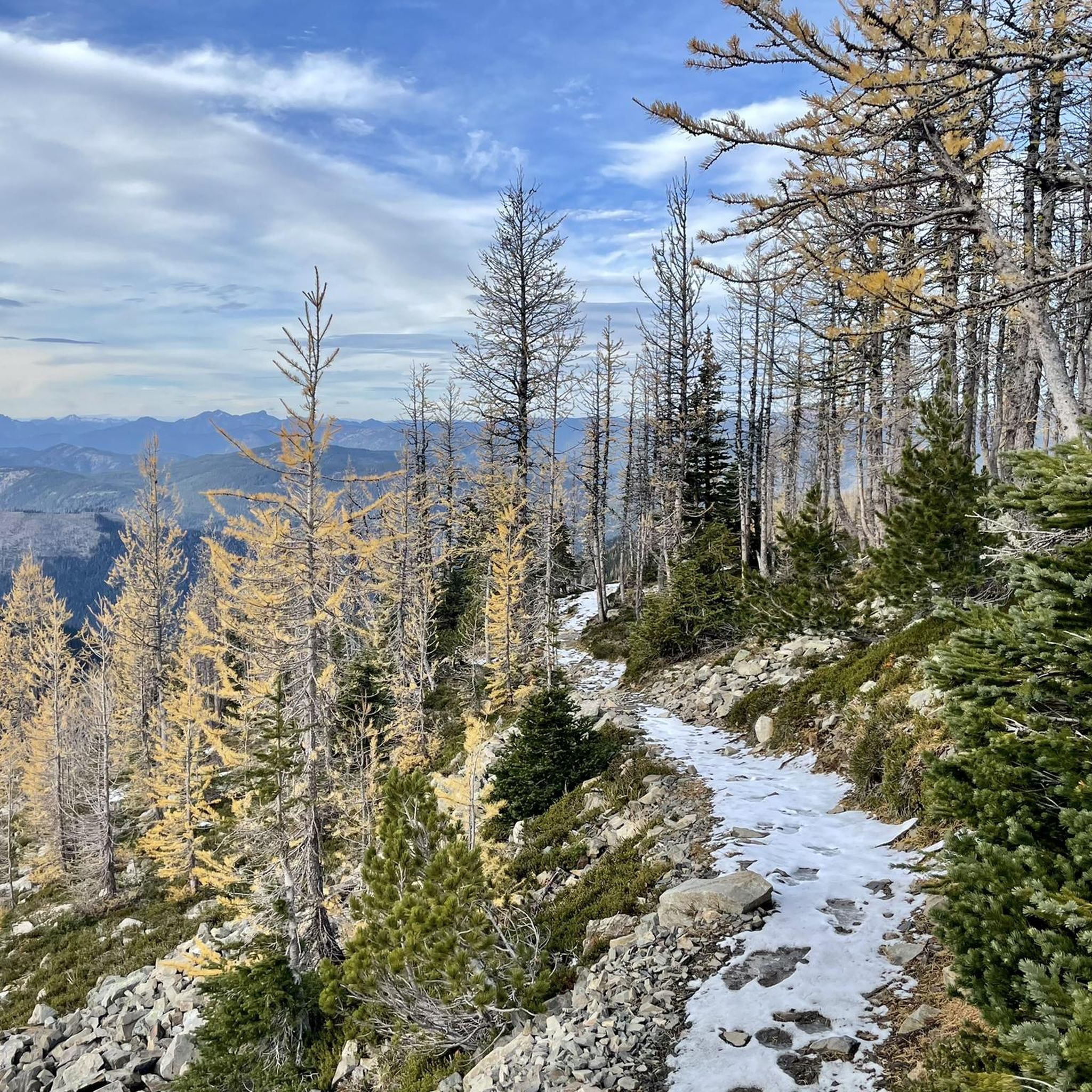
- Hiking in E.C. Manning Provincial Park is defined by diverse terrain, sub-alpine wildflower displays, and golden larch forests in autumn. The network offers options for various ability levels, from easy strolls around lakes to challenging multi-day backcountry treks.
- The routes in E.C. Manning Provincial Park are highly rated by the komoot community with an average score of 4.75 stars from more than 80 reviews. More than 800 hikers have used komoot to explore E.C. Manning Provincial Park's varied terrain.
Last updated: August 24, 2026
10
hikers
19.5km
10:32
1,760m
1,760m
Hard hike. Very good fitness required. Mostly accessible paths. Sure-footedness required.
9
hikers
7.27km
02:50
540m
540m
Moderate hike. Good fitness required. Easily-accessible paths. Suitable for all skill levels.

Sign up for free
4.8
(26)
187
hikers
Moderate hike. Good fitness required. Easily-accessible paths. Suitable for all skill levels.
4.6
(16)
204
hikers
Easy hike. Great for any fitness level. Easily-accessible paths. Suitable for all skill levels.
4.6
(14)
181
hikers
Easy hike. Great for any fitness level. Easily-accessible paths. Suitable for all skill levels.
Get access to more routes and recommendations from other explorers.
Sign up for free
Already have an account?
Our route recommendations are based on thousands of hikes, rides, and runs completed by other people on komoot.
Start today with a free account
Your next adventure awaits.
Login or Signup



Tips from the Community

Parking for the Mount Kelly Trail is available near Allison Pass Summit along Highway 3. Most hikers park beside the Allison Pass highway maintenance yard and carefully cross the highway to reach the trailhead, or if there's space in the small roadside pull off right by the trailhead.
0
0
At roughly 1,931 metres, the summit of Mount Kelly opens onto sweeping views across the Cascade Mountains, with layered ridgelines stretching deep into E.C. Manning Provincial Park. Rocky alpine terrain surrounds the peak, and in late summer the slopes below are often dotted with wildflowers. On clear days, the elevated viewpoint gives a wide perspective over forested valleys and neighbouring summits across southern British Columbia.
0
0
Mount Kelly Trail climbs steadily through subalpine forest before opening onto broad alpine viewpoints overlooking the Cascade Mountains and surrounding valleys of E.C. Manning Provincial Park. The route becomes rockier and more exposed higher up, with wildflowers covering sections of the ridge in summer and lingering snow possible well into the season.
0
0

The trail up to Mount Outram is pretty easy to locate and is well signed. Until the treeline, the trail is a combination of an old logging road and forested single track. Once you get into the alpine, it becomes scree and boulders.
0
0
Mount Outram, with a summit of 2,461 m, is one of the tallest peaks along the Highway 3 corridor and the fourth highest point in the Hozameen Range.
0
0

Lightning Lake Trail runs along the lake shore. At the Rainbow Bridge there is a sign warning of a bear in the area (May 2018). We cross the narrow part of the lake on the bridge and walk back to the car park at the Lightning Lake Day Use Area. https://en.wikipedia.org/wiki/Lightning_Lake
2
0
E.C. Manning Provincial Park (Manning Park) lies in the Cascade Mountains along the Canada-United States border. The park is accessed on British Columbia Highway 3 east of Hope. Four campgrounds for summer camping are located along the road close to Lightning Lake at an altitude of about 1,300 m. https://bcparks.ca/ec-manning-park/
1
0

At the base of Frosty Mountain, the idyllic Twenty Minute Lake invites you to take a hike around. And guess what: It will take you twenty minutes. ;)
4
0
Frequently Asked Questions
How many hiking trails are there in E.C. Manning Provincial Park?
E.C. Manning Provincial Park offers a wide variety of hiking opportunities, with over 20 recorded trails on komoot. These range from easy strolls to challenging multi-day backcountry treks, catering to all skill levels.
What kind of landscapes can I expect to see while hiking in E.C. Manning Provincial Park?
The park boasts exceptionally diverse landscapes, including wet coastal rainforests, jagged snow-capped peaks, and extensive alpine meadows. You'll find a chain of small lakes like Lightning Lake, broad riverbeds, and stunning mountain views across the Cascade Mountains.
Are there any easy or family-friendly hiking trails in E.C. Manning Provincial Park?
Yes, E.C. Manning Provincial Park has several easy and family-friendly options. For a leisurely experience, consider the 500m Beaver Pond Loop or the Lightning Lake Day Use Area – Start of Lightning Lake Trail loop from Skyview Campground, an easy 3.9-mile (6.3 km) trail. The Rein Orchid Trail is another gentle option, often offering excellent bird-watching opportunities.
When is the best time to see wildflowers in E.C. Manning Provincial Park?
E.C. Manning Provincial Park is renowned for its spectacular sub-alpine wildflower displays, which are particularly vibrant in mid-summer. Trails like the Heather Trail and the Paintbrush trail offer access to these unique floral showcases, with wildflowers blooming in full during June, July, and August.
Where can I see golden larches in E.C. Manning Provincial Park during autumn?
In the fall, the park's golden larch forests create a stunning visual spectacle. The Frosty Mountain Trail is particularly noted for its picturesque forests and views of these golden larches as their needles turn a brilliant yellow. You can also find the Alpine Larch Forest on Frosty Mountain Trail.
Are there any trails that feature waterfalls in E.C. Manning Provincial Park?
Yes, the Three Falls Trail is a notable option. This 2.4-mile out-and-back route leads to three unique waterfalls and is known for its scenic forest views, making it a rewarding hike for those seeking cascading water features.
What are some notable landmarks or points of interest to look out for?
Beyond the trails, you can explore several points of interest. The Lightning Lake Day Use Area is a popular spot, and the Rainbow Bridge on the Lightning Lake Trail offers a scenic crossing. For panoramic views, consider the challenging climb to Frosty Mountain Summit or the View of Frosty Mountain and valley.
Are there any circular hiking routes around lakes?
Yes, the park features several loop trails around its prominent lakes. The Lightning Lake Day Use Area – Start of Lightning Lake Trail loop from Lightning Lake Beach is a moderate 5.3-mile (8.5 km) path that circles Lightning Lake, offering scenic views and opportunities for non-motorized water sports.
What do other hikers enjoy the most about hiking in E.C. Manning Provincial Park?
The hiking routes in E.C. Manning Provincial Park are highly rated by the komoot community, with an average score of 4.75 stars from over 80 reviews. Hikers frequently praise the diverse terrain, from sub-alpine wildflower displays to golden larch forests in autumn, and the wide range of options for various ability levels.
Are there any specific areas for viewing rhododendrons?
Yes, near the park's western entrance, you'll find Rhododendron Flats. This area is home to a substantial colony of protected indigenous pinkish-red rhododendrons that typically bloom in early to mid-June, offering a beautiful floral display.
Is it possible to hike to the Canada-United States border from E.C. Manning Provincial Park?
Many trails in E.C. Manning Provincial Park provide breathtaking views of the Cascade Mountains and some even overlook the Canada-United States border. The Pacific Crest Trail Northern Terminus is a significant landmark in the park, marking the end of the famous long-distance trail at the border.
What are the options for longer, more challenging hikes?
For experienced hikers seeking a challenge, the park offers routes like the Frosty Mountain Trail, a 13.2-mile route to the summit, or the Skyline II Trail. These trails involve significant elevation changes and require preparedness for varying conditions, including potential snow even in early fall. Another difficult option is the Mount Outram Trail, a 12.1-mile (19.5 km) trail with significant elevation gain.
Most popular routes in E.C. Manning Provincial Park
Most popular attractions in E.C. Manning Provincial Park

Get inspired with the komoot mobile app


Explore more
Browse the best Hikes in other regions.
