The best walks and hikes in Gowlland Tod Provincial Park
4.4
(275)
2,451
hikers
90
hikes
Hiking in Gowlland Tod Provincial Park offers a diverse landscape characterized by the low mountains of the Gowlland Range, including Jocelyn Hill and Holmes Peak, which provide views of the Saanich Inlet. The park protects a rare dry coastal Douglas-fir habitat, featuring old-growth forests, rocky knolls, and stands of arbutus. Trails often traverse varied terrain, from tranquil Tod Inlet to higher elevations.
Best hiking trails in Gowlland Tod Provincial Park
- The most popular hiking route is Jocelyn Hill and Timberman Trail Loop, a 12.6 miles (20.2 km) difficult trail that takes 6 hours 12 minutes to complete, offering extensive views from Jocelyn Hill.
- Another top favourite among local hikers is Timberman Trail to Squally Reach Viewpoint, an easy 3.9 miles (6.3 km) path. This route leads to a scenic viewpoint overlooking Squally Reach and the Saanich Inlet.
- Local hikers also love the Tod Inlet Trail — Gowlland Tod Provincial Park, a 1.6 miles (2.6 km) trail leading through coastal forest to the tranquil Tod Inlet, often completed in about 44 minutes.
- Hiking in Gowlland Tod Provincial Park is defined by low mountains, diverse forest ecosystems, and views of the Saanich Inlet. The extensive trail network offers options for various ability levels, from easy walks to more challenging routes.
- The routes in Gowlland Tod Provincial Park are highly rated by the komoot community with an average score of 4.5 stars from over 200 reviews. More than 2000 hikers have used komoot to explore Gowlland Tod Provincial Park's varied terrain.
Last updated: October 10, 2026
4.5
(10)
65
hikers
3.50km
01:06
130m
140m
Easy hike. Great for any fitness level. Easily-accessible paths. Suitable for all skill levels.
4.8
(6)
37
hikers
20.2km
06:12
710m
710m
Hard hike. Very good fitness required. Easily-accessible paths. Suitable for all skill levels.

5.0
(4)
49
hikers
6.28km
01:53
190m
190m
Easy hike. Great for any fitness level. Easily-accessible paths. Suitable for all skill levels.
5.0
(2)
35
hikers
5.73km
01:41
160m
160m
Easy hike. Great for any fitness level. Easily-accessible paths. Suitable for all skill levels.
5.0
(1)
28
hikers
2.64km
00:44
50m
50m
Easy hike. Great for any fitness level. Easily-accessible paths. Suitable for all skill levels.
Get access to more routes and recommendations from other explorers.
Already have an account?
Our route recommendations are based on thousands of hikes, rides, and runs completed by other people on komoot.
Start today with a free account
Your next adventure awaits.
Tips from the Community

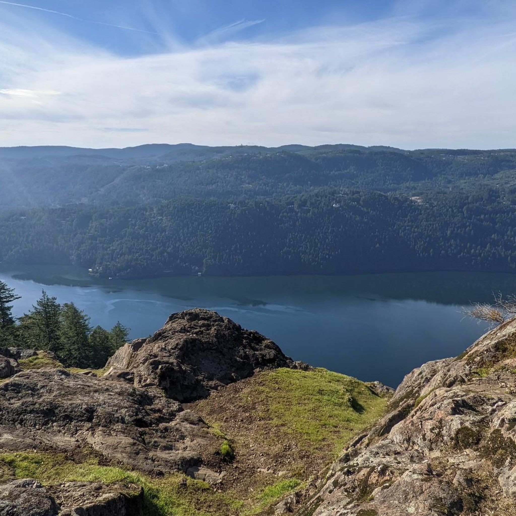
Malahat Viewpoint is reached on a short side trail from Timberman Trail, opening to a view across Saanich Inlet towards the Malahat. The best seat in the house is the swing hanging from the trees, where you can settle in facing the water and surrounding hills. It’s very easy to sit here longer than planned — getting into the swing is definitely easier than convincing yourself to get back out.
0
0

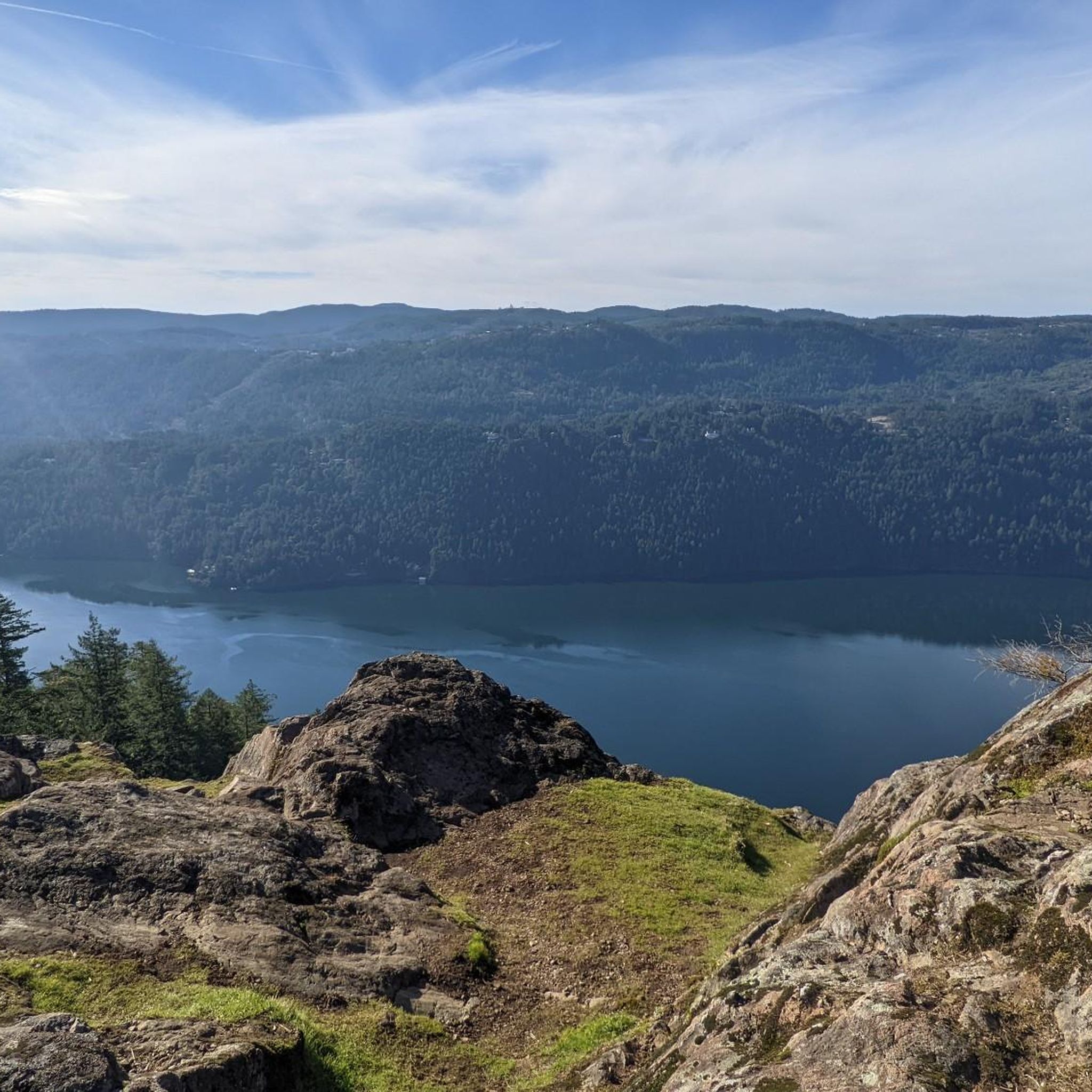
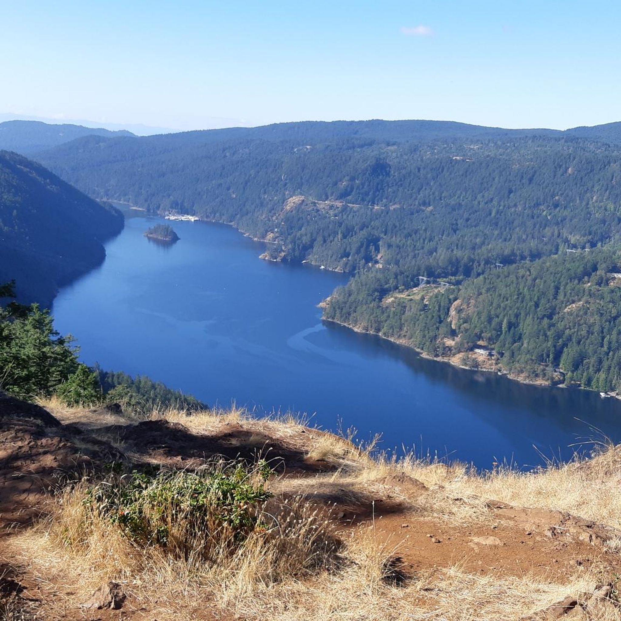
Here you'll find sweeping views across the Saanich Inlet, where forested hills meet the calm waters below. This long, narrow fjord was carved by glaciers during the last Ice Age, creating one of southern Vancouver Island's most scenic landscapes.
0
0
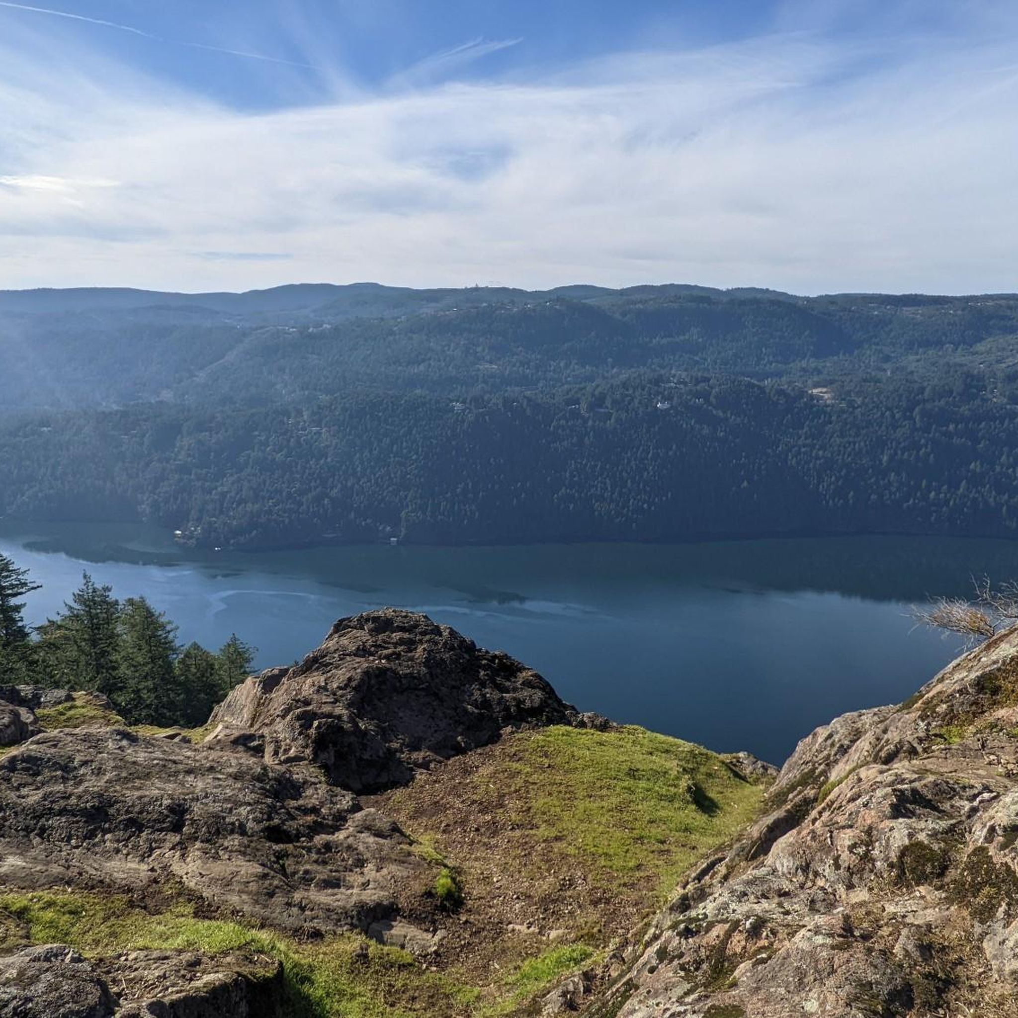
Enjoy a peaceful woodland hike on the Timberman Trail, where scenic viewpoints offer sweeping vistas of the Saanich Inlet. The trail climbs steadily through Douglas fir and western red cedar forest before reaching the lookouts.
0
0

The Saanich Inlet Viewpoint is an early viewpoint on the Timberman Trail. Though not a sweeping view, it's a clear break in the trees, and an exciting teaser for more viewpoints to follow.
0
0
Squally Reach Viewpoint is one of the most scenic lookouts along the Timberman Trail, with views stretching over the Saanich Inlet and Squally Reach. The Timberman Trail climbs through the coastal forest of old Douglas firs, cedars, and vine maple trees to the Squally Reach Viewpoint Trail spur. This short spur trail is a short climb, only about 100 meters to this impressive viewpoint.
0
0

This trailhead sits on the west side of Wallace Drive, just north of Brentwood Bay and has limited roadside parking. From here, a gently sloped trail continues toward Tod Creek and Tod Inlet.
0
0
At the end of the Tod Inlet Trail there’s a small bench area and shoreline access that’s great for a break, and possibly some birdwatching. There are picnic tables and outhouses located along the edge of the inlet. This was once an industrial landing and access point for the early Vancouver Portland Cement Company, and you’ll still see old foundations and remnants from that era near the water.
0
0
There are many concrete foundations and pieces of scattered brickwork left along this trail from the Vancouver Portland Cement Company, which operated along Tod Inlet in the early 1900s. The inlet once supported docks and industrial buildings used to ship cement. These particular ruins are from the clay mill.
0
0
Frequently Asked Questions
How many hiking trails are there in Gowlland Tod Provincial Park?
Gowlland Tod Provincial Park offers an extensive network of over 80 hiking trails, catering to various skill levels. You'll find a mix of easy walks, moderate climbs, and more challenging routes throughout the park.
What is the best time of year to hike in Gowlland Tod Provincial Park?
The park is enjoyable year-round, but spring and early summer are particularly beautiful. During these months, the moss-covered knolls come alive with vibrant wildflowers, and the weather is generally pleasant for hiking. Fall also offers stunning foliage.
What are the general difficulty levels of trails in Gowlland Tod Provincial Park?
The park features a diverse range of trails. You'll find easy walks, such as the Tod Inlet Trail, moderate routes like the View of Saanich Inlet – Jocelyn Hill loop, and more difficult options, including the Jocelyn Hill and Timberman Trail Loop, which involves significant elevation gain.
Are there any notable viewpoints in Gowlland Tod Provincial Park?
Yes, the park is renowned for its spectacular viewpoints. Popular destinations include Jocelyn Hill, Holmes Peak, and Partridge Hills, all offering incredible vistas. The Timberman Trail to Squally Reach Viewpoint also provides scenic views overlooking Squally Reach and the Saanich Inlet.
What kind of natural features and ecosystems can I expect to see?
Gowlland Tod Provincial Park protects a rare dry coastal Douglas-fir habitat. You'll encounter old-growth forests, rocky knolls, grassy meadows, and stands of arbutus and manzanita. The park also safeguards a significant wetland area and is home to over 150 identified plant and animal species, including various wildflowers and 100 different bird species.
Are there any historical or cultural sites within the park?
The park's trails often utilize old logging roads and railway rights-of-way, hinting at the area's history of mineral development and early settlements. Remnants of the former Portland Cement Company townsite and a pioneer copper mine are present. Additionally, the park contains significant archaeological sites, including First Nations village sites over 1,500 years old, important for the Saanich and Malahat First Nations.
What do other hikers enjoy most about Gowlland Tod Provincial Park?
The park is highly rated by the komoot community, with an average score of 4.5 stars from over 200 reviews. Hikers frequently praise the diverse landscapes, the extensive trail network, and the stunning views, especially from peaks like Jocelyn Hill and Holmes Peak. The tranquility of Tod Inlet is also a highlight for many.
Are dogs allowed on the trails in Gowlland Tod Provincial Park?
Yes, dogs are generally permitted in Gowlland Tod Provincial Park. However, they must be kept on a leash at all times to protect wildlife and ensure the safety and enjoyment of all park visitors. Please remember to pack out any waste.
Are there family-friendly hiking options in Gowlland Tod Provincial Park?
Absolutely. The park offers several easy trails suitable for families. The Tod Inlet Trail is a gentle 1.6-mile path through coastal forest, perfect for a leisurely family walk. Other easy sections of the extensive trail network can also be adapted for shorter, family-friendly outings.
Are there any circular or loop trails available?
Yes, Gowlland Tod Provincial Park features several loop trails. A popular option is the challenging Jocelyn Hill and Timberman Trail Loop. For a moderate experience, consider the Jocelyn Hill loop from Gowlland Tod Provincial Park, which offers great views.
Where can I park when visiting Gowlland Tod Provincial Park?
The park has three main access points, each with parking facilities: Tod Inlet, Mackenzie Bight, and Caleb Pike. These points provide convenient starting locations for accessing different parts of the trail system.
What kind of wildlife might I encounter in the park?
Gowlland Tod Provincial Park is rich in biodiversity. You might spot black-tailed deer, red squirrels, and various bird species. Keep an eye out for rare species like the phantom orchid and the blue-listed northern red-legged frog. While less common, black bears and cougars also inhabit the park, so it's always wise to be aware of your surroundings.
Most popular routes in Gowlland Tod Provincial Park
Most popular attractions in Gowlland Tod Provincial Park

Get inspired with the komoot mobile app


Explore more
Browse the best Hikes in other regions.
