The best walks and hikes in Burgoyne Bay Provincial Park
4.9
(66)
661
hikers
33
hikes
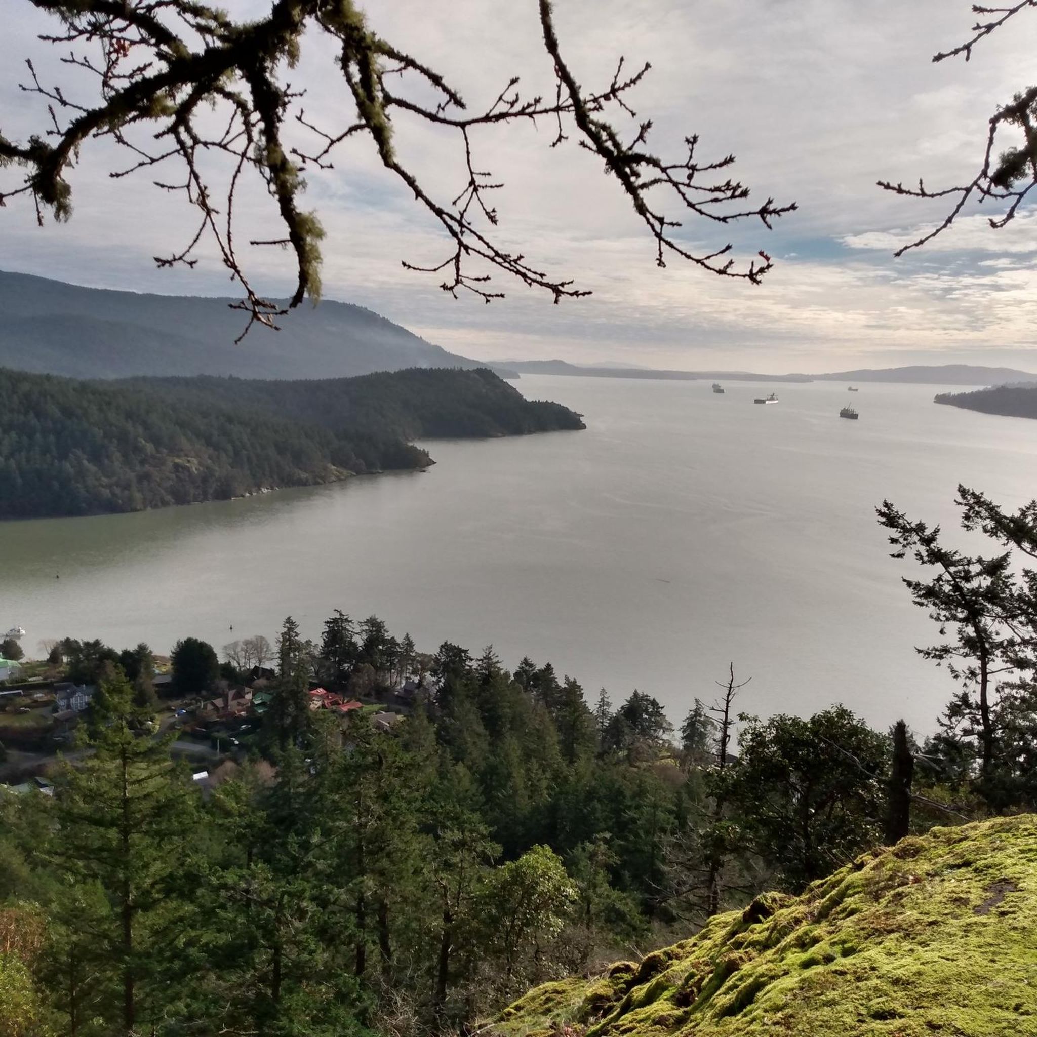
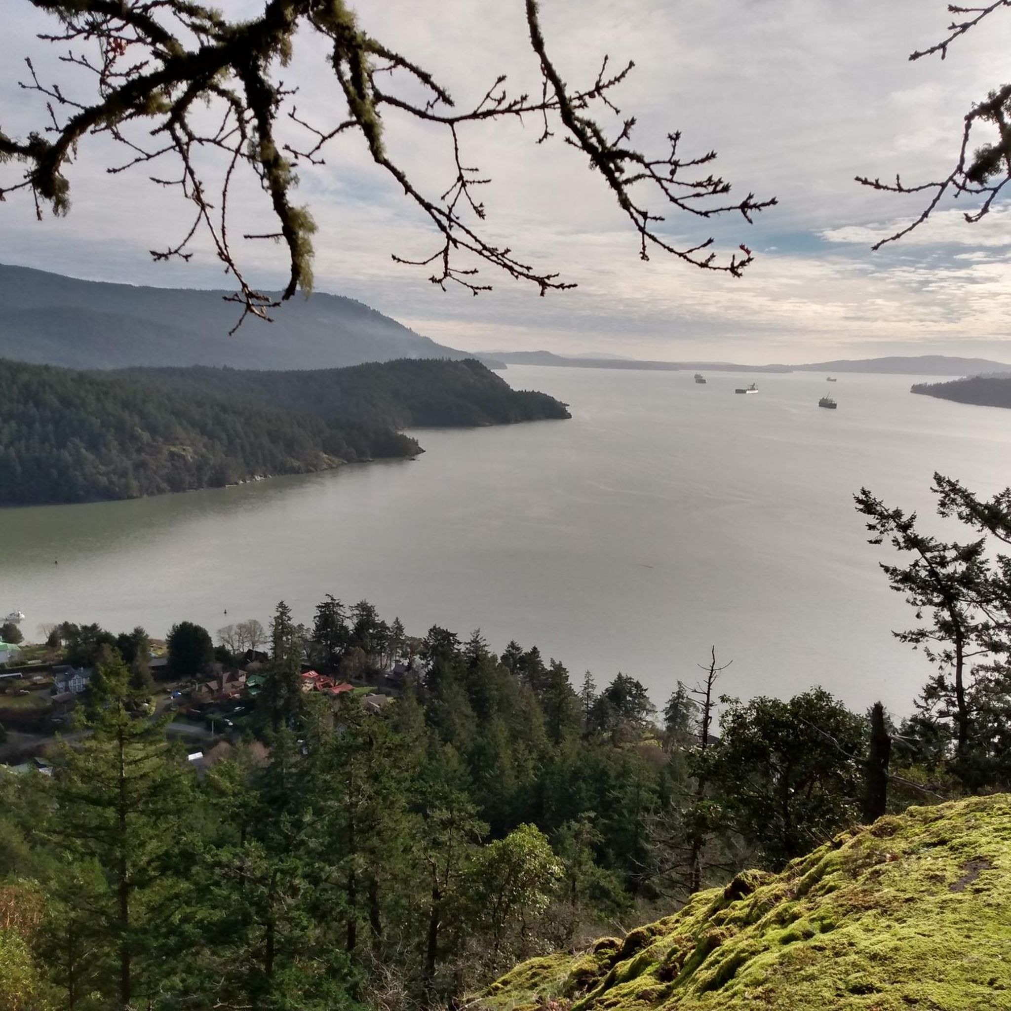
Hiking in Burgoyne Bay Provincial Park offers diverse landscapes, including wooded Douglas-fir forests, critically threatened Garry oak meadows, and open grasslands. The park features rocky shorelines and undeveloped salmon-bearing estuaries, which are unique to Salt Spring Island. Hikers can experience varied terrain and enjoy views of Burgoyne Bay, Mount Maxwell, Baynes Peak, and Vancouver Island across the Sansum Narrows. The area also holds cultural significance with archaeological sites and historic farm buildings.
Best hiking trails in Burgoyne Bay Provincial Park
- The most popular hiking route is Hiking loop from Burgoyne Bay Provincial Park, a 4.7 miles (7.6 km) trail that takes 3 hours 14 minutes to complete. This moderate route traverses varied terrain within the park.
- Another top favourite among local hikers is Bruce Peak loop from Burgoyne Bay Provincial Park, a moderate 8.3 miles (13.4 km) path. This trail offers ascents towards Bruce Peak, providing expansive views of the surrounding area.
- Local hikers also love the Baynes Peak loop from Mount Maxwell Provincial Park, a 3.6 miles (5.7 km) trail leading through forested areas and offering views from Baynes Peak, often completed in about 1 hour 55 minutes.
- Hiking in Burgoyne Bay Provincial Park is defined by dense Douglas-fir forests, Garry oak meadows, and scenic viewpoints overlooking the bay and Vancouver Island. The network offers options for easy and moderate ability levels.
- The routes in Burgoyne Bay Provincial Park are highly rated by the komoot community with an average score of 4.9 stars from over 60 reviews. More than 600 hikers have used komoot to explore Burgoyne Bay Provincial Park's varied terrain.
Last updated: October 20, 2026
5.0
(3)
37
hikers
6.23km
02:43
540m
540m
Moderate hike. Good fitness required. Mostly accessible paths. Sure-footedness required.
5.0
(1)
9
hikers
9.40km
03:29
550m
550m
Moderate hike. Good fitness required. Mostly accessible paths. Sure-footedness required.

5.0
(3)
11
hikers
5.50km
02:00
270m
270m
Moderate hike. Great for any fitness level. Mostly accessible paths. Sure-footedness required.
5.0
(1)
34
hikers
5.46km
01:51
260m
260m
Easy hike. Great for any fitness level. Easily-accessible paths. Suitable for all skill levels.
5.0
(1)
5
hikers
3.90km
01:17
180m
180m
Easy hike. Great for any fitness level. Easily-accessible paths. Suitable for all skill levels.
Get access to more routes and recommendations from other explorers.
Already have an account?
Our route recommendations are based on thousands of hikes, rides, and runs completed by other people on komoot.
Start today with a free account
Your next adventure awaits.
Popular around Burgoyne Bay Provincial Park
Tips from the Community

Rising 603 metres above Burgoyne Bay, Baynes Peak, also known as Mount Maxwell, delivers some of the most dramatic, sweeping views on Saltspring Island. While you can drive directly to the top, Mount Maxwell Road's rough, potholed gravel makes a high-clearance four-wheel-drive vehicle a necessity; otherwise, you can park further down and take one of several forest trails that lead up to the summit viewpoints.
0
0
This trail traces the edge of Baynes Peak aka Mount Maxwell, high above Burgoyne Bay. Much of the trail is shaded under thick forest canopy, but there are a few breaks in the trees with views over the water. As you approach the summit you'll also come across a series of viewpoints with wider vistas than you were able to get through the trees.
0
0

Shortest trail (No:1 trail) to the top of Mt Maxwell and especially suitable when it’s hot as it’s mostly under the canopy of the giant trees . Well marked trail . You can also take #4 down and then #5 to rejoin this trail on the way down
0
0
Hike #4 then 8 then 3 to 4 and you are at the top
0
0
Frequently Asked Questions
How many hiking trails are available in Burgoyne Bay Provincial Park?
There are over 30 hiking routes available in Burgoyne Bay Provincial Park, offering a variety of experiences for different skill levels. The komoot community has explored more than 35 tours in the area.
What kind of terrain can I expect on the trails in Burgoyne Bay Provincial Park?
Hikers can expect diverse terrain, including wooded Douglas-fir forests, critically threatened Garry oak meadows, and open grasslands. Some trails feature rocky shorelines and undeveloped salmon-bearing estuaries. The park's varied landscape provides a mix of forest paths and more open areas.
Are there any family-friendly hiking options in the park?
Yes, Burgoyne Bay Provincial Park offers several easy routes suitable for families. There are 9 easy trails available, providing shorter distances and gentler ascents, perfect for a leisurely walk with children.
Can I bring my dog on the trails in Burgoyne Bay Provincial Park?
While the region research doesn't explicitly state dog rules, provincial parks in British Columbia generally allow dogs on trails if they are on a leash. It's always best to check specific signage at the trailhead or the official BC Parks website for the most current regulations regarding pets in Burgoyne Bay Provincial Park.
What are the best viewpoints or scenic spots in the park?
Hikers are treated to incredible views of Burgoyne Bay itself, Mount Maxwell, Baynes Peak, and Vancouver Island across the Sansum Narrows. Trails like the Bruce Peak loop from Burgoyne Bay Provincial Park offer ascents that provide expansive views of the surrounding area.
Are there any circular hiking routes in Burgoyne Bay Provincial Park?
Yes, the park features several loop trails. A popular option is the Hiking loop from Burgoyne Bay Provincial Park, which is a moderate 4.7-mile (7.6 km) route traversing varied terrain within the park. Another is the Bruce Peak loop from Burgoyne Bay Provincial Park, an 8.3-mile (13.4 km) moderate path.
What natural features or ecosystems can I see while hiking?
The park is rich in diverse ecosystems, including old-growth Douglas-fir forests, critically threatened Garry oak meadows, and open grasslands. You can also observe rocky shorelines and undeveloped salmon-bearing estuaries, which are unique to Salt Spring Island. The park protects several at-risk ecosystems and species.
Is there parking available at Burgoyne Bay Provincial Park trailheads?
Yes, parking is available at Burgoyne Bay Provincial Park. The main access points and trailheads typically have designated parking areas for visitors. It's advisable to arrive early during peak seasons to secure a spot.
Are there any historical or cultural sites to explore within the park?
Yes, Burgoyne Bay Provincial Park holds deep cultural importance. It contains 11 documented archaeological sites and many other sites of spiritual and cultural significance connected to the creation story of the Hul'qumi'num people. There are also historic farm buildings within the park, offering a glimpse into its past.
What is the best time of year to visit Burgoyne Bay Provincial Park for hiking?
The park is beautiful year-round, but spring and fall generally offer the most pleasant hiking conditions with mild temperatures. In May, a specific attraction within the park, Daffodil Point, becomes carpeted with yellow daffodils, creating a beautiful seasonal display.
What facilities are available for hikers in Burgoyne Bay Provincial Park?
The park offers basic facilities for visitors. A public dock is available for limited boat mooring and kayak launching. While specific details on toilets or water are not provided, provincial parks typically have pit toilets at main access points. It's always recommended to carry your own water.
What do other hikers say about their experience in Burgoyne Bay Provincial Park?
The routes in Burgoyne Bay Provincial Park are highly rated by the komoot community, with an average score of 4.9 stars from over 60 reviews. Hikers often praise the diverse landscapes, scenic viewpoints, and the well-maintained trails that offer options for various ability levels.
What are the difficulty levels of hikes in Burgoyne Bay Provincial Park?
The park offers a range of difficulty levels, primarily focusing on easy and moderate routes. There are 9 easy trails and 26 moderate trails, ensuring options for both beginners and more experienced hikers. There are no difficult-rated trails in the park.
Most popular routes in Burgoyne Bay Provincial Park

Get inspired with the komoot mobile app


Explore more
Browse the best Hikes in other regions.
