The best MTB trails in Mkwal'Ts Conservancy
4.0
(3)
305
riders
1
ride
Mountain biking in Mkwal'Ts Conservancy offers opportunities within a diverse landscape located southeast of Pemberton on the western shore of Lillooet Lake. The conservancy spans approximately 3,874 hectares, protecting the lower Ure Creek watershed and bordering Garibaldi Park. While dedicated mountain bike trails are not extensively developed, the Green River Forest Service Road provides access for mountain biking, allowing exploration of the area's natural features. The terrain includes forested areas, views of Lillooet Lake, and varied elevations connecting to upland…
Last updated: June 24, 2026
28
riders
24.2km
03:01
740m
740m
Hard mountain bike ride. Good fitness required. Advanced riding skills necessary. Some portions of the route may require you to push your bike.
4.0
(2)
60
riders
16.0km
02:37
570m
570m
Hard mountain bike ride. Good fitness required. Advanced riding skills necessary. Some portions of the route may require you to push your bike.

Sign up for free
13
riders
8.11km
01:03
360m
360m
Moderate mountain bike ride. Good fitness required. Advanced riding skills necessary.
10
riders
14.7km
02:00
680m
680m
Hard mountain bike ride. Good fitness required. Advanced riding skills necessary. Some portions of the route may require you to push your bike.
9
riders
Hard mountain bike ride. Good fitness required. Advanced riding skills necessary. Some portions of the route may require you to push your bike.
Our route recommendations are based on thousands of hikes, rides, and runs completed by other people on komoot.
Start today with a free account
Your next adventure awaits.
Login or Signup
Popular around Mkwal'Ts Conservancy
Tips from the Community

Lumpy's Epic is a loop trail south of Pemberton for mountain bikers and hikers. Part of the trail runs high on the rocky cliffs above the Green River - outside Nairn Falls Park, with views of Mount Currie in the distance. We ascended from Nairn Falls via the Tower of Power Trail, continued north for a section of Lumpy's Epic, and enjoyed the view of the mountains and the wide valley of the Lillooet River in bright sunshine. (Visit May 27, 2025) https://www.trailforks.com/trails/lumpy-s-epic-8691/
2
1
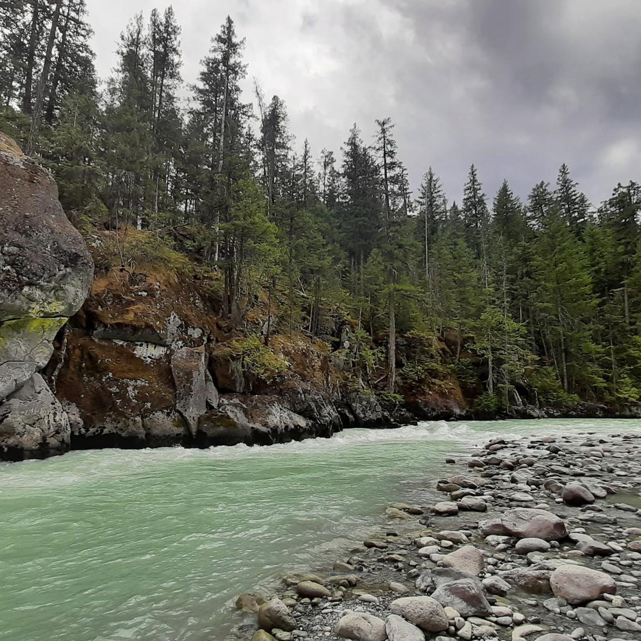
On the trail to Nairn Falls from the parking lot on Highway 99, there are many opportunities to catch a glimpse of the rushing Green River. Occasionally, speedboats carrying tourists pass by on their way to the waterfall.
2
0

Cream Puff is almost completely downhill, following a long ridge of smooth slickrock. And: There is also a Cream Puff pale ale at the local brewery. So, if you like the trail, don't forget to try the beer as well! :)
1
0

The hiking trail to the waterfalls is a small highlight We recommend
1
0
Even if you don't like climbing a lot, you will most likely love this trail called „Happy”. It is – in my opinion – one of the best uphill-trails in the world. You will need good cornering skills in order to enjoy it because there a tons of switchbacks.
4
0
Nice piece of singletrack with great views on the Green River. Stay left wherever you can and this trail spits you out on the entrance of the very technical downhill trail Tower of Power.
2
0
Wow, what a challenging trail all the way down. Basically, it is one rock slab after the other, until you reach the bottom. Whenever you stop, look up and enjoy the fantastic views of majestic Mount Currie.
1
0

The Green River has its origins in 633 m high Green Lake north of Whistler in the Pacific Ranges, a part of the Coast Mountains. It leaves the lake at its northern end and flows initially in predominantly northern, later in an easterly direction through the mountains. From the left, the Green River flows into the rivers Soo River and Rutherford Creek. Then the Green River at Nairn Falls Provincial Park overcomes the Nairn Falls. The Green River finally reaches the Pemberton Valley and flows 6 km east-southeast of Pemberton in the Lillooet River. The British Columbia Highway 99 (Whistler-Pemberton) follows the course of the river from Green Lake to Pemberton.
2
0
Frequently Asked Questions
What kind of mountain biking experience can I expect in Mkwal'Ts Conservancy?
Mountain biking in Mkwal'Ts Conservancy offers a unique experience within a diverse landscape on the western shore of Lillooet Lake. While dedicated mountain bike trails are not extensively developed within the conservancy itself, the Green River Forest Service Road provides access for exploration. The area features forested sections, views of Lillooet Lake, and varied elevations, often presenting a significant challenge for riders.
Are there any easy mountain bike trails in Mkwal'Ts Conservancy?
The routes listed for the Mkwal'Ts Conservancy area tend to be on the more challenging side. There is one moderate trail, the Cream Puff loop from Mosquito Lake Recreation Site, which is 5.0 miles (8.1 km) long. The majority of other routes are rated as difficult.
What are the most challenging mountain bike trails in the Mkwal'Ts Conservancy area?
For experienced riders seeking a challenge, several difficult trails are available. These include the Nimby loop from Pemberton Airport, a 15.0-mile (24.2 km) route with significant elevation gain, and the Happy Trail – Nimby loop from Mosquito Lake Recreation Site, a 9.9-mile (15.9 km) path offering challenging climbs and descents. Another demanding option is the Lumpy’s Epic Trail – Lumpy's Epic – Riverside loop from Nairn Falls Provincial Park.
Are there any loop mountain bike trails in Mkwal'Ts Conservancy?
Yes, several loop trails are available. Popular options include the Nimby loop from Pemberton Airport, the Happy Trail – Nimby loop from Mosquito Lake Recreation Site, and the Cream Puff loop from Mosquito Lake Recreation Site. These loops provide varied terrain and scenic views.
What do other mountain bikers say about the trails in Mkwal'Ts Conservancy?
The mountain biking routes in the Mkwal'Ts Conservancy area are highly rated by the komoot community, with an average score of 4.0 stars from 3 reviews. Over 294 mountain bikers have used komoot to explore the varied terrain, often praising the challenging nature and natural beauty of the area.
Is Mkwal'Ts Conservancy suitable for family mountain biking?
Mkwal'Ts Conservancy is not primarily promoted as a recreational destination, and the listed mountain biking routes are predominantly difficult, with only one moderate option. This suggests that many trails may be too challenging for younger children or families looking for very easy rides. It's important to assess the difficulty and length of specific routes before planning a family outing.
What is the policy on mountain biking within Mkwal'Ts Conservancy?
Mkwal'Ts Conservancy prioritizes the protection of its biological diversity, natural environments, and the cultural heritage of the Lil'wat Nation. It permits low-impact, non-motorized backcountry recreation. While dedicated mountain biking trails are not emphasized, the Green River Forest Service Road, which provides access to the conservancy, is utilized by the public for activities including mountain biking. Visitors should adhere to responsible recreation guidelines to ensure safety and preserve the natural spaces.
Are there any specific viewpoints or natural features to look out for while mountain biking?
The conservancy is situated on the western shore of Lillooet Lake, offering scenic views of the lake. The Ure Creek watershed, which the conservancy protects, connects upland areas within Garibaldi Park to the Lillooet Lake shoreline, showcasing a diverse ecosystem. While specific viewpoints are not highlighted, the natural beauty of the lake and surrounding forests are prominent features.
Can I bring my dog mountain biking in Mkwal'Ts Conservancy?
The Mkwal'Ts Conservancy permits low-impact, non-motorized backcountry recreation. While specific regulations regarding dogs on mountain bike trails are not detailed, it is generally advisable to keep dogs on a leash and ensure they are under control to protect wildlife and respect other users. Always practice Leave No Trace principles.
What is the best season for mountain biking in Mkwal'Ts Conservancy?
While specific seasonal recommendations are not provided, mountain biking in this region is typically best enjoyed during the warmer, drier months, generally from late spring through early autumn. This avoids snow cover and minimizes muddy conditions, ensuring more pleasant and safer riding. Always check local conditions before heading out.
Are there any permits required for mountain biking in Mkwal'Ts Conservancy?
The Mkwal'Ts Conservancy's management plan indicates a focus on protecting natural and cultural values, and it is not promoted as a recreational destination. While low-impact, non-motorized recreation is permitted, there is no mention of specific permits required for mountain biking on the Green River Forest Service Road. However, it's always good practice to check for any updated local regulations or advisories before your visit.
Where can I park when visiting Mkwal'Ts Conservancy for mountain biking?
Access to the Mkwal'Ts Conservancy is primarily via the Green River Forest Service Road. While specific parking areas for mountain bikers are not detailed, access points along this road, such as near Mosquito Lake Recreation Site, are commonly used for starting rides. It is advisable to research specific starting points for your chosen route for parking availability.
Most popular routes in Mkwal'Ts Conservancy

Get inspired with the komoot mobile app


Explore more
Browse the best MTB trails in other regions.
