The best running trails in Réserve Faunique Des Chic-Chocs
62
runners
5
runs
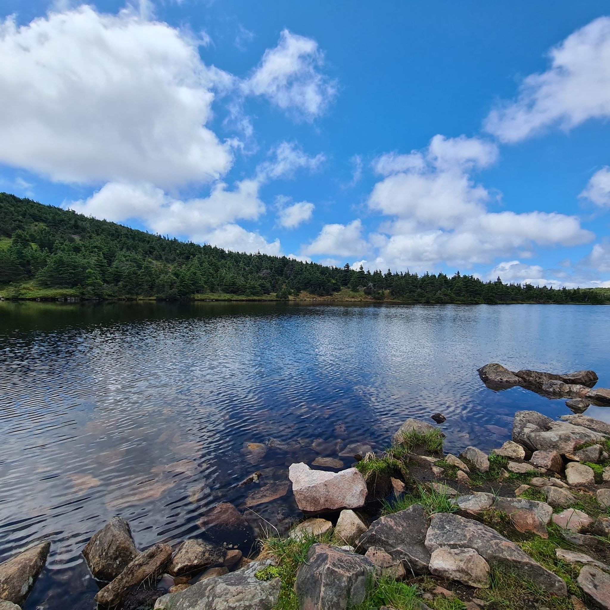
Jogging in Réserve Faunique Des Chic-Chocs offers routes through mountainous landscapes and diverse terrain within the Gaspésie Peninsula. The region is characterized by the Appalachian mountains, featuring bare summits such as Blanche-Lamontagne and Vallières-de-Saint-Réal, which provide significant elevation changes. Deep streams are present in the northern areas, contributing to the varied natural features. The reserve is home to diverse ecosystems, including habitats for moose and mountain caribou.
Best jogging routes in Réserve Faunique Des Chic-Chocs
- The most popular jogging route…
Last updated: October 12, 2026
25
runners
12.1km
01:59
860m
860m
Hard run. Very good fitness required. Mostly paved surfaces. Suitable for all skill levels.
7
runners
7.73km
01:22
590m
590m
Hard run. Very good fitness required. Mostly paved surfaces. Suitable for all skill levels.

14
runners
11.3km
01:39
770m
770m
Hard run. Very good fitness required. Mostly paved surfaces. Suitable for all skill levels.
8
runners
5.44km
00:42
120m
120m
Hard run. Good fitness required. Sure-footedness, sturdy shoes and alpine experience required.
14
runners
8.10km
01:18
460m
460m
Hard run. Very good fitness required. Mostly paved surfaces. Suitable for all skill levels.
Our route recommendations are based on thousands of hikes, rides, and runs completed by other people on komoot.
Start today with a free account
Your next adventure awaits.
Popular around Réserve Faunique Des Chic-Chocs
Tips from the Community

Belvédère de la Lucarne is an elevated platform along the La Lucarne trail, with fantastic sweeping views down into the Sainte-Anne River valley and across the surrounding forested mountains. Lucarne translates to “skylight,” which is a fitting name for this spot after the climb through the forest to reach it. Keep an eye out for wildlife while you’re here, including moose, which have been spotted on this section of trail.
0
0
The Discovery and Visitors Centre sits in the Mont-Albert sector of Parc national de la Gaspésie, with plenty of parking right by the start of several trailheads. The centre has washrooms, a picnic area, Wi-Fi, a convenience store, a café, and an exhibition on the park’s mountain landscape, making it a great place to stop before or after exploring the area. There’s a fee to enter the park, which you can pay at reception or at a self-service terminal if the centre is closed during your visit.
0
0

This is an impressive cascade that shares its name with a much taller, 74-metre (243-ft) waterfall near Quebec City. This Chute Sainte-Anne, although smaller, is still worth a little detour to admire on a hike around the western end of the impressive Mount Albert.
0
0
This footbridge over the Rivière Sainte-Anne provides a lovely view through the valley. Countless hikers have crossed this way from the nearby campground, seeking adventure on the western end of the sprawling Mount Albert.
0
0
Frequently Asked Questions
What kind of terrain can I expect on running trails in Réserve Faunique Des Chic-Chocs?
The Réserve Faunique Des Chic-Chocs is characterized by its mountainous landscapes, featuring striking Appalachian peaks and significant elevation changes. You'll encounter bare summits like Blanche-Lamontagne and Vallières-de-Saint-Réal, as well as deep streams, particularly in the northern parts of the reserve. The trails offer a challenging and invigorating experience through untamed nature.
Are there any easy running routes in Réserve Faunique Des Chic-Chocs?
The running routes listed in this guide are generally considered difficult due to the mountainous terrain and significant elevation gains. For example, the Chute Sainte-Anne loop from P2 La Vallée, while shorter at 5.4 km, still involves considerable ascent. Runners should be prepared for challenging conditions.
What are some of the notable viewpoints or scenic spots along the running paths?
Many routes in the reserve offer spectacular views. The Mont Richardson – Point de vue loop from Le Roselin specifically highlights a viewpoint. You can also expect panoramic vistas from peaks like Mont-Olivine, and breathtaking views of Monts McGerrigle and Lac à Pierre from various elevated sections of the trails.
Are there any loop running trails in Réserve Faunique Des Chic-Chocs?
Yes, several popular running routes in the reserve are loops. Examples include the challenging Pic Sterling – Mont Vallières-de-Saint-Réal loop from Lac Sainte-Anne, the Pic Sterling loop from Lac Sainte-Anne, and the Belvédère de la Saillie loop from Chute Sainte-Anne.
What kind of wildlife might I encounter while running in the reserve?
The Réserve Faunique Des Chic-Chocs is home to diverse fauna, including moose and the vulnerable mountain caribou. While running, you might have the chance to spot these animals in their natural habitat. Be aware that access to certain sectors may be restricted during winter to protect caribou habitats.
What is the best time of year for running in Réserve Faunique Des Chic-Chocs?
The reserve is generally accessible year-round for outdoor activities. However, for running, the warmer months typically offer the most favorable conditions. During winter, some areas might have restrictions due to caribou protection, and trails may be better suited for snowshoeing or other winter sports.
Are there any specific permits required for running on the trails?
While the guide does not specify permits for running, it's always advisable to check the official Réserve Faunique Des Chic-Chocs website or contact their visitor center directly for the most up-to-date information regarding access fees, permits, or any specific regulations for trail use.
Are the running trails in Réserve Faunique Des Chic-Chocs suitable for families?
The trails highlighted in this guide are generally rated as 'difficult' due to significant elevation changes and challenging terrain. This makes them more suitable for experienced runners or families with older children who are accustomed to strenuous mountain hikes and runs. There are no easy routes listed in this guide that would typically be recommended for young children.
What are the typical distances and durations for running routes in the reserve?
Running routes in Réserve Faunique Des Chic-Chocs vary in length and duration. For instance, the Pic Sterling – Mont Vallières-de-Saint-Réal loop from Lac Sainte-Anne is about 12.1 km (7.5 miles) and can take around 2 hours, while the Belvédère de la Saillie loop from Chute Sainte-Anne is shorter at 5.0 km (3.1 miles) but still challenging.
How many running routes are available in Réserve Faunique Des Chic-Chocs?
Komoot currently lists 6 dedicated running routes within Réserve Faunique Des Chic-Chocs. These routes are primarily designed for experienced runners seeking challenging trails with significant elevation changes.
What kind of elevation gain can I expect on the running trails?
The running trails in Réserve Faunique Des Chic-Chocs are known for their significant elevation gains, reflecting the mountainous nature of the region. For example, the Pic Sterling – Mont Vallières-de-Saint-Réal loop from Lac Sainte-Anne involves an ascent of over 850 meters (2,780 feet), providing a strenuous workout.
Most popular routes in Réserve Faunique Des Chic-Chocs

Get inspired with the komoot mobile app


Explore more
Browse the best Running Trails & Routes in other regions.
