Top 10 Running Trails in Paratge Natural Municipal El Tello
4.6
(16)
1,412
runners
104
runs
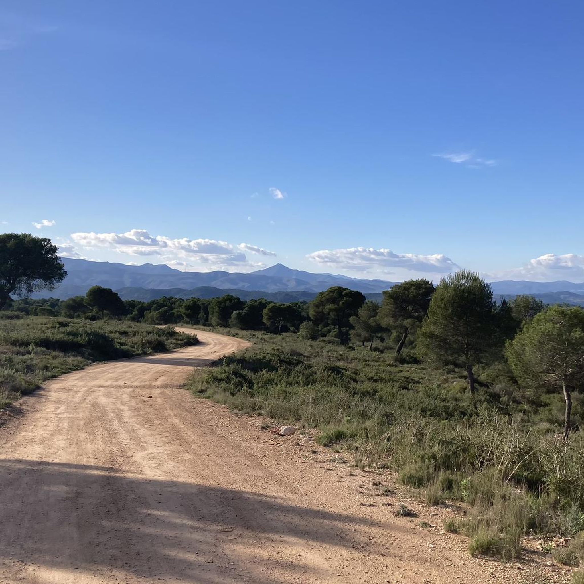
Jogging in Paratge Natural Municipal El Tello offers diverse landscapes for runners. The region is characterized by a mountain surrounded by dryland crops, alongside extensive pine forests and low scrub. El Tello mountain, at 361 meters, provides the highest elevation point, with routes that can offer panoramic views. The park also features areas along the left bank of the Magro River, contributing to a varied running environment.
Best jogging routes in Paratge Natural Municipal El Tello
- The most popular jogging…
Last updated: July 8, 2026
54
runners
17.3km
02:29
620m
620m
Hard run. Very good fitness required. Sure-footedness, sturdy shoes and alpine experience required.
7
runners
12.1km
01:29
260m
260m
Moderate run. Good fitness required. Mostly paved surfaces. Suitable for all skill levels.

Sign up for free
6
runners
Hard run. Very good fitness required. Sure-footedness, sturdy shoes and alpine experience required.
5
runners
9.03km
01:15
350m
350m
Hard run. Very good fitness required. Mostly paved surfaces. Suitable for all skill levels.
72
runners
18.4km
02:43
720m
720m
Hard run. Very good fitness required. Sure-footedness, sturdy shoes and alpine experience required.
Get access to more routes and recommendations from other explorers.
Sign up for free
Already have an account?
Our route recommendations are based on thousands of hikes, rides, and runs completed by other people on komoot.
Start today with a free account
Your next adventure awaits.
Login or Signup

Tips from the Community

Alto del Besori is a mountain located in the Ribera Alta region of the Valencian Community. It is part of the Paraje Natural Municipal del Tello and is known for its impressive panoramic views. The route to Alto del Besori is popular with hikers and offers a varied landscape that includes ravines and pine forests. The route is moderate in difficulty and is suitable for most hikers with some experience.
6
0

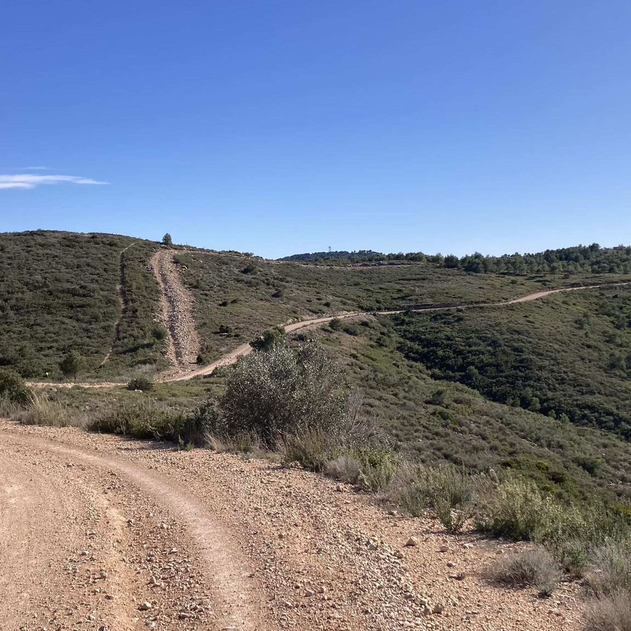
Beautiful views from the top at about 360 meters above sea level. It is reached by taking the detour from the main track and going up a track in good condition with concreted sections. It deserves to visit it!
2
0


Possibility to do different routes for MTB and gravel. From here you can connect with the Alèdua Tower, the Carlet weir, the Clot de les Tortugues, the Júcar-Túria diversion, etc.
1
0
Frequently Asked Questions
How many running routes are available in Paratge Natural Municipal El Tello?
There are over 100 dedicated running routes in Paratge Natural Municipal El Tello, offering a wide variety of distances and difficulty levels for all types of runners. In total, komoot lists 105 routes in the area.
What kind of terrain can I expect on the jogging trails in Paratge Natural Municipal El Tello?
The terrain in Paratge Natural Municipal El Tello is quite varied, featuring mountain trails, extensive pine forests, and low scrub. You'll also find routes along the left bank of the Magro River. The highest point is El Tello mountain at 361 meters, offering routes with significant elevation gain and panoramic views.
Are there any easy running routes for beginners in Paratge Natural Municipal El Tello?
While many routes in Paratge Natural Municipal El Tello are moderate to difficult, there are options suitable for those looking for a less strenuous run. For example, the park is known for attractive walking and hiking trails, some as short as 4.39 km with moderate elevation changes, which can be perfect for a brisk jog. Currently, komoot lists 50 moderate routes that might suit beginners looking for a challenge.
What are some notable landmarks or viewpoints I can see along the running routes?
As you run through Paratge Natural Municipal El Tello, you can encounter several interesting sights. The historic Castle of Aledua is a Site of Cultural Interest, and you can pass by it on routes like the Alèdua Road loop from Llombai. For stunning vistas, consider routes that ascend to Pico Besori or visit viewpoints such as L'Estepar Viewpoint or the Besorí Peak Fire Lookout Tower, which can offer views as far as the Albufera.
Are there any long-distance running trails in the area?
Yes, Paratge Natural Municipal El Tello offers several longer running trails. For instance, the Besori Viewpoint – Besori loop from Cova-Vivenda is a challenging 18.4 km route with significant elevation gain, ideal for experienced runners seeking a longer distance.
What do other runners enjoy most about jogging in Paratge Natural Municipal El Tello?
The area is highly rated by the komoot community, with an average score of 4.5 stars from 15 reviews. Runners often praise the diverse landscapes, from mountain trails to pine forests and riverside paths, and the rewarding panoramic views from higher elevations like Pico Besori.
Can I find circular running routes in Paratge Natural Municipal El Tello?
Absolutely. Many of the routes in Paratge Natural Municipal El Tello are designed as loops, allowing you to start and finish at the same point. Examples include the Besori – Besori Viewpoint loop from Llombai and the Alèdua Road – Besori Viewpoint loop from Riu Magre.
Is Paratge Natural Municipal El Tello suitable for family-friendly jogging?
The park offers a range of trails, and while some are challenging, there are also easier paths that could be suitable for families looking for a gentle jog or walk. The varied landscapes and natural beauty make it an enjoyable place for outdoor activity, but it's always best to check the specific route details for distance and elevation before heading out with children.
What is the best time of year to go running in Paratge Natural Municipal El Tello?
Paratge Natural Municipal El Tello can be enjoyed year-round, but spring and autumn generally offer the most pleasant temperatures for running. During these seasons, the weather is typically mild, and the natural scenery is vibrant. Summer can be hot, so early morning or late afternoon runs are advisable, while winter offers cooler, crisp conditions.
Are there any routes that offer impressive panoramic views?
Yes, several routes lead to high points that provide spectacular views. Ascending to the summit of El Tello mountain, particularly Pico Besori, offers impressive panoramic views that can extend as far as the Albufera. Routes like the Besori Viewpoint – Besori loop from Llombai are known for their scenic overlooks.
What is the typical duration for a running route in Paratge Natural Municipal El Tello?
The duration varies significantly depending on the route's length and difficulty. For example, a moderate 12.1 km route like the Alèdua Road loop from Llombai might take around 1 hour 29 minutes, while a more challenging 17.3 km route such as the Besori – Besori Viewpoint loop from Llombai could take approximately 2 hours 29 minutes.
Most popular routes in Paratge Natural Municipal El Tello
Most popular attractions in Paratge Natural Municipal El Tello

Get inspired with the komoot mobile app


Explore more
Browse the best Running Trails & Routes in other regions.
