The best cycling routes in Parc Naturel Du Mont Bélair
4.5
(72)
815
riders
19
rides
Touring cycling in Parc Naturel Du Mont Bélair offers a network of routes through varied terrain. The area features a mix of forested paths, river-adjacent trails, and gentle elevation changes, providing diverse options for cyclists. The landscape includes natural areas suitable for both leisurely rides and more extended excursions, with several access points for touring bikes.
Best touring cycling routes in Parc Naturel Du Mont Bélair
- The most popular touring cycling route is Rivière Ontaritzi – Lac des Bouleaux loop…
Last updated: July 5, 2026
4.9
(8)
81
riders
58.6km
03:40
230m
230m
Moderate bike ride. Good fitness required. Mostly paved surfaces. Suitable for all skill levels.
4.5
(6)
76
riders
28.6km
01:39
90m
90m
Easy bike ride. Great for any fitness level. Mostly paved surfaces. Suitable for all skill levels.

Sign up for free
5.0
(1)
5
riders
Moderate bike ride. Good fitness required. Mostly paved surfaces. Suitable for all skill levels.
5
riders
62.1km
03:43
210m
210m
Moderate bike ride. Good fitness required. Mostly paved surfaces. Suitable for all skill levels.
23
riders
42.6km
02:27
190m
190m
Moderate bike ride. Good fitness required. Mostly paved surfaces. Suitable for all skill levels.
Get access to more routes and recommendations from other explorers.
Sign up for free
Already have an account?
Our route recommendations are based on thousands of hikes, rides, and runs completed by other people on komoot.
Start today with a free account
Your next adventure awaits.
Login or Signup
Popular around Parc Naturel Du Mont Bélair


Tips from the Community

Rest awhile on this bench before continuing along the La Liseuse Trail. The scenic woodland route is known for its peaceful setting and abundant birdlife.
0
0

Vélopiste Jacques-Cartier / Portneuf is a 68-kilometre multi-use rail trail built along a former railway corridor, linking Saint-Gabriel-de-Valcartier to Rivière-à-Pierre, passing through forest and along rivers, lakes, and small communities northwest of Québec City. The Shannon to Sainte-Catherine-de-la-Jacques-Cartier section follows one of the trail’s quieter stretches, passing through picturesque wooded landscapes and open views near the Jacques-Cartier River on a gentle, crushed-stone surface that's ideal for cycling and walking. Connected to Québec City via the Corridor des Cheminots, the route combines easy grades with peaceful scenery and access to nearby outdoor recreation, making it one of the region’s most popular long-distance trails.
0
0
Fossambault-sur-le-Lac sits on the southeastern shore of Lac Saint-Joseph, about 30 kilometres northwest of Québec City, known for its lakeside setting, forested surroundings, and long history as a vacation destination. Originally developed as a resort community in the early 1900s, the town grew around summer homes and tourism, with much of its character still shaped by the lake and natural landscape. Today, visitors come for its beaches, boating, and quiet residential streets framed by mature trees, making it a peaceful place to stop along the Vélopiste Jacques-Cartier / Portneuf route. From this spot, it’s a short trek into the small, charming town, or you can take a break here at Fernand Lucchesi Park, nestled right along the trail and Rue Gingras.
0
0
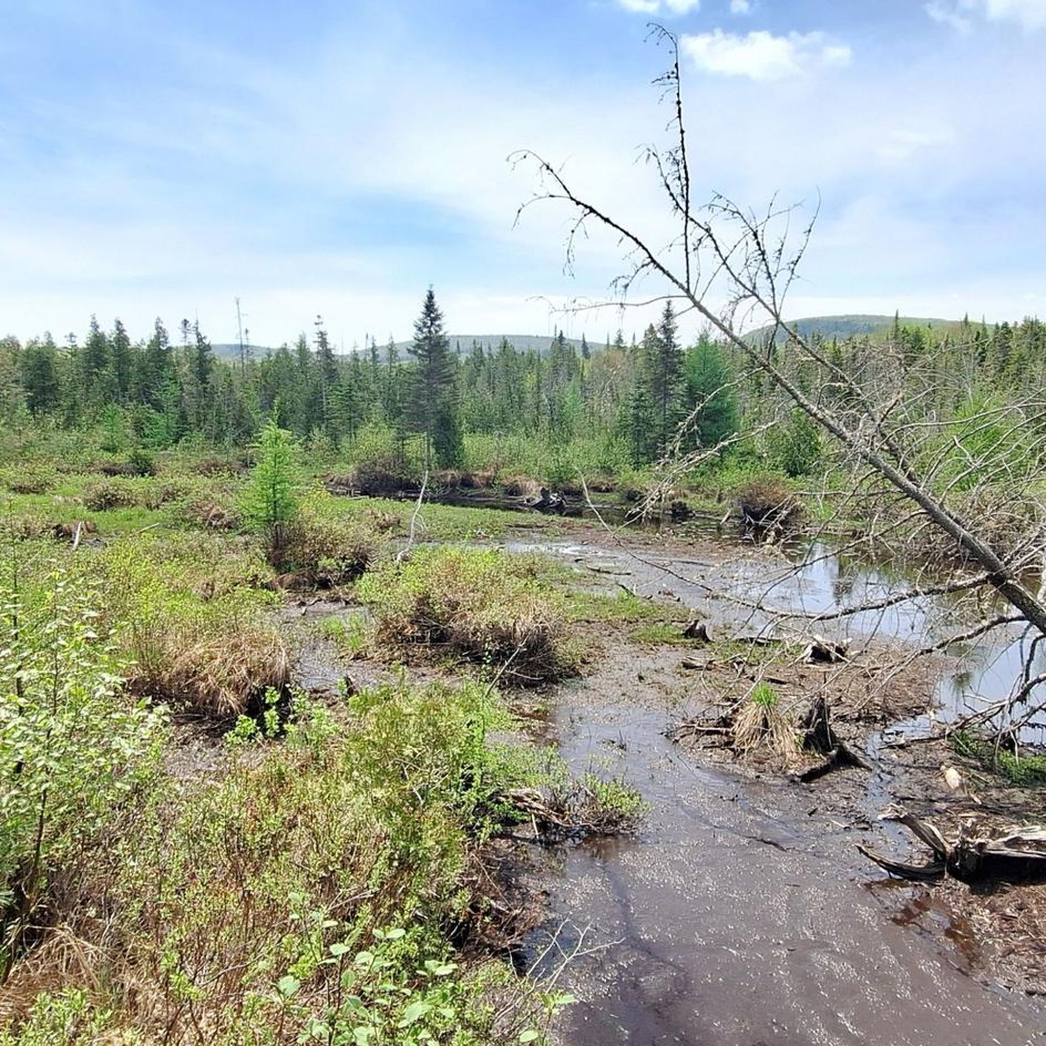
The Great Jacques Cartier Peat Bog is a vast wetland complex covering roughly 6.6 square kilometres across Sainte-Catherine-de-la-Jacques-Cartier, Fossambault-sur-le-Lac, and Shannon, just east of Lac Saint-Joseph. It’s one of the last large peat bogs in the Capitale-Nationale region to remain largely undisturbed. There are wooded areas, open bog pools, marshes, and rare wetland habitats that support diverse plant and wildlife species. The peatland also plays an important ecological role by storing carbon, filtering water, and helping regulate water flow within the surrounding watershed.
0
0
The Jacques-Cartier River Bridge is a former railway bridge near Shannon that crosses high above the Jacques-Cartier River, originally serving the rail line between Québec City and Lac-Saint-Jean. It now carries Vélopiste Jacques-Cartier / Portneuf users across the steep, forested valley, with beautiful views over the river corridor below, and is one of the more recognizable remains of the region’s railway history.
0
0

Kabir Kouba Waterfall cascades down into a limestone canyon and can be seen from two lookout platforms just meters away from the parking area. The falls are significant to the Huron-Wendat Nation, to learn more about that significance, read the interpretive signage around the falls.
1
0


It is a beautiful peaceful site that in my opinion we must return to appreciate it and see its beauty.
0
0
Frequently Asked Questions
What are the typical distances and difficulty levels of touring cycling routes in Parc Naturel Du Mont Bélair?
Parc Naturel Du Mont Bélair offers a range of touring cycling routes. You'll find over 20 routes, with approximately 9 easy routes, 11 moderate routes, and 1 more challenging option. Distances vary, with many routes ranging from 15 to 60 kilometers. For example, the Rivière Ontaritzi – Lac des Bouleaux loop from Terrain Spécial Val-Bélair is about 58.6 km and considered moderate, while the Chute Wendake – Park With Water Playground loop from Val-Bélair is an easier 28.1 km ride.
Where can I find parking and access points for touring cycling in Parc Naturel Du Mont Bélair?
Several routes start from convenient access points. Areas like Val-Bélair and Val-Saint-Michel are common starting points, often providing parking facilities. For instance, the Rivière Ontaritzi – Lac des Bouleaux loop begins near Terrain Spécial Val-Bélair, and the Bicycle Path – St. Charles River Bike Path loop starts from Val-Saint-Michel.
What is the typical duration for touring cycling routes in Parc Naturel Du Mont Bélair?
The duration of touring cycling routes in Parc Naturel Du Mont Bélair varies depending on the distance and your pace. Shorter, easier routes like the Chute Wendake – Park With Water Playground loop from Val-Bélair can be completed in about 1 hour 35 minutes. Longer, moderate routes, such as the Rivière Ontaritzi – Lac des Bouleaux loop, typically take around 3 hours 40 minutes.
Are there family-friendly touring cycling routes in Parc Naturel Du Mont Bélair?
Yes, Parc Naturel Du Mont Bélair offers several family-friendly touring cycling routes. There are approximately 9 easy routes that are suitable for families or those looking for a relaxed ride. The Bicycle Path loop from Val-Bélair is an easy option, covering about 21.6 km.
Which touring cycling routes are suitable for beginners or those looking for an easy ride?
For beginners or those preferring an easy ride, Parc Naturel Du Mont Bélair has several options. The Chute Wendake – Park With Water Playground loop from Val-Bélair is a good choice, offering a gentle 28.1 km ride through local parks. Another easy route is the Bicycle Path loop from Val-Bélair, which is 21.6 km long.
Are there any advanced touring bike trails in Parc Naturel Du Mont Bélair?
While most routes are easy to moderate, there is at least one route classified as difficult for touring cyclists in Parc Naturel Du Mont Bélair. These routes may feature more significant elevation changes or longer distances, providing a greater challenge for experienced riders.
What is the best time of year to go touring cycling in Parc Naturel Du Mont Bélair?
The best time for touring cycling in Parc Naturel Du Mont Bélair is typically from late spring through early autumn (May to October). During these months, the weather is generally mild, and the trails are clear of snow and ice, offering pleasant conditions for riding. Always check local weather forecasts before heading out.
Are there any circular touring cycling routes in Parc Naturel Du Mont Bélair?
Yes, many of the touring cycling routes in Parc Naturel Du Mont Bélair are designed as loops, allowing you to start and end at the same point. Examples include the Rivière Ontaritzi – Lac des Bouleaux loop from Terrain Spécial Val-Bélair and the Bicycle Path loop from Val-Saint-Michel, which covers 55.6 km.
What do other touring cyclists enjoy the most about touring cycling in Parc Naturel Du Mont Bélair?
The touring cycling experience in Parc Naturel Du Mont Bélair is highly rated by the komoot community, with an average score of 4.4 stars from over 60 reviews. Cyclists often praise the varied terrain, which includes river paths and forested sections, and the accessibility of the bicycle paths. The presence of natural areas and scenic views along routes like the St. Charles River are frequently highlighted.
Are there any scenic viewpoints or natural attractions along the touring cycling routes?
Yes, the touring cycling routes in Parc Naturel Du Mont Bélair offer several scenic elements. Many paths follow the St. Charles River, providing views of the waterway and surrounding green spaces. The Chute Wendake – Park With Water Playground loop from Val-Bélair, for example, leads near a waterfall, offering a natural highlight during your ride.
What kind of terrain can I expect on the touring cycling routes in Parc Naturel Du Mont Bélair?
The terrain in Parc Naturel Du Mont Bélair is varied, offering a mix of experiences for touring cyclists. You can expect forested paths, sections running adjacent to rivers, and areas with gentle elevation changes. The network includes accessible bicycle paths, making for a generally smooth riding experience, though some routes may feature more natural surfaces.
How many touring cyclists have explored Parc Naturel Du Mont Bélair using komoot?
Over 800 touring cyclists have used komoot to explore the diverse terrain of Parc Naturel Du Mont Bélair, contributing to the community's high ratings and detailed route information.
Most popular routes in Parc Naturel Du Mont Bélair

Get inspired with the komoot mobile app


Explore more
Browse the best Cycling routes in other regions.
