The best cycling routes in Pretty River Valley Provincial Park
4.4
(26)
363
riders
28
rides
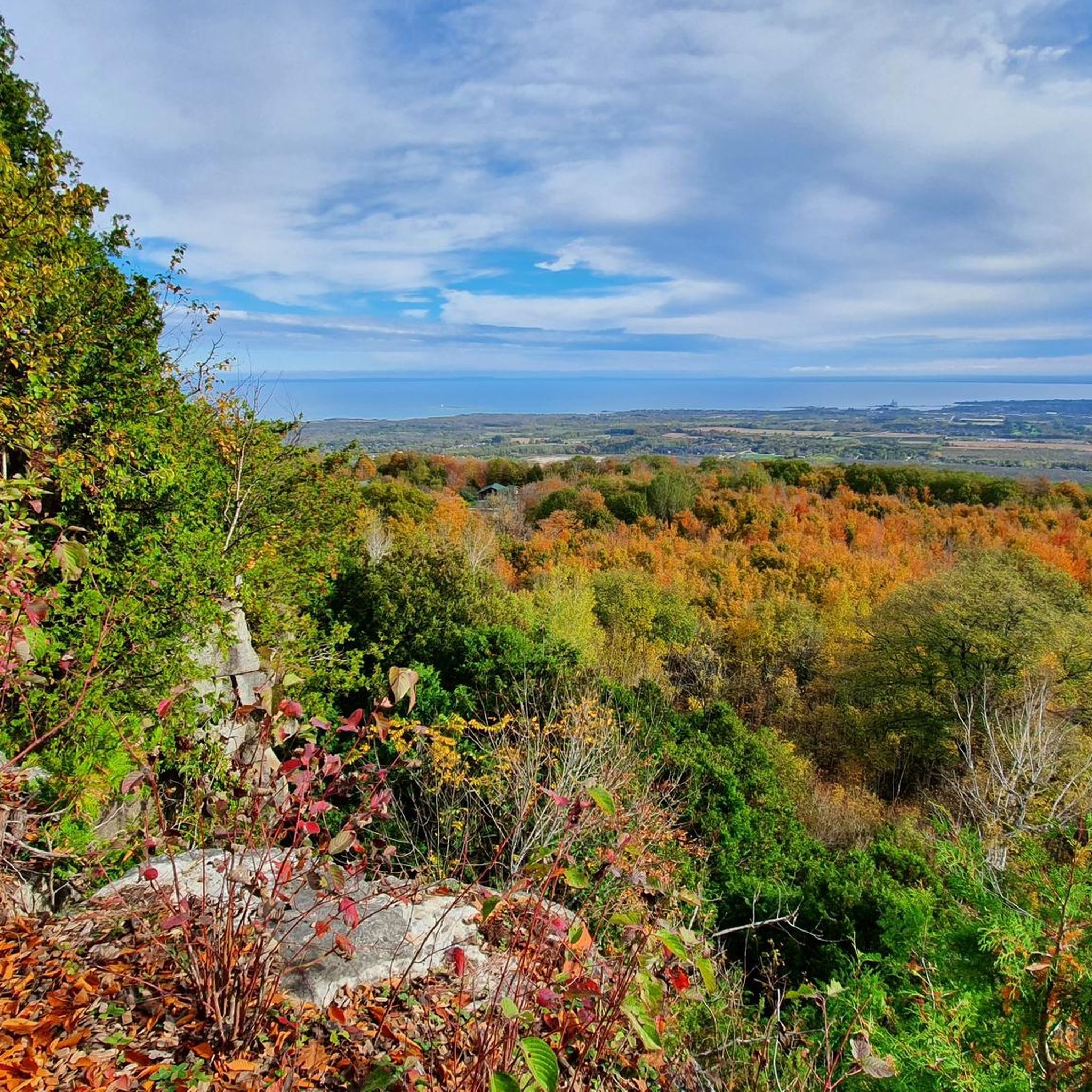
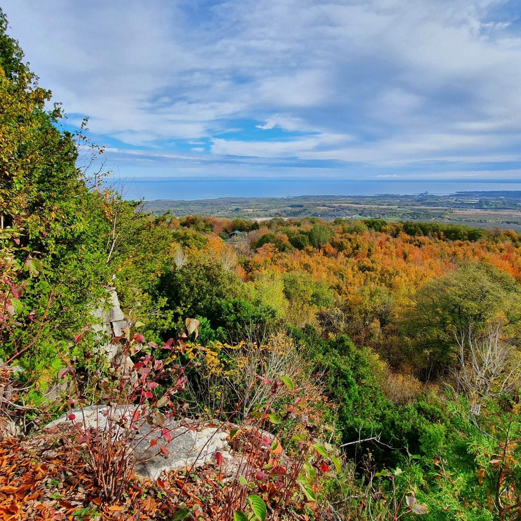
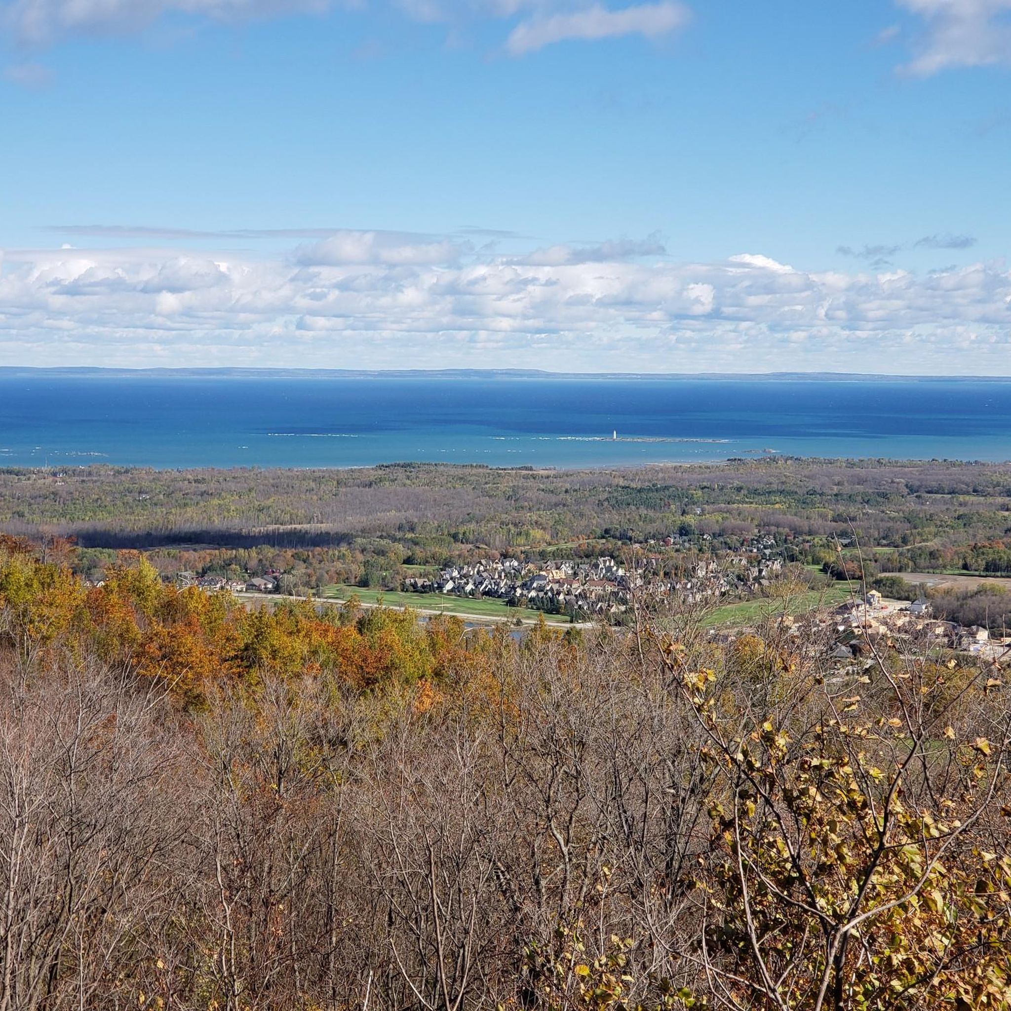
Touring cycling in Pretty River Valley Provincial Park offers routes through diverse landscapes along the Niagara Escarpment, a UNESCO World Biosphere Reserve. The terrain features rolling hills, forested valleys, and significant elevation changes, shaped by glacial processes. Cyclists can expect mature maple and beech forests, coldwater streams, and geological formations like meltwater channels. The park's natural features provide a backdrop for routes with varying distances and elevation gains.
Best touring cycling routes in Pretty River Valley Provincial Park
- The most popular touring cycling route is Bike loop from Pretty River Valley Provincial Park, an 11.7 miles (18.8 km) trail that takes about 1 hour 56 minutes to complete, winding through the park's varied topography.
- Another top favourite among local touring cyclists is 2nd Line Switchback loop from Petun Conservation Area, a moderate 9.1 miles (14.7 km) path that traverses forested areas and offers views of the surrounding countryside.
- Local touring cyclists also love the Kimberley General Store – 12th Sideroad Gravel Climb loop from Blue Mountain Ski Resort, a 56.7 miles (91.3 km) trail leading through challenging terrain with notable elevation changes, often completed in about 5 hours 57 minutes.
- Touring cycling in Pretty River Valley Provincial Park is defined by the Niagara Escarpment's geological features, dense woodlands, and scenic vistas, with options for different ability levels.
- The routes in Pretty River Valley Provincial Park are highly rated by the komoot community with an average score of 4.2 stars from over 20 reviews. More than 400 touring cyclists have used komoot to explore Pretty River Valley Provincial Park's varied terrain.
Last updated: October 21, 2026
3
riders
14.7km
01:29
210m
210m
Moderate bike ride. Good fitness required. Mostly paved surfaces. Suitable for all skill levels.
1
riders
Hard bike ride. Very good fitness required. Mostly paved surfaces. Suitable for all skill levels.

Hard bike ride. Very good fitness required. Mostly paved surfaces. Suitable for all skill levels.
4.8
(4)
96
riders
Moderate bike ride. Good fitness required. Mostly paved surfaces. Suitable for all skill levels.
4.7
(3)
26
riders
Easy bike ride. Great for any fitness level. Mostly paved surfaces. Suitable for all skill levels.
Get access to more routes and recommendations from other explorers.
Already have an account?
Our route recommendations are based on thousands of hikes, rides, and runs completed by other people on komoot.
Start today with a free account
Your next adventure awaits.

Tips from the Community

From the end point of the Black Ash Trail, there are views across the meadow of the Osler Bluff Ski Club, a family-friendly ski and snowboarding resort. The view of the hill has clearings of trees where several runs were built, etched into the forest. In summer, activities like mountain biking and zip-lining, make Osler Bluff Ski Club a year-round hub for outdoor adventure.
0
0
Black Ash Creek flows through wetlands and woods, providing a habitat for local wildlife and scenic views for those exploring the trails along the creek. Hikers and bikers can explore the creek’s surroundings via the Black Ash Trail, Georgian Trail and Boardwalk Trail, all well-maintained pathways that follow the river's curves.
0
0
The Black Ash Trail follows the course of Black Ash Creek, offering a scenic route for walking, jogging, cycling, and cross-country skiing come winter. The trail is well-maintained, flat and made up of hard-packed gravel. The Black Ash Trail also connects to other local pathways, but be careful as it crosses a few busy roads like Mountain Road and Sixth Street.
0
0

Thornbury Railway Bridge carries the Georgian Trail across the mouth of the Beaver River, following the route of the old Northern Railway line that connected Collingwood and Meaford from the 1870s. The last train crossed here in 1984 before the route became part of the walking and cycling trail in 1989. From here, you get beautiful views up the river toward Thornbury Dam and out toward Georgian Bay, especially in autumn, when you can watch salmon making their way upstream to spawn.
0
0
George Christie Nature Trails is a peaceful network of forested paths on the western edge of Collingwood, named in honour of one of the community’s trail pioneers. The towering pines, mixed woodland, and gentle terrain make it a popular destination for walking, trail running, mountain biking, snowshoeing, and cross-country skiing. The trails also connect directly with the Georgian Trail, offering plenty of options for longer adventures.
0
0
Drive slowly down Pretty River Road, as this dirt pullout has no big signage and is easy to pass. There's room for a few cars here, and trailhead access that is a bit quieter than the main parking area at the Pretty River Snowmobile Parking Lot just 400 meters north of here.
0
0

This park is a beautiful mix of urban wetlands and woodlands, boardwalk, natural-surface tracks, and a touch of industrial harbour scenery.
0
0
This path takes you past the wetlands on the fringe of Collingwood Harbour. It's part of an almost 4km loop you can walk around Optimist Harbourview Park.
0
0
Frequently Asked Questions
What kind of terrain can I expect on touring cycling routes in Pretty River Valley Provincial Park?
Touring cycling in Pretty River Valley Provincial Park is characterized by the Niagara Escarpment's varied terrain. You'll encounter rolling hills, significant elevation changes, and dense forests. Routes often feature substantial climbs and descents on mostly well-paved surfaces, though some segments may be unpaved and more challenging. The landscape includes dramatic topography with deep forested valleys and steep escarpment slopes, shaped by glacial processes.
Are there challenging touring cycling routes in the park for experienced riders?
Yes, Pretty River Valley Provincial Park offers several challenging touring cycling routes. For experienced riders seeking a significant test, consider the Kimberley General Store – 12th Sideroad Gravel Climb loop from Blue Mountain Ski Resort. This route spans 91.3 km with over 820 meters of elevation gain, typically taking nearly 6 hours to complete. Another difficult option is the Barrie Collingwood Railway loop from Blue Mountain Ski Resort, which covers 54.2 km with almost 480 meters of ascent.
Are there any easier touring cycling routes suitable for beginners?
While many routes feature significant elevation, there are options that are more moderate. The Bike loop from Pretty River Valley Provincial Park is a moderate 18.8 km route with about 350 meters of elevation gain, taking under 2 hours. Another moderate choice is the 2nd Line Switchback loop from Petun Conservation Area, which is 14.7 km long with over 210 meters of elevation, winding through forested areas.
What natural features or scenic views can I see while cycling in Pretty River Valley Provincial Park?
The park is rich in natural beauty. You can expect to cycle through mature maple and beech forests, encounter coldwater streams, and observe geological features like meltwater channels and moraines. Scenic lookouts along the routes offer sweeping views of the surrounding countryside, and on clear days, you might even catch distant glimpses of Georgian Bay. The park is also home to diverse plant life and wildlife such as deer and various bird species.
Is parking available for cyclists in Pretty River Valley Provincial Park?
Pretty River Valley Provincial Park is a non-operating park without dedicated facilities. While there isn't official parking within the park itself, cyclists typically find parking at access points or nearby trailheads outside the immediate park boundaries. It's advisable to research specific starting points for routes to confirm parking availability.
When is the best time of year for touring cycling in Pretty River Valley Provincial Park?
The best time for touring cycling is generally from spring through fall. The mature maple and beech forests offer vibrant colours, especially in autumn. While the park is open year-round, the significant elevation changes and potential for unpaved segments mean that spring and fall can present varied conditions. Winter cycling is possible on designated trails, but requires appropriate gear and experience due to snow and ice.
Are there touring cycling routes suitable for families with children?
Given the park's rugged terrain and significant elevation changes, many touring cycling routes in Pretty River Valley Provincial Park are more suited for experienced riders. However, some of the shorter, moderate routes like the 2nd Line Switchback loop from Petun Conservation Area (14.7 km) might be manageable for families with older, more experienced children who are comfortable with hills. Always check the route's elevation profile and difficulty before heading out with children.
Can I bring my dog on touring cycling routes in Pretty River Valley Provincial Park?
As a provincial park, Pretty River Valley generally permits dogs on trails, provided they are kept on a leash. However, given the varied terrain and potential for wildlife encounters, ensure your dog is well-behaved and can handle the physical demands of the ride. Always carry water for your pet and clean up after them.
How many touring cycling routes are available in Pretty River Valley Provincial Park?
There are over 30 touring cycling routes available for exploration in Pretty River Valley Provincial Park and the surrounding area. These routes vary in length and difficulty, offering options for different skill levels.
What do other touring cyclists enjoy the most about touring cycling in Pretty River Valley Provincial Park?
The area is highly rated by the komoot community, with an average score of 4.2 stars from over 20 reviews. Reviewers often praise the challenging terrain, the stunning natural beauty of the Niagara Escarpment, and the immersive experience of cycling through dense maple and beech forests. The varied topography and scenic vistas, including glimpses of Georgian Bay, are frequently highlighted as key attractions.
Are there any loop touring cycling routes in Pretty River Valley Provincial Park?
Yes, many of the touring cycling routes in the area are designed as loops, allowing you to start and end at the same point. Examples include the popular Bike loop from Pretty River Valley Provincial Park and the more challenging Kimberley General Store – 12th Sideroad Gravel Climb loop from Blue Mountain Ski Resort. These loops offer a convenient way to explore the diverse landscapes without retracing your path.
What should I bring for bike touring in Pretty River Valley Provincial Park?
Given the varied terrain and the park's non-operating status (meaning no facilities), it's essential to be self-sufficient. You should bring plenty of water, snacks, a repair kit for your bike, and appropriate clothing for changing weather conditions. A helmet is mandatory, and a map or GPS device is highly recommended due to the extensive trail network and potential for unpaved sections. For longer or more challenging routes, consider carrying extra layers and a first-aid kit.
Most popular routes in Pretty River Valley Provincial Park

Get inspired with the komoot mobile app


Explore more
Browse the best Cycling routes in other regions.
