The best MTB trails in Fosso Della Vallaccia - Monte Pormaiore
4.5
(61)
723
riders
72
rides
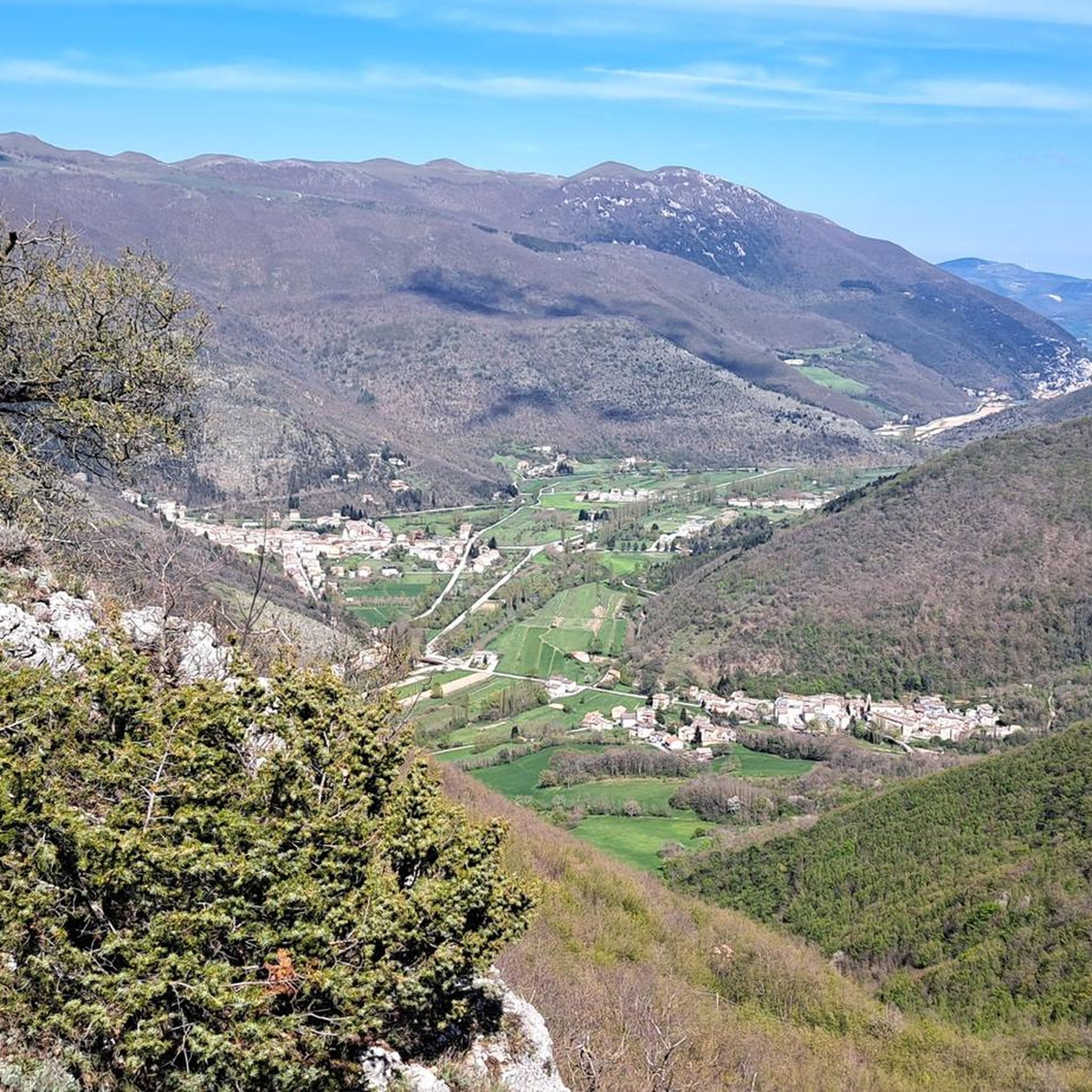
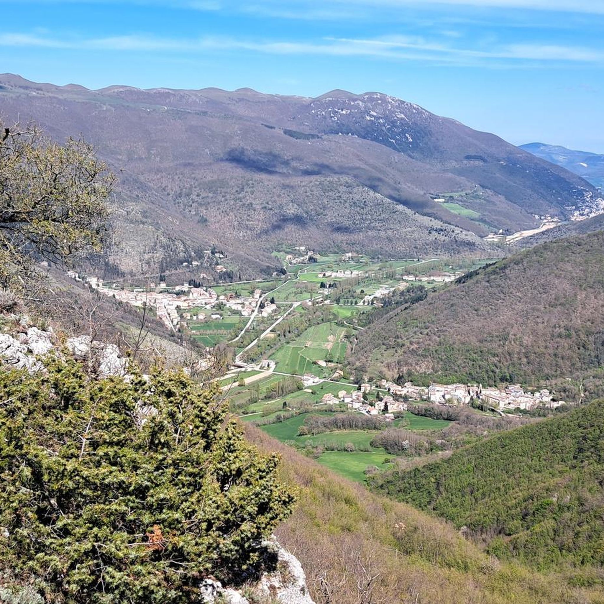
Mountain bike trails in Fosso Della Vallaccia - Monte Pormaiore are situated within a natural park area in Perugia, Italy. The region features diverse terrain, including technical sections with boulders and switchbacks, as well as gravel roads. Notable landscapes include peaks such as Monte Giuoco del Pallone (1200 meters) and Monte Burella (1095 meters), along with the valley of the Topino River. This area is recognized for its ecological importance as a Site of Community Interest (SIC).
Best mountain bike…
Last updated: October 11, 2026
4.0
(3)
25
riders
41.7km
03:45
960m
960m
Hard mountain bike ride. Very good fitness required. Suitable for all skill levels.
4.0
(2)
17
riders
40.3km
03:24
1,070m
1,070m
Hard mountain bike ride. Very good fitness required. Suitable for all skill levels.

7
riders
41.2km
04:03
1,340m
1,340m
Hard mountain bike ride. Very good fitness required. Advanced riding skills necessary.
15
riders
32.7km
02:11
410m
410m
Moderate mountain bike ride. Good fitness required. Suitable for all skill levels.
11
riders
21.8km
02:36
990m
990m
Hard mountain bike ride. Very good fitness required. Advanced riding skills necessary.
Get access to more routes and recommendations from other explorers.
Already have an account?
Our route recommendations are based on thousands of hikes, rides, and runs completed by other people on komoot.
Start today with a free account
Your next adventure awaits.
Popular around Fosso Della Vallaccia - Monte Pormaiore

Tips from the Community

One of the examples of fortified Italian architecture from the late Middle Ages.[2] The fortress was built by incorporating an ancient place of worship dedicated to Saint Michael the Archangel, founded in the Lombard era (8th-9th centuries), called Sant'Angelo di Flea. The Rocca Flea is home to the Gualdo Tadino Civic Museum, which houses the local antiquarium, and its rooms display examples of historic Gualdo Tadino ceramics.
0
0


Pioraco: "Ponte o passerella del Bacio" On the pedestrian walkway along the Potenza river, a sign indicates the obligation to stop and give each other a kiss, with the town in the background, nestled between the rocks
0
0


Fonte di Brescia is a fraction of the municipality of Fiuminata. Located at 650 meters above sea level, here the Potenza river is born, which then flows north-east until it flows into the Adriatic. It is an excellent starting point for many excursions, both on foot and by bicycle, towards Piani di Pioraco, or towards Monte Pennino and Valle Scurosa.
1
1
Gualdo Tadino is an ancient city in the province of Perugia northeast of the Umbrian capital. It is located on the lower slopes of Monte Penna, from here several nature trails start. The city has a long history and was originally an Umbrian village called Tarsina.
2
0

The hermitage of Serrasanta is located at 1348 meters. Here is a medieval church dedicated to the SS. Trinity, always open to welcome those who seek temporary refuge or want to pray.
2
0

At this point the road to the Serra Santa ends at a parking lot. From here, a gravel path leads to the pilgrimage church - depending on your choice of tires, you can cycle to the church or rather push your bike.
0
0
Frequently Asked Questions
How many mountain bike trails are there in Fosso Della Vallaccia - Monte Pormaiore?
There are over 50 mountain bike trails in the Fosso Della Vallaccia - Monte Pormaiore region, offering a diverse range of options for riders.
What is the general difficulty level of mountain bike trails in Fosso Della Vallaccia - Monte Pormaiore?
The trails in Fosso Della Vallaccia - Monte Pormaiore primarily range from moderate to difficult. Approximately half of the routes are classified as moderate, while the other half are difficult, featuring technical sections with boulders and switchbacks, as well as significant elevation gains.
Are there any beginner-friendly mountain bike trails in Fosso Della Vallaccia - Monte Pormaiore?
While the region is known for its moderate to difficult terrain, there are no trails specifically classified as 'easy' in the Fosso Della Vallaccia - Monte Pormaiore area. Riders new to mountain biking might find the moderate routes challenging but rewarding.
What are some advanced mountain bike routes in Fosso Della Vallaccia - Monte Pormaiore?
For experienced riders seeking a challenge, routes like the Muddy Trail and Stream – Rocca Flea loop from Gaifana offer difficult terrain and over 1000 meters of elevation gain. Another demanding option is the Eremo Serrasanta – Muddy Trail and Stream loop from Ponte Parrano, which features nearly 1650 meters of ascent.
Are there any family-friendly mountain biking options in Fosso Della Vallaccia - Monte Pormaiore?
Given the prevalence of moderate to difficult trails, mountain biking in Fosso Della Vallaccia - Monte Pormaiore is generally more suited for riders with some experience. Families with younger children or beginners might find the terrain challenging. It's advisable to check individual route details carefully for suitability.
What kind of landscapes can I expect to see along the mountain bike routes?
The region is a beautiful natural park in Perugia, Italy. You can expect diverse terrain, including forested sections, gravel roads, and views of significant peaks like Monte Giuoco del Pallone (1200 meters) and Monte Burella (1095 meters). The area is also recognized for its ecological importance as a Site of Community Interest (SIC).
Are there circular mountain bike trails available?
Yes, many of the mountain bike routes in Fosso Della Vallaccia - Monte Pormaiore are circular. Examples include the Muddy Trail and Stream loop from Gaifana and the Passo Cornello – Nocera Umbra loop from Ponte Parrano, allowing you to start and finish at the same point.
What is the best time of year for mountain biking in Fosso Della Vallaccia - Monte Pormaiore?
The diverse terrain and natural park setting suggest that spring and autumn would offer pleasant temperatures and vibrant scenery. While winter mountain biking is possible, riders should be prepared for potentially colder weather and varying trail conditions.
What do other mountain bikers enjoy most about the trails in Fosso Della Vallaccia - Monte Pormaiore?
The area is highly rated by the komoot community, with an average score of 4.6 stars from over 35 reviews. Riders often praise the diverse terrain, the challenging technical sections, and the scenic beauty of the natural park setting.
Can I expect to see any wildlife while mountain biking?
As a Site of Community Interest (SIC) with protected habitats and species, the Fosso Della Vallaccia - Monte Pormaiore area offers opportunities for wildlife spotting. Keep an eye out for local fauna within the natural park's diverse ecosystems.
Are there any long-distance mountain bike routes in the region?
Yes, there are several long-distance routes. For example, the Muddy Trail and Stream – Rocca Flea loop from Gaifana covers over 52 kilometers, and the Muddy Trail and Stream loop from Gaifana is nearly 50 kilometers long, providing extensive riding experiences.
What are the typical elevation gains on mountain bike trails here?
The mountain bike trails in Fosso Della Vallaccia - Monte Pormaiore often feature significant elevation gains. Many routes involve ascents of 700 to over 1600 meters, such as the Eremo Serrasanta – Muddy Trail and Stream loop from Ponte Parrano with nearly 1650 meters of climbing.
Most popular routes in Fosso Della Vallaccia - Monte Pormaiore

Get inspired with the komoot mobile app


Explore more
Browse the best MTB trails in other regions.
