The best running trails in Luderbachaue Von Dreieich
4.4
(2634)
80,032
runners
1,226
runs
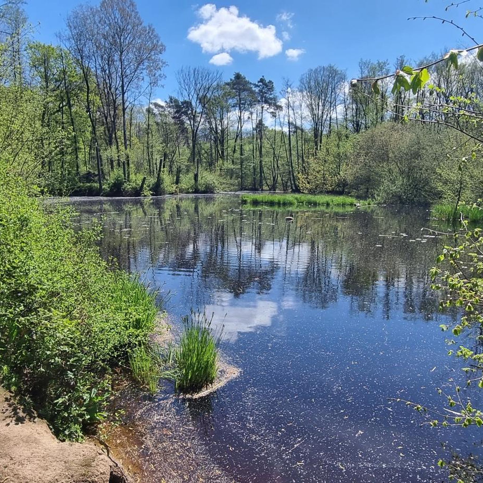
Jogging in Luderbachaue Von Dreieich offers diverse natural landscapes within a nature reserve spanning over 290 hectares of forest. The area features extensive forest cover, including oak-hornbeam, alder-ash floodplain, and beech forests, providing shaded trails. The Luderbach stream, a tributary of the Main River, flows through the reserve, adding to the natural scenery. This region provides varied terrain, from easily accessible paths to more moderate trails, suitable for different fitness levels.
Best jogging routes in Luderbachaue Von Dreieich
- The most popular jogging route is Ebertsberg Summit – Golf Course loop from Herrnröther- und Bornwaldswiesen von Sprendlingen, a 4.4 miles (7.0 km) trail that takes about 44 minutes to complete, featuring moderate elevation changes.
- Another top favourite among local runners is Running loop from Luderbachaue von Dreieich, a moderate 6.3 miles (10.2 km) path. This route offers a comprehensive experience of the reserve's natural environment.
- Local runners also love the View of the Stangenpyramide – Stangenpyramide loop from Dreieichenhain, a 2.3 miles (3.7 km) trail leading through forested areas to a unique landscape art installation, often completed in about 24 minutes.
- Jogging in Luderbachaue Von Dreieich is defined by extensive forests, the tranquil Luderbach stream, and varied terrain. The network offers options for different ability levels, from easy loops to more challenging moderate routes.
- The routes in Luderbachaue Von Dreieich are highly rated by the komoot community with an average score of 4.4 stars from over 2500 reviews. More than 77000 runners have used komoot to explore Luderbachaue Von Dreieich's varied terrain.
Last updated: July 15, 2026
7
runners
Moderate run. Good fitness required. Mostly paved surfaces. Suitable for all skill levels.
5
runners
10.2km
01:05
50m
50m
Moderate run. Good fitness required. Mostly paved surfaces. Suitable for all skill levels.

Sign up for free
4
runners
10.7km
01:09
40m
40m
Moderate run. Good fitness required. Mostly paved surfaces. Suitable for all skill levels.
3
runners
6.28km
00:39
40m
40m
Moderate run. Good fitness required. Mostly paved surfaces. Suitable for all skill levels.
4
runners
10.2km
01:04
60m
60m
Moderate run. Good fitness required. Mostly paved surfaces. Suitable for all skill levels.
Get access to more routes and recommendations from other explorers.
Sign up for free
Already have an account?
Our route recommendations are based on thousands of hikes, rides, and runs completed by other people on komoot.
Start today with a free account
Your next adventure awaits.
Login or Signup
Tips from the Community

They have delicious baked goods here.
1
0

A cast-iron plaque at this spot originally commemorated the last wolf in Dreieich, bearing the inscription: "Here, in 1784, the Princely Isenburg-Birstein Forester Siebenlist shot the last wolf." In the hyperinflation of 1923, the memorial plaque was stolen and replaced in 1933 by a new wooden monument, which was then badly damaged by vandals in 1991. Although the Wolfsstock (Wolf's Stick) is located within the Dreieich municipal boundaries, a support group was formed at the initiative of the Dietzenbach Senior Citizens' Advisory Board. This group campaigned for the monument's restoration and collected donations. Wooden Wolfsstock in the Local History Museum Enlarge image: wooden Wolfsstock © Hedi Weilmünster In the summer of 1998, the Neu-Isenburg Forestry Office placed a boulder from the Odenwald forest at the site and prepared it as a rest area. The boulder bears the inscription "WOLFSSTOCK," the image of a wolf's head, and the date November 26, 1784. Source: https://www.dietzenbach.de/Kultur-Freizeit/Freizeit-Bewegung/Ausflugsziele/Kunst-in-der-Stadt/Wolfsstock.php?object=tx,1799.20291.1
2
0
There are various paths along the Luderbachaue. Some paths are only used by a few runners.
1
0
The name “Wolfsstock” indicates that the last wolf was killed here.
2
0

A beautiful piece of nature. Mosquito alert!!!!!!
1
0
A beautiful piece of nature. Mosquito alert!!!!!!!!
1
0
From the bridge you have a beautiful panorama over Frankfurt and the Taunus.
2
0
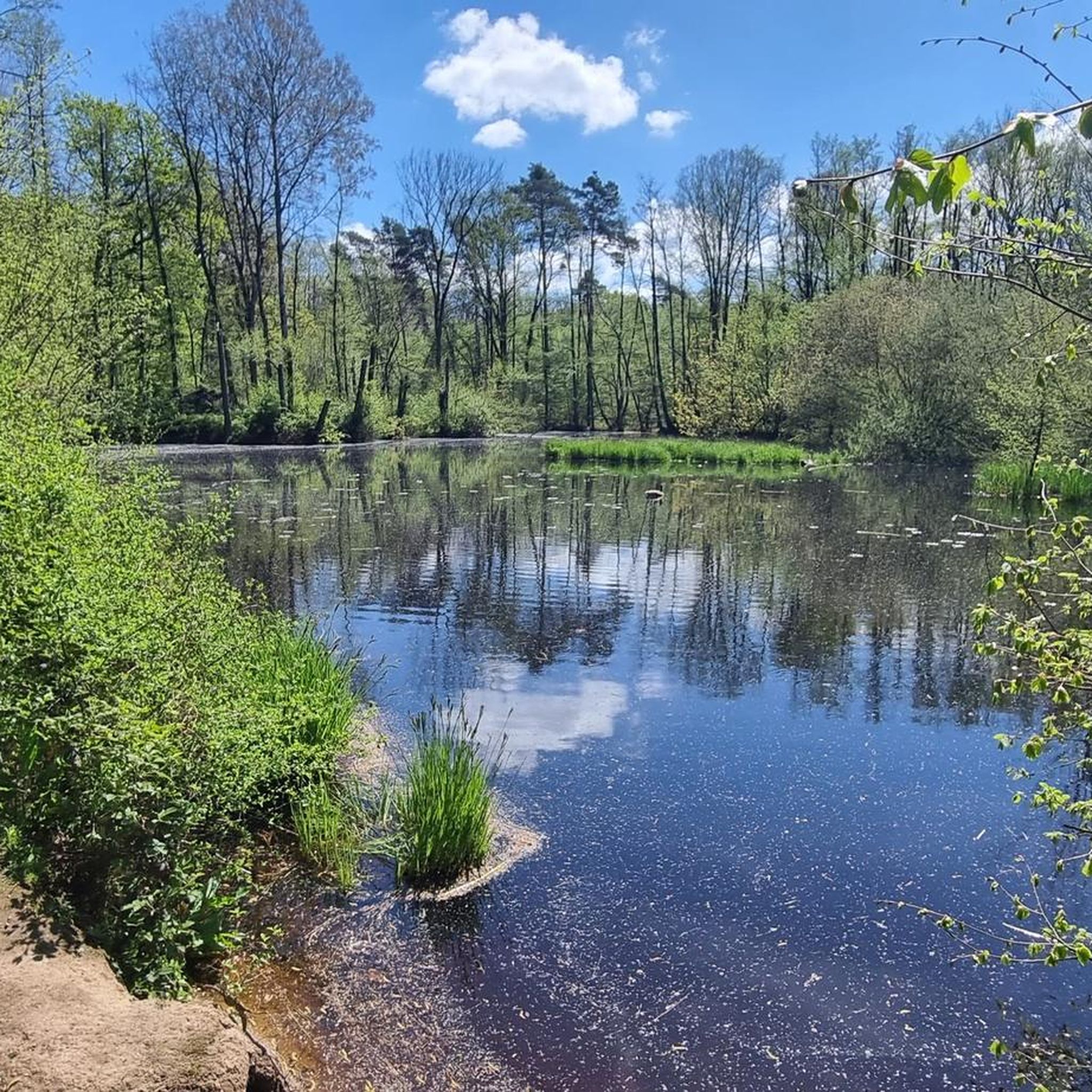
The Dornsee is sometimes also called the “water lily pond”.
6
0
Frequently Asked Questions
How many running routes are available in Luderbachaue Von Dreieich?
The Luderbachaue Von Dreieich offers a vast network of over 1100 running routes. This includes more than 120 easy routes, over 900 moderate options, and around 110 challenging trails, ensuring there's something for every fitness level.
What kind of terrain can I expect on the jogging trails in Luderbachaue Von Dreieich?
The region features diverse terrain, primarily characterized by extensive forests with various tree types like oak-hornbeam, alder-ash floodplain, and beech forests. You'll find a mix of easily accessible, well-trodden paths and more moderate trails, often alongside the tranquil Luderbach stream. The routes generally have moderate elevation changes, making them suitable for a wide range of runners.
Are there any family-friendly running routes in Luderbachaue Von Dreieich?
Yes, Luderbachaue Von Dreieich offers several family-friendly running options. Many of the easy-grade routes are suitable for families. For example, the View of the Stangenpyramide – Stangenpyramide loop from Dreieichenhain is an easy 2.3-mile (3.7 km) trail that leads through forested areas to an interesting landscape art installation, perfect for a shorter outing.
Can I bring my dog on the running trails?
Yes, Luderbachaue Von Dreieich is generally dog-friendly. The extensive forest cover and varied paths provide a great environment for running with your canine companion. Always ensure your dog is under control, and check for any specific local regulations regarding leashes or restricted areas within the nature reserve.
What interesting landmarks or natural features can I see while running in the area?
The Luderbachaue offers several points of interest. You can discover the tranquil Dorn Lake, a peaceful spot for a brief rest. The Reiterruhe Rest Area provides a convenient stop. Don't miss the Stangenpyramide, a unique landscape art installation that also offers panoramic views of the Frankfurt skyline and Taunus mountains on clear days.
Are there any circular running routes available?
Yes, many of the running routes in Luderbachaue Von Dreieich are circular, offering convenient starting and ending points. A popular moderate option is the Running loop from Luderbachaue von Dreieich, which is 6.3 miles (10.2 km) long and provides a comprehensive experience of the reserve's natural environment.
What do other runners say about the trails in Luderbachaue Von Dreieich?
The running routes in Luderbachaue Von Dreieich are highly rated by the komoot community, with an average score of 4.4 stars from over 2500 reviews. More than 77,000 runners have used komoot to explore the varied terrain, often praising the extensive shaded forests and the tranquil atmosphere provided by the Luderbach stream.
Are there any longer running routes for experienced runners?
Yes, for more experienced runners looking for a longer challenge, routes like the Neuhof – Hofgut Neuhof loop from Dreieich offer a moderate 6.6-mile (10.7 km) experience. Another excellent option is the Ebertsberg Summit – Gut Neuhof and Alte Backstube loop from Dreieich, which is 6.3 miles (10.2 km) and features slightly more elevation gain.
Is there parking available near the running trails?
While specific parking locations are not detailed for every route, the Luderbachaue Von Dreieich is well-equipped for outdoor activities, suggesting accessible entry points. Many routes, especially those starting from towns like Dreieich, likely have nearby parking facilities. It's advisable to check the starting point of your chosen route for specific parking information.
What is the best time of year to go running in Luderbachaue Von Dreieich?
The extensive forest cover in Luderbachaue Von Dreieich makes it suitable for running throughout much of the year. Spring and autumn offer pleasant temperatures and beautiful scenery with changing foliage. Summer provides welcome shade from the trees, while winter runs can be picturesque, though conditions may vary. Always check local weather forecasts before heading out.
Are there any facilities like rest areas or huts along the routes?
Yes, you'll find some facilities along the trails. The Reiterruhe Rest Area is directly on a certification route and provides a convenient stop. Additionally, the Götzhard Franke Hut is another point of interest that can serve as a resting spot during your run.
Most popular routes in Luderbachaue Von Dreieich
Most popular attractions in Luderbachaue Von Dreieich

Get inspired with the komoot mobile app


Explore more
Browse the best Running Trails & Routes in other regions.
