The best walks and hikes in Horn Mit Kahlköpfchen
4.6
(2529)
8,439
hikers
485
hikes
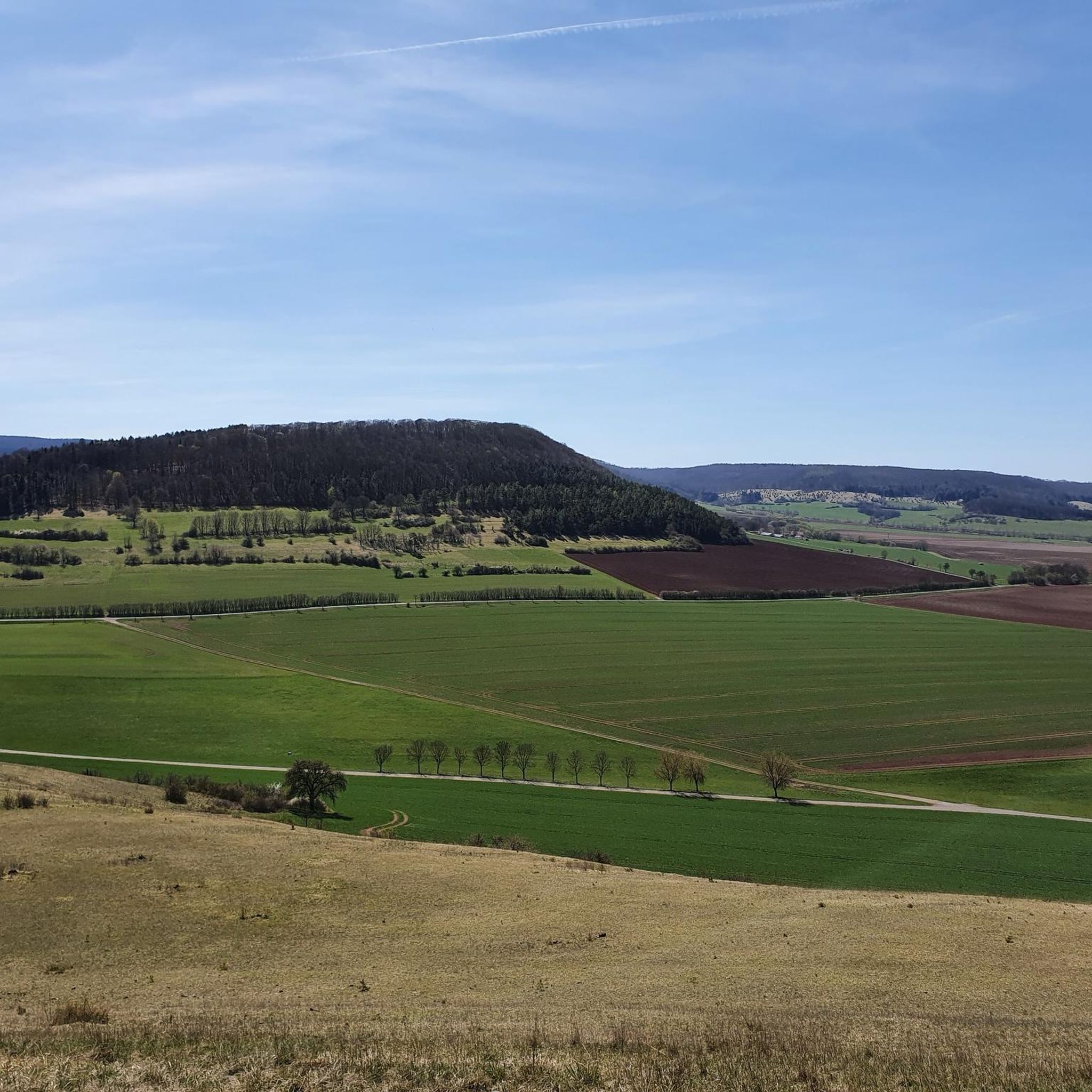
Hiking in Horn Mit Kahlköpfchen offers diverse landscapes characterized by nicely rolling terrain and treeless heights that provide expansive scenic views. The region, nestled in Thuringia, Germany, features the Kahlköpfchen peak at 456 meters and is enhanced by the presence of the Wiesenthalbach stream. These natural features contribute to a varied hiking experience across its open distances.
Best hiking trails in Horn Mit Kahlköpfchen
- The most popular hiking route is Kahlköpfchen Hill – View from Horn (Thuringian Forest) loop from…
Last updated: October 7, 2026
5.0
(2)
5
hikers
11.2km
03:16
300m
300m
Moderate hike. Good fitness required. Easily-accessible paths. Suitable for all skill levels.
5.0
(4)
10
hikers
8.32km
02:30
270m
270m
Moderate hike. Good fitness required. Easily-accessible paths. Suitable for all skill levels.

4.9
(26)
56
hikers
11.2km
03:07
220m
220m
Moderate hike. Good fitness required. Mostly accessible paths. Sure-footedness required.
4.7
(59)
164
hikers
16.2km
04:40
400m
400m
Moderate hike. Good fitness required. Easily-accessible paths. Suitable for all skill levels.
4.7
(48)
164
hikers
Hard hike. Very good fitness required. Easily-accessible paths. Suitable for all skill levels.
Get access to more routes and recommendations from other explorers.
Already have an account?
Our route recommendations are based on thousands of hikes, rides, and runs completed by other people on komoot.
Start today with a free account
Your next adventure awaits.
Tips from the Community

A castle with a campsite is rarely found. Yet this small, fine one is special among the motorhome pitches. Being mobile is a must here, as there is no catering. But plenty of space for guests in the green. The entire area around the castle is worth seeing.
0
0

Here is Touringen stamp station 294
0
0

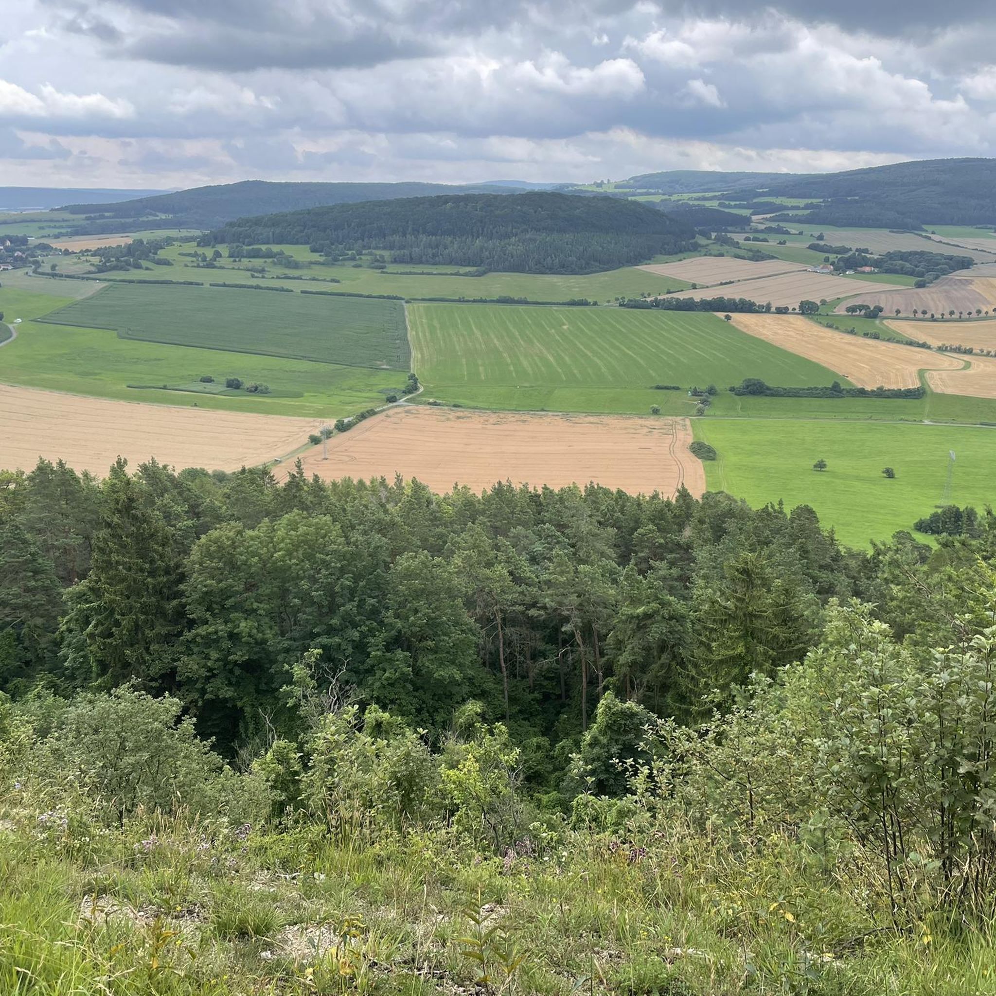
Impressive view of the beautiful landscape of the Rosatal
0
0

The stamp box is incorrectly marked on komoot and is located at the top of the mountain at waypoint 55 (so just keep following the path)
2
0


Here you can stamp your route and take a break to enjoy the view. 😎
2
0

The Touringen stamp point 294 is called “Sitzgruppe am Horn” and is located on top of the mountain ⛰️
0
0
Frequently Asked Questions
How many hiking trails are available in Horn Mit Kahlköpfchen?
Horn Mit Kahlköpfchen offers a wide variety of hiking experiences, with over 480 trails to choose from. These routes cater to different preferences, including easy strolls, moderate paths, and more challenging ascents.
Are there easy hiking trails suitable for beginners or casual walkers?
Yes, the region features over 210 easy hiking trails, perfect for beginners or those seeking a relaxed walk. These routes often traverse the nicely rolling terrain, offering pleasant views without significant elevation changes.
What are some challenging hikes in Horn Mit Kahlköpfchen?
For experienced hikers looking for a challenge, there are nearly 30 difficult routes. One such demanding trail is the View from Horn (Thuringian Forest) – View of Wiesenthal loop from Horn mit Kahlköpfchen, which covers 10.7 miles (17.2 km) with substantial elevation gain, offering sweeping vistas including views of Wiesenthal.
Are there any circular walks in the area?
Many of the trails in Horn Mit Kahlköpfchen are designed as circular routes, allowing you to start and end at the same point. An example is the Kahlköpfchen Hill – View from Horn (Thuringian Forest) loop from Roßdorf, a moderate 7.4-mile (11.9 km) trail that provides views from the Kahlköpfchen peak.
What natural attractions or viewpoints can I see while hiking?
The region is known for its magnificent scenic views and panoramas, especially from its treeless heights. Key viewpoints include the View from Horn (Thuringian Forest) and the Kahlköpfchen Hill itself. You can also find the Shelter at Hornberg, which offers a wonderful spot to enjoy views of Wiesenthal.
Are there any unique landmarks or points of interest to explore?
Beyond the natural beauty, you can explore unique features like the Ibengarten, which hosts over 600 ancient yew trees. The area is also part of the larger Rhön region, known for its extensive spaciousness and meditative silence, and is traversed by the premium long-distance hiking trail, Der Hochrhöner.
Is Horn Mit Kahlköpfchen suitable for family hikes?
Yes, with over 210 easy routes and many moderate options, Horn Mit Kahlköpfchen offers numerous trails suitable for families. The nicely rolling terrain and diverse landscapes provide an engaging environment for all ages to enjoy the outdoors.
Are dogs allowed on the hiking trails?
While specific regulations can vary, generally, dogs are welcome on trails in Horn Mit Kahlköpfchen, especially if kept on a leash. It's always advisable to check local signage for any specific restrictions in certain nature reserve areas.
What is the best time of year to go hiking in Horn Mit Kahlköpfchen?
The region's 'Land of Open Distances' and treeless heights make it enjoyable across multiple seasons. Spring and autumn offer pleasant temperatures and vibrant colors, while summer provides longer daylight hours. Even winter can be beautiful, though some trails might require appropriate gear.
What do other hikers enjoy most about hiking in Horn Mit Kahlköpfchen?
The area is highly rated by the komoot community, with an average score of 4.6 stars from over 1,800 reviews. Hikers frequently praise the diverse landscapes, the expansive scenic views from the treeless heights, and the well-maintained network of trails that cater to various ability levels.
Are there any moderate trails that explore the wider Rhön region?
Absolutely. A popular moderate trail that delves into the broader Rhön landscape is Rhön-Rundweg 1 bei Roßdorf – discover the Rhön. This 6.9-mile (11.2 km) path allows you to experience the characteristic rolling terrain of the Rhön.
Where can I find parking for the hiking trails?
Parking is generally available at common starting points for trails, particularly in and around towns like Roßdorf. Look for designated hiking car parks or roadside parking areas near trailheads. Specific parking information is often detailed on individual route descriptions.
Most popular routes in Horn Mit Kahlköpfchen
Most popular attractions in Horn Mit Kahlköpfchen

Get inspired with the komoot mobile app


Explore more
Browse the best Hikes in other regions.
