The best walks and hikes in Tungelerwallen
4.3
(3369)
17,297
hikers
948
hikes
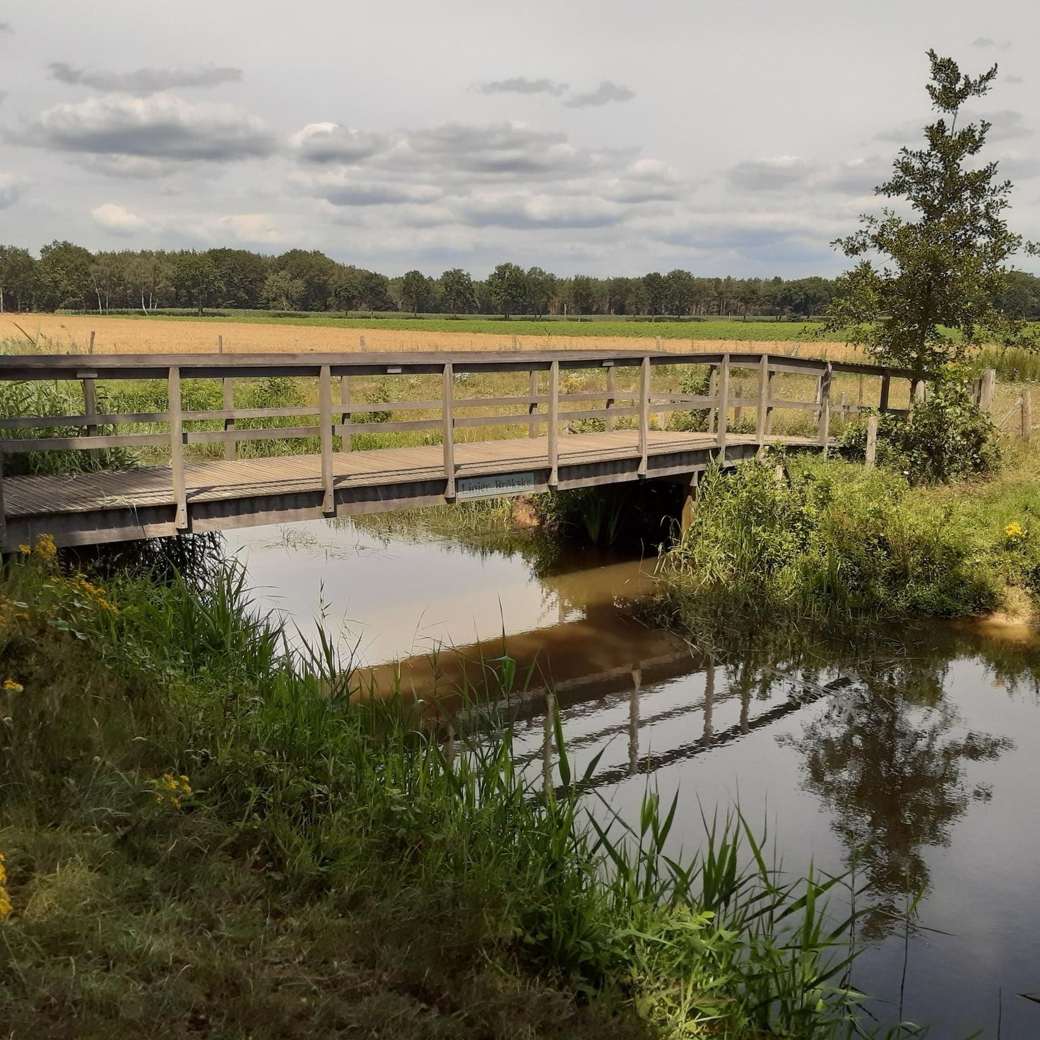
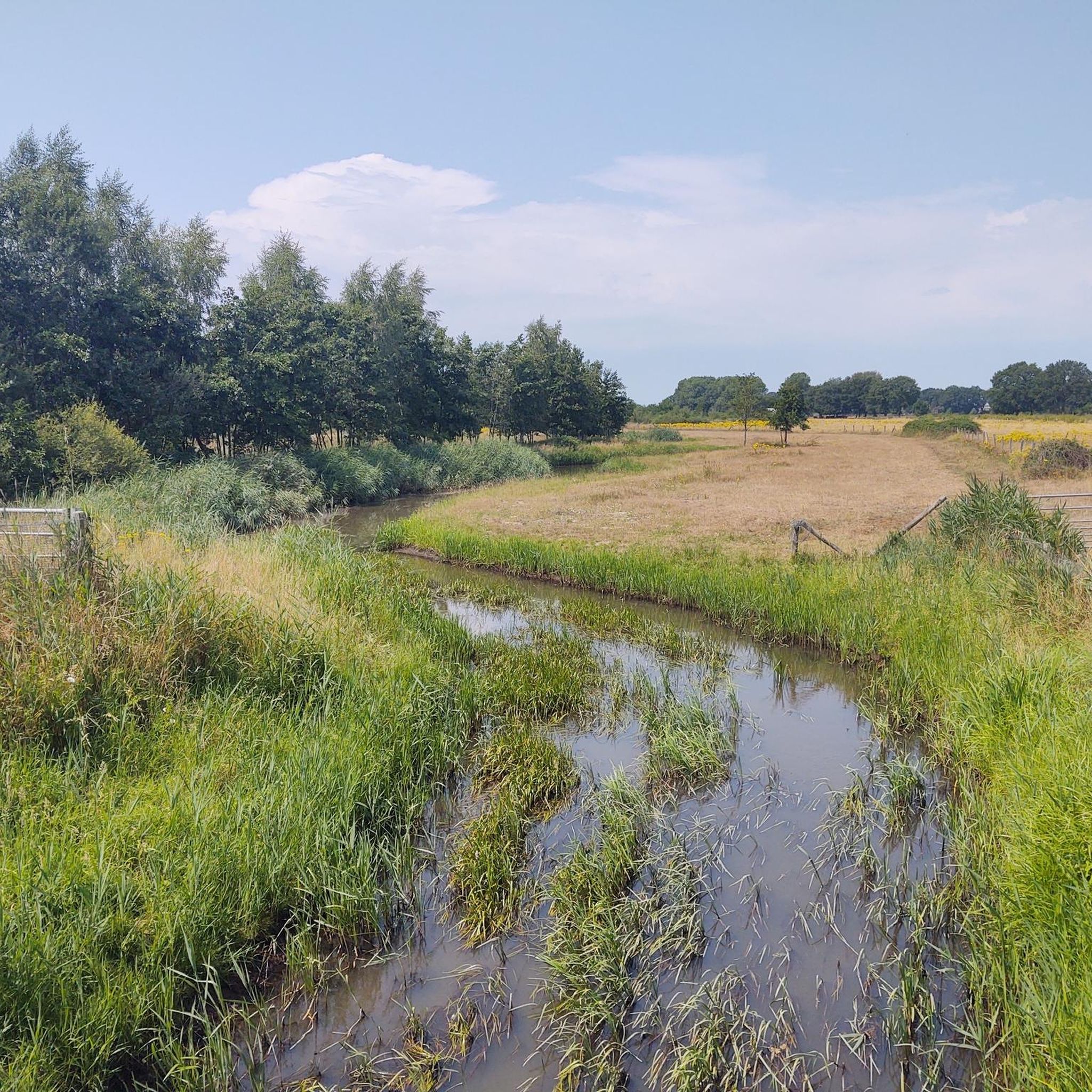
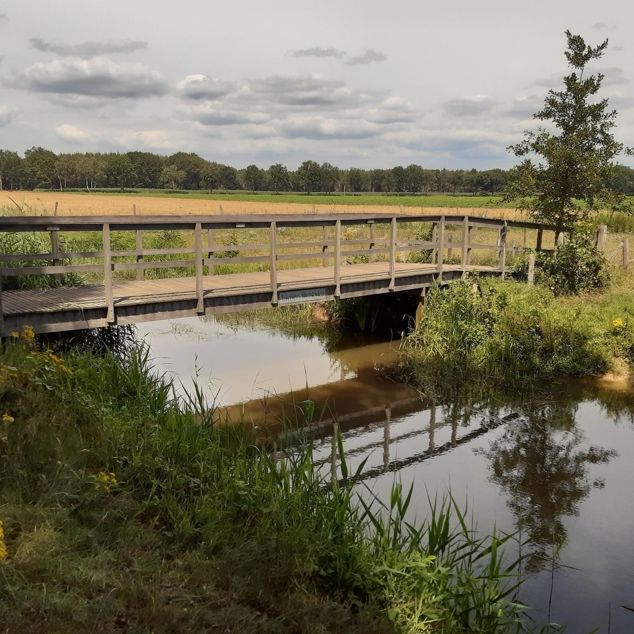
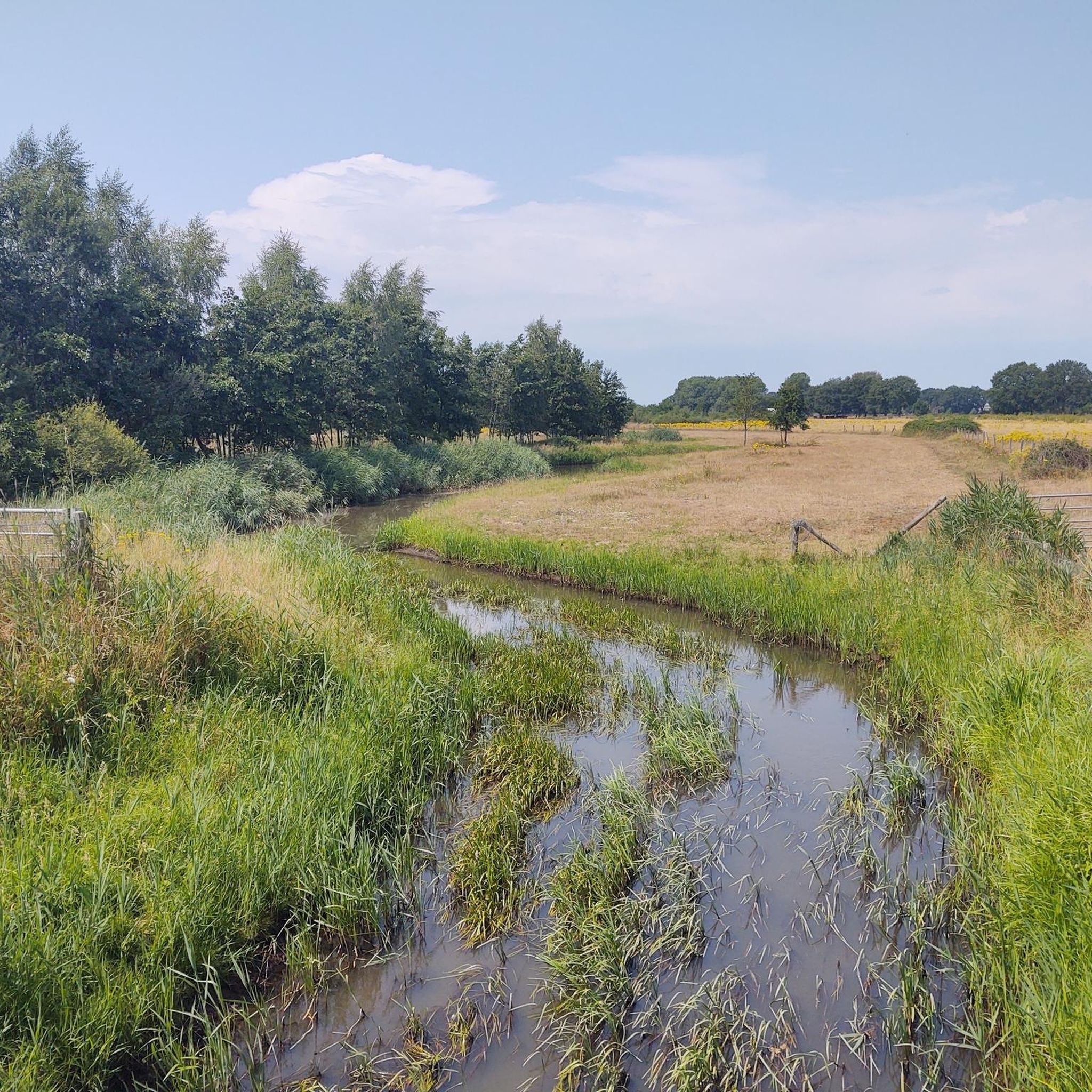
Hiking in Tungelerwallen offers diverse landscapes within a natural park in Limburg, Netherlands. The terrain, originally an old drifting sand complex, features extensive pine forests, interspersed heathlands, and small areas of drifting sand. A notable natural feature is the meandering Tungelroyse Beek (stream), which is integrated into several hiking routes. The region provides varied trail options with minimal elevation gain.
Best hiking trails in Tungelerwallen
- The most popular hiking route is Tungelroijse Beek – Rocks in the Stream loop from Tungelerwallen, a 3.8 miles (6.1 km) trail that takes 1 hour 31 minutes to complete. This easy path follows the picturesque Tungelroyse Beek, featuring unique rock formations in the stream.
- Another top favourite among local hikers is Tungelroijse Beek – Area with Free-Roaming Cattle loop from Tungelroy, an easy 4.7 miles (7.6 km) path. This route offers views of the stream and the chance to observe Scottish Highland cattle grazing.
- Local hikers also love the Forest walk near Weert – Tungelerwallen loop from Tungelerwallen, a 2.2 miles (3.6 km) trail leading through tranquil pine forests, often completed in about 54 minutes.
- Hiking in Tungelerwallen is defined by pine forests, heathlands, and the meandering Tungelroyse Beek. The network offers options for different ability levels, primarily featuring easy, well-accessible paths.
- The routes in Tungelerwallen are highly rated by the komoot community with an average score of 4.3 stars from over 2,700 reviews. More than 14,000 hikers have used komoot to explore Tungelerwallen's varied terrain.
Last updated: July 4, 2026
4.6
(16)
46
hikers
6.10km
01:32
10m
10m
Easy hike. Great for any fitness level. Easily-accessible paths. Suitable for all skill levels.
4.8
(4)
17
hikers
Easy hike. Great for any fitness level. Easily-accessible paths. Suitable for all skill levels.

Sign up for free
4.6
(5)
17
hikers
Easy hike. Great for any fitness level. Easily-accessible paths. Suitable for all skill levels.
4.6
(10)
34
hikers
Moderate hike. Good fitness required. Easily-accessible paths. Suitable for all skill levels.
3.9
(28)
111
hikers
16.0km
04:01
20m
20m
Moderate hike. Good fitness required. Easily-accessible paths. Suitable for all skill levels.
Get access to more routes and recommendations from other explorers.
Sign up for free
Already have an account?
Our route recommendations are based on thousands of hikes, rides, and runs completed by other people on komoot.
Start today with a free account
Your next adventure awaits.
Login or Signup

Tips from the Community

stramprooyse broek
0
0
Tip: Shoes (nice weather) or boots (lots of rain) that can get dirty.
0
0

To be honest, I didn't notice the border at all. The scenic impressions were all the more beautiful for it.
0
0
Very beautiful natural landscape with great animals.
1
0

Krang is a Low Saxon word meaning contrary, headstrong. The De Krang nature reserve is located south of Swartbroek and covers an area of approximately 300 hectares. The area consists of deciduous and coniferous trees, grassland, and rounded fields. It is a marshy area with numerous ponds inhabited by amphibians, primarily salamanders. The leaves of the woody vegetation and deciduous trees fall to the bottom of the ponds, giving the water a blackish cast. Source: https://www.dorpsraad-swartbroek.nl/bezienswaardigheid/natuurgebied-de-krang/
6
0
Krang is a Low Saxon word meaning contrary, headstrong. The De Krang nature reserve is located south of Swartbroek and covers an area of approximately 300 hectares. The area consists of deciduous and coniferous trees, grassland, and rounded fields. It is a marshy area with numerous ponds inhabited by amphibians, primarily salamanders. The leaves of the woody vegetation and deciduous trees fall to the bottom of the ponds, giving the water a blackish cast. Source: https://www.dorpsraad-swartbroek.nl/bezienswaardigheid/natuurgebied-de-krang/
4
0
When you think of a windmill, you usually picture a smock mill. But smock mills are rare in Limburg. There are only two, and one of them is located in Weerterland: De Hoop mill. And then you have to consider that for most of its existence, the mill had no smock at all. De Hoop mill is located on the northeastern edge of the Weert parish of Swartbroek. With a smock height of 7.50 meters, the mill clearly towers above the surrounding residential areas. The mill is unique in Limburg for several reasons. As mentioned, it is one of only two smock mills in the province. Furthermore, it is a wooden, octagonal mill. Elsewhere in the Netherlands, the octagonal mill is one of the most common, but in Limburg there are only four of them. The combination of a wooden octagon and a smock is itself unique in Limburg. The mill has stood in the parish of Swartbroek since 1905, but the mill itself is much older. De Hoop Mill even has a history of almost 250 years, built in 1788 in Delfshaven and later operating as a hulling mill in Vlaardingen. A solid Dutch mill, indeed. But how did this structure end up in Central Limburg? At the end of the 19th century, the mill in Vlaardingen had to be demolished and was put up for sale for demolition. This was precisely the time when miller Antoon Weekers from Swartbroek began considering a windmill operation. The village's watermill had already been demolished in 1880, and the village no longer had a corn mill. Weekers bought the parts of this smock mill and converted them into his grain mill in 1905. Initially, the mill was rebuilt in Swartbroek as a belt mill, without the smock. In 1923, the mill came into the hands of baker-miller Johannes Wilhelmus Roelofsen. In the 1950s, the mill became the property of Franciscus Albertus Munster, who had it thoroughly restored. The mill ran for another six months to everyone's satisfaction, but then problems arose. It came to a standstill, part of the belt was excavated for the construction of a shed, and the fencing was removed from the sails. During the next restoration in 1987, the mill was restored to its former glory as a smock mill by the Weert mill builders Adriaens. Source and more information: https://www.molensinweert.nl/dehoopswartbroek
5
0
The pond is situated between two gates. From the gate closest to the village, you can follow a path with a gate that leads you between two smaller ponds towards the village edge of Swartbroek.
5
0
Frequently Asked Questions
What kind of terrain can I expect when hiking in Tungelerwallen?
Tungelerwallen features a diverse landscape, originally an old drifting sand complex. You'll primarily encounter extensive pine forests, interspersed with heathlands and small, open areas of drifting sand. The beautiful, meandering Tungelroyse Beek (stream) is also a prominent feature, integrated into many routes.
Are the hiking trails in Tungelerwallen suitable for families with children?
Yes, Tungelerwallen is very family-friendly. The trails are generally easy and well-accessible, with minimal elevation gain, making them suitable for various fitness levels. Many routes are loops, perfect for a leisurely family outing. For example, the Forest walk near Weert – Tungelerwallen loop is a shorter, tranquil option.
Can I bring my dog on the hiking trails in Tungelerwallen?
Yes, Tungelerwallen is a dog-friendly area. Many hikers enjoy exploring the trails with their dogs. While specific off-leash zones are not detailed, it's generally advisable to keep dogs under control, especially in areas where Scottish Highland cattle graze, such as along the Tungelroyse Beek.
Are there any circular hiking routes available in Tungelerwallen?
Most of the hiking routes in Tungelerwallen are designed as loops, offering convenient circular walks. These vary in length and allow you to experience different parts of the park without retracing your steps. An example is the Rocks in the Stream – Kerken Brökske Nature Reserve loop, which takes you through scenic natural reserves.
What natural features or landmarks can I see while hiking?
The most notable natural features include the picturesque Tungelroyse Beek, where you can often spot 'rocks in the stream' – a particularly beautiful sight. You might also encounter Scottish Highland cattle grazing along the stream, adding to the scenic charm. The landscape also offers a mix of pine forests, heathlands, and remnants of drifting sand.
What is the best time of year to visit Tungelerwallen for hiking?
Tungelerwallen offers a pleasant hiking experience throughout much of the year. Spring brings fresh greenery, while autumn showcases beautiful fall colors in the forests. The heathlands are particularly vibrant when in bloom during late summer. Even in winter, the tranquil pine forests offer a peaceful escape, though conditions may vary.
Is there parking available near the trailheads in Tungelerwallen?
Yes, there are typically parking options available near the main access points and trailheads for Tungelerwallen. Specific parking areas like Wijffelterbroekdijk are known access points, making it convenient for visitors arriving by car to start their hikes.
What do other hikers enjoy most about Tungelerwallen?
The area is highly rated by the komoot community, with an average score of 4.3 stars from over 2,700 reviews. Hikers often praise the diverse landscapes, the tranquility of the pine forests, and the picturesque sections along the Tungelroyse Beek. The chance to see Scottish Highland cattle is also a frequently mentioned highlight.
Are there any routes where I can see the Scottish Highland cattle?
Yes, you can observe Scottish Highland cattle grazing along the Tungelroyse Beek. The Tungelroijse Beek – Area with Free-Roaming Cattle loop from Tungelroy is specifically designed to offer views of these animals in their natural grazing environment. Remember to maintain a respectful distance from the cattle.
How accessible are the trails for strollers or wheelchairs?
While many trails are described as easy and well-accessible, the presence of drifting sand areas and natural, unpaved paths means that full stroller or wheelchair accessibility might be limited on some sections. For the most comfortable experience with a stroller, look for wider, more established forest paths.
Are there cafes or restaurants near Tungelerwallen for after a hike?
Tungelerwallen is situated near towns like Altweerterheide and Stramproy, and the larger town of Weert is also close by. These areas offer various amenities, including cafes, pubs, and restaurants where you can relax and refuel after your hike.
What kind of birdlife can I expect to see in Tungelerwallen?
The varied habitats of Tungelerwallen support a diverse range of birdlife, making it an interesting spot for birdwatchers. You might observe species such as the Black Woodpecker, Green Woodpecker, Woodlark, Tree Pipit, Goldcrest, Crested Tit, Nightjar, and Stonechat, especially in the forested and heathland areas.
Most popular routes in Tungelerwallen

Get inspired with the komoot mobile app


Explore more
Browse the best Hikes in other regions.
