The best walks and hikes in Momm-Niederung
4.5
(7369)
30,592
hikers
1,104
hikes
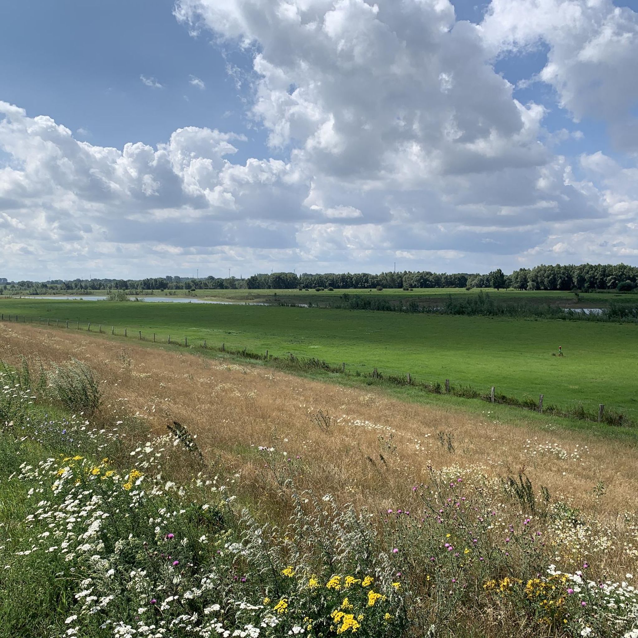
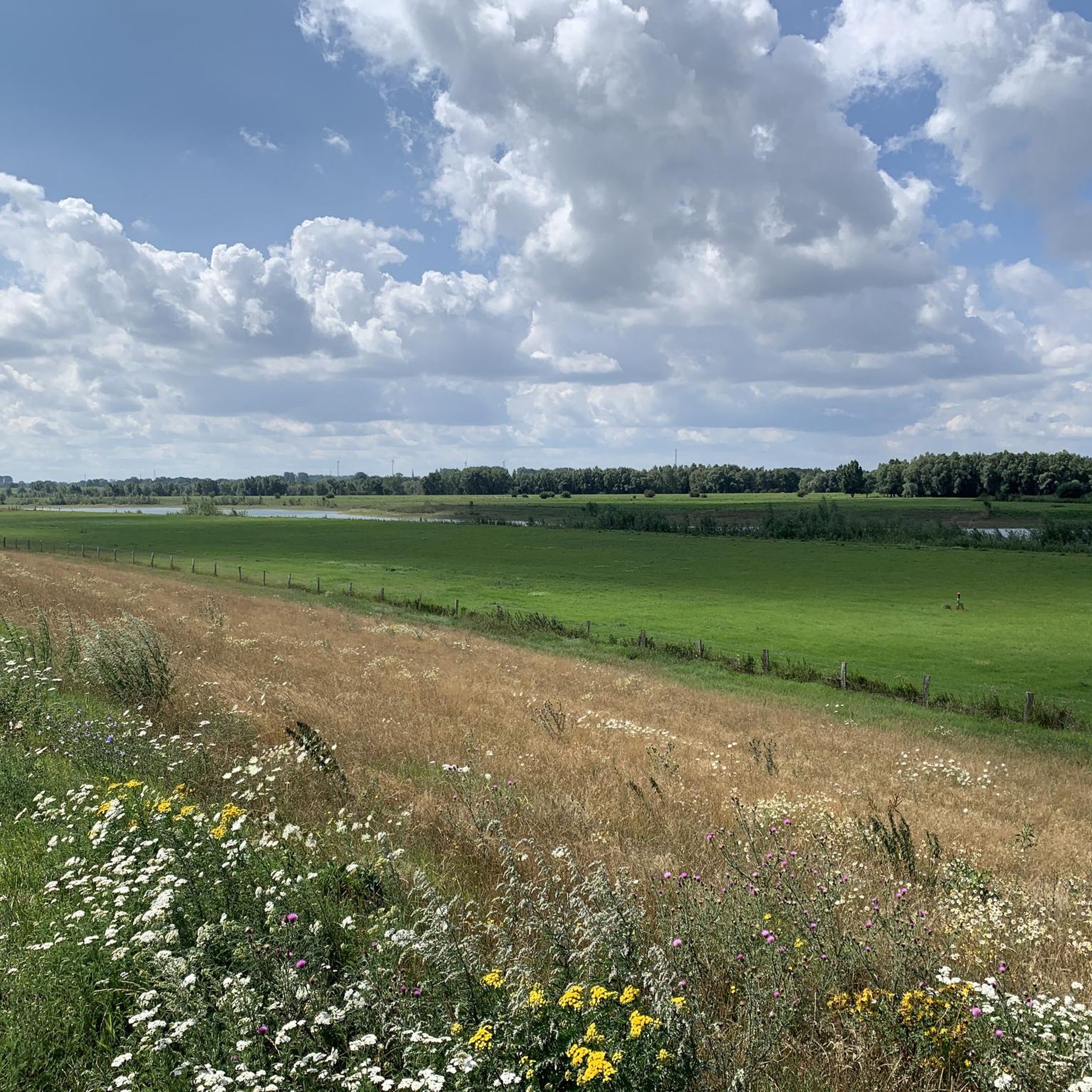
Hiking in Momm-Niederung offers routes through a distinctive cultural landscape bordered by the Rhine River and the Mommbach stream. The terrain features a mix of riverside paths, dikes, and quiet roads. A significant portion of the area is a designated nature reserve, preserving its ecological value and serene atmosphere. The landscape is characterized by its gnarled pollarded trees, typical of the Lower Rhine region, and open meadows.
Best hiking trails in Momm-Niederung
- The most popular hiking route is Götterswickerhamm on…
Last updated: June 24, 2026
4.4
(8)
48
hikers
Easy hike. Great for any fitness level. Easily-accessible paths. Suitable for all skill levels.
3.4
(5)
21
hikers
4.61km
01:10
10m
10m
Easy hike. Great for any fitness level. Easily-accessible paths. Suitable for all skill levels.

Sign up for free
4.1
(7)
13
hikers
4.91km
01:15
10m
10m
Easy hike. Great for any fitness level. Easily-accessible paths. Suitable for all skill levels.
3.5
(8)
17
hikers
Easy hike. Great for any fitness level. Easily-accessible paths. Suitable for all skill levels.
2.3
(4)
12
hikers
Easy hike. Great for any fitness level. Easily-accessible paths. Suitable for all skill levels.
Get access to more routes and recommendations from other explorers.
Sign up for free
Already have an account?
Our route recommendations are based on thousands of hikes, rides, and runs completed by other people on komoot.
Start today with a free account
Your next adventure awaits.
Login or Signup
Tips from the Community

At the end of a small stream
0
0

The Lower Rhine - a wonderful route for hiking or walking.
1
0

"Götterswickerhamm is one of the oldest districts of the town of Voerde (Lower Rhine) in the Wesel district, North Rhine-Westphalia. Götterswickerhamm is located on the right bank of the Lower Rhine at kilometer mark 800..." FURTHER INFORMATION: https://de.wikipedia.org/wiki/G%C3%B6tterswickerhamm
1
0
"The Rhine is the major and important transport axis of our landscape. It connects states and regions – but it also separates countries, federal states, cities, districts, and municipalities. A good example is the district of Wesel, which has its territory on both banks of the Rhine. But to this day, the Rhine is also a river with dangers, with bathers and ship crews being particularly frequent victims. In the past, the number of casualties was much higher, especially in shipping accidents and on-board work accidents. Water police and fireboats with advanced technical equipment are only a modern achievement. The victims recovered from accidents and water bodies on the right bank of the Rhine near Götterswickerhamm were laid out in a small building, the so-called "morgue" or "dead house," until burial. Near Götterswickerhamm, the Rhine makes particularly sharp bends. In addition, a large number of groynes were built here in the Rhine. These are shallow dams built at right angles from the bank toward the middle of the river. In addition to flotsam, drowned bodies were repeatedly washed ashore in this area of the Rhine. Until they could be identified, they were housed in the mortuary, which had been built on the dike for this purpose before 1890. The present mortuaries did not yet exist at that time. The mortuary was relocated to the waterside of the dike during the dike renovation from 1930 to 1933. After its destruction in World War II, it was rebuilt on this site in 1947. With the construction of mortuaries in close proximity to the cemeteries, the house on the dike lost its function. It was demolished in 1971. During the dike renovation in 2010, this rare relic of burial culture disappeared along with the last remnants of the walls. To this day, it is said that the mortuary was once a popular destination for lovers; it was also a test of courage to "view" the washed-up corpses at night. Since 2012, there has been a memorial stone with an information plaque not far from the old site. (Stefan Kronsbein / Johanna Siewers / with kind comments from Heinz Boß, Association for Local Heritage and Transport Voerde (Lower Rhine). Created in cooperation with the Biological Station in the District of Wesel as part of the "Hidden Treasures Inclusive" project. A project of the LVR Network for Landscape Cultural Conservation, 2016) https://www.kuladig.de/Objektansicht/KLD-258330
1
0
" In 1719, a village school in Löhnen was first mentioned in the Götterswickerhammer church register. The current building, complete with a teacher's apartment, was occupied in 1826. Friedrich Haastert served as the school's first teacher for almost 50 years, until 1871. Löhnen is considered the southernmost terp village in Germany, with individual farms built on small mounds of earth. Löhnen's low elevation repeatedly led to flooding of the entire village whenever the Rhine carried too much water. The last major flood in 1926 caused much fear and anxiety and caused the Löhnen school community considerable material loss. In 1913, work began on modernizing the school building, initially installing electric lighting. The replacement of the old coal heating system with electric heating in 1964 could not prevent the school from closing on June 27, 1968. The 27 Löhnen schoolchildren were transferred to the elementary school on the Rönskenstraße and the secondary school on Alexanderstraße in Voerde Mitte. Due to the great distance from Voerde Mitte – approximately 4.4 km – the city of Voerde provided a school bus. Walter Neuse provides a detailed account of the school's history. Since then, the village school has been converted into a village community center and opened in 1980 as Alde School. The owner is the city of Voerde. The "Vivat" Löhnen Citizens' Rifle Club is the leaseholder and can sublease to an operator. Major renovations were last carried out in 1990. In addition to state subsidies, the "Vivat" Löhnen club contributed 110,000 Deutsche Marks. Many Löhnen residents contributed back then. Today, Alde School forms the center of the village, and many people even remember it poetically. " https://www.hv-voerde.de/standort-11-die-alde-school-in-loehnen/
0
0

Very beautiful and close view of the Rhine. It's a great place to linger.
0
0
Here you can enjoy nice views of the Rhine. In the Rheinaue, the Rhine seems very distant.
1
0

Very nice place to stop for a break with a sun terrace right on the Rhine, delicious cakes and tarts, homemade lemonades. Super friendly staff.
6
0
Frequently Asked Questions
How many hiking trails are available in Momm-Niederung?
Momm-Niederung offers a wide variety of hiking opportunities, with over 1,100 trails to explore. These range from easy strolls to more challenging routes, catering to different preferences and fitness levels.
What kind of terrain can I expect when hiking in Momm-Niederung?
The terrain in Momm-Niederung is characterized by its riverside paths along the Rhine and Mommbach stream, fortified dikes, and quiet, less-trafficked roads. You'll encounter open meadows and areas with distinctive pollarded trees, typical of the Lower Rhine region. The routes generally have minimal elevation gain, making them accessible for many.
Are there any easy hiking trails suitable for beginners in Momm-Niederung?
Yes, Momm-Niederung has a significant number of easy trails, with over 800 routes classified as easy. A great option for beginners is the Momm Lowlands Nature Reserve – The Old School Voerde loop from Momm-Niederung, which is just under 4 km long and features very little elevation change.
What natural features or landmarks can I see along the hiking trails?
Hikers in Momm-Niederung can enjoy several unique natural features and landmarks. The area is known for its 'urig gewachsene Kopfbäume' (gnarled pollarded trees), especially willows and ashes, which create a distinctive landscape. You can specifically visit the Avenue of Pollarded Willows in Momm-Niederung. The Momm-Niederung Nature Reserve itself is a highlight, preserving the area's ecological value and biodiversity. Additionally, the Rheindamm between Götterswickerhamm and Ork offers expansive views of the Rhine River.
Are there any circular hiking routes in Momm-Niederung?
Yes, many of the trails in Momm-Niederung are circular, allowing you to start and end at the same point. An excellent example is the Rheinkilometer 800 Marker – View of the Rhine loop from Momm-Niederung, a moderate 8.5 km path that provides expansive views of the Rhine River.
Is Momm-Niederung suitable for family-friendly hikes?
Absolutely. The generally flat and well-maintained paths, especially those along the dikes and quiet roads, make Momm-Niederung very suitable for families. Many routes are barrier-free, and the presence of wildlife like arctic wild geese in winter and stone owls year-round can be engaging for children. The Momm Lowlands Nature Reserve loop from Voerde is a good family-friendly option, taking about 1 hour 10 minutes to complete.
What is the best season for hiking in Momm-Niederung?
Momm-Niederung offers unique experiences throughout the year. In winter, the meadows become a resting place for arctic wild geese, offering a special sight. Spring brings vibrant celandine covering path edges. The extensive orchards are home to stone owls year-round. For comfortable hiking, spring and autumn generally provide pleasant temperatures and beautiful scenery, though the area is accessible in all seasons.
Are dogs allowed on the hiking trails in Momm-Niederung?
Yes, dogs are generally welcome on the hiking trails in Momm-Niederung. As a nature reserve, it's important to keep dogs on a leash to protect local wildlife and respect other hikers. The open paths and dikes provide ample space for walks with your canine companion.
What do other hikers enjoy most about hiking in Momm-Niederung?
The komoot community highly rates Momm-Niederung, with an average score of 4.5 stars from over 6,900 reviews. Hikers frequently praise the serene atmosphere, the picturesque views of the Rhine, and the unique cultural landscape shaped by the pollarded trees. The well-maintained paths and the opportunity to observe local wildlife are also often highlighted.
Are there any villages or towns to explore near the hiking routes?
Yes, the hiking routes often pass through charming villages. Götterswickerhamm, a more than 1,000-year-old Rhine village, is a common starting and ending point for trails. You can also explore Mehrum and Löhnen, described as the southernmost 'Warftendorf' (a village built on an artificial mound) of the Rhine, offering idyllic scenery and a glimpse into the region's history.
Is there public transport access to Momm-Niederung for hikers?
While specific public transport details for trailheads can vary, the villages surrounding Momm-Niederung, such as Götterswickerhamm and Voerde, are typically accessible by local bus services. It's advisable to check local public transport schedules for the most up-to-date information on reaching your desired starting point.
Where can I find parking for hiking in Momm-Niederung?
Parking is generally available in the villages and towns adjacent to the Momm-Niederung, such as Götterswickerhamm and Voerde, which serve as common starting points for many trails. Look for designated parking areas near local amenities or trail access points.
Most popular routes in Momm-Niederung
Most popular attractions in Momm-Niederung

Get inspired with the komoot mobile app


Explore more
Browse the best Hikes in other regions.
