The best MTB trails in Braunschweiger Okeraue
4.5
(1046)
3,785
riders
579
rides
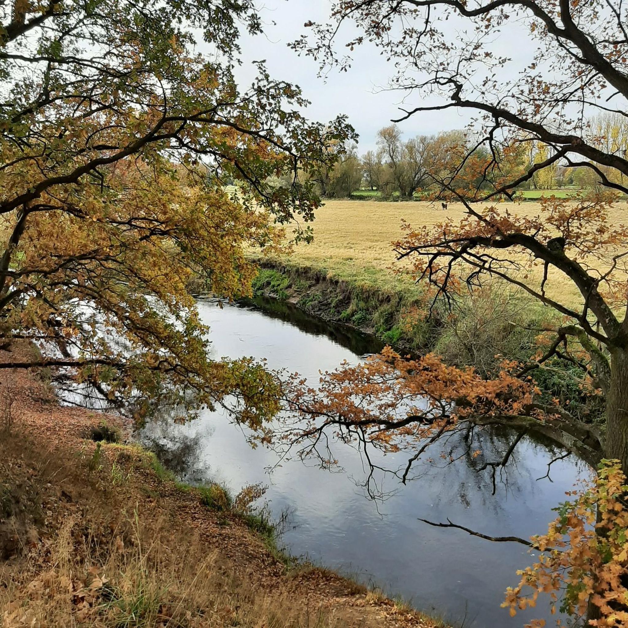
Mountain biking in Braunschweiger Okeraue offers diverse terrain within a 320-hectare nature reserve, characterized by the meandering Oker river. The landscape features riverine forests, unpaved riverbanks, oxbow lakes, and unique inland dunes, providing varied ground conditions for cyclists. This natural setting includes both open grasslands and shaded routes, with dynamic sections and elevation changes suitable for mountain biking. The area provides a mix of asphalted paths, natural trails, and varying elevation profiles.
Best mountain bike trails in Braunschweiger Okeraue
- The most popular mountain bike trail is Sülfeld Lock – Thune-Wenden Canal Bridge loop from Schwülper, a 25.8 miles (41.5 km) trail that takes 2 hours 42 minutes to complete. This moderate route navigates along the canal and through natural riverine environments.
- Another top favourite among local mountain bikers is Singletrack in Walle Forest loop from Alte Landwehr, a moderate 21.0 miles (33.7 km) path. This route features singletrack sections within Walle Forest, offering a more technical riding experience.
- Local mountain bikers also love the Ölper Forest Trail – Gravel Trail Near Kanzlerfeld loop from Schwülper, a 15.8 miles (25.4 km) trail leading through varied forest and gravel paths, often completed in about 1 hour 40 minutes.
- Mountain biking in Braunschweiger Okeraue is defined by the meandering Oker river, riverine forests, and inland dunes. The network offers options for easy, moderate, and difficult ability levels.
- The routes in Braunschweiger Okeraue are highly rated by the komoot community with an average score of 4.5 stars from over 900 reviews. More than 3,800 mountain bikers have used komoot to explore Braunschweiger Okeraue's varied terrain.
Last updated: July 3, 2026
3.7
(7)
22
riders
41.4km
02:43
100m
100m
Moderate mountain bike ride. Good fitness required. Suitable for all skill levels.
5
riders
25.7km
01:43
70m
70m
Moderate mountain bike ride. Great for any fitness level. Advanced riding skills necessary.

Sign up for free
5.0
(2)
2
riders
Moderate mountain bike ride. Great for any fitness level. Advanced riding skills necessary.
5.0
(2)
11
riders
58.2km
03:46
140m
140m
Moderate mountain bike ride. Good fitness required. Advanced riding skills necessary.
4.3
(6)
9
riders
54.2km
03:23
100m
100m
Moderate mountain bike ride. Good fitness required. Suitable for all skill levels.
Get access to more routes and recommendations from other explorers.
Sign up for free
Already have an account?
Our route recommendations are based on thousands of hikes, rides, and runs completed by other people on komoot.
Start today with a free account
Your next adventure awaits.
Login or Signup
Tips from the Community

I always like to include this very beautiful section of the route with this wooden bridge in my tours.
1
0

The Sülfeld lock group is located in the Sülfeld district of Wolfsburg and is a central hub of the Mittellandkanal (MLK). It connects the higher-lying summit level (from the direction of Hanover) with the lower-lying eastern level (towards Magdeburg).
0
0
The Elbe-Seitenkanal (ESK) is one of the most important artificial waterways in Northern Germany. It connects the Mittellandkanal near Wolfsburg with the Elbe near Artlenburg (near Lüneburg) and serves as a powerful shortcut for inland navigation between the Port of Hamburg and the hinterland.
0
0

Bridge over the Elbe-Seitenkanal with a separate cycle path
0
0
The Elbe-Seitenkanal (ESK) near Wasbüttel is an impressive feat of engineering and has a massive impact on the landscape between Gifhorn and Wolfsburg. In shipping, it is often reverently called the "Heide-Suez".
0
0

Unfortunately, swimming is not allowed here, but it's very good to walk or cycle around it.
1
0

A great highlight and photo motif.
0
0

There are two highlights here, but also here: an interesting residential area on the Mittelland Canal near Abbesbüttel with a Mediterranean flair. It doesn't really fit in with this area. But a boat dock behind the house is kind of cool, too.
0
0
Frequently Asked Questions
What types of terrain can I expect on mountain bike trails in Braunschweiger Okeraue?
Braunschweiger Okeraue offers diverse terrain, including natural riverine landscapes with meandering paths, riverine forests, and unique inland dunes. You'll encounter varied ground conditions, from sandy sections to areas with elevation changes along the Oker river, as well as open grasslands and shaded routes.
Are there mountain bike trails suitable for beginners in Braunschweiger Okeraue?
Yes, Braunschweiger Okeraue has trails suitable for beginners. Out of over 600 mountain bike routes, more than 200 are classified as easy, providing accessible options for those new to mountain biking or looking for a more relaxed ride.
Are there any challenging mountain bike trails for advanced riders?
For advanced riders seeking a challenge, Braunschweiger Okeraue offers 37 difficult mountain bike trails. These routes feature more technical sections and varied terrain to test your skills.
What are some natural features or landmarks I can see along the mountain bike trails?
Along the trails, you can explore several natural features and landmarks. The Ölper Weir and the Ölper Mill Site and Weir are notable historical points. You can also ride past Ölpersee West Side, a popular recreational lake, and follow the scenic Oker Riverbank Trail.
Are there any family-friendly mountain bike routes in Braunschweiger Okeraue?
While specific 'family-friendly' designations aren't always explicit, the numerous easy and moderate trails in Braunschweiger Okeraue are generally suitable for families. Routes with less elevation gain and smoother paths, often found near the Oker river or around Ölpersee, can be good choices for a family outing.
Can I bring my dog on the mountain bike trails?
Braunschweiger Okeraue is a nature reserve, and while dogs are generally welcome on trails, they should be kept on a leash to protect wildlife and ensure the safety of other users. Always be mindful of local regulations and other trail users.
What is the best time of year to go mountain biking in Braunschweiger Okeraue?
The spring and autumn months are generally ideal for mountain biking in Braunschweiger Okeraue, offering pleasant temperatures and beautiful scenery. Summer can also be good, especially in the shaded riverine forests. During winter, some paths might be muddy or icy, so checking local conditions is advisable.
Are there any circular mountain bike routes available?
Yes, many mountain bike routes in Braunschweiger Okeraue are designed as loops. For example, the Site of the former Ölper Weir – Ringgleis Oker Bridge (North) loop from Alte Landwehr is an easy circular route, and the Ölper Forest Trail – Lammer Holz Nature Reserve loop from Ölper offers a moderate option.
What is the typical length of mountain bike trails in this region?
Trail lengths vary significantly. You can find shorter routes, such as the Ölper Forest Trail – Lammer Holz Nature Reserve loop from Ölper at about 7.6 miles (12.2 km), up to longer excursions like the Site of the former Ölper Weir – Ringgleis Oker Bridge (North) loop from Alte Landwehr, which is around 20.9 miles (33.6 km).
Are there places to eat or get refreshments near the trails?
While the Okeraue itself is a nature reserve, you can find cafes and restaurants in the nearby districts of Braunschweig, particularly around Ölpersee or in areas bordering the reserve. The Meyer Farm Shop Schweinekoppel is also a local point of interest.
What do other mountain bikers enjoy most about Braunschweiger Okeraue?
The area is highly rated by the komoot community, with an average score of 4.5 stars from over 800 reviews. Reviewers often praise the diverse natural landscapes, the peaceful riverine environment, and the variety of trails that cater to different skill levels, from easy paths to more technical singletrack sections.
Is public transport available to reach the mountain bike trails?
Braunschweiger Okeraue is located northwest of the city of Braunschweig, which has a well-developed public transport network. You can typically reach areas bordering the reserve by bus, and then access the trails. It's advisable to check local bus routes and schedules for the most convenient access points.
Most popular routes in Braunschweiger Okeraue
Most popular attractions in Braunschweiger Okeraue

Get inspired with the komoot mobile app


Explore more
Browse the best MTB trails in other regions.
