The best running trails in Naturschutzgebiet Pfaffenkogel-Gsollerkogel
4.4
(81)
3,959
runners
104
runs
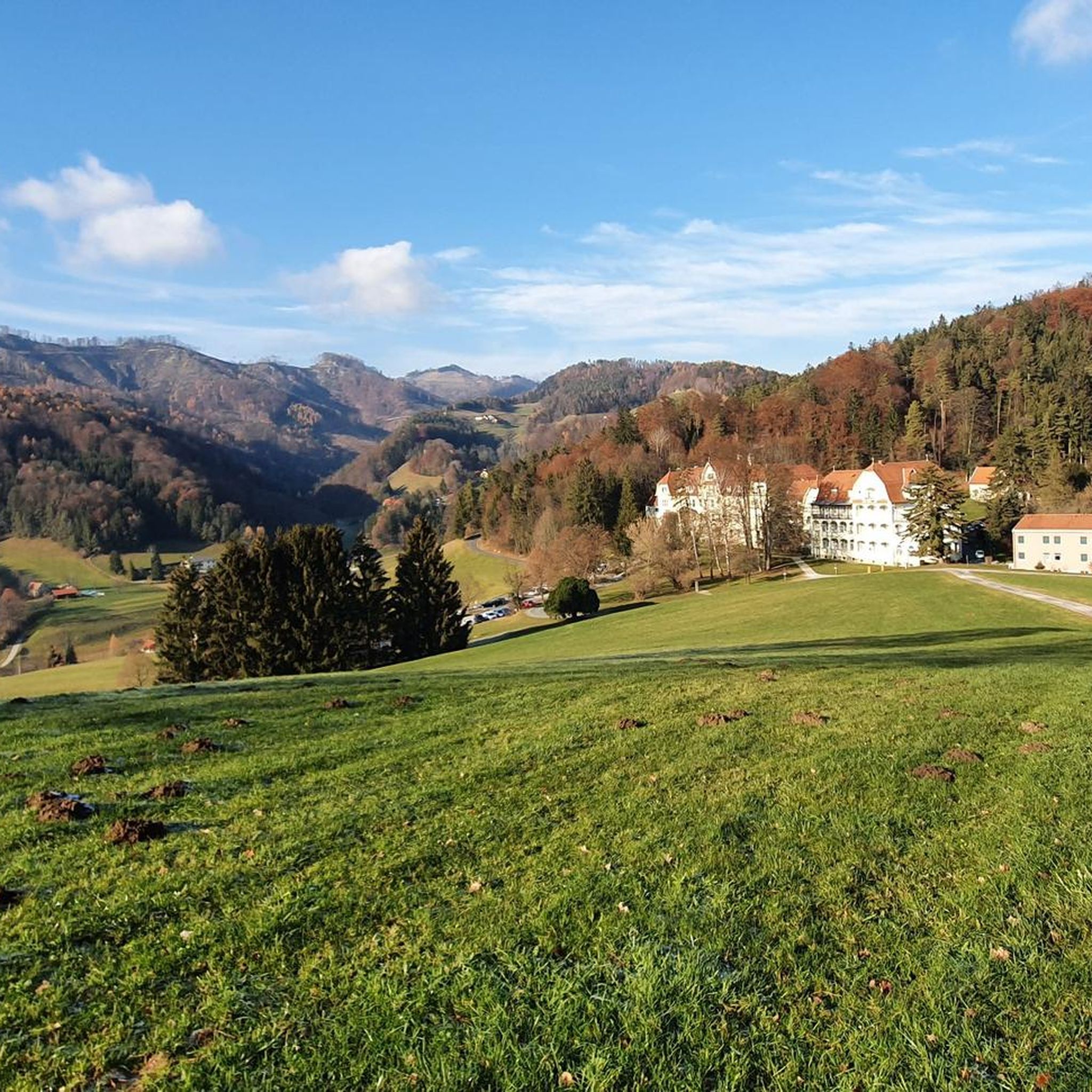
Jogging in Naturschutzgebiet Pfaffenkogel-Gsollerkogel offers diverse landscapes for runners. This nature reserve, situated north of Graz, features the Pfaffenkogel (730m) and Gsollerkogel (670m) ridges, which run parallel to the Murtal. The terrain includes overgrown forest roads, dolomite formations with stair-like steps, and varied gradients suitable for different fitness levels. Runners can experience forested areas, temporary streams, and panoramic views of the Graz mountains and the Murtal.
Best jogging routes in Naturschutzgebiet Pfaffenkogel-Gsollerkogel
- The most popular jogging route is Running loop…
Last updated: July 8, 2026
6
runners
6.36km
00:42
120m
120m
Moderate run. Good fitness required. Mostly paved surfaces. Suitable for all skill levels.
5
runners
9.61km
01:18
330m
330m
Hard run. Very good fitness required. Sure-footedness, sturdy shoes and alpine experience required.

Sign up for free
63
runners
Hard run. Very good fitness required. Sure-footedness, sturdy shoes and alpine experience required.
26
runners
6.53km
00:42
40m
40m
Moderate run. Good fitness required. Mostly paved surfaces. Suitable for all skill levels.
11
runners
9.15km
01:03
150m
150m
Hard run. Good fitness required. Sure-footedness, sturdy shoes and alpine experience required.
Get access to more routes and recommendations from other explorers.
Sign up for free
Already have an account?
Our route recommendations are based on thousands of hikes, rides, and runs completed by other people on komoot.
Start today with a free account
Your next adventure awaits.
Login or Signup
Popular around Naturschutzgebiet Pfaffenkogel-Gsollerkogel
Cycling in Naturschutzgebiet Pfaffenkogel-Gsollerkogel
MTB Trails in Naturschutzgebiet Pfaffenkogel-Gsollerkogel
Road Cycling Routes in Naturschutzgebiet Pfaffenkogel-Gsollerkogel
Hiking in Naturschutzgebiet Pfaffenkogel-Gsollerkogel

Mountain Hikes in Naturschutzgebiet Pfaffenkogel-Gsollerkogel

Gravel biking in Naturschutzgebiet Pfaffenkogel-Gsollerkogel
Tips from the Community

e.g. small-scale folk concerts
0
0

Great highlight to quickly cross the Mur.
0
0

🏝️ The Mur Beach is located directly on the Mur Promenade at the level of the HTL Ortwein in Korösistraße. BEACH VOLLEYBALL - CAFÉ - GARDEN - BEACH BAR https://www.murbeach.at
5
0
🍹 Mur Beach Makartgasse 30 8010 Graz
5
0

The Graz Mur cycle path is always a pleasure to ride, run, walk or walk. The Murinsel invites you to have a cafe with cake. It's simply beautiful to explore the cycle path in Graz.
0
0

An unusual landmark in the water. A floating shell connected to both banks via two footbridges. It houses a café and an amphitheater.
0
0

An object created by New York artist and designer Vito Acconci
4
0

The city of Graz was European Capital of Culture in 2003. Both the new art museum, the "friendly alien", and the Murinsel were built for this occasion. Today, both are fixed components of modern architecture in Graz. The Murinsel not only connects the two banks of the Mur. Inside there is also a cafe with a unique ambience surrounded by the river.
2
0
Frequently Asked Questions
What kind of terrain can I expect on the running trails in Naturschutzgebiet Pfaffenkogel-Gsollerkogel?
The nature reserve offers a diverse range of running surfaces and gradients. You'll find everything from easily accessible paths suitable for all fitness levels to more challenging routes with steeper ascents and descents. Many trails feature overgrown forest roads, providing a natural, softer running surface. The geological makeup, particularly on the Pfaffenkogel, includes dolomite formations with 'stair-like steps' and rugged walls, offering a unique and varied experience.
Are there any easy or beginner-friendly running routes in the Naturschutzgebiet Pfaffenkogel-Gsollerkogel?
Yes, while some routes are challenging, there are options for beginners. For example, the Running loop from Rein Abbey is a moderate 4.0-mile (6.4 km) trail that offers a mix of natural paths and views near the historic Rein Abbey, making it a good choice for those looking for a less strenuous run.
Can I bring my dog on the running trails in Naturschutzgebiet Pfaffenkogel-Gsollerkogel?
Generally, dogs are welcome on trails in the nature reserve, but it's always best to keep them on a leash, especially in forested areas and near wildlife. Be mindful of other runners and hikers. Always carry water for your dog and clean up after them.
Are there any circular running routes available?
Many of the running paths in the area are designed as loops, allowing you to start and finish at the same point. For instance, the Running loop from Stübing is a difficult 6.0-mile (9.6 km) circular path that features varied terrain and passes near the Austrian Open-Air Museum Stübing.
What are the best times of year to go running in Naturschutzgebiet Pfaffenkogel-Gsollerkogel?
The nature reserve is beautiful year-round. Spring and autumn offer pleasant temperatures and vibrant scenery. Summer provides shade in the forested areas, while winter can transform the landscape into a serene, snowy wonderland, though some trails might be more challenging due to ice or snow. Always check local weather conditions before heading out.
Are there any scenic viewpoints or attractions along the running routes?
Absolutely! Joggers can enjoy panoramic views of the Graz mountains and the Murtal. Specific viewpoints offer stunning vistas. You might also encounter the Pfaffenkogel summit itself, or the View of the Mur Valley. The Austrian Open-Air Museum, Stübing is also a notable cultural landmark in the area.
How many running routes are there in Naturschutzgebiet Pfaffenkogel-Gsollerkogel?
There are over 100 dedicated running routes in Naturschutzgebiet Pfaffenkogel-Gsollerkogel, catering to various fitness levels and preferences. This includes a mix of easy, moderate, and difficult trails, ensuring there's something for every runner.
What do other runners enjoy most about jogging in Naturschutzgebiet Pfaffenkogel-Gsollerkogel?
The area is highly rated by the komoot community, with an average score of 4.3 stars from over 60 reviews. Runners often praise the diverse landscapes, the refreshing forested areas, and the stunning panoramic views. The variety of terrain, from soft forest paths to more challenging dolomite formations, is also frequently highlighted.
Are there any routes that pass by water features or waterfalls?
The eastern slopes of the nature reserve feature several temporary water-bearing streams. While not always large waterfalls, these add to the scenic beauty and natural atmosphere of the trails. Some areas are known for their 'waterfall hikes', offering a refreshing element to your run.
Are there any family-friendly running options in the nature reserve?
Yes, there are paths suitable for families, particularly those looking for easier, less strenuous runs. These routes often feature more even terrain and less elevation gain. Always check the route details for distance and difficulty to ensure it's appropriate for your family's fitness level.
Where can I park when visiting the running trails?
Parking is generally available near popular trailheads and access points to the nature reserve. For example, if you plan to run the Mur Hydroelectric Power Plant loop from Deutschfeistritz, you would typically find parking options in or around Deutschfeistritz. It's advisable to check specific route starting points for the most convenient parking.
Can I reach the running trails using public transport?
Public transport options are available to reach the vicinity of the nature reserve. Depending on your starting point, you might use buses or trains to get to nearby towns like Gratwein-Gratkorn or Deutschfeistritz, from where you can access various trailheads. For instance, the Mur Beach loop from Gratwein-Gratkorn is easily accessible if you arrive by public transport in Gratwein-Gratkorn.
Are there any places to eat or drink near the running routes?
Yes, you'll find options for refreshments in the surrounding areas. For example, the Mostschenke Hörgasbauer is a local establishment where you can enjoy traditional food and drinks. Nearby towns also offer cafes and restaurants for a post-run meal or coffee.
Most popular routes in Naturschutzgebiet Pfaffenkogel-Gsollerkogel
Most popular attractions in Naturschutzgebiet Pfaffenkogel-Gsollerkogel

Get inspired with the komoot mobile app


Explore more
Browse the best Running Trails & Routes in other regions.
