The best walks and hikes in Stora Bötet
4.5
(47)
250
hikers
15
hikes
Hiking in Stora Bötet offers diverse trails through a landscape characterized by extensive marshlands, including bogs and fens, which are significant for nature conservation. The region features Gälkhyttedammen, a tarn surrounded by reeds, and elevated terrain like Bötesberget. The Sörmlandsleden trail traverses the area, providing access to these natural features.
Best hiking trails in Stora Bötet
- The most popular hiking route is View of the Lake with Island – Serene Forest Lake loop from Stora Bötet, a 3.9 miles…
Last updated: June 29, 2026
5.0
(7)
19
hikers
Easy hike. Great for any fitness level. Easily-accessible paths. Suitable for all skill levels.
4.7
(14)
71
hikers
8.49km
02:15
80m
80m
Moderate hike. Good fitness required. Mostly accessible paths. Sure-footedness required.

Sign up for free
4.0
(2)
15
hikers
8.04km
02:07
70m
70m
Moderate hike. Good fitness required. Easily-accessible paths. Suitable for all skill levels.
5.0
(2)
12
hikers
6.37km
01:42
70m
70m
Moderate hike. Great for any fitness level. Mostly accessible paths. Sure-footedness required.
2
hikers
22.4km
05:50
150m
150m
Hard hike. Very good fitness required. Easily-accessible paths. Suitable for all skill levels.
Get access to more routes and recommendations from other explorers.
Sign up for free
Already have an account?
Our route recommendations are based on thousands of hikes, rides, and runs completed by other people on komoot.
Start today with a free account
Your next adventure awaits.
Login or Signup
Popular around Stora Bötet
Tips from the Community

Super small village shop with a coffee corner and pastries! The shop next door is also quite well stocked
0
0

Line 561 goes directly to the bus station in Nyköping.
0
0
A friendly neighbor from the nearby settlement brought two deck chairs to the shelter. After a long day of hiking and lugging a backpack, it provided a relaxing and refreshing experience.
0
0

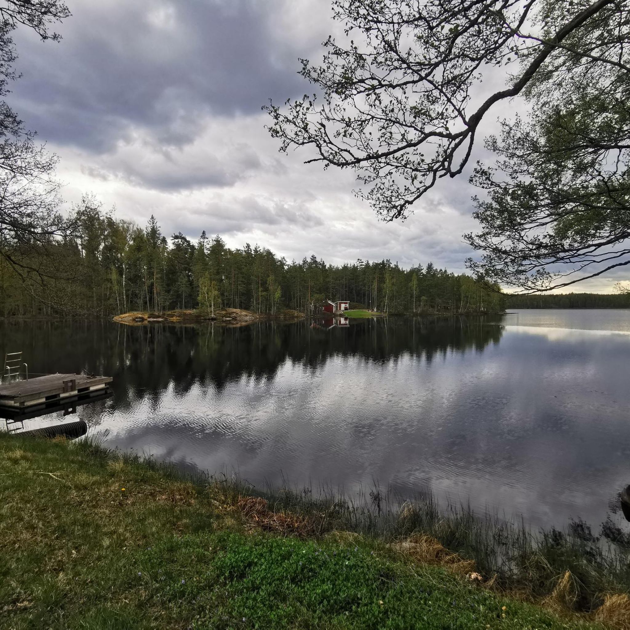
Wonderful view of the lake
0
0

The trail in this area passes by several old copper mines of varying sizes, but this is probably one of the biggest and most interesting one.
1
0
There is a particularly interesting little bridge here as well as a small bench on one side. The bridge passes over a small dried out canal.
1
0
Kärrgruvan is a particularly large historic iron ore mine. In the area are lots of other smaller mines, and there is a short round-trip path that passes by some of them. Here is also a shelter with a fireplace and picnic tables. There is an outhouse/privy, and if you follow the signs there is a simple drinking water well along the path to the north of the shelter. When I visited the firewood had run out and the water well had only a very low water level in it, but the water did look reasonably ok.
2
0
After passing the road, the trail climbs steeply up to this point where you'll find the entrance of an old mine. There is nothing else to see here, so the trail climbs right back down again afterwards.
1
0
Frequently Asked Questions
How many hiking trails are available in Stora Bötet?
There are over 15 hiking routes in Stora Bötet, offering a variety of experiences through its unique natural landscape. These trails are highly rated by the komoot community, with an average score of 4.6 stars.
What kind of landscapes can I expect to see while hiking in Stora Bötet?
Stora Bötet is characterized by extensive marshlands, including both bogs and fens, making it one of Södermanland's largest marsh areas. You'll encounter sparsely covered marsh plains with low-growing pine trees, and flora like bog-rosemary, cranberries, and crowberry. The eastern part features Gälkhyttedammen, a tarn surrounded by reeds, and elevated terrain like Bötesberget, which offers scenic views.
Are there any easy hiking trails suitable for beginners or families in Stora Bötet?
Yes, Stora Bötet offers several easy trails. One popular option is the View of the Lake with Island – Serene Forest Lake loop from Stora Bötet, which is 3.9 miles (6.3 km) long and takes about 1 hour 37 minutes to complete, offering tranquil forest lake views.
Are there any circular hiking routes in Stora Bötet?
Many of the trails in Stora Bötet are designed as circular routes. For example, the Wooden dock with seating – View of the Sea loop from Nävekvarn is a moderate 5.2-mile (8.4 km) loop featuring coastal views. The Sörmlandsleden trail also has a circular loop leading up to Bötesberget within the reserve.
What is the best time of year to visit Stora Bötet for hiking and nature observation?
Stora Bötet is excellent for hiking and birdwatching, especially in late winter or early spring when you might witness the spectacular lek of black grouse on the marsh. Spring and autumn offer beautiful scenery and comfortable hiking temperatures. The area is also home to breeding cranes and various duck and wader species, with owls present in good numbers in certain years.
Are there any challenging or longer hikes in Stora Bötet?
Yes, for those seeking a more challenging experience, the Svartåhällen Shelter – Large historic copper mine loop from Nävekvarn is a difficult 13.9-mile (22.4 km) route that takes approximately 5 hours 50 minutes to complete, offering a longer adventure through varied terrain.
What do other hikers enjoy most about the trails in Stora Bötet?
Hikers frequently praise the diverse terrain, from extensive marshlands to elevated viewpoints, and the serene natural environment. The komoot community has given the routes an average rating of 4.6 stars, highlighting the well-maintained paths and the opportunity to experience unique Swedish nature.
Are there any trails that offer coastal views or lead to the sea?
Yes, the Wooden dock with seating – View of the Sea loop from Nävekvarn is a moderate 5.2-mile (8.4 km) path that provides beautiful coastal views and features a wooden dock with seating, perfect for a break.
Can I access Stora Bötet trails using public transport?
Some trails are accessible from public transport hubs. For instance, the Nävekvarn bus stop – Wooden dock with seating loop from Nävekvarn is a 3.9-mile (6.3 km) trail that starts conveniently from a bus stop, making it accessible without a car.
Are there any trails that pass by interesting natural features like tarns or viewpoints?
Many trails in Stora Bötet offer views of its distinctive natural features. You can explore routes that lead past Gälkhyttedammen, a notable tarn, or ascend Bötesberget, which is part of the Sörmlandsleden trail and provides elevated perspectives of the surrounding marshland.
What is the longest hiking route available in Stora Bötet?
The longest route listed is the Svartåhällen Shelter – Large historic copper mine loop from Nävekvarn, which spans 13.9 miles (22.4 km) and is classified as difficult, taking nearly 6 hours to complete.
Are there any moderate difficulty trails for hikers looking for a bit more challenge than easy routes?
Absolutely. A good moderate option is the Drinking water source (murky) – Nävsjömossen shelter loop from Nävekvarns klint. This trail is 9.8 miles (15.8 km) long and takes approximately 4 hours to complete, offering a balanced challenge.

Get inspired with the komoot mobile app


Explore more
Browse the best Hikes in other regions.
