The best walks and hikes in Gausdalen Naturreservat
4.6
(557)
3,623
hikers
50
hikes
Hiking in Gausdalen Naturreservat offers access to a preserved high-altitude forest and mountainous terrain within Telemark, Norway. The region is characterized by varied elevation changes, numerous mountain lakes, and proximity to Gaustatoppen, known for its panoramic views. This natural reserve provides a diverse environment for outdoor activities, ranging from forest paths to exposed mountain trails.
Best hiking trails in Gausdalen Naturreservat
- The most popular hiking route is Gaustatoppen from Selstali Seter Trail, a 9.9 miles (16.0 km) trail that takes 7 hours 24 minutes to complete. This difficult route offers significant elevation gain towards panoramic views from Gaustatoppen.
- Another top favourite among local hikers is Mana River Riverside Path – Railway Bridge loop from Rjukan, a moderate 4.8 miles (7.7 km) path. This trail follows the Mana River, providing a less strenuous option through varied scenery.
- Local hikers also love the Haddelandsveien and Ryes Veg Trail, a 6.3 miles (10.2 km) trail leading through mountainous terrain with varied elevation, often completed in about 3 hours 54 minutes.
- Hiking in Gausdalen Naturreservat is defined by high-altitude forests, scenic mountain lakes, and challenging ascents to viewpoints like Gaustatoppen. The network offers options for different ability levels, from moderate riverside paths to difficult mountain treks.
- The routes in Gausdalen Naturreservat are highly rated by the komoot community with an average score of 4.6 stars from more than 400 reviews. More than 3000 hikers have used komoot to explore Gausdalen Naturreservat's varied terrain.
Last updated: July 10, 2026
4.3
(6)
33
hikers
16.0km
07:24
960m
960m
Hike the challenging 9.9-mile Gaustatoppen via Gausdalen Nature Reserve trail, gaining 3146 feet for panoramic Norwegian views.
5.0
(2)
9
hikers
7.70km
02:06
120m
120m
Moderate hike. Good fitness required. Easily-accessible paths. Suitable for all skill levels.

Sign up for free
3
hikers
4.28km
01:07
40m
30m
Easy hike. Great for any fitness level. Easily-accessible paths. Suitable for all skill levels.
3.8
(5)
26
hikers
10.2km
03:52
680m
680m
Hike the Haddelandsveien and Ryes Veg Trail, a moderate 6.3-mile route in Vestfjorddalen Naturreservat with 2226 feet of elevation gain.
4.7
(43)
232
hikers
Hard hike. Very good fitness required. Sure-footedness, sturdy shoes and alpine experience required.
Get access to more routes and recommendations from other explorers.
Sign up for free
Already have an account?
Our route recommendations are based on thousands of hikes, rides, and runs completed by other people on komoot.
Start today with a free account
Your next adventure awaits.
Login or Signup
Popular around Gausdalen Naturreservat
Tips from the Community

The cable car is currently out of service due to renovations. Recommissioning is currently planned for 2028.
0
0

Breathtaking and impressive views of the surrounding mountains and fjords. Simply magnificent!
2
0
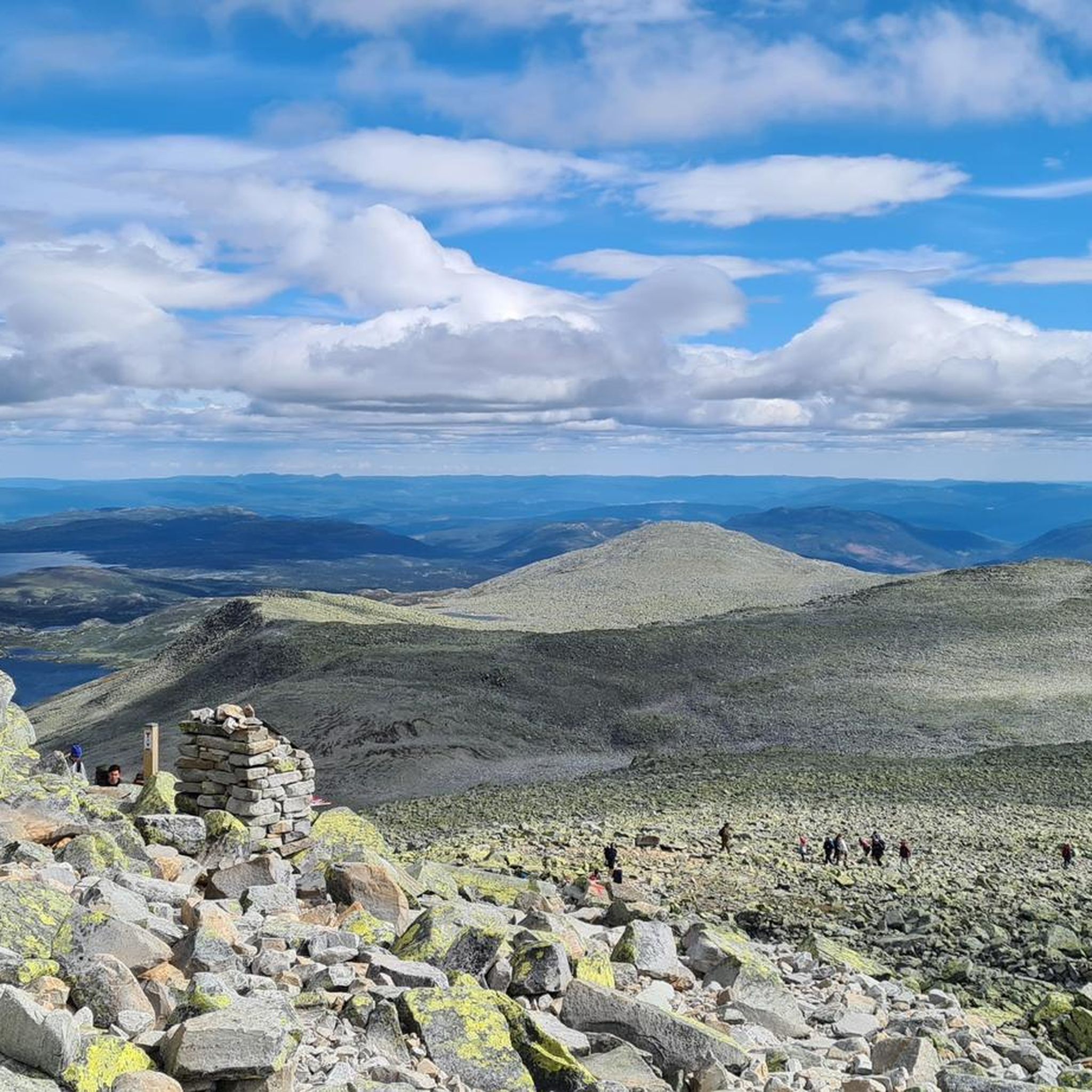
At 1,883 meters, Gaustatoppen is the highest mountain in the Telemark province. On a clear day, the summit offers impressive panoramic views of up to one-sixth of Norway. You can either hike to the summit or take the Gaustatoppen funicular, a convenient ride through the mountain's interior. The Gaustatoppen Tourist Inn awaits you at the summit. Not only can you stay overnight here, but you can also refuel with delicious waffles that taste simply delicious with such a breathtaking view! 😋😋
1
0

Beautiful old railway bridge in Rjukan over the Måna River. Next to it is a bridge for cars.
0
0
The cable car is currently not in operation. It is currently scheduled to reopen in 2028.
3
0

From here, you can not only reach the summit, but also the more easily accessible, broad ridge of Gaustatoppen. The view from here also rewards the climb through the scree.
2
0
Gaustatoppen is several hundred meters higher than the surrounding mountains, and during the last ice age the peak rose above the ice sheet like a nunatak. Frost heaving over thousands of years has caused the mountain's surface to crack into blocks that now lie loose, forming a "block sea". But that's just on the outside. Just below the surface is solid rock, almost the hardest rock there is. That's why the peak is so high.
3
0

A popular and straightforward route that features a hefty amount of elevation gain. However, two rewards await you at the summit. First, there are the magnificent views of the mountains of the mountains of Telemark, Buskerud, and the Oslomarka. Second, there's the thrilling run back down.
0
0
Frequently Asked Questions
What kind of terrain can I expect when hiking in Gausdalen Naturreservat?
Gausdalen Naturreservat is characterized by its unique, high-lying, and relatively untouched high-altitude forest, combined with mountainous terrain. You'll encounter varied elevation changes, including three named peaks: Nybunuten, Hovdenuten, and Gausta. Many trails also feature beautiful mountain lakes, adding to the scenic beauty.
Are there hiking options for all skill levels in Gausdalen Naturreservat?
Yes, the reserve offers a diverse range of hiking experiences suitable for various skill sets. You can find everything from easy walks perfect for families to more demanding routes that require good fitness and sure-footedness. Overall, there are 47 hiking trails, with 17 rated as easy, 18 as moderate, and 12 as difficult.
What do other hikers enjoy most about the trails in Gausdalen Naturreservat?
The trails in Gausdalen Naturreservat are highly rated by the komoot community, with an average score of 4.6 stars from over 470 reviews. Hikers often praise the stunning panoramic views, especially those accessible from Gaustatoppen, and the opportunity to experience a relatively untouched natural environment with high-altitude forests and picturesque mountain lakes.
What are the main natural features or landmarks to look out for in Gausdalen Naturreservat?
The primary natural features include the preserved high-altitude forest, several scenic mountain peaks like Nybunuten, Hovdenuten, and Gausta, and numerous beautiful mountain lakes such as Vatnedalstjønn, Svartetjønn, and Kyrstjønn. The reserve's proximity to Gaustatoppen also means many routes offer access to its iconic panoramic views.
Are there any trails that offer panoramic views?
Absolutely. Many hikes in and around Gausdalen Naturreservat lead to breathtaking panoramic views, particularly those connecting to Gaustatoppen. For example, the difficult Gaustatoppen from Selstali Seter Trail offers significant elevation gain towards the summit, where on a clear day, you can reportedly see up to one-sixth of Norway.
Can I find trails that pass by lakes in the reserve?
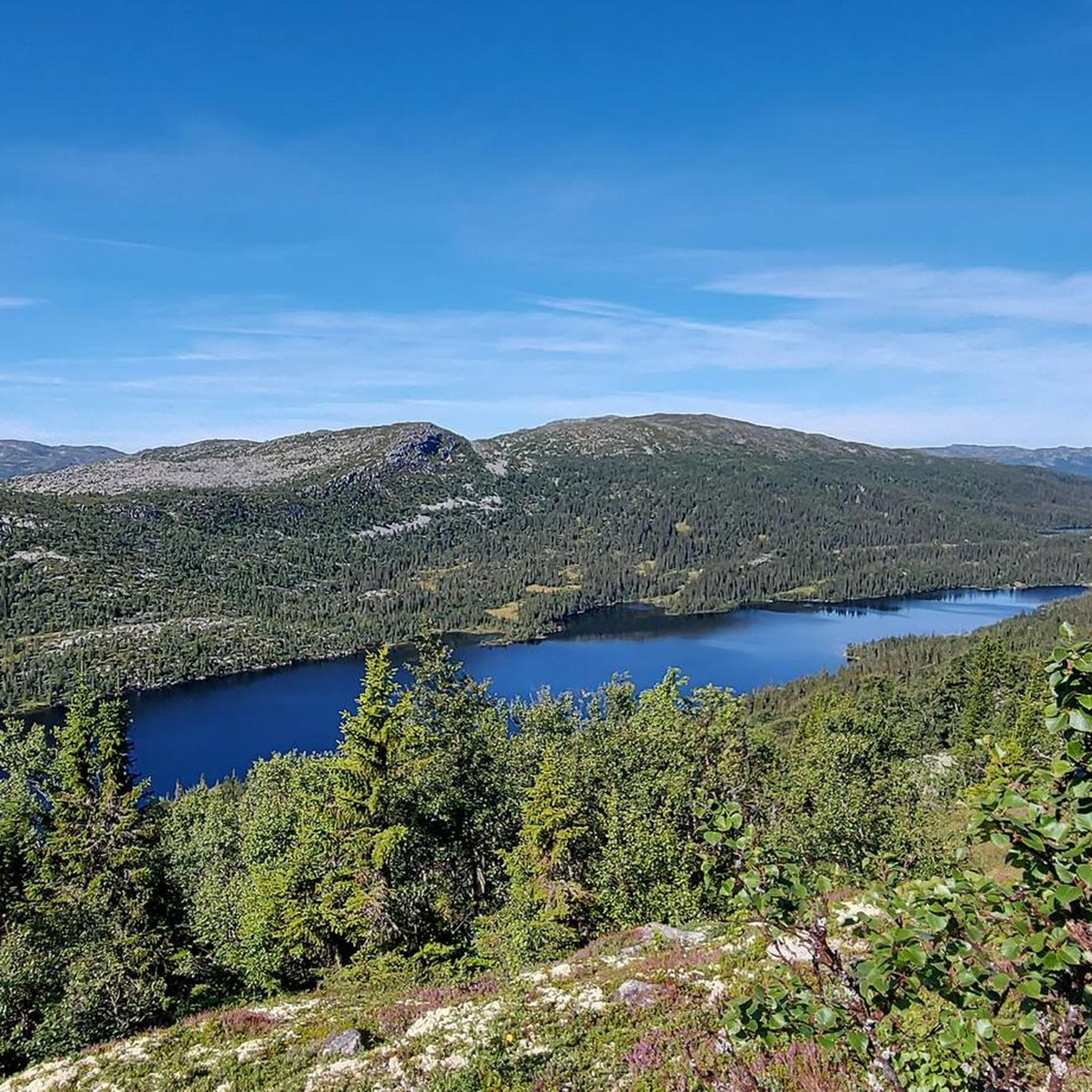
Yes, several hiking routes within Gausdalen Naturreservat feature beautiful mountain lakes. The area is known for its numerous lakes, including Vatnedalstjønn, Svartetjønn, and Kyrstjønn, which add tranquil and scenic elements to many treks. Some trails, like those leading towards Gaustatoppen from Selstali Seter, guide hikers past these serene bodies of water.
Are there family-friendly hiking trails in Gausdalen Naturreservat?
While some routes are challenging, there are also easier options suitable for families. These trails typically involve less strenuous elevation changes and shorter durations, allowing for an enjoyable outdoor experience for all ages. Look for trails marked as 'easy' in the komoot guide.
Is Gausdalen Naturreservat accessible by public transport?
Information on direct public transport access specifically to Gausdalen Naturreservat is limited. However, the region is part of Telemark, Norway, and Rjukan is a nearby town. For detailed information on reaching the area, especially trailheads, it's advisable to check local transport options or consider driving.
Where can I park when visiting Gausdalen Naturreservat?
Specific parking information for Gausdalen Naturreservat trailheads is not detailed in the guide. However, for routes like the Gaustatoppen from Selstali Seter Trail, parking is typically available at or near the Selstali Seter starting point. It's recommended to research specific trailhead parking in advance of your visit.
What is the best time of year to hike in Gausdalen Naturreservat?
The best time to hike in Gausdalen Naturreservat is generally during the warmer months, from late spring to early autumn (roughly June to September). During this period, the trails are typically free of snow, and the weather is more favorable for exploring the high-altitude forests and mountainous terrain. Always check local weather conditions before heading out.
Are there any circular hiking routes in the reserve?
Yes, there are circular routes available. For example, the moderate Mana River Riverside Path – Railway Bridge loop from Rjukan offers a loop experience following the Mana River, providing a less strenuous option through varied scenery. Other routes may also offer loop variations or can be combined for circular treks.
What is the typical duration for hikes in Gausdalen Naturreservat?
Hiking durations vary significantly depending on the trail's difficulty and length. Easy walks can be under two hours, while moderate trails like the Haddelandsveien and Ryes Veg Trail typically take around 3 hours 54 minutes. More challenging routes, such as the Gaustatoppen from Selstali Seter Trail, can take over 7 hours to complete.
Most popular routes in Gausdalen Naturreservat

Get inspired with the komoot mobile app


Explore more
Browse the best Hikes in other regions.
