The best running trails in Dryander National Park
3.6
(5)
498
runners
4
runs
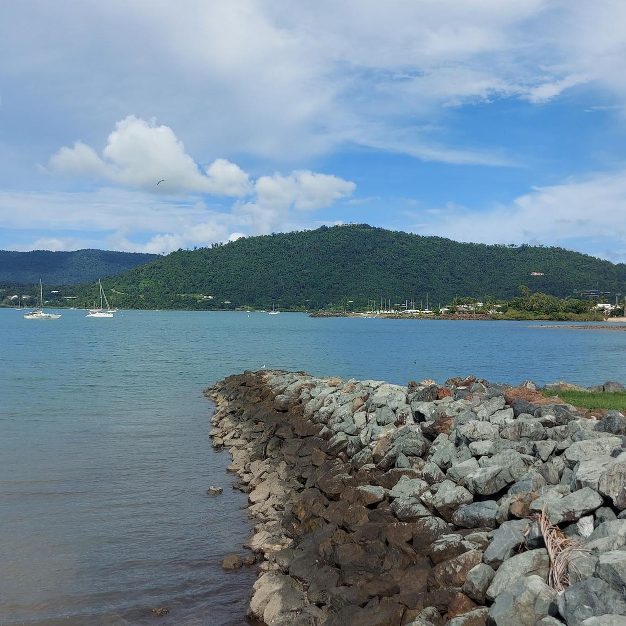
Jogging in Dryander National Park offers routes through diverse landscapes, including rugged mountain terrain, lush forests, and pristine coastline. The park features bulky hills and steep ridges, remnants of ancient volcanic activity, providing elevation challenges. Varied ecosystems, from vine thickets to old-growth forests, offer shaded and visually engaging running experiences. Seasonal rivers and creeks contribute to the scenic beauty, while coastal stretches provide ocean views.
Best jogging routes in Dryander National Park
- The most popular jogging route is Airlie Beach…
Last updated: July 10, 2026
22
runners
17.8km
01:52
170m
170m
Hard run. Very good fitness required. Mostly paved surfaces. Suitable for all skill levels.
5.0
(1)
112
runners
Easy run. Great for any fitness level. Mostly paved surfaces. Suitable for all skill levels.

Sign up for free
3.7
(3)
267
runners
Moderate run. Good fitness required. Mostly paved surfaces. Suitable for all skill levels.
2.0
(1)
89
runners
Moderate run. Good fitness required. Mostly paved surfaces. Suitable for all skill levels.
8
runners
13.0km
01:23
170m
170m
Moderate run. Good fitness required. Mostly paved surfaces. Suitable for all skill levels.
Our route recommendations are based on thousands of hikes, rides, and runs completed by other people on komoot.
Start today with a free account
Your next adventure awaits.
Login or Signup
Popular around Dryander National Park
Tips from the Community

Port of Airlie Marina is a major waterfront transportation hub, serving as a main departure point for ferries and providing easy boating access to the Whitsunday Islands. The marina includes berths, a ferry terminal, and a variety of shops and small cafés, all with stunning views of the Coral Sea. Connected to the town centre and adjacent to scenic walkways, this transportation gateway is a charming spot to visit while exploring the beautiful coastline.
0
0
Airlie Beach Lagoon is a large, artificial swimming facility nestled along the Coral Sea foreshore in the heart of Airlie Beach. There are beautifully landscaped lawns, shaded areas, and shallow entry spots, providing a safe, stinger-free place to swim year-round. Adjacent to the town centre and coastal walkway, it’s an accessible and picturesque spot to relax while exploring the Whitsundays gateway.
0
0

Very worth seeing, you have to see it
0
1
Very worth seeing, you have to see it
0
1

Ideal for swimming a few laps in the morning
0
0
Frequently Asked Questions
How many running routes are available in Dryander National Park?
Dryander National Park offers several dedicated running routes. Our guide features 7 distinct trails, ranging from easy to difficult, allowing you to explore the park's diverse landscapes.
What kind of terrain can I expect on the jogging trails in Dryander National Park?
The running trails in Dryander National Park feature a variety of terrain. You can expect rugged mountain paths, lush forest sections with vine thickets and old-growth trees, and pristine coastal stretches offering ocean views. Some routes include significant elevation gain, while others are flatter.
Are there any challenging running routes for experienced runners?
Yes, for experienced runners seeking a challenge, Dryander National Park has routes with significant elevation gain. For example, the Airlie Beach Lagoon loop from Airlie Beach is a difficult 10.9-mile (17.6 km) path that features substantial climbing and coastal scenery.
Are there any easier or moderate jogging options for beginners or casual runners?
Absolutely. Dryander National Park offers several moderate routes suitable for beginners or those looking for a less strenuous run. The Airlie Beach Lagoon loop from Cannonvale is a popular moderate 5.4-mile (8.7 km) trail with views of the Airlie Beach Lagoon, typically completed in under an hour.
What are the best times of year to go running in Dryander National Park?
The best time to go running in Dryander National Park is generally outside of the wet season (typically November to April) when humidity is high and marine stingers are present in coastal waters (October to May). Cooler, drier months offer more comfortable conditions. Always check local weather and park alerts before your visit.
What kind of views or natural features can I expect to see while running?
Jogging in Dryander National Park offers spectacular natural beauty. You'll encounter diverse forests, seasonal rivers and creeks, and stunning coastal vistas. From higher elevations, such as Mount Dryander, you can enjoy panoramic views of the surrounding seascape and the Whitsunday Islands.
Is Dryander National Park accessible by public transport, or do I need a car?
Access to Dryander National Park is primarily by boat from Airlie Beach or Dingo Beach. While the park itself doesn't have extensive public transport options, you would typically need to arrange boat transport to reach the park's entry points. The routes mentioned in this guide are generally accessible from the Airlie Beach area.
What do other runners say about the trails in Dryander National Park?
The running routes in Dryander National Park are highly regarded by the komoot community, with an average rating of 4.1 stars from over 10 reviews. More than 1000 runners have used komoot to explore the park's varied terrain, often praising the scenic beauty and diverse landscapes.
Are there any circular running routes in the park?
Yes, many of the popular running routes in the area are circular loops, offering a convenient way to start and finish your run at the same point. For instance, the Airlie Beach Lagoon loop from Jubilee Pocket is a moderate 3.8-mile (6.2 km) circular trail.
Can I spot any wildlife while jogging in Dryander National Park?
Dryander National Park is a critical habitat for various species, so wildlife spotting is possible. Keep an eye out for the Proserpine rock-wallaby, ghost bats, and coastal sheath-tail bats. The coastal areas also support marine life like dugongs and marine turtles, though these are less likely to be seen directly from running trails.
Are there any long-distance running options in Dryander National Park?
For those looking for longer distances, Dryander National Park offers routes that can extend your run. The Airlie Beach Lagoon loop from Flametree is a moderate 8.1-mile (13 km) route, providing a good option for a longer endurance run.
What should I be aware of regarding safety when running in Dryander National Park?
When running in Dryander National Park, it's important to be self-sufficient, especially as access is primarily by boat. Be aware of marine stingers in coastal waters from October to May. Always carry enough water, inform someone of your plans, and check park alerts for any closures or conditions before heading out. The rugged terrain can also present challenges, so wear appropriate footwear.

Get inspired with the komoot mobile app


Explore more
Browse the best Running Trails & Routes in other regions.
