The best cycling routes in Thomsons Lake Nature Reserve
4.6
(41)
330
riders
13
rides
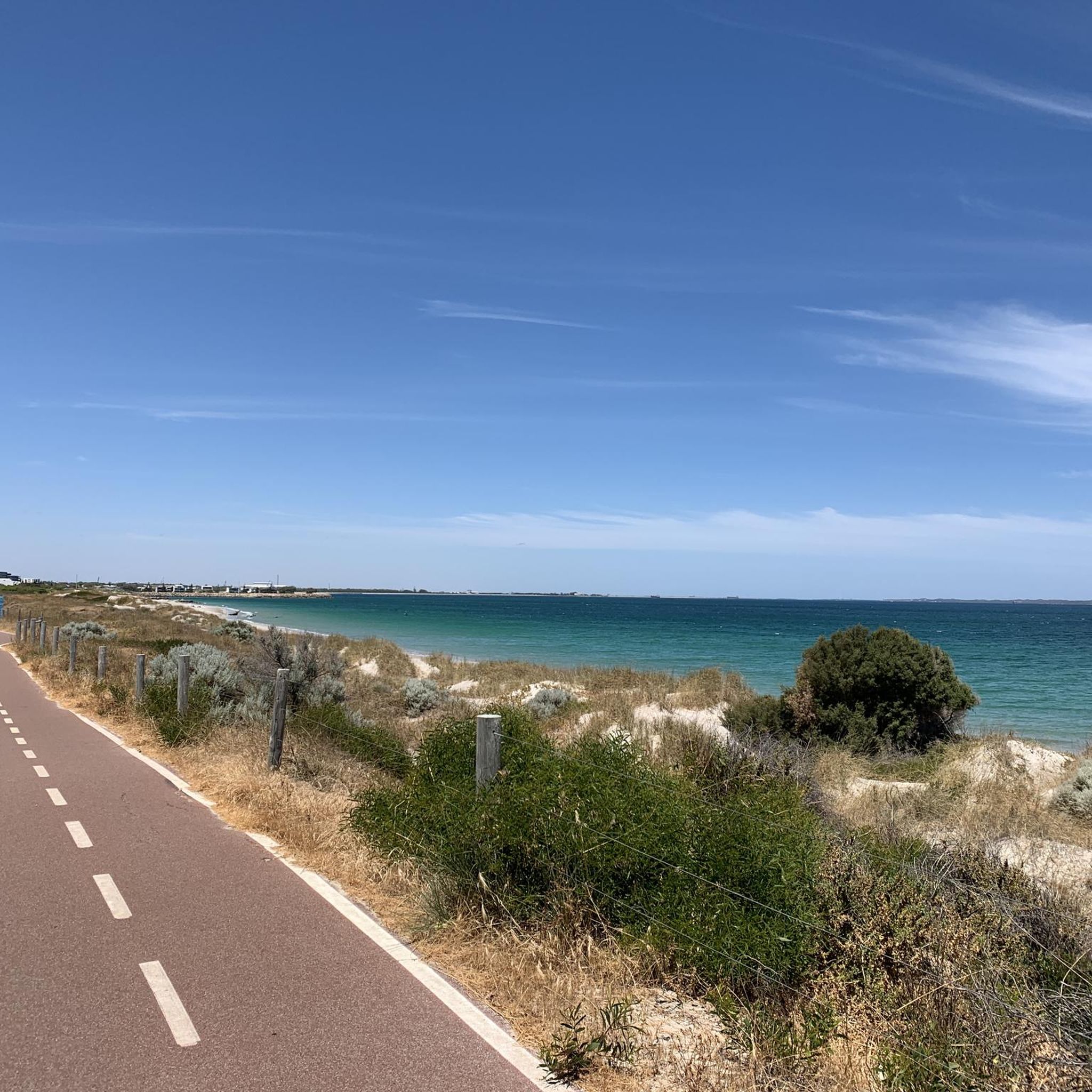
Touring cycling in Thomsons Lake Nature Reserve offers routes through a natural park environment, characterized by the presence of Thomsons Lake itself and surrounding natural areas. The terrain generally features gentle elevation changes, with some routes extending towards river views. This region provides a setting for cycling that includes both shorter loops within the reserve and longer excursions to nearby points of interest.
Best touring cycling routes in Thomsons Lake Nature Reserve
- The most popular touring cycling route is Bike…
Last updated: October 8, 2026
5.0
(1)
3
riders
11.1km
00:45
80m
80m
Easy bike ride. Great for any fitness level. Mostly paved surfaces. Suitable for all skill levels.
5.0
(1)
43
riders
34.8km
02:01
110m
110m
Moderate bike ride. Good fitness required. Mostly paved surfaces. Suitable for all skill levels.

4.0
(1)
15
riders
73.1km
04:17
330m
330m
Moderate bike ride. Good fitness required. Mostly paved surfaces. Suitable for all skill levels.
5.0
(3)
10
riders
52.9km
03:03
160m
160m
Moderate bike ride. Good fitness required. Mostly paved surfaces. Suitable for all skill levels.
6
riders
37.9km
02:15
150m
150m
Moderate bike ride. Good fitness required. Mostly paved surfaces. Suitable for all skill levels.
Get access to more routes and recommendations from other explorers.
Already have an account?
Our route recommendations are based on thousands of hikes, rides, and runs completed by other people on komoot.
Start today with a free account
Your next adventure awaits.
Popular around Thomsons Lake Nature Reserve


Tips from the Community

Shelley Beach sits along a lovely stretch of the Canning River, with calm water in front of you and a wide grassy foreshore just behind. The suburb actually takes its name from the shells once found along these river beaches, which is a nice detail to keep in mind as you walk the shoreline. There are shaded spots, picnic areas and easy access to the foreshore path if you want to linger.
0
0
Bull Creek is where the foreshore starts to feel a little more sheltered, with reeds, river gums and quieter water replacing some of the broader Canning River views. This estuary is an important habitat for fish and waterbirds, and dolphins are occasionally seen here too. The area is known as Gabbiljee to Whadjuk Noongar people, meaning “watery place at the end of the river,” which suits the landscape perfectly.
0
0
This section of the Kwinana Freeway PSP is much more scenic than the name suggests, running alongside the Canning River and passing several parks and stretches of open green space. You still have the convenience of a wide, sealed shared path, but the river views and quieter surroundings make it feel less like a simple commuter route.
0
0

Mt. Henry Bridge Reserve sits directly in the shadow of the historic Mt. Henry Bridge. It's a popular riverside stop for families, fitness enthusiasts, and walkers with public toilets, manicured grassy picnic fields, park benches, and a large car park. The kids' playgrounds here are a stand-out amenity, with modern design including shade sails. For adults, there's free fitness equipment, the Mt. Henry Jetty and the Kerbside Café.
0
0
Deep Water Point Reserve sits right on The Esplanade and has a lot to offer. It features a large green lawn with picnic areas, a waterfront Dôme Café, two children’s playgrounds, a swimming jetty, and a popular public boat ramp. There is quite a bit of parking available in the car park just to the south. On slower days and weekdays, visitors often enjoy coffee and meals on the waterfront and take a relaxing stroll. On summer weekends and on holidays, free public barbecues churn out food by groups enjoying shaded seating areas and busy boat dock.
0
0

The waterfront path does a little loop at the 'Fragment' sculpture, created by artist Kevin Draper. You can see downtown Perth across the water, and it's possible to follow the trail from here to walk or cycle basically the entire visible coast of the Swan River.
0
0
The Shelley Jetty is a wooden jetty in Shelley Beach Park that has a ladder at the end for swimmers or boaters. It has peaceful views and is just across from some public restrooms.
0
0
Kwinana Freeway PSP is a principal shared path running for over 20 kilometres alongside the freeway, designed mainly for cycling and commuting. It’s fully sealed, mostly flat, and direct. However, around the Swan River section, it feels less like a typical commuter route, with open views across the water and towards the city skyline on the western side.
0
0
Frequently Asked Questions
How many touring cycling routes are available in Thomsons Lake Nature Reserve?
There are over 15 touring cycling routes in Thomsons Lake Nature Reserve, catering to various skill levels. You'll find options ranging from easy loops to more challenging moderate excursions.
Are there any beginner-friendly cycling routes in Thomsons Lake Nature Reserve?
Yes, Thomsons Lake Nature Reserve offers several routes suitable for beginners. An excellent easy option is the Bike loop from Thomsons Lake Nature Reserve, which is 6.9 miles (11.1 km) long and features gentle terrain around the lake.
What kind of terrain can I expect on touring cycling routes in Thomsons Lake Nature Reserve?
The terrain in Thomsons Lake Nature Reserve generally features gentle elevation changes, with routes often following lakeside paths and extending towards river views. You'll experience natural parkland environments, making for a pleasant touring cycling experience.
Are there any circular cycling routes around Thomsons Lake Nature Reserve?
Yes, the region offers circular routes perfect for touring cyclists. The popular Bike loop from Thomsons Lake Nature Reserve is a great example, providing a scenic circuit around the immediate vicinity of the nature reserve.
What are some longer touring cycling options that extend beyond the immediate reserve?
For longer rides, you can explore routes that connect to nearby points of interest. The View of the Canning River – Cottesloe Beach loop from Aubin Grove is a moderate 46.2 miles (74.4 km) trail that takes you towards Cottesloe Beach, offering diverse scenery.
Can I access touring cycling routes in Thomsons Lake Nature Reserve using public transport?
Many routes in the wider Thomsons Lake area are accessible via public transport, particularly those starting from hubs like Aubin Grove or Cockburn Central, which are connected by train and bus services. For example, the View of the Canning River – Canning Bridge loop from Aubin Grove starts near public transport links.
What kind of wildlife might I encounter while cycling in Thomsons Lake Nature Reserve?
Thomsons Lake Nature Reserve is known for its diverse birdlife, especially waterbirds, as it's a significant wetland area. Keep an eye out for various species of ducks, swans, and other migratory birds. You might also spot reptiles and small mammals native to the Australian bushland.
Are there cafes or pubs near the touring cycling routes in Thomsons Lake Nature Reserve?
While Thomsons Lake Nature Reserve itself is a natural area, routes extending into surrounding suburbs like Aubin Grove or Cockburn Central, or towards destinations like Canning Bridge or Cottesloe Beach, will have access to cafes and pubs. For instance, the Shelley Bridge – Kerbside Café loop from Aubin Grove explicitly mentions a café in its name, indicating refreshment stops along the way.
What is the best season for touring cycling in Thomsons Lake Nature Reserve?
The best season for touring cycling in Thomsons Lake Nature Reserve is typically spring (September to November) and autumn (March to May) when the weather is milder and more comfortable. Summers can be very hot, and winters, while mild, might bring more rain.
What do other touring cyclists enjoy most about the routes in Thomsons Lake Nature Reserve?
The touring cycling routes in Thomsons Lake Nature Reserve are highly rated by the komoot community, with an average score of 4.6 stars from over 40 reviews. Cyclists often praise the peaceful lakeside paths, the scenic river views, and the well-maintained natural parkland environment.
Are there any routes with significant elevation gain for a more challenging ride?
While the region generally features gentle elevation changes, some longer routes will accumulate more ascent. For example, the View of the Canning River – Cottesloe Beach loop from Aubin Grove, at 46.2 miles (74.4 km), involves a total elevation gain of approximately 339 meters, offering a more extended workout.
Where can I find parking for touring cycling routes in Thomsons Lake Nature Reserve?
Parking is generally available at key access points around Thomsons Lake Nature Reserve. For routes starting from nearby residential areas or commercial hubs like Aubin Grove or Cockburn Central, you'll find designated parking facilities, often near public transport stations or local amenities.

Get inspired with the komoot mobile app


Explore more
Browse the best Cycling routes in other regions.
