The best road cycling routes in Leda Nature Reserve
4.9
(29)
339
riders
10
rides
Road cycling in Leda Nature Reserve offers diverse landscapes for cyclists. The region features a central chain of lakes and wetlands, bordered by woodlands, and dunes covered by open forests. Cyclists can navigate undulating hill country and small limestone outcrops, providing varied terrain. The reserve's topography contributes to an engaging cycling experience.
Best road cycling routes in Leda Nature Reserve
- The most popular road cycling route is Mt Henry Bridge – Perth Water Bike Trail loop from Wellard, a…
Last updated: July 17, 2026
4.9
(29)
241
riders
81.1km
03:18
280m
280m
Moderate road ride. Good fitness required. Mostly well-paved surfaces and easy to ride.
3
riders
99.6km
04:39
760m
760m
Moderate road ride. Good fitness required. Mostly well-paved surfaces and easy to ride.

Sign up for free
7
riders
Easy road ride. Great for any fitness level. Mostly well-paved surfaces and easy to ride.
5
riders
50.2km
02:11
220m
220m
Moderate road ride. Good fitness required. Mostly well-paved surfaces and easy to ride.
15
riders
17.2km
00:51
20m
20m
Easy road ride. Great for any fitness level. Mostly well-paved surfaces and easy to ride.
Get access to more routes and recommendations from other explorers.
Sign up for free
Already have an account?
Our route recommendations are based on thousands of hikes, rides, and runs completed by other people on komoot.
Start today with a free account
Your next adventure awaits.
Login or Signup
Popular around Leda Nature Reserve

Tips from the Community

Mount Henry Bridge Reserve sits directly in the shadow of the historic Mount Henry Bridge. It's a popular riverside stop for families, fitness enthusiasts, and walkers with public toilets, manicured grassy picnic fields, park benches, and a large car park. The kids' playgrounds here are a stand-out amenity, with modern design including shade sails. For adults, there's free fitness equipment, the Mount Henry Jetty and the Kerbside Café.
0
0

Safety Bay was given its name in 1837 after being identified as a safe location to anchor ships. The area is now surrounded by a suburb of the same name, and the calm, sheltered beach make it a popular destination for families. However, shark activity is common in the area so be sure to check conditions before going and follow all posted signage while visiting the area.
0
0
This shared-use path travels the length of Warnbro Sound with amazing ocean views and beach access along the way. The paved route passes by parks, playgrounds, benches, and BBQs so you can easily spend the day stopping at various location along the way and hopefully ending things with a beautiful sunset.
0
0
Covering over 6,500 hectares the Shoalwater Islands Marine Park protects important ocean habitats for hundreds of species. Visitors can enjoy kayaking, snorkeling, swimming, and diving. There are also wildlife cruises that take you out to the nearby islands to explore even more.
0
0

Millers Pond is a calm wetland area along the South Perth Foreshore, offering one of the best spots for skyline reflections across still water. A short boardwalk leads you out over the pond, framing views of Perth’s city towers beyond the reeds and paperbark trees. It’s a quieter contrast to the open riverfront, with birdlife often around the water’s edge.
0
0
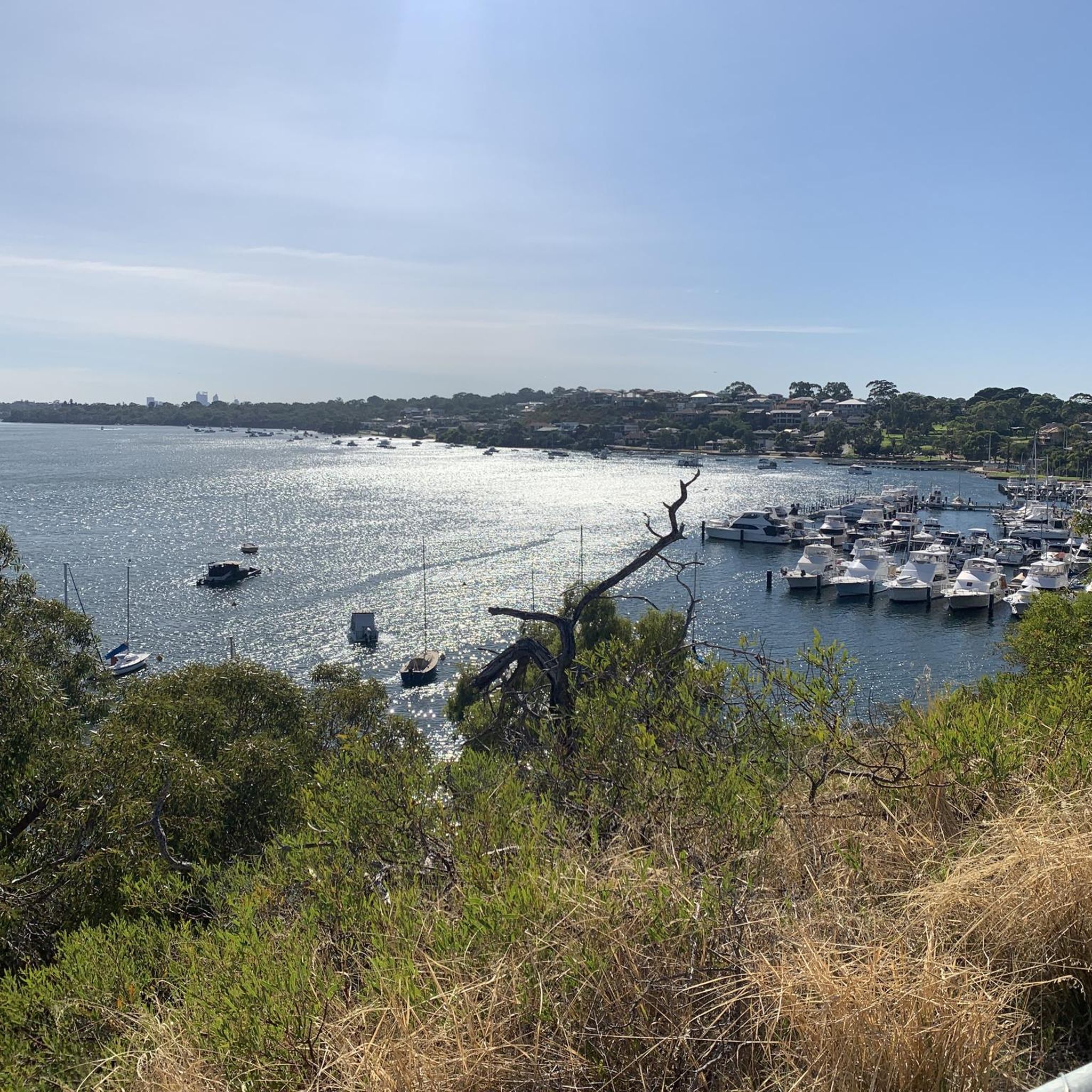
This quiet riverside viewpoint offers one of the best perspectives of the Perth skyline across the Swan River. A bench sits beside the path, making it a great place to pause and take in the cityscape rising above the water. Just below the viewpoint, a small pier extends out into the river, bringing you closer to the water and offering an even clearer look back toward the skyline.
1
0

Canning Bridge is a major road bridge that carries Canning Highway across the Canning River between the suburbs of Applecross and Como. Originally built in the 1930s, this key bridge has been rebuilt several times over the years. Under the bridge, various walking and cycling paths wind along the river, connecting several of the surrounding foreshore parklands and offering plenty of options for exploring this beautiful area.
0
0
Kwinana Freeway Shared Path is a major walking and cycling route that runs alongside the Kwinana Freeway through Perth’s southern suburbs. Part of Perth’s Principal Shared Path (PSP) network, the sealed trail provides a direct corridor used by both recreational users and commuters. This quiet section offers a beautiful view of the Canning River and is ideal for connecting to several river foreshore routes and nearby suburbs.
0
0
Frequently Asked Questions
How many road cycling routes are available in Leda Nature Reserve?
Leda Nature Reserve offers a selection of 9 road cycling routes. These include 5 easy routes and 4 moderate routes, catering to various skill levels.
What is the best time of year for road cycling in Leda Nature Reserve?
The mild climate in Leda Nature Reserve makes it an ideal destination for road cycling adventures year-round. You can enjoy the routes comfortably for much of the year.
What kind of terrain can I expect when road cycling in Leda Nature Reserve?
You can expect diverse terrain, including undulating hill country and small limestone outcrops. The reserve features a central chain of lakes and wetlands, with woodlands and open forests. Routes vary from mostly well-paved surfaces to some that may include unpaved segments on more challenging excursions.
Are there routes suitable for beginners or families?
Yes, Leda Nature Reserve has several easy road cycling routes perfect for beginners or families. For example, the Roadbike loop from Kwinana is an easy 44.3 km trail, and the Lake Richmond Lookout loop from Rockingham is another easy option at 27.3 km.
Are there any historical landmarks or points of interest to see along the road cycling routes?
Yes, beyond its natural beauty, Leda Nature Reserve is home to the historic Sloan Cottage near its eastern boundary, offering a glimpse into the area's past. The reserve also holds archaeological potential related to the Sloan family's farming history and its connection with the Whadjuk Noongar people.
What natural features can I expect to see while cycling in the reserve?
Leda Nature Reserve is rich in natural features. You'll encounter wetlands and woodlands, including swamps bordered by flooded gum and swamp paperbark. To the east, dunes are covered by open forests of jarrah, banksia, woody pear, and sheoak. The area is also known for its diverse flora and fauna, including the southern brown bandicoot, western brush wallaby, and echidna.
Is there parking available for cyclists in Leda Nature Reserve?
While specific parking areas for cyclists are not detailed, routes often start from towns like Wellard, Kwinana, and Rockingham, where public parking facilities are typically available. It's advisable to check local parking options near your chosen starting point.
Can I reach Leda Nature Reserve by public transport for cycling?
Leda Nature Reserve is accessible from nearby towns like Wellard, Kwinana, and Rockingham, which are generally served by public transport. You can plan your route to start from these locations to utilize public transport options.
Are there any loop trails for road cycling in the reserve?
Yes, many of the road cycling routes in Leda Nature Reserve are designed as loops. Examples include the Mt Henry Bridge – Perth Water Bike Trail loop from Wellard and the Serpentine Dam loop from Wellard, offering convenient circular journeys.
What do other road cyclists enjoy most about cycling in Leda Nature Reserve?
The road cycling routes in Leda Nature Reserve are highly rated by the komoot community, with an average score of 4.5 stars from over 30 reviews. Cyclists often praise the diverse landscapes, varied terrain, and the engaging experience offered by the wetlands, woodlands, and undulating hill country.
Are there longer, more challenging road cycling routes for experienced riders?
For experienced riders seeking a challenge, routes like the Serpentine Dam loop from Wellard offer a longer excursion of over 100 km with significant elevation gain, traversing varied terrain including undulating hill country. Some routes may also include unpaved segments for an added challenge.
Are there routes with significant elevation gain in Leda Nature Reserve?
Yes, some routes in Leda Nature Reserve feature notable elevation gains. For instance, the Serpentine Dam loop from Wellard includes an ascent of approximately 760 meters, providing a good workout for those looking for climbs.
Most popular routes in Leda Nature Reserve

Get inspired with the komoot mobile app


Explore more
Browse the best Road cycling routes in other regions.
