The best walks and hikes in Tasman National Park
4.8
(128)
1,746
hikers
16
hikes
Hiking in Tasman National Park traverses a landscape characterized by dramatic coastal features, including Australia's highest sea cliffs and unique geological formations. The park encompasses diverse ecosystems, from towering dolerite cliffs to eucalypt forests and coastal heathlands. Hikers can explore natural wonders such as Tasman Arch, The Blowhole, and the Tessellated Pavement. This region offers a range of paths, from coastal walks to trails through varied vegetation.
Best hiking trails in Tasman National Park
- The most popular hiking route is Cape Hauy Track, a 6.4 miles (10.2 km) trail that takes 3 hours 34 minutes to complete. This moderate path offers views of towering sea cliffs and the iconic Totem Pole.
- Another top favourite among local hikers is Cape Raoul Lookout loop from Cape Raoul, a moderate 3.7 miles (6.0 km) path. This route provides extensive cliff-top scenery along the Tasman Peninsula.
- Local hikers also love the View of Waterfall Bay – Tasmans Arch loop from Waterfall Bay Road Conservation Covenant, a 2.8 miles (4.5 km) trail leading through coastal formations, often completed in about 1 hour 16 minutes.
- Hiking in Tasman National Park is defined by rugged coastline, impressive sea cliffs, and diverse eucalypt forests. The network offers options for different ability levels, from easy strolls to challenging multi-day treks.
- The routes in Tasman National Park are highly rated by the komoot community with an average score of 4.8 stars from over 115 reviews. More than 1500 hikers have used komoot to explore Tasman National Park's varied terrain.
Last updated: July 2, 2026
4.7
(48)
697
hikers
10.2km
03:34
390m
390m
Moderate hike. Good fitness required. Mostly accessible paths. Sure-footedness required.
4.9
(37)
389
hikers
15.3km
06:12
850m
850m
Hard hike. Very good fitness required. Mostly accessible paths. Sure-footedness required.

Sign up for free
4.9
(10)
49
hikers
8.39km
02:33
260m
260m
Moderate hike. Good fitness required. Easily-accessible paths. Suitable for all skill levels.
4.8
(4)
220
hikers
Hard hike. Very good fitness required. Easily-accessible paths. Suitable for all skill levels.
4.7
(18)
149
hikers
Easy hike. Great for any fitness level. Easily-accessible paths. Suitable for all skill levels.
Get access to more routes and recommendations from other explorers.
Sign up for free
Already have an account?
Our route recommendations are based on thousands of hikes, rides, and runs completed by other people on komoot.
Start today with a free account
Your next adventure awaits.
Login or Signup
Popular around Tasman National Park
Tips from the Community

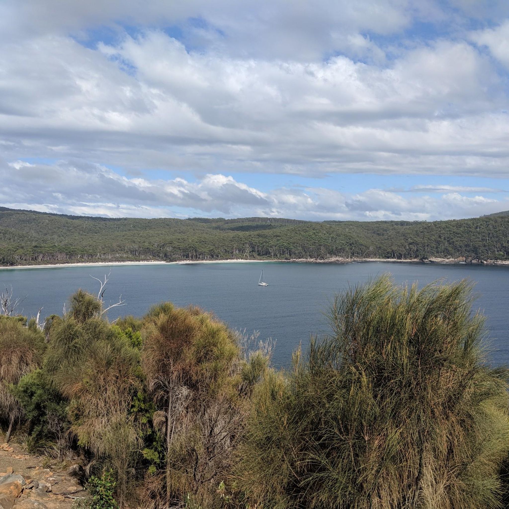
This viewpoint overlooking Waterfall Bay along the Tasman Coastal Trail offers incredible views of the sheer cliffs that drop down to the ocean and stretch all the way to Cape Hauy. The waterfall at Waterfall Bluff only flows after heavy rain, so it can be dry at times. Even when the waterfall isn’t running, the lookout is still breathtaking, with its sweeping coastal scenery and rugged cliffs that make for a memorable experience.
0
0
Waterfall Bluff is a coastal headland in Tasman National Park, known for its sheer cliffs and exposed ocean setting. The bluff is named for a seasonal waterfall that drops over the cliff edge, especially after heavy rain, and falls directly toward the sea below. It’s a beautiful spot to spend time, taking in the breathtaking panoramic views along the rugged Tasman Peninsula coastline.
0
0
Devils Kitchen is a deep, narrow trench cut into the coastal cliffs formed by wave erosion, beginning as a sea cave that has since collapsed and widened into a steep-sided chasm. This is a great vantage point to get a clear view of the ocean surging between the towering rock walls below.
0
0
Tasmans Arch is an impressive natural rock arch on the Tasman Peninsula, formed by wave erosion in the coastal cliffs of Tasman National Park. It's the remains of a collapsed sea cave, where ongoing erosion has carved a deep opening with the ocean passing underneath. There are fantastic views into the arch and the surrounding coastline, making it an ideal opportunity to capture some memorable photos while you're here.
0
0
Seal Lookout is a short side trip from the main cape viewpoint, providing a closer angle down to the rocky platforms at the base of the cliffs. From here, seals can sometimes be spotted resting on the rocks or in the water below, though they may require careful viewing or binoculars to see clearly. This lookout also gives a striking perspective of the narrow dolerite ridge forming the cape as it drops into the ocean.
0
0
Cape Lookout sits near the end of the track, offering fantastic, sweeping views along the narrow spine of Cape Raoul as it extends into the Tasman Sea. From this vantage point, you can clearly see the full length of the cape, its steep sides dropping away to the water on both sides. The lookout captures the raw, exposed nature of the headland, often accompanied by strong coastal winds.
0
0
The dolerite cliffs are towering columnar formations that plunge sharply into the ocean, forming one of the most striking geological features in Tasman National Park. These cliffs rise hundreds of metres and create sheer, rugged walls that dominate views along the track and from the lookouts. Their dramatic vertical structure and exposure to the sea highlight the wild, eroded character of Tasmania’s southeastern coastline.
0
0
Cape Raoul Lookout is one of the first major viewpoints along the track, where the forest opens onto a cliff edge with expansive views across the Tasman Peninsula coastline. From here, the landscape begins to transition from sheltered woodland to exposed coastal heath, with the dramatic drop of the cape becoming immediately apparent. It’s a key turning point where you'll first experience the scale of the cliffs and the increasingly windswept terrain ahead.
0
0
Frequently Asked Questions
What is the difficulty range of hiking trails in Tasman National Park?
Tasman National Park offers a diverse range of hiking trails suitable for various fitness levels. You'll find everything from easy strolls, with 6 routes categorized as easy, to more challenging multi-day treks. There are 5 moderate and 5 difficult routes available, ensuring options for both casual walkers and experienced hikers.
Are there family-friendly hiking trails in Tasman National Park?
Yes, Tasman National Park has several trails suitable for families. For an accessible option, consider the View of Waterfall Bay – Tasmans Arch loop from Doo Town, which is an easy 4.5 km path. These shorter, less strenuous walks allow families to enjoy the unique coastal formations and natural beauty without extensive effort.
Can I hike with my dog in Tasman National Park?
Generally, dogs are not permitted on walking tracks or in national parks in Tasmania to protect native wildlife and natural environments. It's always best to check the official Parks and Wildlife Service Tasmania website for the most current regulations regarding pets in specific areas of Tasman National Park.
Do I need a permit to hike in Tasman National Park?
Yes, a valid Parks Pass is required for entry into Tasman National Park. For specific multi-day treks like the Three Capes Track, separate booking and fees apply. You can find detailed information and purchase passes on the official Parks and Wildlife Service Tasmania website: parks.tas.gov.au.
What unique natural attractions can I see while hiking in Tasman National Park?
Hiking in Tasman National Park allows you to witness dramatic coastal landscapes and unique geological formations. You can explore towering sea cliffs, some reaching over 300 meters, and natural wonders like Tasman Arch, The Blowhole, and the Tessellated Pavement. Iconic sea stacks such as The Candlestick and The Totem Pole at Cape Hauy are also prominent features.
What kind of wildlife might I encounter on the trails?
Tasman National Park is rich in wildlife. Hikers often have opportunities to spot marine life such as seals, dolphins, little penguins, and even whales during migration seasons. The park is also an Important Bird Area, home to various species including the endangered Swift Parrot, Wedge-tailed Eagle, and Tasmanian Sea Eagle.
When is the best time of year to hike in Tasman National Park?
Tasman National Park can be enjoyed year-round, but the warmer months from spring to autumn (September to May) generally offer the most pleasant hiking conditions with milder weather and longer daylight hours. However, the dramatic coastal scenery is impressive in any season, and winter hiking can offer a unique, rugged experience if you are prepared for cooler temperatures and potentially stronger winds.
How long do hikes in Tasman National Park typically take?
Hike durations vary significantly depending on the trail. Shorter, easy walks like the View of Waterfall Bay – Tasmans Arch loop from Doo Town can be completed in about 1 hour 16 minutes. More strenuous routes, such as the Cape Hauy Viewpoint – Cape Hauy loop from Doo Town, typically take around 3 hours 34 minutes, while multi-day treks like the Three Capes Track require several days.
Is parking available at the trailheads in Tasman National Park?
Yes, parking is generally available at the main trailheads and popular access points within Tasman National Park. For example, routes often start from locations like Doo Town or Cape Raoul, where designated parking areas are provided for visitors accessing the trails. It's advisable to arrive early during peak seasons to secure a spot.
Are there challenging multi-day hikes available in Tasman National Park?
Yes, for experienced hikers seeking a challenge, the park is home to the renowned Three Capes Track, an award-winning 46-kilometer multi-day walk that typically takes three nights to complete. This trail offers unparalleled views of Cape Pillar, Cape Hauy, and Cape Raoul. Additionally, the Cape Raoul Lookout loop from Cape Raoul is a difficult 15.3 km path providing extensive cliff-top scenery.
What do other hikers say about the trails in Tasman National Park?
The trails in Tasman National Park are highly regarded by the komoot community, with an average rating of 4.9 stars from over 90 reviews. Hikers frequently praise the rugged coastline, impressive sea cliffs, and the diverse eucalypt forests. Many appreciate the well-maintained paths and the breathtaking views offered along routes like the View of Munro Bight Cliffs – View of The Blades loop from Bare Knoll Campground.
Are there any circular hiking routes in Tasman National Park?
Yes, Tasman National Park offers several circular hiking routes. Examples include the Cape Hauy Viewpoint – Cape Hauy loop from Doo Town, which is a moderate 10.2 km trail, and the Tunnel Bay Arch – Shipstern Bluff loop from Carnarvon Bay, a moderate 12.7 km path. These loops provide varied scenery and bring you back to your starting point.
Most popular routes in Tasman National Park
Most popular attractions in Tasman National Park

Get inspired with the komoot mobile app


Explore more
Browse the best Hikes in other regions.
