The best cycling routes in Port Phillip Bay Coastal Reserve
4.6
(10)
137
riders
6
rides
Touring cycling in Port Phillip Bay Coastal Reserve features a network of routes primarily along the coastline and bayfront areas. The terrain is generally flat to gently undulating, with minimal elevation gain, making it suitable for various cycling abilities. Routes often follow established paths, offering views of the bay and connecting coastal towns. The area is characterized by its proximity to the water, urban-coastal landscapes, and diverse shorelines including sandy beaches and wetlands.
Best touring cycling routes in Port Phillip…
Last updated: July 8, 2026
5.0
(1)
24
riders
41.3km
02:24
150m
150m
Moderate bike ride. Good fitness required. Mostly paved surfaces. Suitable for all skill levels.
4.0
(3)
12
riders
23.8km
01:27
150m
150m
Easy bike ride. Great for any fitness level. Mostly paved surfaces. Suitable for all skill levels.

Sign up for free
4.7
(3)
7
riders
45.6km
02:43
170m
170m
Moderate bike ride. Good fitness required. Mostly paved surfaces. Suitable for all skill levels.
5.0
(4)
69
riders
35.4km
02:05
150m
150m
Moderate bike ride. Good fitness required. Mostly paved surfaces. Suitable for all skill levels.
6
riders
64.1km
03:53
270m
270m
Moderate bike ride. Good fitness required. Mostly paved surfaces. Suitable for all skill levels.
Our route recommendations are based on thousands of hikes, rides, and runs completed by other people on komoot.
Start today with a free account
Your next adventure awaits.
Login or Signup
Popular around Port Phillip Bay Coastal Reserve


Tips from the Community

The Barwon River flows for 160 kilometres through Victoria and is lined by trails on both sides as it flows through Geelong. The name is an anglicized version of the Aboriginal word Parwan, which means either magpie or great wide. The river is popular for walking, jogging, cycling, kayaking, and rowing. There are also many parks and reserves along its banks, so there is no shortage of ways to enjoy your time at the river.
0
0

Barwon River Trail follows the Barwon River through Geelong on more than 20 kilometres of mostly sealed paths, connecting Fyansford to South Geelong. The trail runs along both sides of the river, passing through a mix of parkland, wetlands, and open riverbanks. Along the way, it links key spots like Queens Park, Balyang Sanctuary, Belmont Common, and Buckley Falls. You’ll also pass playgrounds, picnic areas, and quieter sections of river, with multiple access points and parking throughout, and no entry fee.
0
0

Mittagong Campsite, also labelled as Girl Guides Victoria, has a history rooted in community service and outdoor education. It has been used for guiding activities, leadership training, and outdoor adventures for Victoria's young. There are also old military relics on display. This is also the start of the Hovells Creek Trail, with a small dirt lot perfect to start on the northern end of this long, paved pathway.
0
0
The Hovell Creek Trail terminates at Limeburners Lagoon, a beautiful waterfront area. Nearby sits a boathouse and other iconic landmarks. Walk along the sandy shoreline or out on the fishing pier or jetty for the best views of the water.
0
0

Rippleside Park is a large coastal reserve overlooking Corio Bay, popular for its open lawns, walking paths, and relaxed seaside atmosphere. The park includes picnic and barbecue areas, a playground, and connections to the Geelong waterfront trail, making it a hub for families and outdoor recreation. Its waterfront setting and beautiful views toward the city skyline make it a lovely place to spend the day.
0
0
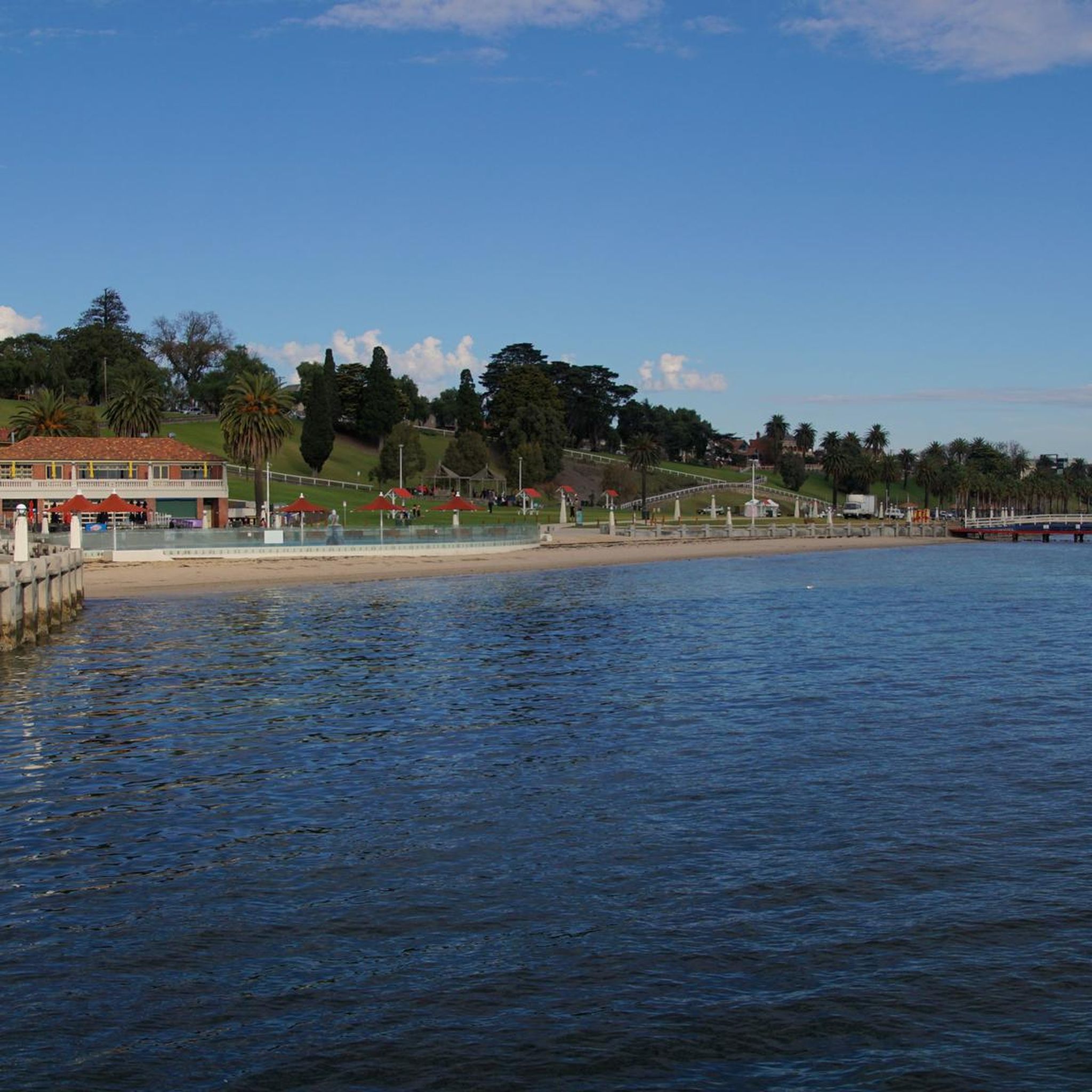
Eastern Beach sits along the sheltered waters of Corio Bay, and is a beautiful spot to unwind by the water. The foreshore is lined with a wide promenade, shaded lawns, and palm trees, making it a popular spot that's perfect for walks or picnics, or a casual day at the beach.
0
0
Barwon River flows through Victoria to meet the sea at Barwon Heads, forming a wide estuary that separates Ocean Grove from its neighbouring town. It’s calm, tidal waters are ideal for canoeing, boating, fishing, and paddleboarding, with plenty of shady spots along the foreshore. The river connects inland wetlands and Lake Connewarre to the coast, creating an important ecological waterway and a popular local recreation spot.
0
0
Barwon River Trail follows the Barwon River through Geelong on more than 20 kilometres of mostly sealed paths, connecting Fyansford to South Geelong. The trail runs along both sides of the river, passing through a mix of parkland, wetlands, and open riverbanks. Along the way, it links key spots like Queens Park, Balyang Sanctuary, Belmont Common, and Buckley Falls. You’ll also pass playgrounds, picnic areas, and quieter sections of river, with multiple access points and parking throughout, and no entry fee.
0
0
Frequently Asked Questions
How many touring cycling routes are available in Port Phillip Bay Coastal Reserve?
There are 7 touring cycling routes available in Port Phillip Bay Coastal Reserve, catering to various skill levels from easy to moderate.
Are there easy touring cycling routes suitable for beginners or families?
Yes, Port Phillip Bay Coastal Reserve offers several easy routes perfect for beginners and families. For instance, the Eastern Beach – Geelong Bollard Sculptures loop from North Shore is an easy 21.5 km path that provides scenic coastal riding with points of interest along the Geelong waterfront. Another easy option is the Hovells Creek loop from North Shore.
What is the typical length of touring cycling routes in the Port Phillip Bay Coastal Reserve?
The touring cycling routes in Port Phillip Bay Coastal Reserve vary in length. You'll find shorter, easy rides around 19-21 km, such as the Eastern Beach – Geelong Bollard Sculptures loop from North Shore, up to longer moderate routes like the Spirit of Tasmania Terminal – Valhalla Brewing loop from Lara, which is about 46.5 km.
Are there circular touring cycling routes available in Port Phillip Bay Coastal Reserve?
Many of the touring cycling routes in Port Phillip Bay Coastal Reserve are designed as loops, offering convenient starting and ending points. Examples include the popular Eastern Beach – Spirit of Tasmania Terminal loop from Lara and the View of the Barwon River – Eastern Beach loop from North Geelong.
What is the best season for touring cycling in Port Phillip Bay Coastal Reserve?
The Port Phillip Bay Coastal Reserve is generally pleasant for cycling year-round, but the best seasons are typically spring (September to November) and autumn (March to May). During these times, the weather is mild, and you can avoid the hotter summer days and cooler winter temperatures, making for more comfortable rides along the bay.
Which touring cycling routes offer the best viewpoints of Port Phillip Bay?
Routes that hug the coastline naturally offer excellent bay views. The Eastern Beach – Spirit of Tasmania Terminal loop from Lara is particularly noted for its extensive bay views and connection to key coastal landmarks. The Eastern Beach – Geelong Bollard Sculptures loop from North Shore also provides scenic coastal riding along the Geelong waterfront.
Are there cafes or refreshment stops along the touring cycling routes?
Given the urban-coastal nature of the Port Phillip Bay area, many routes pass through or near towns and populated areas where you can find cafes, restaurants, and shops for refreshments. The routes often connect coastal towns, making it easy to stop for a break.
Can I bring my dog on touring cycling routes in Port Phillip Bay Coastal Reserve?
While many shared paths in Australia allow dogs on a leash, specific regulations can vary within the Port Phillip Bay Coastal Reserve and its various municipalities. It's always best to check local signage or the relevant council websites for the specific section of the path you plan to cycle to ensure dogs are permitted.
Where can I find parking for touring cycling routes in Port Phillip Bay Coastal Reserve?
Parking is generally available at various access points along the Port Phillip Bay coastline, especially near popular beaches, parks, and town centers that serve as common starting points for cycling routes. Look for public car parks in areas like Geelong, Lara, and North Shore.
Is public transport available to access touring cycling routes in Port Phillip Bay Coastal Reserve?
Yes, public transport options, primarily trains and buses, serve the towns and areas around Port Phillip Bay. V/Line trains connect Melbourne to Geelong, and local bus services operate within the region, allowing access to various points along the cycling paths. Check V/Line and local bus schedules for routes that accommodate bicycles.
What do other touring cyclists enjoy the most about touring cycling in Port Phillip Bay Coastal Reserve?
The area is highly rated by the komoot community, with an average score of 4.5 stars from over 20 reviews. Reviewers often praise the extensive bay views, the generally flat and accessible terrain suitable for various abilities, and the convenience of routes connecting coastal towns and landmarks.
Are there any challenging touring cycling routes in Port Phillip Bay Coastal Reserve?
While the terrain is generally flat to gently undulating, some routes are classified as moderate due to their length. For example, the Eastern Beach – Spirit of Tasmania Terminal loop from Lara is a 41.3 km moderate trail that offers a good distance challenge, and the Spirit of Tasmania Terminal – Valhalla Brewing loop from Lara is even longer at 46.5 km.
Most popular routes in Port Phillip Bay Coastal Reserve

Get inspired with the komoot mobile app


Explore more
Browse the best Cycling routes in other regions.
