The best cycling routes in O'Halloran Hill Recreation Park
4.6
(65)
1,593
riders
78
rides
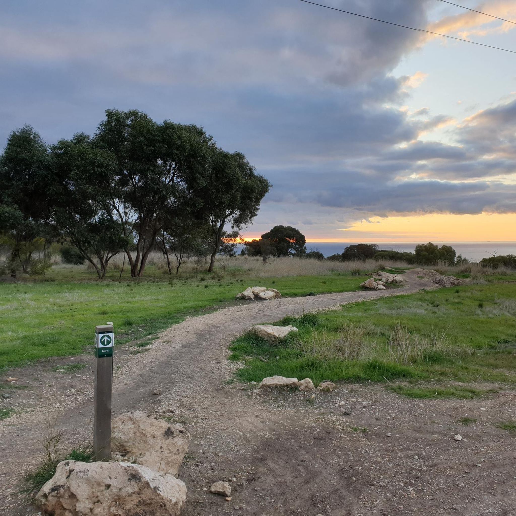
Touring cycling routes in O'Halloran Hill Recreation Park traverse a landscape characterized by grassy rolling hills and deeply divided gullies. The park features regenerated stands of grey box eucalypts and river red gums, providing shaded sections along the paths. From various vantage points, cyclists can experience views of the city, the Adelaide Hills, and the coastline. This area offers a diverse terrain for touring cyclists.
Best touring cycling routes in O'Halloran Hill Recreation Park
- The most popular touring cycling route…
Last updated: July 4, 2026
5.0
(4)
104
riders
49.2km
02:55
140m
140m
Moderate bike ride. Good fitness required. Mostly paved surfaces. Suitable for all skill levels.
5.0
(3)
101
riders
Easy bike ride. Great for any fitness level. Mostly paved surfaces. Suitable for all skill levels.

Sign up for free
13
riders
13.1km
01:08
90m
90m
Easy bike ride. Great for any fitness level. Mostly paved surfaces. Suitable for all skill levels.
37
riders
50.7km
03:08
450m
450m
Hard bike ride. Very good fitness required. Mostly paved surfaces. Suitable for all skill levels.
5
riders
Moderate bike ride. Good fitness required. Mostly paved surfaces. Suitable for all skill levels.
Get access to more routes and recommendations from other explorers.
Sign up for free
Already have an account?
Our route recommendations are based on thousands of hikes, rides, and runs completed by other people on komoot.
Start today with a free account
Your next adventure awaits.
Login or Signup


Tips from the Community

From this spot, the river meets the sea, opening into Gulf St Vincent between Henley Beach South and West Beach. As you walk near the outlet, you’ll find a mix of sandy shoreline with beautiful coastal views, and calm river edges, with seabirds and changing tides giving the area a constantly shifting feel. Whether you stop for a beach walk or watch the water flow into the ocean, it’s a peaceful place to experience where Adelaide’s best-known river reaches the coast.
0
0
River Torrens Linear Park is a long green corridor that follows the River Torrens (Karrawirra Pari) through Adelaide, linking parks, wetlands, picnic areas, and shared-use trails from the Adelaide Hills to the coast at Henley Beach. Established to improve river health and public access, the park combines open lawns, native vegetation, wetlands, playgrounds, and shaded riverbanks that support birdlife and recreation throughout the city. Its mostly flat, continuous pathway makes it popular for walking and cycling, with multiple access points connecting the surrounding suburbs and reserves.
0
0
Shoreline Loop is an easy, well-formed walking and cycling trail that circles Happy Valley Reservoir, covering roughly 11 kilometres on mostly flat, compacted gravel paths. The loop follows the water’s edge through open grassland and regenerating bushland, with expansive reservoir views and plenty of birds and other wildlife, especially kangaroos, to see along the way. Popular for walking, running, and cycling, it’s a peaceful, accessible route with several lookout points and benches, ideal for a break to enjoy the scenery. The trail is open from 7:30 am to sunset, with gated access points that are locked overnight, so keep this in mind if you’re planning an early morning or later-day stroll through the park.
0
0
Boundary Loop is a longer walking and cycling route within Happy Valley Reservoir that skirts the outer edges of the reserve through a mix of open grassland and regenerating bush. Extending beyond the main shoreline circuit, it’s quieter, with less traffic, minimal elevation changes and wider views across the surrounding hills and water. Popular with walkers, trail runners, and cyclists, the loop offers a slightly more remote-feeling alternative to the central pathway.
0
0

Currently, as of summer 2025 / 26, this bikeway is widely closed due to the construction of two more overpasses and major maintenance work on the tram tracks. There is an official detour between Glenelg and Goodwood Road. It is well signposted but not as nice as the original bikeway.
1
0

Happy Vally Reservoir. Lovely scenic ride around the Reservoir.
0
0
Here, the esplanade is less busy than in Henley Beach.
1
0
Frequently Asked Questions
How many touring cycling routes are available in O'Halloran Hill Recreation Park?
There are over 80 touring cycling routes available in O'Halloran Hill Recreation Park, catering to various skill levels. You'll find a good mix of easy, moderate, and difficult options to explore the park's diverse terrain.
What kind of terrain can I expect on touring cycling routes in O'Halloran Hill Recreation Park?
The park features a diverse landscape of grassy rolling hills and deeply divided gullies with steep side slopes. You'll cycle through areas with regenerated stands of grey box eucalypts and river red gums, providing shade. The routes offer varied experiences, from coastal views to inland reservoir vistas.
Are there any family-friendly touring cycling routes in the park?
Yes, O'Halloran Hill Recreation Park offers several easy touring cycling routes suitable for families. An example is the View of Happy Valley Reservoir loop from Reynella East, which is 16.1 km long and generally takes about 1 hour 25 minutes. Another easy option is the Brighton Beach Promenade – Glenelg Esplanade loop from Seacliff, offering coastal scenery.
Can I bring my dog on the touring cycling trails?
Yes, dogs are permitted in O'Halloran Hill Recreation Park, but they must be kept on a leash at all times. Many of the fire access tracks, which are also used by cyclists, are shared paths, so ensure your dog is under control for the safety of all users.
What are some notable natural features or viewpoints along the cycling routes?
From various points within the park, cyclists can enjoy stunning views of the city, the Adelaide Hills, and the coastline. The park's landscape includes regenerated grey box eucalypts and river red gums, and you might even spot woodland and grassland birds, reptiles, or western grey kangaroos. Geologically, you can observe Precambrian Umberatana Group rock formations and a visible bluestone quarry.
Are there any circular touring cycling routes in the area?
Many of the touring cycling routes in and around O'Halloran Hill Recreation Park are designed as loops. For instance, the Glenelg Esplanade – River Torrens Linear Park loop from Seacliff is a moderate 48.6 km route connecting coastal esplanades with a linear park system. Another option is the Brighton Beach Promenade – Mouth of the River Torrens loop from Seacliff, an easy 28.2 km path offering coastal scenery.
What do other touring cyclists enjoy most about cycling in O'Halloran Hill Recreation Park?
The area is highly rated by the komoot community, with an average score of 4.6 stars from over 50 reviews. Cyclists often praise the diverse terrain, the mix of coastal and inland views, and the opportunity to experience both natural landscapes and accessible urban connections. The regenerated eucalypt stands and rolling hills provide a pleasant cycling environment.
Are there any particularly challenging touring cycling routes in the park?
Yes, for those seeking a more challenging ride, there are difficult routes available. An example is the Forest Cycle Path – Coast to Vines Rail Trail loop from Marino Rocks, a 50.7 km route with significant elevation changes, making it suitable for experienced touring cyclists.
What is the best time of year to go touring cycling in O'Halloran Hill Recreation Park?
The park is enjoyable year-round, but spring and autumn generally offer the most pleasant cycling conditions with milder temperatures. Summers can be hot, so early morning or late afternoon rides are recommended. Winters are usually mild, though some tracks might be damp after rain.
How can I access O'Halloran Hill Recreation Park by public transport or find parking?
The park is approximately 16 kilometers south of Adelaide and is accessible via the bicycle veloway on either side of the Southern Expressway, connecting it to regional cycling networks. For those driving, parking is available at various access points around the park. While specific public transport routes aren't detailed here, local bus services connect to areas surrounding the park.
Are there any facilities like picnic spots or cafes within or near the park?
O'Halloran Hill Recreation Park provides picnic spots, often shaded by regenerated trees, which are perfect for a break during your ride. While there are no cafes directly within the park, its proximity to Adelaide's southern suburbs means you'll find various cafes, pubs, and accommodation options in nearby towns like Seacliff, Brighton, or Reynella East.
Most popular routes in O'Halloran Hill Recreation Park

Get inspired with the komoot mobile app


Explore more
Browse the best Cycling routes in other regions.
