The best walks and hikes in San Antonio
4.6
(11)
109
hikers
7
hikes
Hiking in San Antonio offers diverse landscapes, transitioning from the South Texas plains to the rolling hills and deep canyons of the Texas Hill Country. The region features limestone bluffs, riverine paths, and varied ecosystems including wooded areas, prairies, and marshlands. Many trails are defined by ancient oak trees and cypress-lined creeks, providing extensive tree cover.
Best hiking trails in San Antonio
- The most popular hiking route is Imbabura Main Summit – Imbabura Summit loop from montaña letrero imbabura,…
Last updated: July 11, 2026
5.0
(4)
36
hikers
9.84km
07:02
1,120m
1,120m
Hard hike. Very good fitness required. Sure-footedness, sturdy shoes and alpine experience required.
5.0
(1)
12
hikers
10.7km
02:50
100m
100m
Moderate hike. Good fitness required. Easily-accessible paths. Suitable for all skill levels.

Sign up for free
5.0
(1)
12
hikers
10.1km
02:40
90m
90m
Moderate hike. Good fitness required. Easily-accessible paths. Suitable for all skill levels.
6
hikers
19.4km
10:36
1,770m
1,770m
Hard hike. Very good fitness required. Sure-footedness, sturdy shoes and alpine experience required.
4.67km
01:21
110m
110m
Easy hike. Great for any fitness level. Easily-accessible paths. Suitable for all skill levels.
Get access to more routes and recommendations from other explorers.
Sign up for free
Already have an account?
Our route recommendations are based on thousands of hikes, rides, and runs completed by other people on komoot.
Start today with a free account
Your next adventure awaits.
Login or Signup


Tips from the Community

Beautiful, demanding hike, e.g. from Ibarra/La Esperanza or with an off-road vehicle to the end of the road. With a bit of luck, there will be no clouds and you will have a view. However, caution is advised, it can be very windy at the top and the weather can change quickly.
0
0

Finca Sommerwind is a German café with a beer garden, an international campsite, cabanas, and tiny houses. A nice place to relax.
2
0

Good physical condition and protective equipment are required for safety.
0
0

Look for a sacred place with beautifully landscaped hiking trails. At the top you can crawl through narrow caves and discover other smaller waterfalls. Entrance fees are required.
2
0
Behind the figures at the parking lot there is a sales area of the local indigenous people, where you can also have a drink.
2
0
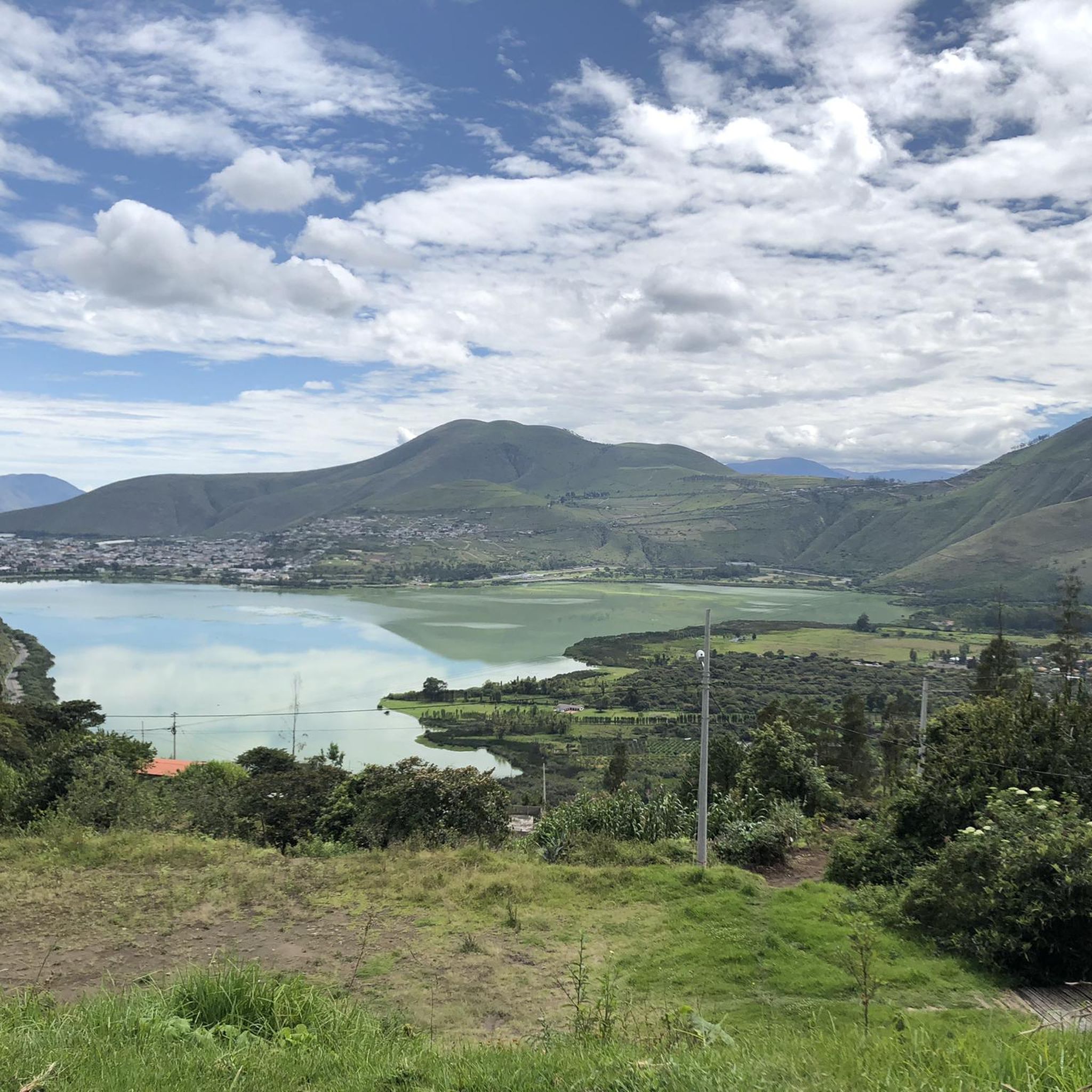
The lake is called Blood Lake because the Spaniards slaughtered 40,000 indigenous people. The lake was bright blue until 2020, when someone said they should put lobsters there (but they don't taste good). But with that came an algae plague and the lake is now green. Even if you are no longer allowed to swim, it is still a popular destination. There is a cycle and footpath along the lake and there is also a (car) race track.
2
0

In the soft stone, rather hard sand, carved figures
0
0
Frequently Asked Questions
What types of hiking trails can I find in San Antonio?
San Antonio offers a diverse range of hiking trails, from riverine paths and limestone bluffs to rolling hills and deep canyons. You'll find varied ecosystems including prairies and marshlands, with many trails providing extensive tree cover from ancient oak trees and cypress-lined creeks. Options range from gentle riverside strolls to more rugged canyon trails.
Are there family-friendly hiking options in San Antonio?
Yes, San Antonio has several parks with trails suitable for families. For example, Eisenhower Park offers paths for beginners, including the easy 2.9-mile Hillview and Yucca Nature Trail Loop. Phil Hardberger Park also features varied landscapes and walking trails that are great for all ages.
Can I bring my dog on the hiking trails in San Antonio?
Many parks in San Antonio welcome dogs, typically requiring them to be on a leash. It's always best to check specific park regulations before you go, but generally, trails in areas like Phil Hardberger Park and Medina River Natural Area are popular choices for dog walkers.
What is the best time of year to go hiking in San Antonio?
The cooler months, from late fall through early spring (roughly October to April), are generally the most pleasant for hiking in San Antonio. Temperatures are milder, making longer excursions more comfortable. During warmer months, seek out trails with significant tree cover, such as those in Friedrich Wilderness Park, to stay cool.
Are there any loop hikes available in San Antonio?
Yes, many parks feature loop trails. For instance, Eisenhower Park has the popular Hillview and Yucca Nature Trail Loop. Brackenridge Park also offers shadier options like the 1.5-mile Waterworks Loop. Loop trails are great for experiencing diverse scenery without retracing your steps.
Where can I find trails with good views in San Antonio?
For panoramic views, head to Eisenhower Park, where the Eisenhower Tower at 1,280 feet offers expansive vistas of the city and the Texas Hill Country. Friedrich Wilderness Park also provides views of the San Antonio skyline from its limestone hills.
Are there opportunities for wildlife spotting while hiking?
Absolutely. San Antonio's natural areas are rich in wildlife. Friedrich Wilderness Park is known for bird watching, being a nesting site for endangered species. Government Canyon State Natural Area is excellent for spotting white-tailed deer and wild turkeys, while Medina River Natural Area boasts diverse riverside wildlife.
What are the difficulty levels of hiking trails in San Antonio?
Hiking in San Antonio caters to all skill levels. You can find easy trails, such as an easy 2.9-mile path through forested areas, moderate routes like a 6.3-mile path with varied terrain, and more challenging, difficult trails that can be up to 5.6 miles with significant elevation gain. The region offers options from gentle strolls to rugged canyon trails.
Is public transportation available to San Antonio's hiking parks?
Public transportation options to some of San Antonio's larger parks exist, though direct access might vary. For example, Friedrich Wilderness Park and Eisenhower Park are accessible via certain bus routes, but it's advisable to check VIA Metropolitan Transit schedules and routes for the most current information and nearest stops to your desired park.
Are there any unique natural features to look out for on San Antonio trails?
Yes, San Antonio's trails showcase unique natural features. You can find impressive geological formations and limestone bluffs throughout the region. Government Canyon State Natural Area is particularly notable for its 110-million-year-old dinosaur tracks, which are the only publicly known ones in Bexar County.
What do other hikers say about the trails in San Antonio?
The hiking trails in San Antonio are highly rated by the komoot community, with an average score of 4.6 stars from over 11 reviews. Hikers often praise the varied terrain, the extensive tree cover providing shade, and the opportunities to experience the unique transition from plains to the Texas Hill Country.
Are there any trails with water features like rivers or creeks?
Yes, several trails in San Antonio follow riverine paths. The Medina River Natural Area offers over 2 miles of trails under the canopy of riverside forests along the Medina River. You'll also find cypress-lined creeks throughout the region, providing tranquil natural settings.
Most popular attractions in San Antonio

Get inspired with the komoot mobile app


Explore more
Browse the best Hikes in other regions.
