The best walks and hikes around Brennberg
4.5
(1619)
5,428
hikers
86
hikes
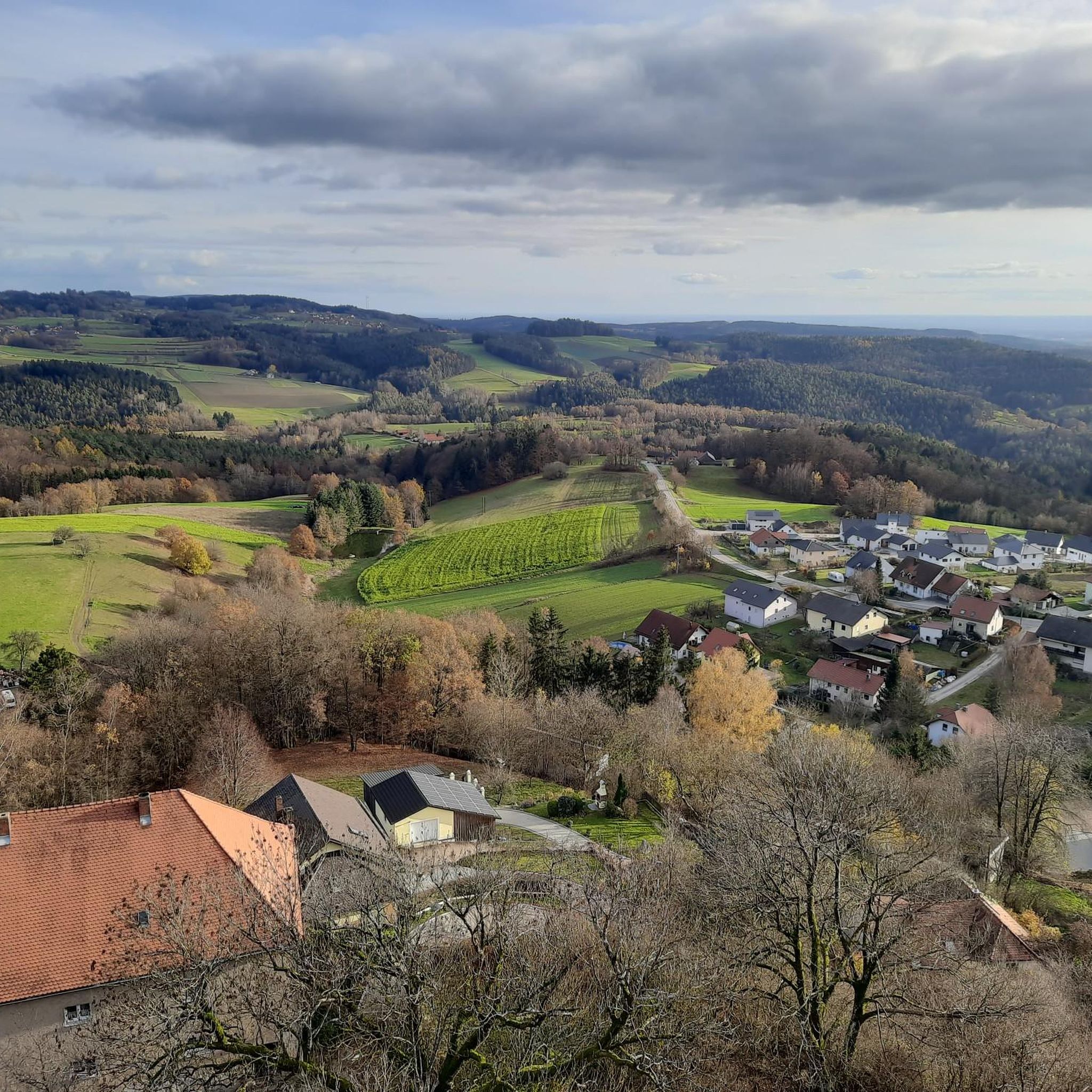
Hiking around Brennberg offers diverse landscapes at the foot of the Bavarian Forest. The region features charming hills, dense forests, and meandering rivers, providing varied terrain for exploration. A notable natural feature is the Höllbach Valley Nature Reserve, characterized by its stream carving through granite and gneiss blocks. The area's topography includes verdant meadows and idyllic rivers, creating a tranquil environment for hikers.
Best hiking trails around Brennberg
- The most popular hiking route is Höllbach Wooden Bridge – Hölltal Rock…
Last updated: October 8, 2026
4.8
(672)
2,325
hikers
5.32km
01:31
110m
110m
Moderate hike. Great for any fitness level. Mostly accessible paths. Sure-footedness required.
4.6
(92)
255
hikers
10.3km
02:53
190m
190m
Moderate hike. Good fitness required. Mostly accessible paths. Sure-footedness required.

4.5
(24)
82
hikers
7.85km
02:18
220m
220m
Moderate hike. Good fitness required. Easily-accessible paths. Suitable for all skill levels.
4.6
(21)
81
hikers
10.1km
02:53
250m
250m
Moderate hike. Good fitness required. Easily-accessible paths. Suitable for all skill levels.
4.5
(24)
78
hikers
8.01km
02:17
190m
190m
Moderate hike. Good fitness required. Easily-accessible paths. Suitable for all skill levels.
Get access to more routes and recommendations from other explorers.
Already have an account?
Our route recommendations are based on thousands of hikes, rides, and runs completed by other people on komoot.
Start today with a free account
Your next adventure awaits.

Other adventures around Brennberg

Tips from the Community

A rustic wooden bridge, which slightly changes direction in the middle with a kink, leads here over the Höllbach stream. On days when the wooden planks are particularly slippery, the railing attached to one side provides a little more security.
10
0
Not only the granite block sea and the roaring stream of the Höllbach shape the nature reserve. Some open meadow areas also belong to it.
15
0
The Hölle nature reserve encompasses an approximately 600-meter-long section of the Höllbachtal valley in the Falkensteiner Vorwald with the surrounding forest areas. The block sea of bizarrely weathered granite blocks along the Höllbach, as this section of the Wiesent's upper course is called, is an approximately 7000 square meter sub-area of the nature reserve established in 1950. It is part of the European "Natura 2000" protected area network. In the shady, cool and moist climate even in summer, numerous animal and plant species worthy of protection have been preserved.
10
0
The Höllbach flows through a rocky valley in the Falkensteiner Vorwald, characterized by mighty gneiss and granite blocks piled on top of each other. During the last ice age, they weathered from the bedrock into a block sea. At this point, the rock appears in a particularly impressive form of "wollsack weathering" (sack weathering). The blocks are largely covered by mosses.
12
1
The Höllbach repeatedly roars over the granite blocks that nature has placed in its path.
15
0
Here begins the fantastic circular hiking trail through the "Hölle" nature reserve, which leads for long stretches along the Höllbach through the valley.
11
0
On this rustic wooden boardwalk, hikers can cross the Höllbach. The railing attached to one side provides a little security, especially when the planks are smooth and slippery in wet weather.
10
0

Frequently Asked Questions
What kind of landscapes can I expect to see while hiking around Brennberg?
Brennberg, situated at the foot of the Bavarian Forest, offers a diverse landscape characterized by charming hills, dense forests, and meandering rivers. A major highlight is the wild and romantic Höllbach Valley (Hölle) Nature Reserve, where the Höllbach stream carves its way through impressive granite and gneiss blocks, creating a unique natural monument.
Are there many hiking trails available in the Brennberg area?
Yes, the Brennberg region boasts a wide selection of hiking opportunities. There are nearly 90 different hiking routes available, catering to various preferences and fitness levels. You'll find a balanced mix of easy and moderate trails, with a few more challenging options for experienced hikers.
Are there any historical landmarks or viewpoints to discover on the trails?
Absolutely. A significant historical attraction is the 12th-century Brennberg Castle Ruins, perched majestically on a hill. Many routes, such as the Brennberg Castle – Distant view near Brennberg loop from Brennberg, incorporate this site. You can climb the tower for expansive views, sometimes reaching the Alps on clear days. Other viewpoints, like the View of the Walhalla, are also accessible.
Are there family-friendly hiking options in Brennberg?
Yes, Brennberg offers several routes suitable for families. Many trails are well-marked and accessible, providing enjoyable experiences for different fitness levels. The Höllbach Wooden Bridge – Hölltal Rock Formations loop from Brennberg, for instance, is a moderate 5.3 km trail that follows the scenic Höllbach stream, offering an engaging experience for families.
Can I bring my dog on the hiking trails in Brennberg?
Many trails in Brennberg are suitable for dogs, allowing you to explore the picturesque hills and forests with your canine companion. The natural environment, with its varied terrain and streams, provides a great setting for walks. Always ensure your dog is under control and check local regulations for specific nature reserves like the Höllbach Valley.
Are there circular hiking routes available?
Yes, Brennberg is ideal for circular walks, allowing you to start and end your hike in the same location. Many popular routes are designed as loops, such as the Höllbach Wooden Bridge – Hölltal Rock Formations loop from Brennberg or the Höllmühle – Distant view near Brennberg loop from Brennberg, which offers varied terrain and distant views.
What natural features are prominent in the Brennberg hiking area?
The most prominent natural feature is the Höllbach Valley (Hölle) Nature Reserve, known for its wild gorge where the Höllbach stream flows through impressive granite and gneiss blocks. You'll encounter moss-covered rocks, a beautiful root path, and features like the Höllbach Wooden Bridge and Hölltal Rock Formations.
What do other hikers say about the trails in Brennberg?
The hiking routes in Brennberg are highly regarded by the komoot community, holding an average rating of 4.6 stars from over 1400 reviews. Hikers often praise the dramatic natural formations of the Höllbach Valley, the historical allure of the castle ruins, and the well-maintained network of trails within the Bavarian Forest foothills.
What is the best time of year to go hiking in Brennberg?
Brennberg is an excellent hiking destination throughout much of the year. Spring and autumn offer pleasant temperatures and vibrant scenery, with spring bringing lush greenery and autumn showcasing colorful foliage. Summer is also popular, though trails can be busier. The region's diverse landscapes are beautiful in any season, but always check local weather conditions before heading out.
Are there options for longer-distance hiking in the area?
Yes, Brennberg is connected to the renowned Goldsteig long-distance hiking trail. This allows hikers to explore longer distances and connect to other picturesque locations within the Bavarian Forest, offering opportunities for multi-day adventures or extended day hikes along its feeder and connector routes.
How can I get to the hiking trails in Brennberg?
Brennberg is accessible by car, with various parking options available near trailheads, especially for popular routes. For those relying on public transport, it's advisable to check local bus schedules to Brennberg, as connections might vary. Planning your route in advance will help ensure smooth access to your chosen hiking starting point.
Most popular routes around Brennberg
Most popular attractions around Brennberg

Get inspired with the komoot mobile app


Explore more
Browse the best Hikes in other regions.
