The best walks and hikes in Amatitlán
4.1
(84)
1,230
hikers
17
hikes
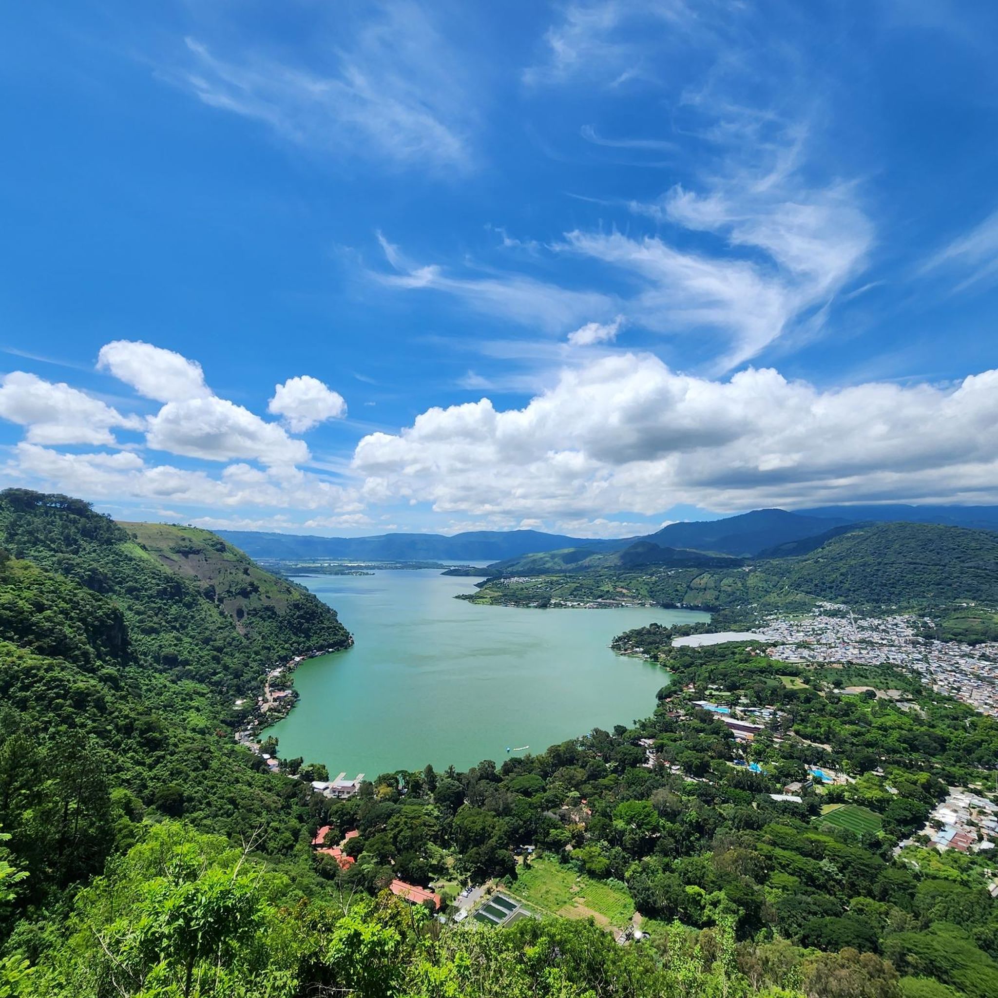
Hiking trails in Amatitlán offer diverse landscapes centered around Lake Amatitlán and its surrounding hills. The region is characterized by volcanic terrain, including views of Pacaya Volcano and Volcán de Agua, alongside smaller hills like Cerro Chino and Cerro Las Minas. Hikers can expect paths that traverse varied elevations, providing perspectives of the lake and distant peaks. The area features a mix of open viewpoints and paths through natural vegetation.
Best hiking trails in Amatitlán
- The most popular hiking route…
Last updated: July 1, 2026
4.6
(29)
445
hikers
6.18km
02:17
400m
400m
Moderate hike. Good fitness required. Easily-accessible paths. Suitable for all skill levels.
4.7
(17)
276
hikers
Moderate hike. Good fitness required. Easily-accessible paths. Suitable for all skill levels.

Sign up for free
4.7
(3)
55
hikers
Moderate hike. Good fitness required. Easily-accessible paths. Suitable for all skill levels.
4.3
(3)
45
hikers
5.49km
01:57
340m
340m
Moderate hike. Good fitness required. Easily-accessible paths. Suitable for all skill levels.
42
hikers
3.55km
01:24
270m
270m
Easy hike. Great for any fitness level. Easily-accessible paths. Suitable for all skill levels.
3.0
(1)
29
hikers
5.06km
02:01
400m
400m
Moderate hike. Good fitness required. Easily-accessible paths. Suitable for all skill levels.
4.0
(1)
23
hikers
6.59km
02:28
440m
440m
Moderate hike. Good fitness required. Easily-accessible paths. Suitable for all skill levels.
3.0
(1)
4
hikers
6.84km
02:52
590m
590m
Moderate hike. Good fitness required. Easily-accessible paths. Suitable for all skill levels.
Get access to more routes and recommendations from other explorers.
Sign up for free
Already have an account?
Our route recommendations are based on thousands of hikes, rides, and runs completed by other people on komoot.
Start today with a free account
Your next adventure awaits.
Login or Signup

Tips from the Community

High humidity on the ascent and cold winds at the top. Bring plenty of clothing.
0
0

Start of the path to the volcano, the climb up is very simple via a well-trodden road and signs. Slope and terrain simple and manageable even with sneakers.
2
0
Panoramic point that gives a good idea of the majesty of the volcano which, at times, delights with puffs and eruptions.
0
0
Best panoramic point to observe the volcano and its fumaroles. The route is absolutely simple and suitable for everyone with simple sneakers.
0
0
The pizza is not the best, the hygiene is non-existent and the cost is exorbitant. In any case, the experience of eating it on an active volcano more than makes up for these shortcomings.
0
0
Strategically positioned along the ascent to the volcano, this kiosk offers a refreshing break based on freshly peeled seasoned oranges for just a few pennies. I definitely recommend a stop!
0
0

Entry 02/2022: 100 Quetzales for foreigners, 30 for Guatemalans and 10 for students. Entry is only possible with a guide. If you have not already booked a tour in advance, you can try to join a group in advance. If the ascent or descent is too difficult for you, you can go on horseback instead of on foot (200 quetzales one way). Children sell hiking sticks on site. There are toilets and a shop downstairs. To avoid disappointment: there is no lava escaping from the volcano, and it is not possible to climb to the top. The hike is approximately 3 km each way. Further and current information: http://www.volcanpacaya.info/
3
0
The last eruption was in 2021, according to the tour guide it is currently no longer possible to climb the summit. The routes end below. A tour with a guide is necessary to be able to go to the direction of the Pacayas.
2
0
Frequently Asked Questions
Are there easy hiking trails in Amatitlán?
Yes, Amatitlán offers several easy hiking options. For instance, the Mirador 2 cerro chino loop from Übernachtungplatz kostenfrei is an easy 2.1-mile (3.5 km) trail that provides a pleasant experience for beginners or those looking for a relaxed walk.
What kind of challenging hikes can I find in Amatitlán?
While most trails are moderate, Amatitlán does offer some more challenging ascents, particularly those involving volcanic terrain. These routes often feature greater elevation changes and can be longer, providing a good workout for experienced hikers.
Are there many circular hiking routes in Amatitlán?
Yes, many of the popular hiking routes in Amatitlán are circular, offering varied scenery without retracing your steps. Examples include the View of Pacaya Volcano loop from San Francisco de Sales and the Cerro Las Minas loop from Santa Isabel.
Are the hiking trails in Amatitlán suitable for families with children?
Many trails in Amatitlán are suitable for families, especially the easier and moderate routes. The varied landscapes and views of the lake and volcanoes can be engaging for children. Always check the specific trail's distance and elevation gain to ensure it matches your family's ability.
Can I bring my dog on the hiking trails in Amatitlán?
Generally, many outdoor areas in Amatitlán are dog-friendly, but it's always best to check local regulations for specific trails or protected areas. Keep your dog on a leash and ensure you clean up after them to maintain the natural environment for everyone.
What do hikers enjoy most about the trails in Amatitlán?
The hiking trails in Amatitlán are highly rated by the komoot community, with an average score of 4.2 stars. Hikers frequently praise the stunning views of Lake Amatitlán, the prominent Pacaya and Volcán de Agua volcanoes, and the diverse volcanic landscapes.
What kind of landscapes can I expect to see while hiking in Amatitlán?
Hiking in Amatitlán offers a rich variety of landscapes. You'll encounter volcanic terrain with clear views of Pacaya Volcano and Volcán de Agua, serene lake vistas, and paths winding through smaller hills like Cerro Chino and Cerro Las Minas. The routes often feature a mix of open viewpoints and natural vegetation.
Is there parking available for hikers in Amatitlán?
Parking availability can vary depending on the trailhead. For routes starting from more established points, you may find designated parking areas. For less frequented trails, roadside parking might be an option. It's advisable to research specific trailhead parking before your hike.
What should I wear for hiking in Amatitlán?
Given the varied terrain and potential for elevation changes, it's recommended to wear comfortable, layered clothing suitable for outdoor activity. Sturdy hiking shoes with good grip are essential, especially on volcanic paths. Sun protection, such as a hat and sunscreen, is also advised.
When is the best time of year to go hiking in Amatitlán?
The dry season, typically from November to April, is generally considered the best time for hiking in Amatitlán. During these months, you can expect clearer skies, less rain, and more comfortable temperatures, making for more enjoyable trail conditions and better visibility of the volcanoes and lake.
Are there any routes that offer unique experiences, like a pizza stand?
Yes, for a truly unique experience, consider the Pizza Stand on Pacaya Volcano – View of Volcán de Agua loop from Übernachtungplatz kostenfrei. This moderate 3.2-mile (5.2 km) path not only provides views of Volcán de Agua but also passes a notable pizza stand, offering a memorable stop during your hike.
How many hiking trails are there in Amatitlán?
Amatitlán offers a diverse network of over 18 hiking trails, catering to various skill levels from easy walks to more challenging ascents. This includes 2 easy, 13 moderate, and 3 difficult routes.

Get inspired with the komoot mobile app


Explore more
Browse the best Hikes in other regions.
