The best walks and hikes in San Pedro De Atacama
4.8
(136)
2,238
hikers
33
hikes
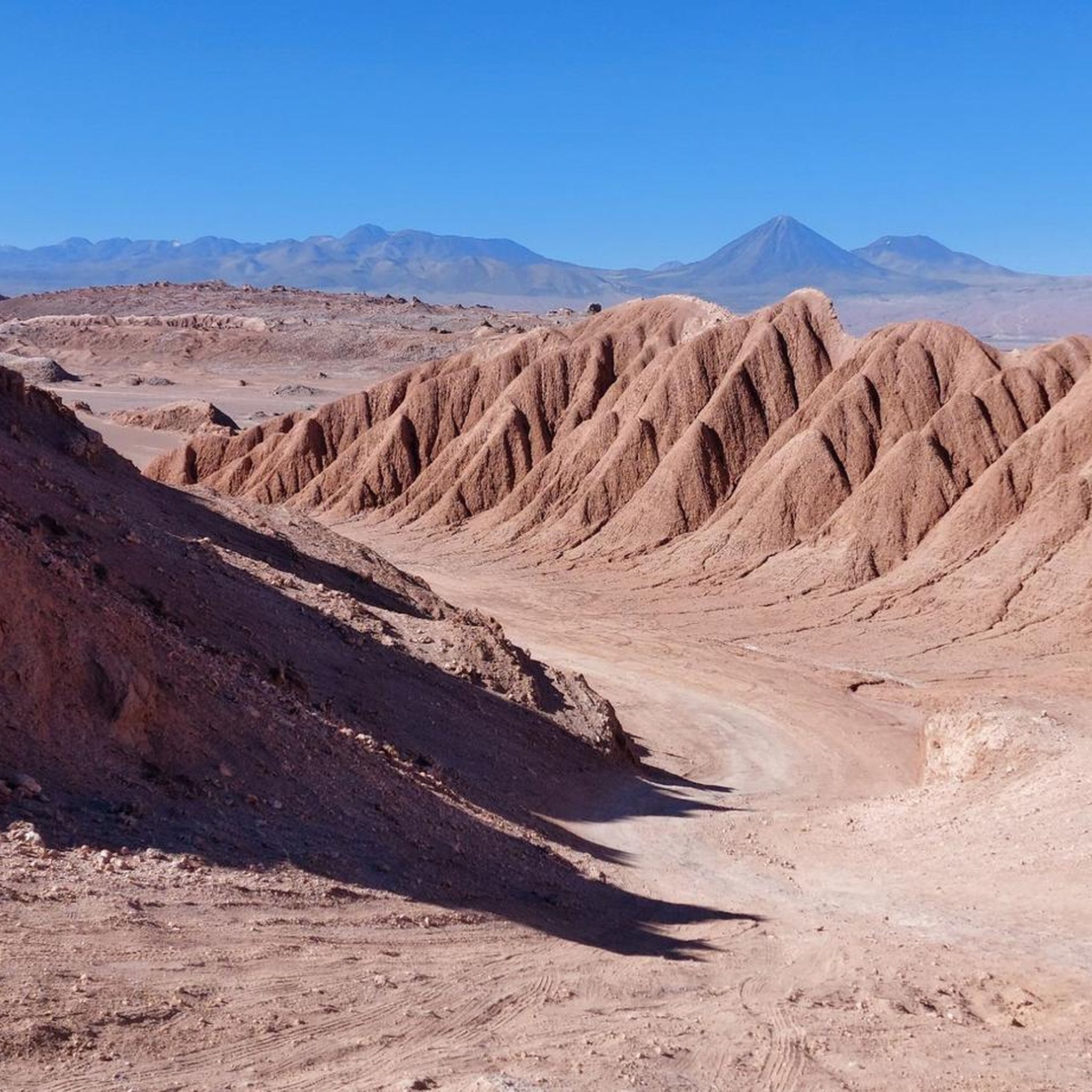
Hiking in San Pedro De Atacama offers diverse desert landscapes, unique geological formations, and high-altitude natural features. The region is characterized by arid terrain, vast salt flats, and volcanic peaks. Hikers can explore areas with moon-like valleys, red sand dunes, and vibrant mineral-painted mountains. This environment provides a range of trails through canyons, geyser fields, and high-altitude lagoons.
Best hiking trails in San Pedro De Atacama
- The most popular hiking route is Piedras Rojas (Red Rocks) loop from Salar Aguas Calientes, a 1.7 miles (2.7 km) trail that takes 43 minutes to complete. This easy route explores the distinctive red rock formations and the Salar Aguas Calientes.
- Another top favourite among local hikers is Pukará de Quitor – Valley of Death loop from San Pedro de Atacama, a moderate 6.7 miles (10.8 km) path. This trail combines historical sites with the unique desert scenery of the Valley of Death.
- Local hikers also love the View of the Atacama Desert – Mirador Achachis loop from Santuario de la Naturaleza Valle de la Luna y Sierra de Orbate, a 1.7 miles (2.7 km) trail leading through the Valle de la Luna, often completed in about 46 minutes.
- Hiking in San Pedro De Atacama is defined by vast salt flats, volcanic peaks, and high-altitude lagoons. The network offers options for different ability levels, from easy walks to more challenging ascents.
- The routes in San Pedro De Atacama are highly rated by the komoot community with an average score of 4.7 stars from over 100 reviews. More than 1,900 hikers have used komoot to explore San Pedro De Atacama's varied terrain.
Last updated: July 10, 2026
4.9
(8)
486
hikers
Easy hike. Great for any fitness level. Easily-accessible paths. Suitable for all skill levels.
4.6
(29)
157
hikers
10.7km
02:55
160m
160m
Moderate hike. Good fitness required. Easily-accessible paths. Suitable for all skill levels.

Sign up for free
5.0
(9)
163
hikers
Easy hike. Great for any fitness level. Easily-accessible paths. Suitable for all skill levels.
4.7
(15)
123
hikers
Moderate hike. Good fitness required. Easily-accessible paths. Suitable for all skill levels.
4.8
(6)
132
hikers
5.65km
01:37
140m
140m
Easy hike. Great for any fitness level. Easily-accessible paths. Suitable for all skill levels.
5.0
(7)
92
hikers
Easy hike. Great for any fitness level. Easily-accessible paths. Suitable for all skill levels.
4.8
(6)
108
hikers
Easy hike. Great for any fitness level. Easily-accessible paths. Suitable for all skill levels.
4.5
(4)
96
hikers
Moderate hike. Good fitness required. Easily-accessible paths. Suitable for all skill levels.
5.0
(5)
40
hikers
Moderate hike. Good fitness required. Easily-accessible paths. Suitable for all skill levels.
5.0
(2)
78
hikers
Easy hike. Great for any fitness level. Easily-accessible paths. Suitable for all skill levels.
Get access to more routes and recommendations from other explorers.
Sign up for free
Already have an account?
Our route recommendations are based on thousands of hikes, rides, and runs completed by other people on komoot.
Start today with a free account
Your next adventure awaits.
Login or Signup
Popular around San Pedro De Atacama
Tips from the Community

Technically easy. Nevertheless, do not underestimate. Lots of water, sun and cold protection. The air is veeery thin.
4
0

At more than 5000 meters, a good acclimatization to altitude is required. Walk slowly.
0
0


check timetables and prices before traveling. the site is magnificent 😍
0
0

Nice viewpoint, but usually crowded during the day.
1
0
The Temple of San Pedro was built in 1557, possibly dependent on the Bishopric of Cuzco, but the building that remains today is the result of an extension of the previous temple from the mid-18th century, which in turn underwent partial reconstructions after earthquakes and fires. The Church of San Pedro is the largest of the Atacama churches. It was built on a stone foundation and for its construction mortar, clay plaster with straw and carob, chañar and cactus wood bound with leather strips were used. Built in the shape of a Latin cross with a single nave 41 meters long and 7.5 meters wide, it has two side chapels that give it the shape of a cruise, in addition to a baptistery near the entrance, a sacristy in the rear, a choir and a bell tower made of adobe from 1965, when it was built to replace an older one made of wood. It has all the characteristics of the Andean mestizo style: a compact volume, adobe walls almost a meter wide and a gable roof that ends in continuous eaves. Inside, the main altar has an altarpiece with stucco and painted motifs on the wood, adobe and stone structure in the Baroque style. The Church of San Pedro de Atacama was declared a Historic Monument in 1951. Due to the damage it suffered from the earthquakes that struck the region, important restoration work began in 2014, which included the installation of two ancient paintings of unknown angels. Source: https://www.monumentos.gob.cl/monumentos/monumentos-historicos/iglesia-san-pedro-atacama
2
0
All information about San Pedro de Atacama (in English, Spanish, Portuguese) at https://sanpedroatacama.com/
2
0
There is a lot going on here, especially in the evenings; in the mornings the street seems deserted. If you are looking for souvenirs or a tour operator, this is the place for you.
2
0
Frequently Asked Questions
What kind of terrain can I expect when hiking in San Pedro de Atacama?
San Pedro de Atacama offers incredibly diverse desert landscapes. You'll encounter arid, moon-like terrain with bizarre rock formations in areas like Valle de la Luna, and red sand dunes in Valle de Marte. Other trails lead through vast salt flats, high-altitude lagoons, and even vibrant, mineral-painted mountains in Rainbow Valley. The region also features canyons, geothermal fields, and volcanic peaks.
Are there easy hiking trails suitable for families or beginners in San Pedro de Atacama?
Yes, San Pedro de Atacama has many easy trails perfect for families and beginners. For example, the Piedras Rojas (Red Rocks) loop from Salar Aguas Calientes is an easy 1.7-mile (2.7 km) route. Another accessible option is the Valle de la Luna – View of Valle de la Luna loop from Duna Mayor I, which is 0.8 miles (1.3 km) and offers stunning views of the iconic valley.
What are some notable natural features or landmarks to see while hiking?
The region is rich with unique natural features. You can explore the surreal landscapes of Valle de la Luna and Valle de Marte, witness the vibrant colors of Rainbow Valley, or visit the high-altitude Altiplanic Lagoons (Miscanti and Miñiques) with their flamingos. The Garganta del Diablo Canyon offers a beautiful excursion into narrow rock formations. Don't miss the Chaxa Lagoon, known for its flamingos, or the ancient fortress of Pukará de Quitor.
Are there any challenging hikes for experienced trekkers?
Yes, for experienced hikers seeking a challenge, the region offers more demanding ascents. The Cerro Toco Summit loop from Telescopio de Cosmología de Atacama is a moderate 2.8-mile (4.5 km) hike with significant elevation gain, leading to panoramic views. The Licancabur Volcano, while not listed as a komoot tour here, is also a well-known challenging trek in the area for those seeking high-altitude mountaineering.
What is the best time of year to go hiking in San Pedro de Atacama?
San Pedro de Atacama is a year-round destination, but the shoulder seasons (spring: September-November, and autumn: March-May) often offer the most pleasant hiking conditions with mild temperatures and clear skies. Summer (December-February) can be very hot, especially at lower altitudes, while winter (June-August) brings colder temperatures, particularly at night and at higher elevations, but generally remains dry and sunny.
Are there any circular hiking routes in San Pedro de Atacama?
Many trails in San Pedro de Atacama are designed as loops, allowing you to start and end at the same point. Examples include the Pukará de Quitor – Valley of Death loop from San Pedro de Atacama, a moderate 6.7-mile (10.8 km) path, and the Valley of Death – Valley of Death Viewpoint loop from San Pedro de Atacama, which is 6.3 miles (10.1 km).
What do other hikers say about the trails in San Pedro de Atacama?
The hiking trails in San Pedro de Atacama are highly rated by the komoot community, with an average score of 4.7 stars from over 100 reviews. Hikers frequently praise the unique, otherworldly landscapes, the stunning views, and the opportunity to explore diverse geological formations. Many appreciate the well-marked paths and the variety of options for different skill levels.
How many hiking trails are available in San Pedro de Atacama?
There are over 30 hiking routes available in San Pedro de Atacama, offering a wide range of experiences from easy strolls to more challenging treks. This includes 19 easy routes, 11 moderate routes, and 4 difficult routes, catering to all levels of hikers.
Is public transport available to reach trailheads, or is a car necessary?
While some popular trailheads closer to San Pedro de Atacama might be accessible by local transport or organized tours, many of the more remote and spectacular hiking areas, especially those in the high desert or national reserves, are best reached by private vehicle or guided tours. Parking is generally available at major attractions and trail starting points, but it's advisable to check specific access details for your chosen route.
Are there any trails where I can spot wildlife?
Yes, several areas offer opportunities for wildlife spotting. The high-altitude Altiplanic Lagoons, such as Miscanti and Miñiques, and the Chaxa Lagoon within the Salar de Atacama, are famous for their populations of flamingos and other bird species. Keep an eye out for vicuñas and guanacos in the more remote desert areas.
Are there any specific permits required for hiking certain areas?
Some protected areas and national reserves, such as Los Flamencos National Reserve (where the Altiplanic Lagoons are located) and Valle de la Luna, require entrance fees or permits. It's recommended to check the specific requirements for each destination before your visit, as regulations can change. Local tour operators can also provide up-to-date information on permits and access.
What are the Puritama Hot Springs, and can I hike there?
The Puritama Hot Springs are a series of natural thermal pools nestled in a canyon, surrounded by lush vegetation. While primarily known for relaxation, there are hiking opportunities in the surrounding area. The Puritama Trail passes through oases and ancient petroglyphs, leading to these natural pools. The nearby Guatin Canyon also features trails with cascading waterfalls and giant cacti.
Most popular routes in San Pedro De Atacama
Most popular attractions in San Pedro De Atacama

Get inspired with the komoot mobile app


Didn’t find what you were looking for?
Check out more Hikes throughout San Pedro De Atacama below and find the perfect route in your destination.
Explore more
Browse the best Hikes in other regions.
