The best walks and hikes in Pucarani
5.0
(37)
375
hikers
6
hikes
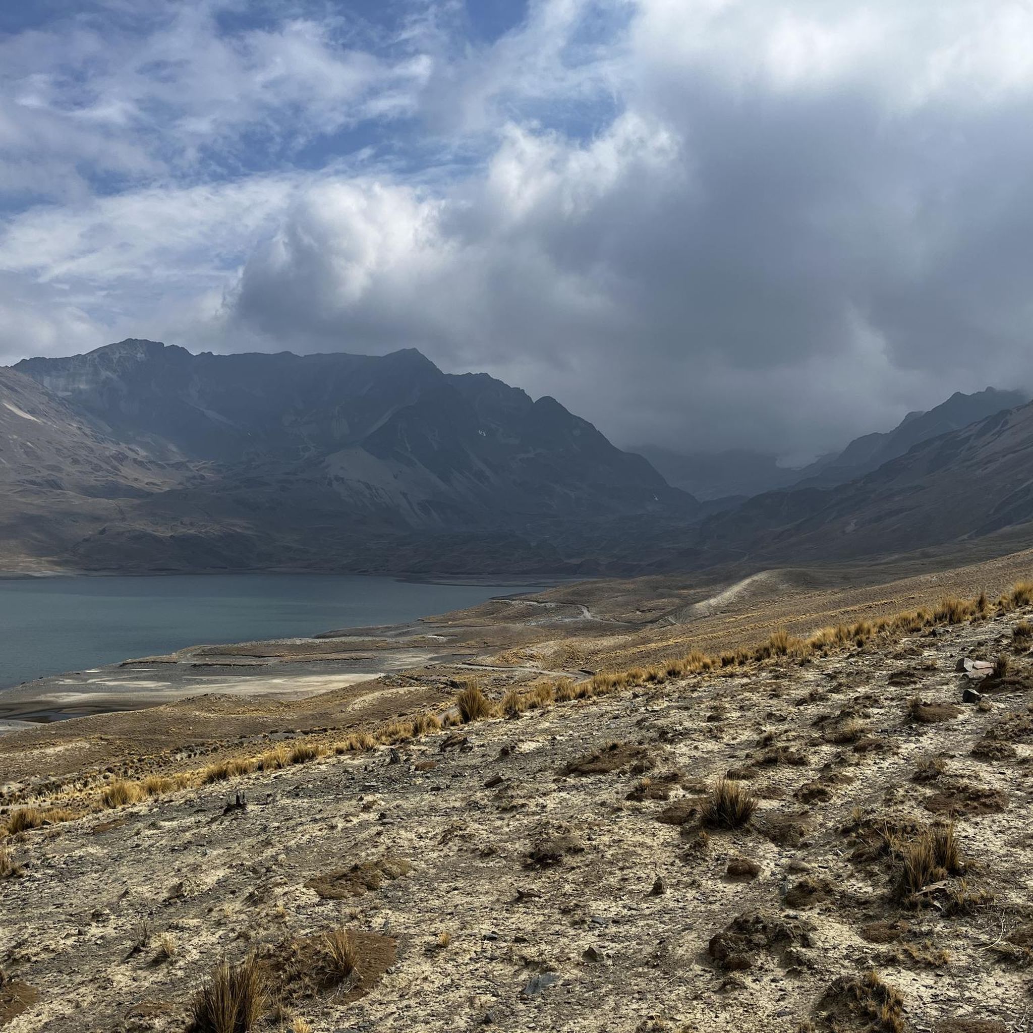
Hiking trails in Pucarani are set within the dramatic high-altitude landscapes of the Cordillera Real in Bolivia. The region features an average elevation of 4050 meters, characterized by low mountain ranges, steep hills, and narrow valleys. This topography, combined with an Altiplano climate, offers challenging routes and extensive views.
Best hiking trails in Pucarani
- The most popular hiking route is View of Huayna Potosí – View of the Cordillera Real loop from Refugio Casa Blanca, a 2.5 miles (4.1…
Last updated: July 10, 2026
4.8
(28)
294
hikers
11.2km
05:54
830m
830m
Hard hike. Very good fitness required. Sure-footedness, sturdy shoes and alpine experience required.
5.0
(5)
32
hikers
12.5km
06:22
850m
850m
Hard hike. Very good fitness required. Sure-footedness, sturdy shoes and alpine experience required.

Sign up for free
5.0
(3)
20
hikers
21.7km
09:17
960m
960m
Hard hike. Very good fitness required. Sure-footedness, sturdy shoes and alpine experience required.
5.0
(1)
18
hikers
6.89km
04:00
620m
620m
Hard hike. Good fitness required. Sure-footedness, sturdy shoes and alpine experience required.
8
hikers
4.66km
01:50
170m
170m
Hard hike. Great for any fitness level. Sure-footedness, sturdy shoes and alpine experience required.
3
hikers
Hard hike. Good fitness required. Sure-footedness, sturdy shoes and alpine experience required.
Our route recommendations are based on thousands of hikes, rides, and runs completed by other people on komoot.
Start today with a free account
Your next adventure awaits.
Login or Signup
Popular around Pucarani

Tips from the Community

I'm planning a trip to Bolivia soon and saw this comment. How can I find more information about staying with this family?
0
0

Tuni is a very small village on the edge of the Cordillera Real in the La Paz department in Bolivia. It is located at over 4,400 m altitude and is therefore ideal for acclimatization for hikes in the beautiful mountains. The residents are mostly alpaca herders and are very friendly. The nearby Laguna Tuni is also very beautiful.
2
0
The Laguna Chair Khota is located at approx. 4665 m in the Tuni-Condoriri National Park. It is fed by the Condoriri glaciers and therefore has a beautiful turquoise color. The mighty rock faces of the Condoriri rise on the north bank.
2
0
The 5327 m high Pico Austria is a beautiful panoramic peak in the Cordillera Real. From there, if the weather is clear, you can visit Condoriri and its wings and glaciers, Huayna Potosí and some turquoise blue lagoons. The climb is technically easy, but you should definitely acclimatise in advance as the height should not be underestimated. You have to pay 20 Bs for entry to the national park (as of 10/2023), which will be collected in the park by local rangers.
2
0
The pass, at an altitude of 5152 m, lies between the Carro Jallayco and the Pico Austria. Paths lead here from the south from the Laguna Chiar Khota and from the north-west from the Juri Khota lagoon. The further climb to Pico Austria runs towards the south-west.
2
0
The lagoon is located at approx. 4550 m in the Tuni-Condoriri National Park. In clear conditions, the mighty Condoriri can be seen with its steep rock faces and impressive glaciers behind it.
1
0

From the summit of Pico Austria you have stunning views of the surrounding mountains, the Huayana Potosi, El Alto to Titicaca
1
0
From the summit of Pico Austria, views reach Titicaca, El Alto and Huayana Potosi.
0
0
Frequently Asked Questions
How many hiking trails are available in Pucarani?
Pucarani offers 10 hiking trails, ranging from easy walks to challenging summit ascents. These routes provide diverse experiences within the high-altitude landscapes of the Cordillera Real.
Are there any easy hiking trails suitable for beginners in Pucarani?
Yes, for those seeking an easier experience, the Refugio Pico Austria loop from La Rincondada is an excellent choice. This 4.7 km (2.9 mi) trail is rated as easy and offers a good introduction to the region's beauty without extreme difficulty.
What is the best time of year to go hiking in Pucarani?
The most favorable weather conditions for hiking in Pucarani are during the dry season, which runs from May to September, particularly June to August. During this period, you can expect clearer skies and more stable conditions for exploring the high Andean scenery.
What natural landmarks or attractions can I see along the hiking trails in Pucarani?
Hiking in Pucarani offers access to several stunning natural landmarks. You can visit the iconic Pico Austria Summit for panoramic views, or experience the turquoise waters of Laguna Chiar Khota and Laguna Tuni. Some trails also offer views of the majestic Huayna Potosí (6,088 m).
Are there any circular hiking routes in Pucarani?
Yes, many of the trails in Pucarani are circular, allowing you to start and end at the same point. Examples include the View of Huayna Potosí – View of the Cordillera Real loop from Refugio Casa Blanca and the Pico Austria Summit – Laguna Chiar Khota loop from La Rincondada, which offer diverse high-altitude experiences.
What should I know about high-altitude hiking in Pucarani?
Pucarani is situated at an average elevation of 4050 meters, with trails reaching much higher. It is crucial to allow for proper acclimatization before attempting strenuous hikes. Stay hydrated, walk at a slow pace, and be aware of symptoms of altitude sickness. Consulting a doctor before your trip is also recommended.
Are there any family-friendly hiking options in Pucarani?
While many trails in Pucarani are challenging due to high altitude and steep sections, the Tuni Village and Laguna Tuni – Tuni Village Homestay loop from Estancia Tuni is a moderate option that might be suitable for families with older children who are accustomed to hiking. It offers scenic views around Laguna Tuni and opportunities to spot local wildlife.
What kind of wildlife can be seen while hiking in Pucarani?
The high-mountain lakes and surrounding areas, particularly around Laguna Tuni, are known for their unique wildlife. Hikers might spot alpacas, various bird species, and even flamingos, adding to the natural beauty of the landscape.
What do other hikers enjoy most about the trails in Pucarani?
The trails in Pucarani are highly rated by the komoot community, with an average score of 4.9 stars from over 50 reviews. Hikers consistently praise the spectacular high Andean scenery, the breathtaking views of peaks like Huayna Potosí and Condoriri, and the stunning turquoise glacier-fed lakes.
Are there any refugios or accommodation options near the hiking trails?
Yes, the region has refugios that serve as starting points or rest stops for many trails. For instance, the View of Huayna Potosí – View of the Cordillera Real loop from Refugio Casa Blanca starts from Refugio Casa Blanca, and the Paso Chacoti (5150 m) – Pico Austria Summit loop from Refugio Condoriri begins near Refugio Condoriri, providing convenient access to the trails.
What is the terrain like for hiking in Pucarani?
The terrain in Pucarani is characterized by dramatic high-altitude landscapes, including low mountain ranges, steep hills, and narrow valleys. Trails often involve significant elevation changes, rocky paths, and can be exposed to the elements, requiring appropriate footwear and gear.
Most popular routes in Pucarani
Most popular attractions in Pucarani

Get inspired with the komoot mobile app


Didn’t find what you were looking for?
Check out more Hikes throughout Pucarani below and find the perfect route in your destination.
Explore more
Browse the best Hikes in other regions.
