The best walks and hikes in San Luis Potosí
5.0
(17)
160
hikers
12
hikes
Hiking in San Luis Potosí offers diverse landscapes, from arid deserts to lush, tropical jungles. The region is characterized by significant natural features such as the Sierra de Álvarez mountains, the unique desert terrain around Real de Catorce, and the numerous waterfalls and river systems of the Huasteca Potosina. Hikers can explore pine forests, volcanic rock formations, and deep caverns, with elevations varying across the state.
Best hiking trails in San Luis Potosí
- The most popular hiking route is View of the Sierra de Álvarez – La Ventana Rock Arch loop from El Órgano, a 6.4 miles (10.3 km) trail that takes 4 hours 10 minutes to complete. This difficult route offers views of the Sierra de Álvarez and a natural rock arch.
- Another top favourite among local hikers is Real de Catorce – Cerro El Quemado loop from Real de Catorce, a moderate 6.5 miles (10.5 km) path. This trail explores the desert landscape surrounding the historic mining town of Real de Catorce, leading to Cerro El Quemado.
- Local hikers also love the Sótano de las Golondrinas loop from Entrada al Parque Natural Sótano de las Golondrinas, a 0.8 miles (1.2 km) trail leading through the natural park, often completed in about 34 minutes.
- Hiking in San Luis Potosí is defined by diverse terrain including mountain forests, desert landscapes, and areas with waterfalls and caverns. The network offers options for various ability levels, from easy walks to more challenging mountain ascents.
- The routes in San Luis Potosí are highly rated by the komoot community with an average score of 5.0 stars from over 9 reviews. More than 150 hikers have used komoot to explore San Luis Potosí's varied terrain.
Last updated: July 7, 2026
5.0
(5)
35
hikers
10.3km
04:10
440m
440m
Hard hike. Good fitness required. Sure-footedness, sturdy shoes and alpine experience required.
5.0
(10)
38
hikers
17.3km
05:34
670m
670m
Hard hike. Very good fitness required. Mostly accessible paths. Sure-footedness required.

Sign up for free
5.0
(1)
24
hikers
10.5km
03:11
340m
350m
Moderate hike. Good fitness required. Easily-accessible paths. Suitable for all skill levels.
7
hikers
9.62km
03:09
440m
440m
Moderate hike. Good fitness required. Easily-accessible paths. Suitable for all skill levels.
3
hikers
16.2km
06:28
640m
640m
Hard hike. Very good fitness required. Sure-footedness, sturdy shoes and alpine experience required.
7
hikers
3.17km
01:06
130m
130m
Moderate hike. Great for any fitness level. Mostly accessible paths. Sure-footedness required.
8
hikers
Easy hike. Great for any fitness level. Easily-accessible paths. Suitable for all skill levels.
5
hikers
8.69km
02:38
260m
260m
Moderate hike. Good fitness required. Mostly accessible paths. Sure-footedness required.
4
hikers
4.53km
01:10
20m
20m
Easy hike. Great for any fitness level. Easily-accessible paths. Suitable for all skill levels.
3
hikers
Moderate hike. Good fitness required. Easily-accessible paths. Suitable for all skill levels.
Get access to more routes and recommendations from other explorers.
Sign up for free
Already have an account?
Our route recommendations are based on thousands of hikes, rides, and runs completed by other people on komoot.
Start today with a free account
Your next adventure awaits.
Login or Signup

Tips from the Community

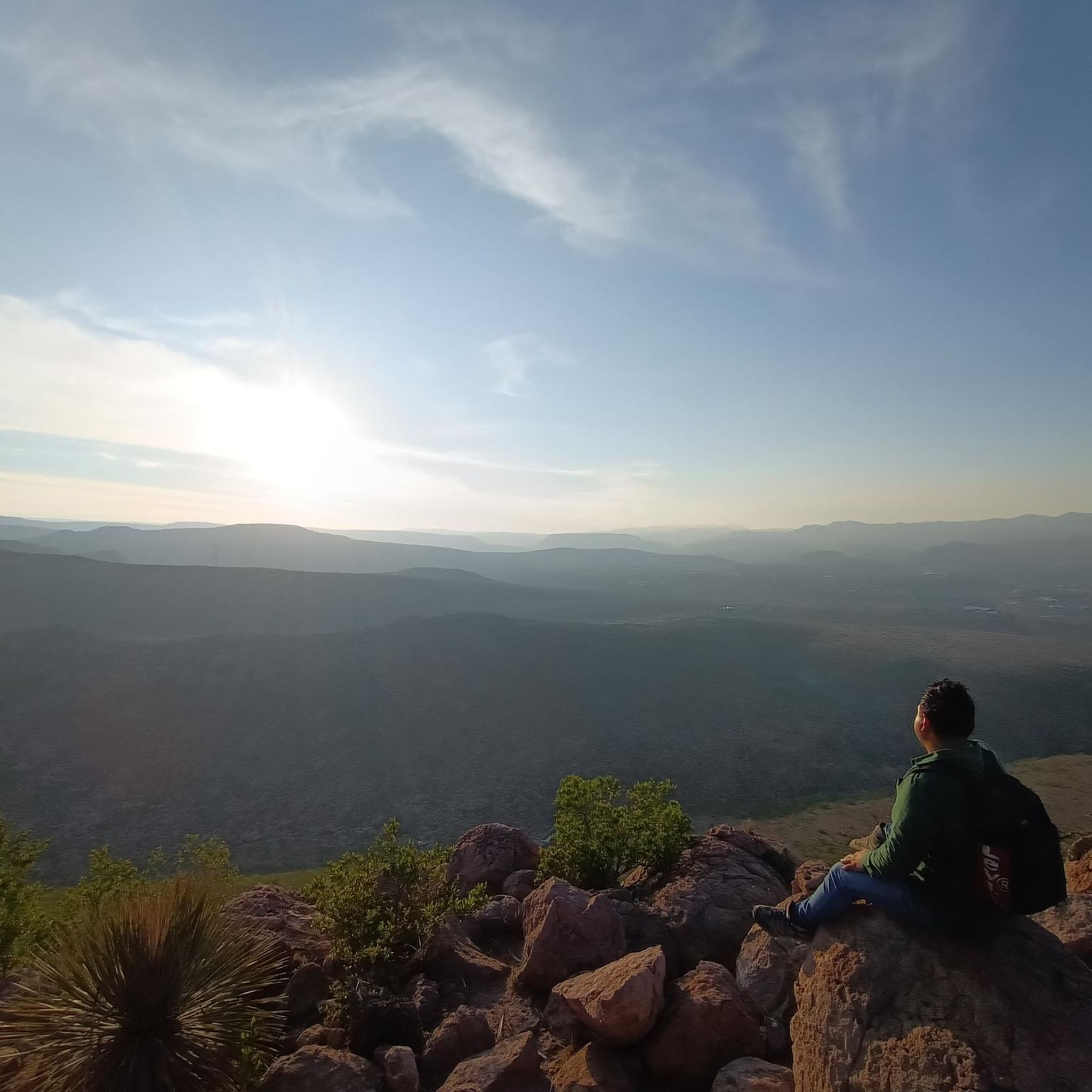
Sacred mountain of the Huichol. We were there in mid-April and everything was blooming in bright colors. And of course the view was beautiful. You can also take a horseback tour there in Real de 14.
0
0
From Wadley you can take the bus at 7.30 to Estacion Carorce and from there at 8.00 by Willy (jeep) to Real de Catorce (as of April 2024). We had breakfast and didn't leave until 11.00. As a result, we didn't arrive back in Wadley until long after dark, at 9.30 p.m. It wasn't a problem because we were back on a road by sunset. We took few breaks, but looked and marveled a lot, so plan enough time :)
0
0
beautiful town, we were told very touristy on weekends, but very quiet during the week
0
0

Large market with many possibilities. Very authentic and best visits with an interpreter if you don't speak Spanish
0
0
Frequently Asked Questions
How many hiking trails are available in San Luis Potosí?
San Luis Potosí offers a diverse range of hiking experiences, with over 10 routes documented on komoot. These trails cater to various skill levels, from easy walks to more challenging ascents through mountains and deserts.
What is the best time of year to go hiking in San Luis Potosí?
The Huasteca Potosina region, known for its waterfalls and rivers, is suitable for hiking year-round due to its tropical climate. For desert and mountain areas like Real de Catorce or Sierra de Álvarez, the cooler, drier months from October to May are generally more comfortable, avoiding the intense summer heat and potential rainy season.
What kind of terrain can I expect on hikes in San Luis Potosí?
San Luis Potosí boasts incredibly diverse landscapes. You can hike through the lush, tropical jungles and river systems of the Huasteca Potosina, explore the arid desert terrain around Real de Catorce, or trek through the pine forests of the Sierra de Álvarez National Park. The region also features unique geological formations like deep caverns and natural rock arches.
Are there easy hiking trails suitable for beginners or families in San Luis Potosí?
Yes, San Luis Potosí has easy trails perfect for beginners or families. For example, the Sótano de las Golondrinas loop from Entrada al Parque Natural Sótano de las Golondrinas is an easy 0.8-mile (1.2 km) trail. The area around Tamasopo Waterfalls and Puente de Dios also offers relatively easy walks with opportunities for swimming.
Are there challenging hikes for experienced trekkers in San Luis Potosí?
Absolutely. Experienced hikers can find challenging routes, particularly in the Sierra de Álvarez and around Real de Catorce. The View of the Sierra de Álvarez – La Ventana Rock Arch loop from El Órgano is a difficult 6.4-mile (10.3 km) trail with significant elevation gain. The hike to Wirikuta (Cerro del Quemado) from Real de Catorce also presents a challenging 15-kilometer ascent at high altitude.
Are there hiking trails that feature waterfalls in San Luis Potosí?
The Huasteca Potosina region is famous for its spectacular waterfalls. While specific komoot routes for all waterfalls are not listed here, many trails in this area, such as those around Tamasopo and Puente de Dios, lead to stunning cascades and natural pools where you can often swim. Tamul Waterfall, one of Mexico's tallest, is also a major attraction, often accessed by boat but with hiking opportunities nearby.
Can I find circular hiking routes in San Luis Potosí?
Yes, many of the hiking routes in San Luis Potosí are circular, allowing you to start and end at the same point. Examples include the Real de Catorce – Cerro El Quemado loop from Real de Catorce and the View of San Luis Potosí – Chilaquiles loop from Lomas del Pedregal.
What are some notable natural landmarks to see while hiking in San Luis Potosí?
San Luis Potosí is rich in natural wonders. You can explore the massive vertical cavern of Sótano de las Golondrinas, witness the natural rock formation of Puente de Dios, or marvel at the towering Tamul Waterfall. The Sierra de Álvarez also features impressive rock formations like La Ventana Rock Arch, visible on routes such as the View of the Sierra de Álvarez – La Ventana Rock Arch loop from La Amapola.
Are there any hikes near the capital city of San Luis Potosí?
Yes, there are several hiking options close to the capital. The Sierra de Álvarez National Park is just outside the city and offers well-marked trails. Within the city's vicinity, you can find routes like the View of San Luis Potosí loop from Parque Tangamanga or the Lago Club Campestre loop from Fraccionamiento Nuevo Morales, which are moderate to easy.
What do other hikers enjoy most about hiking in San Luis Potosí?
The hiking trails in San Luis Potosí are highly rated by the komoot community, with an average score of 5.0 stars from over 9 reviews. Hikers often praise the region's incredible natural diversity, from the refreshing waterfalls of the Huasteca Potosina to the unique desert landscapes around Real de Catorce, and the panoramic views from mountain trails.
Are there any hikes that offer cultural or historical insights in San Luis Potosí?
Yes, the region offers hikes that blend natural beauty with cultural history. The trails around Real de Catorce, an old mining town, lead through a desert landscape with historical significance, including the sacred mountain of Wirikuta (Cerro del Quemado) for the Wixárika people. You can explore the Puerto del Palillo – Real de Catorce loop from Real de Catorce to experience this unique blend.
Are there opportunities for wild swimming or water activities during hikes?
The Huasteca Potosina region is a prime location for wild swimming and water activities. Many hikes in this area, particularly around Tamasopo Waterfalls and Puente de Dios, lead to natural pools and rivers where you can cool off. Laguna de la Media Luna is another spring-fed lake with crystal-clear waters ideal for swimming and diving, often accessible via nearby trails.
Most popular routes in San Luis Potosí

Get inspired with the komoot mobile app


Didn’t find what you were looking for?
Check out more Hikes throughout San Luis Potosí below and find the perfect route in your destination.
Explore more
Browse the best Hikes in other regions.
