The best walks and hikes in Potosí
4.5
(50)
574
hikers
16
hikes
Hiking in Potosí, Bolivia, offers diverse experiences across a high-altitude, rugged mountain landscape. The region is characterized by dramatic elevations, including the iconic Cerro Rico, and features of the Altiplano. Hikers can explore areas with artificial lakes, unique rock formations, and volcanic peaks. The terrain elevation in Potosí provides challenging ascents and panoramic views of the surrounding natural features.
Best hiking trails in Potosí
- The most popular hiking route is Valley of the Machos – Devil's Pass loop from Tupiza, a 6.9 miles (11.1 km) trail that takes 3 hours 12 minutes to complete. This moderate route navigates through distinctive rock formations and rugged landscapes.
- Another top favourite among local hikers is View of Tunupa Volcano loop from Khala Loma, a difficult 7.1 miles (11.4 km) path. This trail offers expansive views of Tunupa Volcano and involves significant elevation gain.
- Local hikers also love the Laguna Colorada loop from Mirador de Flamencos, a 1.0 mile (1.6 km) trail leading through the striking red lake area, often completed in about 25 minutes.
- Hiking in Potosí is defined by high-altitude mountain ranges, unique Altiplano landscapes, and volcanic features. The network offers options for different ability levels, from easy walks around lakes to difficult ascents.
- The routes in Potosí are highly rated by the komoot community with an average score of 4.5 stars from over 40 reviews. More than 500 hikers have used komoot to explore Potosí's varied terrain.
Last updated: July 10, 2026
4.8
(13)
100
hikers
11.1km
03:12
260m
260m
Moderate hike. Good fitness required. Easily-accessible paths. Suitable for all skill levels.
5.0
(3)
69
hikers
11.4km
05:27
1,100m
1,100m
Hard hike. Very good fitness required. Sure-footedness, sturdy shoes and alpine experience required.

Sign up for free
4.5
(4)
48
hikers
5.60km
02:11
410m
410m
Moderate hike. Good fitness required. Easily-accessible paths. Suitable for all skill levels.
5.0
(8)
29
hikers
18.6km
05:26
480m
480m
Hard hike. Very good fitness required. Easily-accessible paths. Suitable for all skill levels.
30
hikers
1.61km
00:25
10m
20m
Easy hike. Great for any fitness level. Easily-accessible paths. Suitable for all skill levels.
5.0
(2)
22
hikers
3.70km
02:21
440m
440m
Moderate hike. Good fitness required. Mostly accessible paths. Sure-footedness required.
5.0
(1)
8
hikers
6.81km
02:00
170m
170m
Easy hike. Great for any fitness level. Easily-accessible paths. Suitable for all skill levels.
8
hikers
13.2km
03:40
240m
240m
Moderate hike. Good fitness required. Easily-accessible paths. Suitable for all skill levels.
9
hikers
8.11km
02:13
120m
120m
Moderate hike. Good fitness required. Easily-accessible paths. Suitable for all skill levels.
10
hikers
3.23km
01:11
200m
200m
Easy hike. Great for any fitness level. Easily-accessible paths. Suitable for all skill levels.
Get access to more routes and recommendations from other explorers.
Sign up for free
Already have an account?
Our route recommendations are based on thousands of hikes, rides, and runs completed by other people on komoot.
Start today with a free account
Your next adventure awaits.
Login or Signup
Popular around Potosí
Tips from the Community

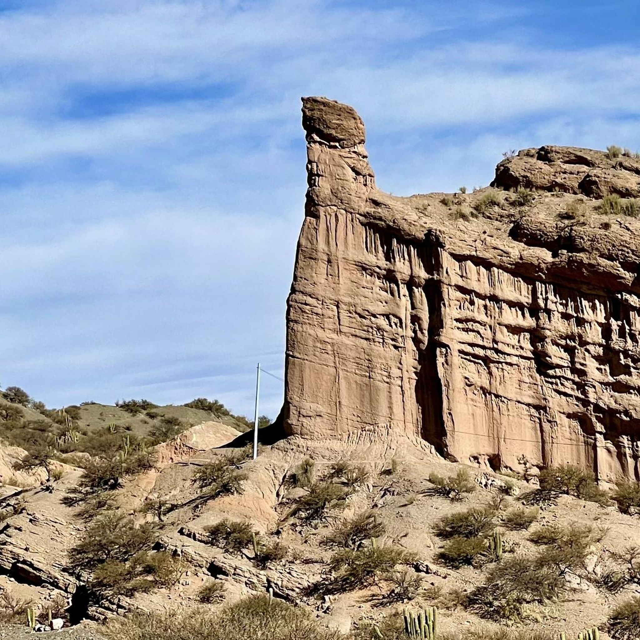
Easy hike, possibly accessible by torito from Tupiza. Horseback riding trips are also offered here.
2
0
You have to look closely to discover the small drawings.
1
0
Climbers can enter the canyon about 1 km further.
1
0

A lonely spot on the windswept Altiplano at an altitude of more than 4,000 meters: The Laguna Colorada not only has a unique location, but also combines all the colors of nature. The deep blue of the sky, the barren brown mountains and, last but not least, the unusual, bright red of the lagoon, which has given the lake the name Laguna Colorada (colored lagoon). Together with the pink flamingos that live here, the Laguna Colorada is a wonderful spectacle of nature that will delight nature lovers. During your visit to the Altiplano, explore the huge, colored salt lake, which stretches for kilometers and creates a dreamlike backdrop that no picture can really capture. Along with the Island of the Sun and the Salar de Uyuni, the Laguna Colorada is one of the most beautiful places on earth that Bolivia has to offer. Source: https://www.skr.de/bolivien-reisen/sehenswuerdigkeiten/laguna-colorada/
3
0

A beautiful place for bird watching and a spectacle of colors: The red of the water, the white borax deposits on the bank, the green of the plants on the bank, the blue of the sky and, last but not least, the many flamingos make the place seem surreal.
3
0

The Laguna Colorada is a 60 square kilometer lake that is only between 0.35 and 1.5m deep. It is part of the Reserva National de Fauna Andina Eduardo Abaroa and is located at 4278m altitude. Its reddish color is caused by the high mineral content and algae. The lagoon is a wonderful place for bird watching. Numerous flamingos also live here; All three species (Andean flamingo, Chilean flamingo and James flamingo) are represented.
4
0

Nice little walk. By the way, there are providers who offer the tour with horses
1
1
Frequently Asked Questions
What types of hiking trails can I find in Potosí?
Potosí offers a diverse range of hiking trails, from easy walks around high-altitude lakes to challenging ascents in rugged mountain terrain. You'll find routes exploring the unique Altiplano landscape, volcanic features, and distinctive rock formations. There are over 15 routes available, catering to various fitness levels.
Are there any easy or family-friendly hikes in Potosí?
Yes, Potosí has several easy trails suitable for families or those looking for a less strenuous experience. An excellent option is the Laguna Colorada loop from Mirador de Flamencos, a short 1.6 km walk through the striking red lake area. Another easy route is the View of Tupiza – Statue in Tupiza loop from Tupiza, which covers 6.8 km.
What are some of the more challenging hikes in Potosí?
For experienced hikers seeking a challenge, Potosí offers difficult routes with significant elevation gain. The View of Tunupa Volcano loop from Khala Loma is a demanding 11.4 km path providing expansive views of the volcano. Another difficult option is the longer Devil's Pass – Valley of the Machos loop from Tupiza, spanning 18.6 km.
Are there any circular hiking routes in Potosí?
Many of the trails in Potosí are designed as loops, allowing you to start and end at the same point. Examples include the Valley of the Machos – Devil's Pass loop from Tupiza, the Uturuncu loop from Uturuncu, and the View of the Mountain Ridge loop from Tunupa.
What natural landmarks or attractions can I see while hiking in Potosí?
Potosí's hiking trails often lead to spectacular natural features. You can explore the unique rock formations of the Valley of the Machos, witness the iconic Devil's Pass, or marvel at the vibrant red waters of Laguna Colorada, known for its flamingos. Other notable sights include the Sol de Mañana Geothermal Field and other high-altitude lakes like Laguna Verde and Laguna Blanca.
What is the best time of year to go hiking in Potosí?
Potosí is located at a very high altitude, so weather conditions can vary. Generally, the dry season from May to October offers clearer skies and more stable weather, making it ideal for hiking. However, be prepared for cold temperatures, especially at higher elevations, and significant temperature drops between day and night. Always check local forecasts before heading out.
What kind of wildlife and flora can I expect to see on the trails?
The Altiplano landscape around Potosí is home to unique high-altitude flora and fauna. While hiking, you might encounter vicuñas, llamas, and alpacas. Birdwatchers will be particularly interested in Laguna Colorada, a prime spot for observing three species of flamingos. The rugged terrain also features hardy, adapted plant life.
What should I consider regarding the high altitude when hiking in Potosí?
Potosí is situated at an altitude of around 4,000 meters (13,420 ft), with some hikes reaching up to 5,000 meters. Acclimatization is crucial to avoid altitude sickness. Take it easy on your first few days, stay hydrated, and consider shorter, easier hikes initially. Always carry plenty of water, sun protection, and warm layers, as weather can change rapidly.
How do other hikers rate the trails in Potosí?
The hiking routes in Potosí are highly regarded by the komoot community, with an average score of 4.5 stars from over 40 reviews. More than 500 hikers have used komoot to explore Potosí's varied terrain, often praising the dramatic landscapes and unique natural features.
Are there any hikes that feature historical or cultural elements?
While many trails focus on natural beauty, some routes pass near areas with historical significance. For example, the region's history is deeply tied to mining. You might find routes that offer glimpses into the past, such as the Rock Wall With Petroglyphs – Devil's Pass loop from Tupiza, which hints at ancient human presence.
Can I find viewpoints with panoramic vistas on the hiking trails?
Absolutely. Potosí's mountainous terrain is perfect for panoramic views. Trails like the View of Tunupa Volcano loop from Khala Loma and the View of the Mountain Ridge loop from Tunupa are specifically designed to offer expansive vistas of the surrounding landscapes, including the iconic Cerro Rico and the vast Altiplano.
Most popular routes in Potosí
Most popular attractions in Potosí

Get inspired with the komoot mobile app


Didn’t find what you were looking for?
Check out more Hikes throughout Potosí below and find the perfect route in your destination.
Explore more
Browse the best Hikes in other regions.
