The best walks and hikes in Buenos Aires
4.4
(52)
416
hikers
15
hikes
Hiking in Buenos Aires offers a diverse range of outdoor experiences, from urban ecological reserves to more challenging trails in nearby mountain ranges. The region features wetlands, expansive city parks, and coastal paths along the Río de la Plata. Further afield, areas like Sierra de la Ventana and Tandil provide varied terrain including hills, forests, and rock formations. These natural features create a varied landscape for walking and hiking.
Best hiking trails in Buenos Aires
- The most popular hiking route is Puesto Glorieta – Ascent to Cerro Tres Picos loop from Puesto Glorieta, a 11.7 miles (18.8 km) trail that takes 6 hours 19 minutes to complete. This difficult route features significant elevation gain towards Cerro Tres Picos.
- Another top favourite among local hikers is Senda de las Ánimas – Trail of the Spirits loop from Golf, an easy 3.6 miles (5.8 km) path. This trail offers a gentle walk through natural surroundings, often completed in about 1 hour 33 minutes.
- Local hikers also love the Garganta Olvidada Waterfall loop from Monumento Natural Cerro de La Ventana, a 2.2 miles (3.5 km) trail leading through varied terrain to a waterfall, often completed in about 1 hour 36 minutes.
- Hiking in Buenos Aires is defined by urban ecological reserves, coastal paths, and the hills of nearby mountain ranges. The network offers options for different ability levels, from easy strolls to more demanding ascents.
- The routes in Buenos Aires are highly rated by the komoot community with an average score of 4.3 stars from more than 40 reviews. More than 300 hikers have used komoot to explore Buenos Aires's varied terrain.
Last updated: July 10, 2026
5.0
(5)
37
hikers
19.3km
06:37
940m
940m
Hard hike. Very good fitness required. Easily-accessible paths. Suitable for all skill levels.
5.0
(1)
41
hikers
Easy hike. Great for any fitness level. Easily-accessible paths. Suitable for all skill levels.

Sign up for free
4.4
(7)
29
hikers
5.80km
01:33
60m
70m
Easy hike. Great for any fitness level. Easily-accessible paths. Suitable for all skill levels.
29
hikers
Easy hike. Great for any fitness level. Easily-accessible paths. Suitable for all skill levels.
4.0
(1)
26
hikers
Moderate hike. Good fitness required. Easily-accessible paths. Suitable for all skill levels.
11
hikers
6.17km
01:50
180m
180m
Easy hike. Great for any fitness level. Easily-accessible paths. Suitable for all skill levels.
4.5
(2)
8
hikers
3.45km
01:36
220m
220m
Moderate hike. Great for any fitness level. Mostly accessible paths. Sure-footedness required.
5
hikers
3.15km
00:50
30m
30m
Easy hike. Great for any fitness level. Easily-accessible paths. Suitable for all skill levels.
5
hikers
Easy hike. Great for any fitness level. Easily-accessible paths. Suitable for all skill levels.
5
hikers
5.71km
01:27
10m
10m
Easy hike. Great for any fitness level. Easily-accessible paths. Suitable for all skill levels.
Get access to more routes and recommendations from other explorers.
Sign up for free
Already have an account?
Our route recommendations are based on thousands of hikes, rides, and runs completed by other people on komoot.
Start today with a free account
Your next adventure awaits.
Login or Signup


Tips from the Community

This hike is a medium-difficulty trail. It's recommended to wear good shoes, have water, and have promotions. Install the komoot app to use the map to guide you.
0
0

beautiful view over the beach area.
0
0
Extensive grounds with a view of the harbor.
0
0

Climbing over large rocks.
0
0
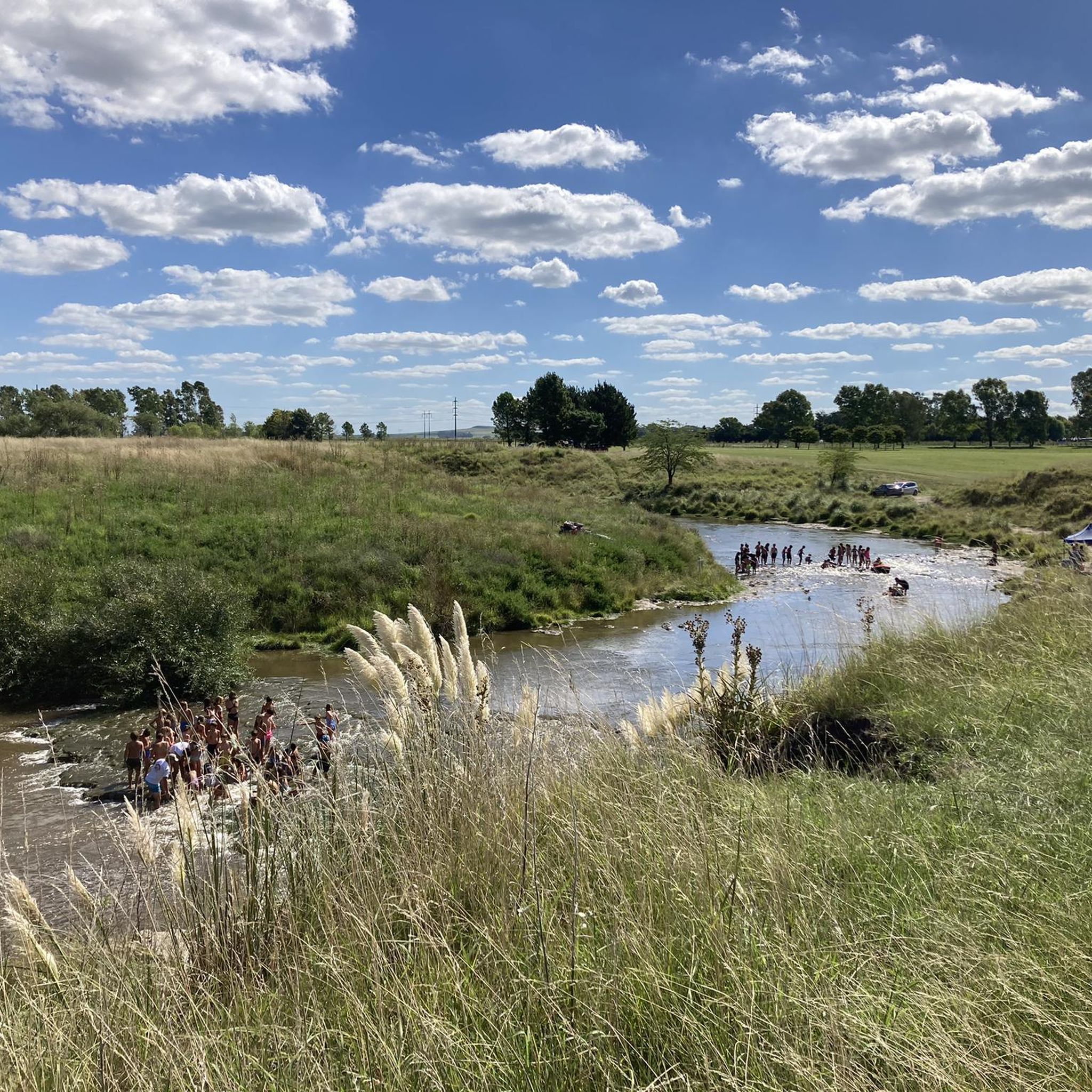
There are many cool pools here to cool off in!
2
0


nice route for the bike!!
0
0
Frequently Asked Questions
How many hiking trails are available in Buenos Aires?
Buenos Aires offers a diverse selection of over 15 hiking routes, catering to various preferences and skill levels. These include urban ecological reserves, coastal paths, and trails in nearby mountain ranges.
What do other hikers enjoy about the trails in Buenos Aires?
The hiking routes in Buenos Aires are highly rated by the komoot community, with an average score of 4.3 stars from more than 40 reviews. Hikers often praise the varied terrain, from tranquil wetlands to more demanding ascents, and the opportunities to connect with nature both within the city and in its surrounding areas.
Are there easy hiking trails suitable for beginners in Buenos Aires?
Yes, Buenos Aires has several easy trails perfect for beginners or those seeking a leisurely walk. For example, the Senda de las Ánimas – Trail of the Spirits loop from Golf is an easy 3.6-mile (5.8 km) path that offers a gentle walk through natural surroundings.
Are there challenging hikes for experienced trekkers in the Buenos Aires region?
For experienced trekkers, the region offers more demanding routes, particularly in the mountain ranges further afield. A notable challenging option is the Puesto Glorieta – Ascent to Cerro Tres Picos loop from Puesto Glorieta, an 11.7-mile (18.8 km) trail with significant elevation gain towards Cerro Tres Picos.
Are there any circular hiking routes in Buenos Aires?
Yes, many trails in the Buenos Aires region are designed as loops, offering varied scenery without retracing your steps. An example is the Torreón del Monje – Typical Mar del Plata Chalets loop from Leandro N. Alem, which provides a pleasant circular walk.
Are there any hiking trails that feature waterfalls in the Buenos Aires region?
Yes, you can find trails leading to waterfalls, especially in the more mountainous areas. The Garganta Olvidada Waterfall loop from Monumento Natural Cerro de La Ventana is a 2.2-mile (3.5 km) trail that takes you through varied terrain to a picturesque waterfall.
What natural features can I expect to see on hikes in Buenos Aires?
Hiking in Buenos Aires offers a diverse range of natural features. Within the city, you can explore wetlands and coastal paths along the Río de la Plata at the Reserva Ecológica Costanera Sur. Further afield, areas like Sierra de la Ventana and Tandil provide hills, forests, and rock formations. You might also encounter lakes such as Lake del Fuerte or the San Vicente Lagoon Nature Reserve.
Are the hiking trails in Buenos Aires family-friendly?
Many areas in Buenos Aires are suitable for family outings. Urban parks like Parque Tres de Febrero (Palermo Woods) and the Botanical Garden offer gentle paths perfect for families. The Reserva Ecológica Costanera Sur also provides accessible trails for a family-friendly nature experience.
Can I bring my dog on the hiking trails in Buenos Aires?
Dog-friendly policies vary by location. While many urban parks in Buenos Aires welcome dogs, often on a leash, specific ecological reserves or national parks might have restrictions to protect wildlife. It's always best to check the specific rules for the park or reserve you plan to visit beforehand.
Is parking available near the hiking trails in Buenos Aires?
Parking availability depends on the specific trail location. For urban reserves like Costanera Sur Ecological Reserve or large parks like Parque Tres de Febrero, there are often designated parking areas nearby. For trails further from the city, such as those in provincial parks, parking is typically available at trailheads or visitor centers.
What is the best time of year to go hiking in Buenos Aires?
The best time for hiking in Buenos Aires is generally during spring (September to November) and autumn (March to May). During these seasons, the weather is mild and pleasant, with comfortable temperatures and less humidity, making it ideal for outdoor activities. Summers can be hot and humid, while winters are generally mild but can be damp.
What should I wear for hiking in Buenos Aires?
For hiking in Buenos Aires, especially during spring and autumn, wear comfortable layers that can be adjusted to changing temperatures. Lightweight, breathable clothing is recommended. Always bring sturdy, comfortable walking shoes. If hiking in more rugged areas or during cooler months, consider waterproof outerwear and warmer layers.
Are there any interesting landmarks or places to explore near the hiking trails?
Yes, Buenos Aires and its surroundings offer many interesting landmarks. Near some trails, you might find historical sites like the Torres Train Station or natural monuments such as Cerro de las Ánimas. The city itself is rich with cultural attractions that can be combined with urban walks.
Most popular routes in Buenos Aires
Most popular attractions in Buenos Aires

Get inspired with the komoot mobile app


Didn’t find what you were looking for?
Check out more Hikes throughout Buenos Aires below and find the perfect route in your destination.
Explore more
Browse the best Hikes in other regions.
