The best running trails in La Convención
63
runners
3
runs
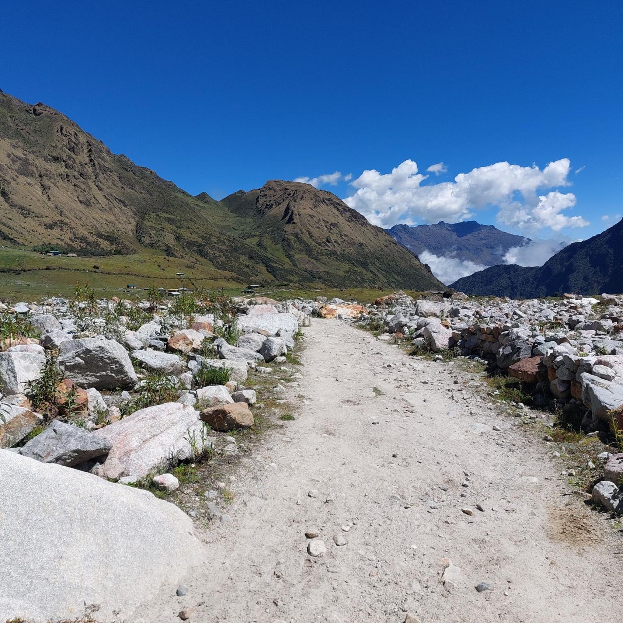
Jogging routes in La Convención traverse a diverse landscape, ranging from high Andean peaks to the Amazon basin. The region is characterized by snow-capped mountains, dense forests, and river valleys, offering varied terrain for runners. Its rugged topography includes challenging uphill climbs and descents, as well as paths through areas rich in archaeological sites. The significant altitude variations across the province provide a unique environment for running.
Best jogging routes in La Convención
- The most popular jogging route is Montaña…
Last updated: July 10, 2026
38
runners
11.7km
01:35
570m
570m
Hard run. Very good fitness required. Mostly paved surfaces. Suitable for all skill levels.
16
runners
4.15km
01:18
580m
580m
Hard run. Very good fitness required. Sure-footedness, sturdy shoes and alpine experience required.

Sign up for free
30
runners
13.9km
02:10
810m
810m
Hard run. Very good fitness required. Sure-footedness, sturdy shoes and alpine experience required.
Our route recommendations are based on thousands of hikes, rides, and runs completed by other people on komoot.
Start today with a free account
Your next adventure awaits.
Login or Signup
Popular around La Convención
Other adventures in La Convención

Tips from the Community

Those who are not fit should not undertake the ascent and descent in bad weather. It's a good 600 meters of elevation gain, mostly on steps. And slippery downhill, especially when wet.
0
0

It's the highest viewpoint. You can pass it from the trail, but otherwise the climb is worth it.
0
0

How times change. This used to be a place to take a break, everyone had their snack with them and took their lunch break or afternoon nap here. It was a place to relax. But in recent years the number of visitors has increased so much that more and more areas have been closed or regulated. I like to remember this wonderful time when we could still enjoy this amazing view without any time restrictions.
0
0

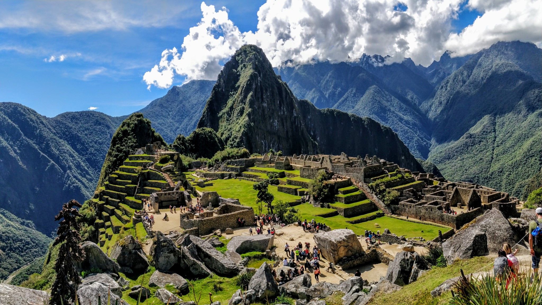
This spot offers the best view of Macchu Picchu. If you get here very early, you have the chance to enjoy the ruins without the many selfie photographers. Here you are in awe of the achievement of the Incas in building such a city in this place.
0
0
Aguas Calientes (as the name suggests) used to be known for its thermal baths, I remember when almost all of us would relax our muscles in the baths there after the Inca Trail. To get to the baths you have to walk up the hill in town, here you can rent towels or swimming trunks.
1
0

Huayna Picchu, also called Wayna Picchu, means "young peak" in Quechua. It is widely believed in the region that the mountain served as a watchtower to protect the sanctuary of Machu Picchu. The Machu Picchu site is located between two mountains - Huayna Picchu and Machu Picchu Mountain. Although both offer exciting hiking routes, there are certain differences between Huayna Picchu and Machu Picchu that you need to be aware of, including altitude, difficulty, and duration. From both mountains, you can enjoy beautiful views of the Machu Picchu ruins and the surrounding mountains. Huayna Picchu is the majestic, cone-shaped mountain that you often see in the background of the most famous photographs and postcards of Machu Picchu. The Huayna Picchu hike is generally considered moderate to difficult, so it can be challenging at times.
0
0
The climb was extremely steep...if you choose too high a pace and depending on your luggage and previous load (Inca Trail) you will quickly experience strong signs of fatigue...very painful thighs...take it easy and slowly
0
0
We were allowed to walk along here in the heavy rain, all completely wrapped up in colorful rain ponchos...the stones are extremely slippery, be careful
0
0
Frequently Asked Questions
How many running routes are available in La Convención?
Komoot currently features a selection of 3 challenging running routes in La Convención, designed for experienced runners seeking demanding terrain and significant elevation changes.
What kind of terrain can I expect on running trails in La Convención?
Running in La Convención offers incredibly diverse terrain, ranging from high Andean peaks to the Amazon basin. You'll encounter snow-capped mountains, dense forests, and river valleys. The rugged topography includes challenging uphill climbs and descents, as well as paths through areas rich in archaeological sites. Be prepared for significant altitude variations across the province.
Are there any challenging running routes in La Convención?
Yes, all the running routes currently featured in La Convención are classified as difficult. For example, the Montaña Huayna Picchu loop from Machu Picchu is a 7.1-mile (11.5 km) trail with challenging ascents and views of ancient ruins, while the Montaña Machupicchu loop from Machu Picchu features steep climbs through mountainous landscapes.
What natural features or landmarks can I see while running in La Convención?
La Convención is rich in natural beauty and historical sites. You might encounter impressive waterfalls like Siete Tinajas, Yanay Falls, and Illapani Falls, especially around Quillabamba. The Urubamba River is a prominent feature, and you can explore lush tropical forests. Historically, the region boasts significant Inca archaeological sites such as Choquequirao and Vilcabamba, and you can also visit the Llactapata Ruins.
What is the best time of year for jogging in La Convención?
The province experiences a tropical climate. While outdoor activities are possible year-round, it's important to be mindful of the rainy season, which typically runs from November to April. During this period, trails might be wetter and more challenging. The dry season generally offers more favorable conditions for running.
Are there any family-friendly running options in La Convención?
Given the challenging nature and significant elevation changes of the currently listed routes, they are generally more suited for experienced runners. However, the diverse landscape of La Convención offers many natural paths. For families, exploring less strenuous sections near towns like Quillabamba or along coffee plantations might provide more suitable, gentler options, though these may not be specifically designated running trails.
Can I find routes that offer scenic views or viewpoints?
Absolutely. The running routes in La Convención are renowned for their spectacular vistas. Trails often lead through mountainous landscapes, offering panoramic views of Andean peaks, dense forests, and river valleys. Routes like the Montaña Huayna Picchu loop provide stunning views of ancient ruins and the surrounding natural beauty.
What should I know about the altitude when running in La Convención?
La Convención features significant altitude variations, with some areas reaching over 3,200 meters above sea level. Runners should be aware of this and allow for acclimatization, especially if coming from lower elevations. Starting with shorter, less intense runs and staying hydrated is advisable to adjust to the higher altitude.
Are there any specific archaeological sites I can explore near running paths?
Yes, La Convención is rich in historical significance. The region is home to important Inca archaeological sites such as Choquequirao (often called the 'Sacred Sister of Machu Picchu') and Vilcabamba, the last refuge of the Inca Empire. The Llactapata Ruins are also a notable historical site that can be found near some trails, offering a blend of natural beauty and ancient history.
What kind of wildlife might I encounter on the trails?
Due to its diverse geography, spanning from high Andean peaks to the Amazon basin, La Convención is home to a variety of flora and fauna. In the tropical forests and jungle areas, you might encounter diverse wildlife, including a wide variety of birds, and tropical fruit trees like banana, papaya, and mango. Protected areas like Megantoni National Sanctuary also boast impressive biodiversity.
Are there any circular running routes available?
Yes, the featured routes in La Convención are designed as loops. For instance, the Montaña Huayna Picchu loop from Machu Picchu and the Montaña Machupicchu loop from Machu Picchu are both circular paths, allowing you to start and finish at the same point.
Most popular attractions in La Convención

Get inspired with the komoot mobile app


Didn’t find what you were looking for?
Check out more Running Trails & Routes throughout La Convención below and find the perfect route in your destination.
